Software and mobile applications are equally as important to conservation technology as the hardware used in the field. Increasingly developed specifically for #tech4wildlife needs, there are mobile apps and software options designed to help with protected area management, wildlife crime reporting, and anti-poaching patrol planning, data analysis, community science, data visualization and GIS mapping, outreach and engagement, and even conservation storytelling.
Likewise, mobile games have opened up new avenues for engaging the public in conservation efforts, allowing for immersive storytelling and interactive experiences. By combining cutting-edge technology and important conservation information with a media form already familiar to the public, conservationists are finding exciting ways to make audiences feel personally invested in critical species and habitats.
Whether you're looking for software and mobile app developers to help you with your own conservation tech needs, you have questions about development, you're looking for resources, or you'd like to share your own app, software, or gaming tools, this is the group for you!
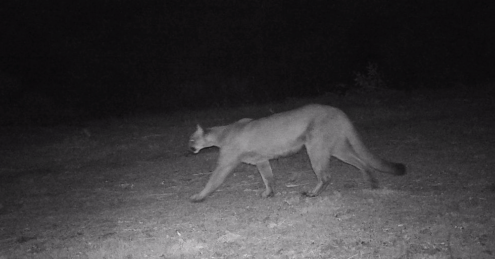
Header photo: Trevor Hebert

Wildlife Drones
Wildlife Drones has developed the world’s most innovative radio animal-tracking system using drones so you can track your radio-tagged animals like never before.

- 11 Resources
- 8 Discussions
- 32 Groups
- @eccrc25
- | she/they
- 0 Resources
- 0 Discussions
- 5 Groups

Allen Institute for AI
Communications for EarthRanger and Skylight

- 7 Resources
- 5 Discussions
- 10 Groups

Studying Biodiversity, Wildlife, and Ecosystem Health @ UEdi. Professionally software engineer, program manager, developer educator


- 0 Resources
- 5 Discussions
- 3 Groups

Technologist and Visual storyteller focusing on social, conservations issues.

- 0 Resources
- 31 Discussions
- 16 Groups

- @Alex.S
- | She/Her
MSc Marine Biologist and Data Scientist, Co-Founder and CSO & CTO of Galene Pathways
- 0 Resources
- 0 Discussions
- 8 Groups

Chartered Geographer and Fellow of the Royal Geographical Society. 32 years in GIS, currently as a Senior Product Manager. Main interests: biogeography, biodiversity, ecosystem integrity, ecosystem services, rewilding.
- 0 Resources
- 0 Discussions
- 3 Groups

- @nabilla.nuril
- | She/Her
Incoming student of UCL MSc Ecology and Data Science
- 0 Resources
- 0 Discussions
- 11 Groups

- @ecosystem2
- | he/him
- 0 Resources
- 0 Discussions
- 4 Groups

- @ATM
- | HE
I studied Wildlife and Ecotourism Management in University of Ìbàdàn, Nigeria, I'm a front-end developer. I am interested in conservation technology
- 0 Resources
- 5 Discussions
- 11 Groups

- @valeria
- | she/her
Studio Pixel
AI integration architect, AI product manager. I've built the front-end of this website 😁
- 0 Resources
- 3 Discussions
- 13 Groups

- @KelseyGrace
- | she/her
Hello! I am PhD student studying Animal behaviour and welfare at the University of Lincoln. I am specializing in studying gopher tortoise cognition and applying what we learn to conservation practices.
- 0 Resources
- 0 Discussions
- 6 Groups
Article
Earth Blox dataset review: Meta Global Canopy Height (1m)

Cassie Anderson
Review by Professor Iain H Woodhouse
29 April 2024
Article

In a recent publication we tested Underwater Passive Acoustic Monitoring (UPAM) as a feasible non-invasive technique to study the calling behavior of therathened aquatic Andean frogs under natural conditions in the...
6 April 2024
Article
Firetail 12 - new stuff

Tobias Petri
visualization, annotation, and analysis of GPS and tag sensor data - a tour of the latest version
20 March 2024
Article
Emerging trends for Nature-Based Solutions project assessments
8 March 2024
Article
Firetail - updated price model from 03/2024
Tobias Petri
more affordable pricing for our software for the visualization and annotation of GPS and acceleration data
4 March 2024
Careers
Machine Learning Postdoc Position, Understory

Ross Davison
Join us to help prevent biodiversity loss! Understory is hiring a postdoc to lead R&D Development on generalizing Computer Vision models for vegetation identification across space/time/phenotypes.
29 February 2024
Careers
SMART Partnership Director

Richard Bergl
The SMART Partnership is hiring a Program Director to oversee all aspects of the partnership's operations
21 February 2024
Article
Scaling biodiversity scoring for supply chains aligned with TNFD
Cassie Anderson
How Earth Blox reduced biodiversity impact analysis from 2 months to 1 hour for a global bank.
20 February 2024
Careers

The Wildlife Restoration Foundation is hiring a Conservation Technology Intern
8 February 2024
Careers
Two year postdoc - Machine Learning & Bioacoustics
Emmanuel Dufourq
Two years in Cape Town, South Africa. Yearly visits to Rwanda. If you love to code, and all things Python/deep learning/tech stuff/ then you'll have an awesome time!
16 January 2024
Article
Using geospatial data and the TNFD L.E.A.P approach to assess nature-related risks, impacts and opportunities in supply chains.
4 January 2024
Article

SEE Shell is an innovative phone app that uses machine learning to identify products made from the shell of the critically endangered hawksbill sea turtle.
14 December 2023
July 2024
event

Filippo Maria Buzzetti

October 2024

November 2023
event

Cassie Anderson


| Description | Activity | Replies | Groups | Updated |
|---|---|---|---|---|
| Hi everybody 👋🏽,I'm a UX designer, and I design interfaces and improve user experiences/flows. I would love to contribute to conservation... |
|
Software and Mobile Apps | 11 months 2 weeks ago | |
| That sounds like a really neat project! Do fish get re-caught often enough that individual ID is useful? Is sample bias (more data from popular spots) an issue? |
|
AI for Conservation, Citizen Science, Software and Mobile Apps | 11 months 3 weeks ago | |
| Hello all! Bluspark is a plateform that allows natural area managers such as natural parks or reserves to optimize their day to day... |
|
Citizen Science, Community Base, Connectivity, Conservation Tech Training and Education, Ethics of Conservation Tech, Protected Area Management Tools, Software and Mobile Apps | 1 year ago | |
| Thank you so much for your reply! I'll look in to this now :) |
|
Acoustics, Autonomous Camera Traps for Insects, Camera Traps, Data management and processing tools, Drones, Remote Sensing & GIS, Software and Mobile Apps | 1 year 1 month ago | |
| Hi Andrea! Although I am a keen user and observer of the Moveapps initiative, my R or Python coding skills are next to non- existing. I am therefore not likely to be contributing... |
|
Biologging, Conservation Tech Training and Education, Data management and processing tools, Emerging Tech, Human-Wildlife Conflict, Open Source Solutions, Software and Mobile Apps | 1 year 1 month ago | |
| I'm curious to understand how people are using satellite data. What problems does satellite imagery solve for you?... |
|
Remote Sensing & GIS, Software and Mobile Apps | 1 year 1 month ago | |
| Hi all, In the last couple of months I have started using the Google 'Lens' app on my Android phone and I have been really impressed... |
|
Software and Mobile Apps, Wildlife Crime | 1 year 2 months ago | |
| Depending on the type of data you're needing to collect, the EarthRanger or SMART platforms might be helpful. They each have mobile apps but also a suite of integrated software to... |
|
Software and Mobile Apps | 1 year 3 months ago | |
| Hi Jim, could you please update us on your final choice and experience so far? |
+13
|
Citizen Science, Software and Mobile Apps | 1 year 3 months ago | |
| No, I was never able to figure out how to send these to anyone on here. I was hoping to learn how to clear these videos up if possible! |
|
Camera Traps, Data management and processing tools, Open Source Solutions, Software and Mobile Apps | 1 year 4 months ago | |
| Fab - thanks Carly! |
|
Software and Mobile Apps | 1 year 6 months ago | |
| The open-source program Audacity can show the spectrograms and histograms and has quite a lot of other useful features, e.g. playing ultrasound calls slower, so it can be heard by... |
|
Acoustics, Citizen Science, Data management and processing tools, Open Source Solutions, Software and Mobile Apps | 1 year 6 months ago |


Mangrove soundscape
27 August 2022 4:57pm

30 August 2022 10:10pm
Camilo--
Are you interested only in airborne sounds or do you want to deploy hydrophones? That decision would inform a lot of other decisions about your purchase of equipment, as would having a clearer picture of your budget.

23 September 2022 5:39pm
Hi there Camilo,
What an interesting project! If you are looking for a lower cost, but effective tools for acoustic monitoring you might want to look into two options:
SoundTraps - are very commonly used and perform quite well:
SonarPoints - these are also a great instrument option:
Senior Conservation Technology Expert Position (Consultancy) with the Global Wildlife Program
22 September 2022 5:35pm
Conservation Technology Research Internship

26 August 2022 4:58pm
Developer, Mara Elephant Project

19 August 2022 12:35pm
Lead Software Engineer for ARISE

19 August 2022 8:22am
Lead Software Engineer, Wildlife Insights

10 August 2022 11:06pm
Building a simple AI-powered, human-in-the-loop system to manage wildlife camera trap images & annotations
10 August 2022 8:12pm
Hi folks! I built out a human-in-the-loop annotation platform for Felidae Conservation Fund, a SF-Bay Area nonprofit last Fall using MegaDetector. I'm looking for feedback from this amazing community around areas of collaboration, especially data/software resources we can share!
Building a simple AI-powered, human-in-the-loop system to manage wildlife camera trap images & annotations - Abhay Kashyap
A journey of building a simple AI-powered, human-in-the-loop system to manage wildlife camera trap images & annotations
 Abhay Kashyap
Research Associate
 San Diego Zoo Wildlife Alliance
29 July 2022 9:34pm
Octophin Digital - Internship

28 July 2022 5:21pm
Firetail - Tutorial Series 22.3 - An introduction to Firetail - Update 2022

26 July 2022 8:16pm
Glad to announce I just replaced the Firetail introductory tutorial with a 2022 revision centered around Firetail 9:
- general concepts
- Movebank data handling
- Map Viewport
- Studies handling
- Annotation overview
- AI-based segmentation overview (FireSOM)
and quite a bit more to get you an idea what is possible with the new version.
Service Designer
13 July 2022 9:05am
Director, Imaging Technology Lab (Woods Hole Oceanographic Institution)

11 July 2022 6:32pm
Data Fellow at National Center for Ecological Analysis & Synthesis
9 July 2022 1:02am
Consultancy: Development and Implementation of SMART (Spatial Monitoring and Reporting Tool) for São Tomé and Príncipe
1 July 2022 6:15pm
Hello there
1 July 2022 5:00pm
New Conservation Tech Directory update
27 June 2022 4:45pm
UKAN+ Monitoring UK Biodiversity Symposium 15-16th June
31 May 2022 2:58pm
ICT Assistant
 Fauna & Flora
31 May 2022 12:50pm
Full Stack Engineer (US)
 Key Conservation
13 May 2022 12:58am
Full Stack Engineer (Global)
Key Conservation
11 May 2022 9:54pm
Looking for examples of cities using digital sustainability tools

22 April 2022 4:28pm
Join the Black Mammalogists Week Hackathon!
 WILDLABS Team
19 April 2022 12:00am
Looking for - Intelligence Database Software
14 June 2021 10:13am

21 March 2022 9:19pm
Hi Dexter,
In case you have not found your solution yet: I don't know of an off the shelf solution for what you need, but it seems to me that any more or less developed relational database software can do the core of what you are looking for.
You'll need to develop the database application to model (perhaps people from Hemmersbach can help with that) and store what data you want to capture about suspects, incidents, firearms and what have you.
Export to XL should be a no-brainer .
Entity-relationship visualization (I think you mean networks of suspects, firearms, etc.) is not easy for such softwares, but exporting the data and then importing to a network visualizer (GEPHI perhaps) should be possible.
For temporal and spatial data you would do something similar. Don't let the database software do it (unless it has a plugin or extension for it) but export to Geographical Information System software. I can not suggest any, but there must be plenty of that around, probably even open source/freeware.
If you insist on having it all integrated, then that is probably possible, but you'll have to pay a developer for it.
Hopefully this helps
Frank
Opportunity: Coding 4 Conservation
 Coding 4 Conservation
10 March 2022 12:00am
Apply now: Women in Conservation Technology Programme, Kenya
8 March 2022 12:00am
Technical Difficulties: Lessons from the Field of App Development
 John Cornell
21 December 2021 12:00am
Use of apps to monitor wildlife trade
14 October 2021 8:29pm
3 November 2021 12:46am
Not designed specifically for wildlife marketplaces, but SMART Collect can be used for citizen science and community reporting projects.

5 November 2021 5:22pm
DeerLab.com's trail camera software was built to manage and analyze photos. It's a cloud-based web application that has a number of features, from photo recognition to manual tagging of any animal. While geared toward hunters, it's also used for camera trap studies.
5 November 2021 6:56pm
Biologists without Borders has developed a free mobile app (i of the Elephant) that lets the public report where ivory is being sold. We send our reports of ivory being offered for sale to US Fish and Wildlife, State wildlife agents, National Whistleblowers Center, and the Department of Homeland Security for investigation and prosecution. So far, our intel has led to six successful prosecutions in the US. It can be used anywhere in the world.
Driven by data: Improved protected area effectiveness in Royal Manas National Park, Bhutan
 Society for Conservation Biology
29 October 2021 12:00am
29 August 2022 2:47pm
You might check out the devices listed in the Conservation Tech Directory - you can search for 'acoustic recorder' or 'ARU' or something like that.
The most common off-the-shelf models (other than Frontier Labs' BARLTs mentioned above😊) are Open Acoustic Devices Audiomoths & Hydromoths (which may be particularly useful for you since they come in completely watertight cases that can be stuck underwater for deployments), Wildlife Acoustics' SongMeter series, and Cornell Lab of Ornithology's Swift units.