This group is home to the protected area management tools that bring data collection, analysis, and reporting together to enable frontline conservation work in real-time. These integrated systems include many tools and topics related to other community groups, so if you're interested in this space make sure to check out our Sensors and Connectivity groups as well.
Resources for Getting Started:
- Watch the recording of our virtual meetup on Networked Sensors for Security and Human-Wildlife Conflict Prevention, including talks from WWF, SmartParks, and Sensing Clues.
- Check out this Introduction to SMART on our YouTube channel.
- Hear about the work Wildlife Protection Solutions is doing in this space.
- Watch Ted Schmidt's lunchtime lecture on Tech Readiness and Protected Area Management Tools.
- For a marine perspective, watch Max Schofield's Tech Tutors episode: How do I use open access remote sensing data to monitor fishing?
Header image: Save the Elephants
No showcases have been added to this group yet.

I'm a Doctoral Candidate working with the Smithsonian National Zoo. I use animal movement to build contact network models between wildlife, domestic animals, and people.


- 0 Resources
- 17 Discussions
- 12 Groups
- @camille.monchicourt
- | He / Him
Head of Information Systems at Ecrins national park (France). Open source communities manager (GeoNature, Geotrek, BAM).

- 1 Resources
- 1 Discussions
- 7 Groups

- @MandyEyrich
- | She/Her
University of Florida (UF)
Wildlife Conservation meets Experience Strategy -- 15+ years of cross-sector expertise specializing in user-centric technology and product strategy (UX research, UX/UI design), process optimization, and end-to-end agile product development, moving from ideation to iteration

- 0 Resources
- 12 Discussions
- 26 Groups

WILDLABS & Wildlife Conservation Society (WCS)
I'm the Bioacoustics Research Analyst at WILDLABS. I'm a marine biologist with particular interest in the acoustics behavior of cetaceans. I'm also a backend web developer, hoping to use technology to improve wildlife conservation efforts.


- 54 Resources
- 42 Discussions
- 34 Groups
Fauna & Flora
Remote Sensing Scientist, Conservation Technology & Nature Markets

- 66 Resources
- 66 Discussions
- 12 Groups

I support humanitarian drone operations in the Global South, as well as ecology and conservation efforts utilising drones. I specialise in drone: Safety, Operations, Regulations, and Airspace Management

- 1 Resources
- 23 Discussions
- 22 Groups

- @StephODonnell
- | She / Her
Tech, Sustainable Finance at World Bank & CFA (prev. Founder WILDLABS)


- 197 Resources
- 670 Discussions
- 31 Groups

- @crazybirdguy
- | Him
Field Biologist at Yayasan Cikananga Konservasi Terpadu, Indonesia, with experience and interest mainly in ornithology, citizen science and bioaccoustic
- 0 Resources
- 11 Discussions
- 12 Groups
Building perimeter monitoring technology for protected areas with Safora
- 0 Resources
- 2 Discussions
- 10 Groups

- @TaliaSpeaker
- | She/her
WILDLABS & World Wide Fund for Nature/ World Wildlife Fund (WWF)
I'm the Executive Manager of WILDLABS at WWF

- 28 Resources
- 64 Discussions
- 33 Groups
Committed to using technology, data and innovation to create efficient, safe and impactful solutions.

- 0 Resources
- 0 Discussions
- 16 Groups
My research focuses on using Next-Generation Sequencing (NGS) to study endangered species, including carnivores, chiropterans (bats), and lizards, as well as their microbiomes.
- 7 Resources
- 10 Discussions
- 20 Groups
Careers
Consider applying if you have a passion for conservation, low-powered hardware, edge-AI, and embedded systems.
18 June 2026
Careers
Ecologist (Postdoctoral Research Fellow), IS-0408-09

Lacey Hughey
The Smithsonian’s National Zoo & Conservation Biology Institute (in collaboration with Duke Farms, a center of the Doris Duke Foundation) is seeking a postdoctoral researcher to lead the development of next-gen...
1 June 2026
Careers
Programme Manager (SERCA Impact & Capacity)

Adrien Pajot
The Zoological Society of London and the SMART-EarthRanger Conservation Alliance (SERCA) are seeking a Programme Manager to lead delivery of a major international programme focused on strengthening the management...
28 May 2026
Article

🌍 Conservation technology is transforming how we protect wildlife, but are we thinking carefully enough about the risks? Drones, camera traps, GPS trackers, acoustic sensors, AI, and remote sensing have become...
22 May 2026
Careers
Ecological Data Scientist
Lacey Hughey
The Smithsonian Institution is the world’s largest museum, education, and research complex, with 21 museums and the National Zoo. This position is located in the Smithsonian's National Zoo and Conservation Biology...
21 April 2026
Article
Join the 2026 #Tech4Wildlife Challenge! (Feb. 2-6)

WILDLABS Team
For the 10th year in a row, we’re inviting the community to share photos and videos of how they’re engaging with technology for wildlife conservation. Participate to connect with the community, vote for your favorites,...
20 January 2026
Careers
SERCA Chief Product Officer

Jordan Steward
Full-time, initial 12-month contract, renewable based on performance and funding.
6 January 2026
Careers
Volunteer Google Ads Specialist Needed!

Rebekka Stutz
We’re reaching out again because we haven’t received any matching applications yet—and we truly believe someone in the Wildlabs community could be the perfect fit. If you care about conservation and want to use your...
19 November 2025
Article

The University of Hawai‘i - Ocean & Resources Engineering program is seeking project ideas from community groups, marine/ocean scientists, government agencies, companies, and non-governmental organizations for their...
16 November 2025
Careers
Volunteer Google Ads Specialist Wanted!
Rebekka Stutz
Are you a Google Ads Pro passionate about wildlife and nature conservation? Do you want to use your skills to make a real difference? We’re looking for someone like you to join our small but passionate team and help us...
22 October 2025
Careers
The Marine Innovation Lab for Leading-edge Oceanography develops hardware and software to expand the ocean observing network and for the sustainable management of natural resources. For Fall 2026, we are actively...
24 July 2025
Article
Nature Tech for Biodiversity Sector Map launched!

Carly Batist and 1 more
Conservation International is proud to announce the launch of the Nature Tech for Biodiversity Sector Map, developed in partnership with the Nature Tech Collective!
1 April 2025
FREE Drone & GIS Mini Course from GeoWing Academy

FREE Drone & GIS Mini Course from GeoWing Academy
FREE Drone & GIS Mini Course from GeoWing Academy


Protected Area Technician (PAT) Training
Protected Area Technician (PAT) Training
Protected Area Technician (PAT) Training


July 2026
event

Renilde
June 2026
event
Rebekka Stutz
event
Renilde
11 Products
Recently updated products


Getting behavioral data out of datasets that weren't built for it
16 June 2026 3:49pm
10 July 2026 12:55pm
I have tens of thousands of camera trap bycatch African mammal videos that are available for analysis to anyone who can turn them into published papers, data that is actually useful for conservation, or publicity for wildlife and conservation.
They are already manually sorted into carnivores / herbivores and the carnivores are sorted and/or tagged to species. I do not have the resources to do anything further with them.
14 July 2026 1:18am
Peter, this is a generous offer - thank you. A dataset that's already sorted carnivore/herbivore with carnivores tagged to species is a real head start, and the fact that it's bycatch from another purpose is exactly the kind of "data built for one question, useful for another" material I've been thinking about.
A few questions to figure out fit: what capture mode are the videos - continuous clips, triggered bursts, fixed intervals? And roughly how long are the clips? I'm interested in whether there's enough temporal continuity to read behavior (time budgets, activity sequences), not just presence/absence. Also curious which species are best represented, and what any reuse would look like on your end in terms of credit and terms.
I'd genuinely like to explore turning some of this into something publishable and conservation-useful. Would you be open to a direct conversation off-thread?
Warmly,
Maggie
14 July 2026 1:27am
Kim, this is great - thank you for sharing it. And to answer directly: yes, footage like this is genuinely useful for behavioral work, precisely because a continuous clip establishes a whole ecological scene rather than a single detection.
What's nice here is the range of behavior visible at once. The mother is engaged in what looks like foraging, while the juveniles are showing enrichment behaviors - exploratory, playful, curious, moving freely and not staying tethered to her. Posture and pose carry a lot of the signal too: tail position, body orientation, how attention is directed. That's the kind of thing you can only read when you have temporal continuity and enough frame to see the whole animal.
One question it raises - and this is exactly the interpretive challenge I find interesting - is whether the mother is actually foraging or "reading" the landscape through scent, which looks similar on camera but means something quite different behaviorally. Disambiguating those is where the real work is.
I'd love to hear more about your setup and how much footage like this you're generating. Continuous thermal at this quality, running for months, is a valuable stream.
Maggie
July15: “Wildlife Tracking for Connection” online learning session
1 July 2026 4:20pm
Senior Hardware Product Development Engineer - Conservation X Labs
18 June 2026 4:42pm
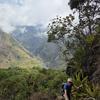
Quantifying 15-months of fynbos vegetation recovery using Drone Photogrammetry and QGIS
12 June 2026 11:56am
Ecologist (Postdoctoral Research Fellow), IS-0408-09
1 June 2026 4:02pm
Programme Manager (SERCA Impact & Capacity)
28 May 2026 2:31pm
Rights of Nature by Tribal and First Nations learning session (Co-creation with the More-than-Human sandbox)
28 May 2026 11:18am
Help shape best-practice guidance on conservation technology - input to survey
22 May 2026 10:20am
Call for Collaboration: Share your voice at ICTC next week!
11 February 2026 3:29am
19 February 2026 3:35am
Hi Anna!
Is there anything that sparks your curiosity, which I can address for you? Take a look at the upcoming day 2 and day 3 sessions, and if you see anything that intrigues you, please let me know! I'll happily join the session that aligns, and share your thoughts! ☺️
Kind regards,
Mandy
13 May 2026 2:18pm
That's a great idea @MandyEyrich ! Similar to your idea, I wrote up an article with geospatial highlights from ICTC 2026: https://wildlabs.net/en/article/wildlabs-geospatial-group-ictc-2026.
Is the Human-Wildlife Coexistence article available yet? Would love to read it and share it with colleagues at Fauna & Flora.
13 May 2026 2:21pm
@annavallery here's the article with geospatial-ish highlights in case you're interested: https://wildlabs.net/en/article/wildlabs-geospatial-group-ictc-2026. Let me know if you have any questions or specific interests. Happy to share further details!
Nature Tech Unconference - Anyone attending?
8 March 2025 12:11pm
24 April 2026 9:59am
What about this year? Who will be there?
https://www.naturetechweek.com/
I am planning to be there for the Unconference and some satellite events.
28 April 2026 4:10pm
I'll be there for the Unconference- looking forward to it!
13 May 2026 12:05pm
Myself and the Fauna & Flora Conservation Technology team will be there (@Chelsea_Smith and @ugyenpenjor ) and also the WILDLABS team @HRees ! See you!
Custom Hydrophone Records Dolphins
23 April 2026 3:33pm
3 May 2026 7:46am
Brett, you may reach out to @Lucille, who under the auspices of the Partnership for Observation of the Global Ocean (POGO), the Scientific Committee of Ocean Research (SCOR), and the International Quiet Ocean Experiment (IQOE) is managing the development of LC-MARE a low cost marine acoustic recorder. An ultra low power ADC is indeed an important component, so there may be some synergies.
6 May 2026 3:35pm
This is really interesting — especially the part about experimenting with different high-value uses.
I’m currently working on a small edge AI project for ecosystem monitoring, and it’s made me realize how different things can look outside of controlled environments.
Out of curiosity, during those experiments, what ended up being the biggest constraint — was it more about technical feasibility, cost, or something unexpected in real-world conditions?
11 May 2026 7:34pm
cool!
When you say: "...first usable result that validates our hardware and software signal chain." can you share what those chains are?
As for connectivity, yeah, that's a HUGE challenge ... Can you do SMS-level connectivity to Starlinks?
I presume you'd want to log basic temp/salinity, and perhaps include a basic accelerometer for wave motion over something like MQTT.
As for pushing down bioacoustic processing to the devices, yeah, would be awesome to do some minimal envelope threshold detection, and just send back compressed versions of 'the good stuff' . Maybe even listen for propellers and/or fishing sonar too, and send EarthRanger alerts.
And of course you'd want to do OTA updates, which in turn introduces security, etc.
Fun project!
Nature Credit Markets Webinar with Sensing Clues: Trustworthy Data for Validation and Verification Purposes
11 May 2026 6:51am
Are you Using EarthRanger?
9 June 2022 6:02am
16 March 2023 4:55pm
Netty,
I was recently working with a client integrating Internet of Things hardware alerts through EarthRanger to automatically create a work order and dispatch fieldworkers to deal with the alert issue. Unfortunately the client has become very busy and the work put on hold, but we are interested in completing the integration to the benefit of all those using EarthRanger. Do you have a contact at EarthRanger who we could deal with directly?
Rupert
16 March 2023 5:29pm
Hi Rupert,
My name is Jordan Steward and I lead comms and marketing for EarthRanger. Happy to put you in contact with a member of our team who can help you out here. My email is [email protected].
Thanks,
Jordan
8 May 2026 9:34am
yes
May 19: Catalysing Nature-Centrism Learning Session (Co-creation with the More-than-Human sandbox)
2 May 2026 3:51pm
Looking for internships, fellowships, and scholarships in conservation technology
2 May 2026 9:03am
War in Iran - has it impacted your projects?
23 April 2026 9:10pm
Ecological Data Scientist
21 April 2026 9:22pm
Looking To Utilize My Skillsets To Help
19 March 2026 10:26pm
Seeking input: Help shape the future of Movebank
19 March 2026 7:59pm
Camera Trap Integration Webinar with Sensing Clues: Connecting Your Camera Traps with All Your Conservation Data
19 March 2026 10:07am
When Wildlife Becomes Data: Ethical AI in Biodiversity Monitoring- Join the GEO Indigenous Alliance Summit 2026 March 16-19
5 March 2026 3:53pm
East Africa coordination between ICTC Peru and GCTDF Kenya – informal community update
27 January 2026 12:52am
24 February 2026 1:03pm
How are current drone pilots in the Mara handling biometric authorization for flight logs to ensure data integrity?
25 February 2026 11:27am
Hi @DavidGlobalDroneForum , I have attended ICTC and tried to be in the drone-related sessions as much as possible. I'm am not based in Africa but very much would like to better understand how drones are being used there as the organisation I work for are keen to increase the use of drones in that area. Would be happy to contribute in some way with reflections depending on timeline. Unfortunately I won't attend the conference in Kenya in person. I have also signed up to the Drone WG so was hoping to share something then too!
When should managers actively breach a temporarily closed estuary?
20 February 2026 10:16am
What Do Other Fields Most Often Underestimate About Your Work?
13 February 2026 12:45pm
Co-Create Conservation Tech: Features, Fixes & Roadmap Workshop "Cluey" with Sensing Clues
10 February 2026 8:07am
Women in Conservation Forum (WiCF) 2nd March in Nairobi: GoFundMe platform
30 January 2026 5:14am
30 January 2026 10:52am
Hello Macayle
It is of great pleasure that there is this opportunity coming to East Africa. I would like to attend this. Do you have any recommendation for funding a student to attend such a forum? I will share this opportunity with our East Africa WhatsApp group too.
2 February 2026 2:33am
Hi Susan,
Thank you for your message.
I apologise, but as we are a non-profit and mostly volunteer-run, we are presently unable to provide funding support to people to travel to Nairobi for the forum.
Thank you for sharing WiCF with the whatsapp community; that’s lovely of you!
I can write up an official letter of invitation if that would help with a university bursary application, and WiCF attendees will receive a certificate of attendance for the day.
I have a small invitation flyer; feel free to share this with others who may be interested.
Kind regards,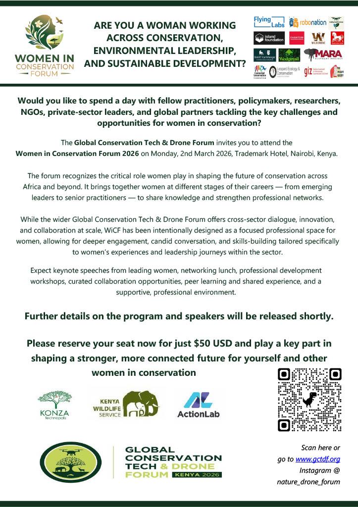
Macayle
Women in Marine Conservation session in the Women in Conservation Forum (WiCF) day 2nd March in Nairobi, Kenya.
30 January 2026 4:52am
30 January 2026 4:56am
Disclaimer: The related organisations in the blue box below are not partnership statements. I am merely trying to spread the word. We only have official partnerships (e.g. by an MoU) with CCF and WildDrone for the GCTDF.
Thank you!
30 January 2026 10:55am
Hi Macayle
Are these two different forums; one in Mombasa and other in Nairobi? can you make me understand please?
1 February 2026 2:02am
Community-led Land-Use Management Webinar with Sensing Clues: The Mponda Case
29 January 2026 7:23am
Join the 2026 #Tech4Wildlife Challenge! (Feb. 2-6)
20 January 2026 6:21pm
20 January 2026 10:22pm
Best time of the year!
2 February 2026 9:45am
This year am In for the @tech4Wildlife challenge
25 February 2026 9:47am
Women in Conservation Forum: Monday 2nd March 2026 Nairobi
15 January 2026 7:21am