GIS, or Geographic Information Systems, play a crucial role in nature conservation. Every day, mapping and spatial analysis are aiding conservation decisions, protected areas designation, habitat management on reserves and monitoring of wildlife populations, to name but a few examples. Want to learn more about how remote sensing is used in conservation? Check out the first two episodes of this season of Tech Tutors, where our Tutors answer the questions How do I use open source remote sensing data to monitor fishing? and How do I access and visualise open source remote sensing data in Google Earth Engine?
You can also check out our Virtual Meetup Archive for a range of panels that overlap with Remote Sensing & GIS topics.

- @kricherds
- | she/her
Technology advisor for social change

- 0 Resources
- 0 Discussions
- 13 Groups

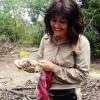
- @Muzna
- | She, Her
Muzna Kashaf is a dedicated herpetologist who recently achieved her MPhil, showcasing her commitment to advancing knowledge in the field. Her research focus lies in amphibians, and she has utilized Geographic Information Systems (GIS) to enhance precision of her studies.
- 0 Resources
- 0 Discussions
- 2 Groups

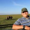
My name is Ann Wambui ,a conservationist working as a conservation officer at Mugie Conservancy. Am a Diploma holder specialized in Wildlife Management from the Wildlife Research Training Institute. Currently, am Distance Learning student at the Africa Nazarene University.

- 1 Resources
- 5 Discussions
- 9 Groups

- @diyaquanauts
- | he / him
Digital nomad, software developer, running mechatronic engineering firm in Seychelles to assist ocean conservation groups.
- 0 Resources
- 7 Discussions
- 9 Groups
- 0 Resources
- 0 Discussions
- 3 Groups
A Wildlife Biologist interested in Environment Assessment and Restoration, In-situ and Ex-situ strategies, Technologies used in Conservation and Illegal Wildlife Trade.
- 0 Resources
- 5 Discussions
- 13 Groups
- @otgonbayartm
- | He / His
Thanks to WILDLABS. This community is what exactly matches to my interest in Nature Conservation as IT professional.
- 0 Resources
- 0 Discussions
- 7 Groups

- @owenmartin22
- | He/Him
I am a firefly researcher and wildlife painter based in Boulder, Colorado
- 0 Resources
- 0 Discussions
- 4 Groups

- @Markbowler
- | He/Him
University of Suffolk
Wildlife distributions and the effects that human activity has on populations. Spatial ecology of Amazonian mammals through audio and camera surveys. Hunter and gun tracking in Peru. Bats in suburban and agricultural landscapes in the UK
- 0 Resources
- 1 Discussions
- 9 Groups

- 0 Resources
- 0 Discussions
- 15 Groups

- @Brickles
- | He/Him
- 0 Resources
- 0 Discussions
- 6 Groups

- @RHugtenburg
- | He/They
Student at Aberystwyth University. Bug Fanatic🪲. Worked at Octophin Digital for my industrial year placement 🐙.
- 0 Resources
- 0 Discussions
- 20 Groups
Article
The partnership will support the Global South with the development, planning and management of marine protected areas (MPAs) in the high seas.
22 September 2023
Article
Textbook: Cloud-Based Remote Sensing with Google Earth Engine

Stephanie O'Donnell
The first most comprehensive textbook for Earth Engine "Cloud-Based Remote Sensing with Google Earth Engine" now has many video tutorials by authors,
5 September 2023
Funding
Ecosystems Conservation: Action with CSOS/NGOS - EXPRO+

European Space Agency
Learn more about ESA's call for expressions of interests for projects relating to the conservation and restoration of ecosystems.
1 September 2023
Careers
Senior Spatial Ecologist

The Charles Darwin Foundation
The Charles Darwin Foundation for the Galapagos Islands (CDF) is recruiting a Senior Spatial Ecologist to join our shark research team and strengthen the ongoing long-term research on shark population ecology and...
24 August 2023
Careers

WCS is seeking a Conservation Technology Specialist to join their work in the Okapi Wildlife Reserve.
11 August 2023
Careers
Deadline Approaching: GIS Capacity Internship

Meredith Palmer
We're looking for an enthusiastic early career individual looking to develop their GIS, remote sensing, and capacity building skills.
24 July 2023
Article
Conservation StoryMap competition

Adrian Hughes
ESRI and IUCN have teamed up to launch a StoryMap competition. Storytellers are invited to share stories on a range of conservation topics including technological innovation, ecological corridors and initiatives by...
17 July 2023
Careers
Due Diligence Technical Specialist - Climate Impact Partners

Esther Githinji
Climate Impact Partners are looking for a Due Diligence Technical Specialist to join their supply-side team for an opportunity to carry out DD on projects, at a leading provider of high-quality carbon credit programmes.
27 June 2023
Funding

JICA, Japan’s International Cooperation Agency is seeking a digital partner with a proven track record in conservation technology as we launch a pilot project to test technologies to mitigate human-elephant conflict in...
19 June 2023
Careers
GIS Application Specialist in Nairobi, DGB Group
Esther Githinji
If you have a strong background in GIS, a passion for environmental sustainability, and the desire to contribute to the world's carbon neutrality, this is a great opportunity for you!
15 June 2023
Careers
Fisheries Analyst (Pacific)

Global Fishing Watch
With a focus on using and combining vessel tracking data, other satellite derived datasets and big data methods and AI generated estimates related to vessel identity and activity, the Fisheries Analyist with Global...
15 June 2023
Careers

Come work with us! WILDLABS and Fauna & Flora are seeking an intern to help develop the movement ecology content on the Inventory - our wiki-inspired database of conservation technology. Accepting applications until...
6 June 2023
July 2024

September 2024

September 2023

event

Stephanie O'Donnell
event

Cassie Anderson
111 Products
Recently updated products
| Description | Activity | Replies | Groups | Updated |
|---|---|---|---|---|
| Hi @emmahiggins , sounds like a great plan. Could you tell more about the content of the program, and perhaps the institutional context (which department(s) is(are)... |
|
Build Your Own Data Logger Community, AI for Conservation, Autonomous Camera Traps for Insects, Biologging, Camera Traps, Citizen Science, Climate Change, Acoustics, Community Base, Connectivity, Conservation Dogs, Conservation Tech Training and Education, Data management and processing tools, Drones, Early Career, Earth Observation 101 Community, East Africa Community, eDNA & Genomics, Emerging Tech, Ending Wildlife Trafficking Online, Ethics of Conservation Tech, Footprint Identification Technique (FIT), Human-Wildlife Conflict, Marine Conservation, Open Source Solutions, Protected Area Management Tools, Remote Sensing & GIS, Sensors, Software and Mobile Apps, Sustainable Fishing Challenges, Wildlife Crime, Women in Conservation Tech Programme (WiCT) | 12 hours 24 minutes ago | |
| Depending what you want to do, there are free services to annotate values for each point, interpolating between available time-location records in the RS data.The EnvDATA Track... |
|
Remote Sensing & GIS | 1 week 2 days ago | |
| Hi Folks,I'm interested in being the group leader for the Remote Sensing & GIS group, but it would be great to have a co-lead.... |
|
Remote Sensing & GIS | 2 weeks 4 days ago | |
| Hi folks!@Chelsea_Smith from Fauna & Flora joined last month's variety hour to share more about Fauna & Flora's work with... |
|
Remote Sensing & GIS, Data management and processing tools, Protected Area Management Tools | 1 month 1 week ago | |
| Calling practitioners working in connectivity... we're doing some thinking around modelling functional connectivity, and the data that... |
|
Remote Sensing & GIS | 1 month 2 weeks ago | |
| Thank you Carly, I will definitely take a look. |
|
Acoustics, Biologging, Climate Change, Conservation Tech Training and Education, Data management and processing tools, Remote Sensing & GIS, Software and Mobile Apps | 2 months ago | |
| We will be conducting in-person demos of our cutting-edge drone technology in the US this year! 🇺🇸 If you're interested in experiencing... |
|
Biologging, Drones, Remote Sensing & GIS, Software and Mobile Apps | 3 months 2 weeks ago | |
| Am working on similar AI challenge at the moment. Hoping to translate my workflow to wolves in future if needed. We all are little overstretched but it there is no pressing... |
|
Camera Traps, AI for Conservation, Build Your Own Data Logger Community, Data management and processing tools, Marine Conservation, Protected Area Management Tools, Remote Sensing & GIS | 3 months 4 weeks ago | |
| Real nice video. I'll have another look in the weekend in detail. |
+10
|
Acoustics, Community Base, Protected Area Management Tools, Remote Sensing & GIS, Sensors | 4 months ago | |
| Hi!I would take a look at Although developed for camera trap imagery, it is by no means restricted to such.Cheers,Lars |
|
Camera Traps, Community Base, Data management and processing tools, Drones, Emerging Tech, Remote Sensing & GIS, Software and Mobile Apps | 4 months ago | |
| Thank you for the links. As a trainer in GIS I have gone through them and they are very helpful for a beginner in QGIS. |
|
Remote Sensing & GIS | 4 months ago | |
| Thank you for this! Will take a look. |
|
Climate Change, Conservation Tech Training and Education, East Africa Community, Remote Sensing & GIS | 4 months 1 week ago |


How do Wildlife Crime Experts view Remote Sensing Technologies used to Combat Illegal Wildlife Crime?
7 November 2016 12:00am
Earth Observation from Space: the Optical View

22 September 2016 9:56am
19 October 2016 8:19am
We're expecting to have some results by the end of the year. We can already see that the use of a drone was beneficial for media and communication for the expedition, but I expect it to come into its own when we make full use of the orthomosaic aerial photography and digital surface model from photogrammetry which we are hoping to use in order to elucidate metrics of vegetation structure in relation to the forest edge. If we discover something really cool, I will post it here!
19 October 2016 8:23am
Now the course is officially over, I wonder how people found it? Too difficult, too easy or just right?
Request for Expression of Interest for Individual Consultants to Conduct Remote Sensing and Geospatial Analysis
4 August 2016 12:00am
Apply now for the 2016 Annual Geo for Good User Summit

16 June 2016 12:40am
Drone Training in the U.S.

5 May 2016 9:46am
Conservation apps with a GPS focus
5 April 2016 3:27pm

26 April 2016 2:34pm
My goto application is CyberTracker. It can be adapted on your desktop exactly to record the data that you want (including pictures and GPS reading, but not compass direction).

26 April 2016 4:53pm
Another option is OruxMaps, free for android, not very intuitive but very powerful. But it's important to bear in mind that phone GPS accuracy can be lower than "traditional" GPS, specially when part of the sky is blocked.
Here is a test https://blogs.esri.com/esri/arcgis/2013/07/15/smartphones-tablets-and-gps-accuracy/
ZSL Symposium: Space - the final frontier for biodiversity monitoring?

19 April 2016 2:29pm
Indonesian Peatlands and the Need for New Monitoring Technologies

20 March 2016 6:15pm
Geographic Information System Equipment
9 March 2016 4:30pm
10 March 2016 11:46am
Hi Felix,
Thanks for sharing your question! I would have thought your course adviser might be the best person to advise about what equipment you would be required to take the course. However, GIS applications usually require access to a computer, a GIS program like ArcGIS or MapInfo, and access to information like satellite imagery or other data layers that are used by your GIS program. These should be provided by your university course - most universities have GIS labs where they teach you how to use the programs without the requirement to invest in equipment while learning.
Cheers,
Stephanie
10 March 2016 12:36pm
Thank you. I am doing pre reading and Information gathering, so I'll know what to expect and be prepared.
Thank you for your kind answer Stephanie.
Disruptive Technology: Embracing the Transformative Impacts of Software on Society
10 March 2016 12:00am
Mapping Reduced-Impact Logging with Lidar
 Justine E. Hausheer
8 March 2016 12:00am
New paper in Nature on Landsat data to reduce deforestation
25 February 2016 10:15am
Advance Remote sensing classification
17 February 2016 4:33pm
Google Earth Engine User Summit · June 2016
12 February 2016 7:09pm
Upcoming GIS and Remote Sensing Courses
9 February 2016 12:00am
GIS Storytelling: How Story Maps can harness the power of maps and geography to promote conservation
12 January 2016 2:54pm
Satellite imagery grants from Digital Globe Foundation

28 December 2015 3:22pm
ArcGIS subscriptions through ESRI Conservation Program grants
28 December 2015 2:50pm
Google Earth Outreach and Geo for Good conference
24 December 2015 8:47pm
Achieving Moonshots: Advancing Humankind and Preserving Nature
22 December 2015 12:00am
Cheap Space, DIY Imaging and Big Data
21 December 2015 12:00am
MapBiomas: New mapping platform will track annual deforestation in Brazil
17 December 2015 8:44pm
Cheap Space, DIY Imaging and Big Data = Good News for Conservation
16 November 2015 7:48pm
From Data Collection to Decisions
 Tim Wilkinson
6 November 2015 12:00am
22 September 2016 4:37pm
Really interesting project! When are you expecting to have some results? Do you think the use of drones was beneficial for the project? Will you be using them again?