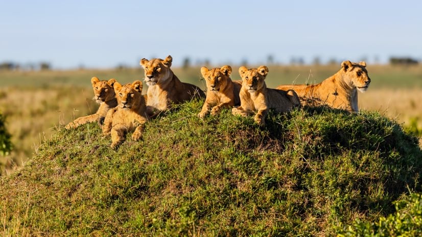
GIS, or Geographic Information Systems, play a crucial role in nature conservation. Every day, mapping and spatial analysis are aiding conservation decisions, protected areas designation, habitat management on reserves and monitoring of wildlife populations, to name but a few examples. Want to learn more about how remote sensing is used in conservation? Check out the first two episodes of this season of Tech Tutors, where our Tutors answer the questions How do I use open source remote sensing data to monitor fishing? and How do I access and visualise open source remote sensing data in Google Earth Engine?
You can also check out our Virtual Meetup Archive for a range of panels that overlap with Remote Sensing & GIS topics.
May 2024

July 2024

January 2024
event

Esther Githinji
December 2023

111 Products
Recently updated products
| Description | Activity | Replies | Groups | Updated |
|---|---|---|---|---|
| I am not an acoustics person but train and deploy canines in the field. Are you looking for something that records sniff rate and patterns? For GPS I just use a Garmin... |
|
Acoustics, Biologging, Remote Sensing & GIS | 4 months 2 weeks ago | |
| In what ways can drones contribute to linking individuals, communities, and small-scale producers in rural areas, facilitating the support... |
|
Drones, Remote Sensing & GIS | 4 months 2 weeks ago | |
| @dmorris joined Variety Hour to give us 'a bunch of lightning talks inside a lightning talk'. Check out the recording to get a whirlwind... |
|
AI for Conservation, Drones, Remote Sensing & GIS | 4 months 2 weeks ago | |
| I'm registered with the TWS2023 app, so feel free to nudge me there as well |
|
Biologging, Remote Sensing & GIS, Software and Mobile Apps | 5 months 3 weeks ago | |
| Digital Earth Africa are doing fantastic work to make Earth Observation data free and accessible, delivering decision-ready products to the... |
|
East Africa Community, Remote Sensing & GIS | 6 months 3 weeks ago | |
| Stefano Puliti joined Variety Hour to share his work using 3D photogrammetric data from UAVs for pre- and post-harvest inventory of forest... |
|
Climate Change, Data management and processing tools, Drones, Remote Sensing & GIS | 6 months 3 weeks ago | |
| Carly, that would be great! Thanks! I work with soundscapes and love the work of Rainforest Connection! I'll send you an email (@CUNY) to coordinate! |
|
Acoustics, AI for Conservation, Conservation Tech Training and Education, Drones, eDNA & Genomics, Emerging Tech, Remote Sensing & GIS | 10 months 4 weeks ago | |
| Do you have a wild animal tracking story that involves adventure or misadventure? Share it with us! From going around in circles for hours... |
|
Biologging, Citizen Science, Drones, Remote Sensing & GIS | 11 months 1 week ago | |
| I'm looking for any recommendations for any entry level/internship remote roles/companies in the United States that are focused in... |
|
AI for Conservation, Conservation Tech Training and Education, Early Career, Remote Sensing & GIS | 1 year ago | |
| Hi Jeremy, With a quick search I've found the paper linked below. It looks like equipments such as Livox MID are sufficient for plot-level analyses, but not for individual... |
|
Drones, Earth Observation 101 Community, Emerging Tech, Remote Sensing & GIS, Sensors | 1 year ago | |
| Indeed, I'll be there too! I like to meet new conservation friends with morning runs, so I will likely organize a couple of runs, maybe one right near the conference, and... |
|
Acoustics, AI for Conservation, Autonomous Camera Traps for Insects, Camera Traps, Remote Sensing & GIS | 1 year ago | |
| Thank you so much for your reply! I'll look in to this now :) |
|
Acoustics, Autonomous Camera Traps for Insects, Camera Traps, Data management and processing tools, Drones, Remote Sensing & GIS, Software and Mobile Apps | 1 year 1 month ago |


Biodiversity Intactness dataset now available on the Earth Engine community catalog

16 October 2023 1:21pm
Working Student (m/f/d) GIS & RS Monitoring of Biodiversity & Agroecology in Africa & Asia

6 October 2023 2:05pm
Discover Digital Earth Africa
6 October 2023 1:26pm
How 3D Technologies are Reshaping Forest Ecology and Conservation
6 October 2023 1:13pm
GEO BON Monitoring Biodiversity for Action

5 October 2023 3:10pm
GIS & Data Science Specialist
28 September 2023 1:32pm

GIS & Data Science Specialist, Connected Conservation Foundation

27 September 2023 1:28pm
GIS in Disaster Risk Management Training
26 September 2023 12:22pm
1st Wildlife Scientific Conference 2023
25 September 2023 11:10am
IUCN and AI2 to provide AI technology at no cost to fast-track implementation of newly signed UN High Seas Treaty
22 September 2023 9:54am
CIEEM 2023 Autumn Conference: Modernising Ecology: Techniques and Approaches
5 September 2023 1:59pm
Intro to Systematic Conservation Planning with Marxan
5 September 2023 1:18pm
Remote Sensing | Free Full-Text | Estimation of Forest LAI Using Discrete Airborne LiDAR: A Review
5 September 2023 11:57am
📢 New Paper: Estimation of Forest LAI Using Discrete Airborne LiDAR: A Review by Luo Tian, Yonghua Qu and Jianbo Qi
👉 Read the full article: https://www.mdpi.com/2072-4292/13/12/2408

Estimation of Forest LAI Using Discrete Airborne LiDAR: A Review
The leaf area index (LAI) is an essential input parameter for quantitatively studying the energy and mass balance in soil-vegetation-atmosphere transfer systems. As an active remote sensing technology, light detection and ranging (LiDAR) provides a new method to describe forest canopy LAI. This paper reviewed the primary LAI retrieval methods using point cloud data (PCD) obtained by discrete airborne LiDAR scanner (DALS), its validation scheme, and its limitations. There are two types of LAI retrieval methods based on DALS PCD, i.e., the empirical regression and the gap fraction (GF) model. In the empirical model, tree height-related variables, LiDAR penetration indexes (LPIs), and canopy cover are the most widely used proxy variables. The height-related proxies are used most frequently; however, the LPIs proved the most efficient proxy. The GF model based on the Beer-Lambert law has been proven useful to estimate LAI; however, the suitability of LPIs is site-, tree species-, and LiDAR system-dependent. In the local validation in previous studies, poor scalability of both empirical and GF models in time, space, and across different DALS systems was observed, which means that field measurements are still needed to calibrate both types of models. The method to correct the impact from the clumping effect and woody material using DALS PCD and the saturation effect for both empirical and GF models still needs further exploration. Of most importance, further work is desired to emphasize assessing the transferability of published methods to new geographic contexts, different DALS sensors, and survey characteristics, based on figuring out the influence of each factor on the LAI retrieval process using DALS PCD. In addition, from a methodological perspective, taking advantage of DALS PCD in characterizing the 3D structure of the canopy, making full use of the ability of machine learning methods in the fusion of multisource data, developing a spatiotemporal scalable model of canopy structure parameters including LAI, and using multisource and heterogeneous data are promising areas of research.
 MDPI
MDPI
Textbook: Cloud-Based Remote Sensing with Google Earth Engine
5 September 2023 11:49am
Ecosystems Conservation: Action with CSOS/NGOS - EXPRO+
 European Space Agency
1 September 2023 5:57am
Senior Spatial Ecologist
 The Charles Darwin Foundation
24 August 2023 11:22pm
How to report on biodiversity impacts at scale for TNFD
24 August 2023 12:41pm
Born Free Uses Smart Maps to Save Lions, Solve Human-Wildlife Conflict
17 August 2023 2:35pm
Location intelligence helps Born Free Kenya understand where communities and lions are in conflict. Outreach to fortify cattle corrals is guided by smart maps and spatial analysis.
Born Free Uses Smart Maps to Save Lions, Solve Human-Wildlife Conflict
Born Free maps the conflict between lions and communities to find solutions, including fortifying fences to keep lions away from livestock.
 Esri
Esri
Conservation Technology Specialist
 WCS
WCS
11 August 2023 1:21am
Society for Conservation GIS International Conference

26 July 2023 5:19pm
Deadline Approaching: GIS Capacity Internship

24 July 2023 5:18pm
Conservation StoryMap competition

17 July 2023 12:52pm
Monitoring large wildlife populations with ML and Satellites
11 July 2023 7:28pm
Here's an interesting new paper in Nature about how new techniques in machine learning and satellite remote sensing are allowing researchers to monitor and count large populations of migratory terrestrial mammals like elephants and zebras.
International Geoscience and Remote Sensing Symposium (IGARSS) 2023
4 July 2023 2:32pm
The role of low-code Earth observation tools in accelerating the sustainability transition
30 June 2023 2:13pm
We've published a paper on the role of low-code Earth observation tools in the sustainability transition. It covers how different roles in a business like analysts and executives can benefit from this tech and how it can be applied to ESG, Nature Based Solutions and insurance and finance.
Due Diligence Technical Specialist - Climate Impact Partners
27 June 2023 11:31am
Plastics Remote Sensing Discovery Programme workshop
27 June 2023 10:08am
Information Session: Technology Testing to Mitigate Human-Elephant Conflict in West Bengal

19 June 2023 11:07pm