GIS, or Geographic Information Systems, play a crucial role in nature conservation. Every day, mapping and spatial analysis are aiding conservation decisions, protected areas designation, habitat management on reserves and monitoring of wildlife populations, to name but a few examples. Want to learn more about how remote sensing is used in conservation? Check out the first two episodes of this season of Tech Tutors, where our Tutors answer the questions How do I use open source remote sensing data to monitor fishing? and How do I access and visualise open source remote sensing data in Google Earth Engine?
You can also check out our Virtual Meetup Archive for a range of panels that overlap with Remote Sensing & GIS topics.
- 0 Resources
- 0 Discussions
- 1 Groups

British Antarctic Survey (BAS)
Machine learning researcher at the British Antarctic Survey
- 0 Resources
- 0 Discussions
- 5 Groups
I am a dedicated professional with a bachelor of science in Wildlife management. I have extensive experience working in research as a Research Assistant and currently serve as a Human-Wildlife Conflict Mitigation Supervisor.

- 0 Resources
- 1 Discussions
- 5 Groups

- @capreolus
- | he/him
Capreolus e.U.
wildlife biologist with capreolus.at


- 1 Resources
- 71 Discussions
- 16 Groups

- @Edonga
- | He/His
Paul Edonga is from the Indigenous Pastoralist Tribes of Northern Kenya. A seasoned Leader in indigenous-led conservation of Endangered Beisa Oryx, African Small Antelopes their habitats & Dryland Forests. He's the founder of Save Beisa Oryx Community Resilience Trust-SBOC
- 0 Resources
- 1 Discussions
- 11 Groups
- @AngelMassay
- | Miss
A GoodManager, a conservationist, an ecologist
- 0 Resources
- 2 Discussions
- 4 Groups

Msc student on wildlife management and conservation
- 0 Resources
- 1 Discussions
- 9 Groups

- @CathyNj
- | She
Catherine Njore is a seasoned Cartographer with over 17yrs experience and specializing in children cartography. She recently designed a Cartography: Fun with Maps Program(CFMP); a program that assists children to learn how to draw, read and use maps effectively.

- 1 Resources
- 14 Discussions
- 6 Groups
Author of Conservation Biology in Sub-Saharan Africa
- 0 Resources
- 0 Discussions
- 1 Groups

An Environmental sciences and Management graduate from SUA, passionate and eager to drive change to the Environment, making World a better place for present and future generations.

- 0 Resources
- 3 Discussions
- 14 Groups

working on the digital transformation for environment, climate, and conservation
- 0 Resources
- 5 Discussions
- 2 Groups
- @raquelgo
- | (she/her/hers)
- 0 Resources
- 0 Discussions
- 17 Groups
Careers
Fisheries Analyst (Pacific)

Global Fishing Watch
With a focus on using and combining vessel tracking data, other satellite derived datasets and big data methods and AI generated estimates related to vessel identity and activity, the Fisheries Analyist with Global...
15 June 2023
Careers

Come work with us! WILDLABS and Fauna & Flora are seeking an intern to help develop the movement ecology content on the Inventory - our wiki-inspired database of conservation technology. Accepting applications until...
6 June 2023
Careers
Natural Capital GIS & Data Administrator

Esther Githinji
The Future Forest Company (FFC) team are looking for an enthusiastic, early career data and GIS administrator to join them. The role will manage spatial and operational data, with a particular focus on carbon from...
31 May 2023
Careers
PostDoc in forest remote sensing

Eva Lindberg
Open position in SLU, Umeå, Sweden
25 May 2023
Careers
Field Surveyor

Cameron Frayling
We are a team of ecologists and technologists who believe good business must be good for nature. We’re building an economy that puts nature and business in balance by incentivising the restoration of nature at scale.
16 May 2023
Careers
Machine Learning Researcher - Computer Vision (Remote)
Cameron Frayling
We are a team of ecologists and technologists who believe good business must be good for nature. We’re building an economy that puts nature and business in balance by incentivising the restoration of nature at scale.
2 May 2023
Careers
Data Scientist (Geospatial), Global Fishing Watch
Global Fishing Watch
Global Fishing Watch are looking for a data scientist to join the Research and Innovation team. Help us tackle geospatial data fusion problems to produce the most complete picture of human activity at sea.
19 April 2023
Article
Due diligence for Nature Based Solutions

Cassie Anderson
How to use geospatial data for rapid analyses of forest carbon projects
5 April 2023
Article
Meeting customer deadlines, without having to hire more staff
Cassie Anderson
How environmental consultancy Eticwood use geospatial data for rapid forest carbon project assessments
24 March 2023
Article
Python for Geographers (video)

Stephanie O'Donnell
This technical workshop was recorded at the Esri Developer Summit 2021. Presenters use packages to make GIS workflows reproducible through code, work with spatial data and make relevant maps using open source packages...
21 March 2023
Careers
Proposals wanted for Innovation in Practice

Ellie Warren
The Innovation in Practice edition of Methods in Ecology and Evolution is still seeking proposals about conservation technology
6 March 2023
Article
Mobilising East African nature restoration professionals
Matthew Creasey
Scholarships available for training courses focussing on nature restoration in East Africa
21 February 2023
June 2024
event

Cassie Anderson
July 2024

September 2024

May 2024
April 2024
March 2024
event

Stephanie O'Donnell
event
Stephanie O'Donnell
112 Products
Recently updated products
| Description | Activity | Replies | Groups | Updated |
|---|---|---|---|---|
| Indeed, I'll be there too! I like to meet new conservation friends with morning runs, so I will likely organize a couple of runs, maybe one right near the conference, and... |
|
Acoustics, AI for Conservation, Autonomous Camera Traps for Insects, Camera Traps, Remote Sensing & GIS | 1 year 2 months ago | |
| Thank you so much for your reply! I'll look in to this now :) |
|
Acoustics, Autonomous Camera Traps for Insects, Camera Traps, Data management and processing tools, Drones, Remote Sensing & GIS, Software and Mobile Apps | 1 year 2 months ago | |
| Our project in very short is, setting up a sensor network for monitoring airborne biomass, mainly insects, birds and bats in near realtime, and to develop a forecast model to be... |
|
Autonomous Camera Traps for Insects, Biologging, Remote Sensing & GIS, Sensors | 1 year 2 months ago | |
| Dear @gcamara , thank you so much for your elaborate reply. I am afraid, I am still overlooking something. Do I understand correctly, that the relationship between EO and local... |
|
Remote Sensing & GIS | 1 year 2 months ago | |
| I'm curious to understand how people are using satellite data. What problems does satellite imagery solve for you?... |
|
Remote Sensing & GIS, Software and Mobile Apps | 1 year 3 months ago | |
| Hi all,I've been quickly developing in-house drone services in the UK for Providence Ecological and have found some useful information for building a workflow with Rich... |
+8
|
Remote Sensing & GIS, Drones | 1 year 3 months ago | |
| Oh good call! I'll add that to our events calendar as well :) |
|
Remote Sensing & GIS, Sensors | 1 year 3 months ago | |
| Hi everyone, I seek your help for the choice of my thesis subject, I hold a Master's degree in Management of protected areas and I have... |
|
Camera Traps, Data management and processing tools, Protected Area Management Tools, Remote Sensing & GIS | 1 year 4 months ago | |
| I just came across this interesting paper in which seismic monotoring of animals like elephants was mentioned. This is the study refered to:Cheers,Lars |
|
AI for Conservation, Camera Traps, Emerging Tech, Ethics of Conservation Tech, Human-Wildlife Conflict, Remote Sensing & GIS, Sensors | 1 year 5 months ago | |
| Hi Steph. Would be interested also. |
|
Biologging, Community Base, Connectivity, Data management and processing tools, Emerging Tech, Remote Sensing & GIS | 1 year 5 months ago | |
| Thanks so much!! |
|
Acoustics, AI for Conservation, Biologging, Camera Traps, Community Base, Data management and processing tools, Drones, eDNA & Genomics, Emerging Tech, Open Source Solutions, Remote Sensing & GIS, Software and Mobile Apps | 1 year 8 months ago | |
| Hello. I am a PhD candidate at Penn State University. I submitted a post to this group back in March and I am resubmitting... |
|
Community Base, Data management and processing tools, Remote Sensing & GIS, Wildlife Crime | 1 year 9 months ago |


ANGELA ANDREW MASSAY
7 June 2024 12:43pm
ICI calls for €20-25M project applications for Colombia

5 June 2024 5:50pm
New WildLabs Funding & Finance group
5 June 2024 3:24pm
6 June 2024 1:38am
6 June 2024 4:16am
Remote Sensing & GIS Group Leadership

8 May 2024 4:25pm

28 May 2024 5:42pm
Hi Cathy! Please check out the below article on group managers. Essentially, we're asking for a 12 month commitment of 1 hour a week (more or less) to promote engagement in WILDLABS groups by sparking conversations, engaging with people's content, and planning 1 virtual event a month to bring the community together. (This could be bringing a speaker in, or just having a 45 minute coffee call for people in the sector to get to know each other and share their work.)
As a group manager, you have the full support of the WILDLABS community team. We have a dedicated Slack channel, monthly calls to support you in your group management, and so much more.
Being a group manager is a great way to give back to the conservation tech community, steer conversations in the direction you think is important, foster a vibrant space for collaboration, and build your network. Shoot me an email if you're interested ([email protected])! I'm happy to hop on a call to discuss more in-depth.
29 May 2024 5:43am
Hi Cathy, please check out what Alex sent and DM me if you're still interested in co-leading the group. Thanks.
Vance
31 May 2024 8:13am
Unfortunately I may fail to deliver so I cannot take it up. Am off net at times for two weeks straight.
But excited about everything GIS so I follow keenly.
Thank you for the explanation. 🤍

Share Your Work in a Conservation Technology Video

17 May 2024 9:06pm
SCGIS Annual Conference: Conservation for Action

17 May 2024 7:30pm
Using Raster data?
23 April 2024 1:17pm
3 May 2024 4:14pm
Hi Sarah,
It depends on what question you're asking. It would make sense to upload the land cover rasters for each year and then your data (you didn't mention what form your data is in). Then, you could run an analysis to look at temporal change in the landcover or other types of analyses, depending on what you're trying to do.
Best,
Vance
17 May 2024 1:42pm
Depending what you want to do, there are free services to annotate values for each point, interpolating between available time-location records in the RS data.
The EnvDATA Track Annotation Service on Movebank (use the "generic time-location records" option).
NASA's AppEEARS point extraction tool.
The Inventory User Guide

1 May 2024 12:46pm
Introducing The Inventory!
1 May 2024 12:46pm
2 May 2024 3:08pm

3 May 2024 5:33pm
17 May 2024 7:29am
Hiring Chief Engineer at Conservation X Labs

1 May 2024 12:19pm
Delving into #tech4wildlife Innovation across East Africa with Sandra Maryanne & Catherine Njore
 Esther Githinji
30 April 2024 11:37am
Earth Blox dataset review: Meta Global Canopy Height (1m)
23 May 2024 7:23pm
27 May 2024 8:58am
Ecologist Postdoctoral Research Fellow
23 April 2024 4:32pm
Program Manager: Integrating movement and camera trap data with international conservation policy

22 April 2024 10:16pm
Postdoc: Biologging & Camera Trap Data Integration
22 April 2024 10:10pm
Fauna & Flora: Bridging geospatial data and people together for enhanced conservation management

17 April 2024 11:31am
Starting a Conservation Technology Career with Vainess Laizer
Esther Githinji
16 April 2024 1:34pm
Modelling functional connectivity?

11 April 2024 11:55am
Applied hierarchical modelling (AHM) for species distribution and abundance
9 April 2024 7:22pm
Post Doctoral Research Assistant at ZSL
9 April 2024 7:03pm
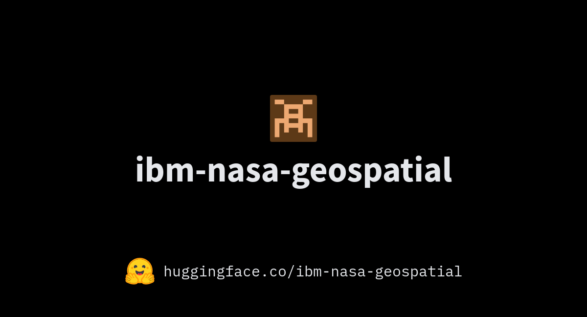
ibm-nasa-geospatial (IBM NASA Geospatial)
28 March 2024 9:22am
NASA and IBM have teamed up to create an AI Foundation Model for Earth Observations, using large-scale satellite and remote sensing data, including the Harmonized Landsat and Sentinel-2 (HLS) data.
Catch up with The Variety Hour: March 2024
21 March 2024 7:39pm

21 March 2024 9:48pm

30 March 2024 3:08pm
31 March 2024 12:43pm
Leveraging Actuarial Skills for Conservation Impact
15 March 2024 12:31pm
19 March 2024 6:35pm
Thank you for your response Akiba. I will have a look. 👏🏻
19 March 2024 7:52pm
I would look into the TNFD (Taskforce on Nature-Related Disclosures), Finance for Biodiversity, Accounting for Nature, etc. which are all focusing on how to incorporate nature risk into corporate reporting and sustainability frameworks!
20 March 2024 3:48pm
Thank you Carly, I will definitely take a look.
Consultants - Mapping EU’s Marine Protected Areas and analyzing their ecological coherence
19 March 2024 9:39am
2 Postdoctoral Conservation Ecologist Positions at Smithsonian’s National Zoo and Conservation Biology Institute (SNZCBI)
14 March 2024 7:18pm
International Day of Forests: "New Technological Innovations are Needed to Halt Deforestation and Forest Degradation" Panel
14 March 2024 12:16pm
PhD Opening: Revealing the Dynamics of Soaring Environments Through GPS and Drones
13 March 2024 2:11pm
5 June 2024 4:14pm