In recent years, drone technologies have been explored for a range of applications in conservation including (but not limited to) mapping, biodiversity inventories, antipoaching patrols, wildlife tracking, and fire monitoring. The rise of customizable, open-source drones like those of ArduPilot and OpenROV hold promise for more effective conservation applications, and combined with other monitoring sensors and devices, they are capable of collecting high-resolution data quickly, noninvasively, and at relatively low cost.
However, challenges remain in putting these tools to use. A recent paper reviewing 256 conservation drone projects highlighted some of these major obstacles, ranging from unintended social and ecological consequences of drone operations to still prohibitive costs, both in terms of hardware and in terms of storing and processing large volumes of data. The longstanding challenge of power/battery life remains as well.
If you're considering trying out drones for yourself, and want to explore the possibilities and understand the major conversations happening around this technology, check out these beginner's resources and conversations from across the WILDLABS platform:
Three Resources for Beginners:
- Conservation Technology User Guidelines Issue 5: Drones, World Wildlife Fund | Drones, best practices, ethics, regulations, case studies
- WILDLABS Virtual Meetup Recording: Drones, Craig Elder, Dr. Claire Burke, and Gabriel Levin | Drones, thermal camera, wildlife crime, ML, biologging
- New Paper: Drones and Bornean Orangutan Distribution, Sol Milne | Drones, data analysis, citizen science, community science, primates
Three Forum Threads for Beginners:
- Curious about radio-tracking with drones? | Wildlife Drones, Biologging (5 replies)
- Drones for GIS Best practice Document | Adrian Hughes, Drones (10 replies)
- WWF Conservation Technology Series: Drones in Conservation | Aurélie Shapiro, Drones (7 replies)
Three Tutorials for Beginners:
- How do I use a drone to capture radio-tracking data? | Debbie Saunders, Tech Tutors
- How do I choose the right drone for my conservation goals? | Shashank Srinivasan, Tech Tutors
- How do I strategically allocate drones for conservation? | Elizabeth Bondi, Tech Tutors
Want to know more about using drones, and learn from experts in the WILDLABS community? Make sure you join the conversation in our Drones group!
*Header photo: Parker Levinson, Point Blue Conservation Science
A Wildlife Biologist interested in Environment Assessment and Restoration, In-situ and Ex-situ strategies, Technologies used in Conservation and Illegal Wildlife Trade.
- 0 Resources
- 5 Discussions
- 13 Groups
Tanzania Wildlife Research Institute (TAWIRI)
Conservation biologist based in Tanzania


- 0 Resources
- 2 Discussions
- 2 Groups
- @ChloeSutcliffe
- | She/her
Working with drones and LiDAR to build datasets on above ground biomass
- 0 Resources
- 0 Discussions
- 4 Groups

- 0 Resources
- 0 Discussions
- 15 Groups

- @nancyalice
- | she/her
Conservation Communicator | Technology for Wildlife Foundation (TfW)
- 0 Resources
- 0 Discussions
- 10 Groups

- 8 Resources
- 0 Discussions
- 4 Groups
- 0 Resources
- 1 Discussions
- 2 Groups

- @Robincrocs
- | He/Him//El//Ele
Wildlife biologist, works with Caimans and Crocodiles
- 0 Resources
- 0 Discussions
- 14 Groups

International Union for the Conservation of Nature (IUCN)
Key Biodiversity Areas Programme Officer, IUCN


- 0 Resources
- 89 Discussions
- 8 Groups
- @a.zubiria
- | she/her
- 0 Resources
- 0 Discussions
- 11 Groups
- 0 Resources
- 0 Discussions
- 8 Groups
Early career, assistance in biologging projects with owls and eagles
- 0 Resources
- 0 Discussions
- 5 Groups
Article
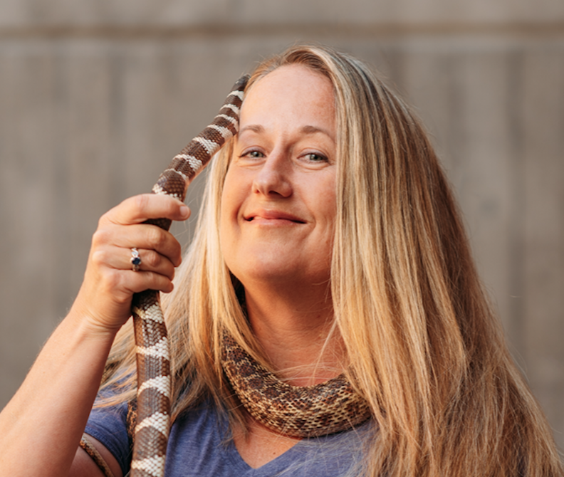
In this case study from herpetologist Emily Taylor, we learn about the best methods and gear used to track snakes, lizards, and other reptiles and amphibians via radio-telemetry, and how these techniques have changed...
31 July 2020
Article
Kākāpō Dreaming: A Wildlife Drones Adventure

Wildlife Drones
What is it like to track endangered species using drones? In this blog post from Wildlife Drones, Dr. Debbie Saunders travels to New Zealand to track the Kākāpō, an extemely rare and elusive bird of which approximately...
8 July 2020
Article

The Monterey Bay Aquarium Research Institute's MARS ocean observatory may someday make conducting deep-sea research more accessible and affordable thanks to Deep-Sea Connect, their new wireless system engineered to ...
31 March 2020
Article
#Tech4Wildlife 2020 Photo Challenge In Review

WILDLABS Team
2020 marked our fifth year holding our annual #Tech4Wildlife Photo Challenge, and our community made it a milestone to remember. Conservationists took to Twitter last week to share their best high-tech snapshots from...
4 March 2020
Funding

The 2020 Tusk Awards are now accepting nominations of outstanding individuals who have made a significant impact on conservation in Africa. These nominations offer the rare and exciting opportunity to honor your peers...
3 March 2020
Article
How do you weigh a live whale?

Fredrik Christiansen
How do we actually know a whale weighs 40 tonnes? After all, we can’t exactly capture an animal the size of a bus and simply put it on a scale. Fredrik Christiansen explains their new, non-invasive way of weighing...
9 October 2019
Article
From the Field: Melissa Schiele

WILDLABS Admin
In this From the Field interview, we talk to Melissa Schiele, a tech whiz, marine ecologist, and conservationist at the Zoological Society of London. She shares with us about her work helping to develop the first-ever...
10 June 2019
Article
Canopy height mapping with drones
Tom Swinfield
Tom Swinfield and colleagues at the Forest Ecology and Conservation Group have assessed the quality of three dimensional forest models produced from drone surveys, and conclude that concerns about their quality for...
31 May 2019
Article

In this blog, Laure Joanny adds her perspectives to an ongoing discussion that we've been seeing in the community about conservation tech and it's relationship to e-waste. How do we tackle the challenge of battery waste...
3 May 2019
Article
#Tech4Wildlife Photo Challenge: Our Favourites from 2019
WILDLABS Team
Happy World Wildlife Day! To celebrate, this week we've asked our community to share photos showing how they are using tech in the field or the lab, using the #Tech4Wildlife hashtag.
3 March 2019
Article
Using Swiss AI and Drones to Count African Wildlife

Susan Misicka
After a promising first run in Namibia, a Swiss project could aid savanna conservation using drones and automatic image analysis.
18 February 2019
Article

In this case study, Science Reporter Jamie Morton tells the story of how Kiwi scientists are teaming up with a local underwater robotics company to gain world-first insights into the lives of whales in Antarctica.
4 February 2019
May 2023

April 2023

29 Products
Recently updated products
| Description | Activity | Replies | Groups | Updated |
|---|---|---|---|---|
| Hi all,I've been quickly developing in-house drone services in the UK for Providence Ecological and have found some useful information for building a workflow with Rich... |
+8
|
Remote Sensing & GIS, Drones | 1 year 3 months ago | |
| Hi folks, @Lars_Holst_Hansen asked this over on twitter and hasn't had any replies yet, so I thought it might be something that... |
|
Drones | 1 year 3 months ago | |
| Bluesky have a commercial tree crown dataset available covering most of Great Britain (England, Wales and parts of Scotland). There is a canopy layer with approximate outlines of... |
|
AI for Conservation, Drones | 1 year 3 months ago | |
| Hi Lindy,WebODM has now a native Windows installer version which costs around 147 $ once - https://opendronemap.org/webodm/download/.Is has almost all the advantages of the high... |
|
Drones | 1 year 4 months ago | |
| My original background is in ecology and conservation, and am now in the elected leadership of the Gathering for Open Science Hardware which convenes researchers developing open... |
|
AI for Conservation, Biologging, Camera Traps, Conservation Tech Training and Education, Data management and processing tools, Drones, Emerging Tech, Sensors | 1 year 4 months ago | |
| Hey Sol, The only way for you to collect information from a GPS tag attached to a FAD is if that tag transmits that data to the drone. Unfortunately most receiver packages... |
|
Drones, Emerging Tech, Open Source Solutions | 1 year 6 months ago | |
| Thanks so much!! |
|
Acoustics, AI for Conservation, Biologging, Camera Traps, Community Base, Data management and processing tools, Drones, eDNA & Genomics, Emerging Tech, Open Source Solutions, Remote Sensing & GIS, Software and Mobile Apps | 1 year 8 months ago | |
| Hey all!I am Ayush, a core team member of my school's Robotics Club (Center For Innovation, Indian Institute of Technology, Madras). There... |
|
Drones, Sensors, Wildlife Crime, Early Career | 1 year 10 months ago | |
| @gracieermi & I are happy to announce the latest update to the Conservation Tech Directory, bringing our total resources in the... |
|
Acoustics, AI for Conservation, Biologging, Camera Traps, Community Base, Data management and processing tools, Drones, eDNA & Genomics, Remote Sensing & GIS, Software and Mobile Apps | 1 year 11 months ago | |
| Some folks doing work in this space - Wildlife Drones, Conservation Drones, UAV Wild, AfricanDrones, Oceans Unmanned, Geonadir. |
|
Drones, AI for Conservation, Citizen Science, eDNA & Genomics, Emerging Tech | 1 year 11 months ago | |
| Hi I can help...I think I have a few ideas where this can work. Thanks |
+4
|
Drones | 1 year 11 months ago | |
| >>>Ideally I'd be able to log angle/acceleration data (IMU), GPS (XYZ) >>>camera-trigger events (hotshoe of camera) to an SD card. The Pixhawk class... |
|
Drones | 2 years 4 months ago |