GIS, or Geographic Information Systems, play a crucial role in nature conservation. Every day, mapping and spatial analysis are aiding conservation decisions, protected areas designation, habitat management on reserves and monitoring of wildlife populations, to name but a few examples. Want to learn more about how remote sensing is used in conservation? Check out the first two episodes of this season of Tech Tutors, where our Tutors answer the questions How do I use open source remote sensing data to monitor fishing? and How do I access and visualise open source remote sensing data in Google Earth Engine?
You can also check out our Virtual Meetup Archive for a range of panels that overlap with Remote Sensing & GIS topics.

Sustainability Manager for CERES Tag LTD. An animal health company; animal monitoring, conservation, & anti-poaching/ rural crime. Wildlife, livestock, equine & companion. #CeresTrace #CeresWild #CeresRanch


- 2 Resources
- 19 Discussions
- 24 Groups

Wildlife Drones
Wildlife Drones has developed the world’s most innovative radio animal-tracking system using drones so you can track your radio-tagged animals like never before.


- 11 Resources
- 8 Discussions
- 32 Groups

My main interest is in the application of geospatial technology for ecology and conservation
- 0 Resources
- 12 Discussions
- 6 Groups
- @jcaris
- | hi/him
Smith College & Cummings School of Veterinary Medicine at Tufts University
Senior Drone Data Scientist, Tufts University; Former Director of the Spatial Analysis Lab at Smith College. Teaching, learning, and collaborating with brilliant students & faculty
- 0 Resources
- 0 Discussions
- 9 Groups

I help conservation scientists spend less time on boring stuff.


- 0 Resources
- 28 Discussions
- 6 Groups

- @crazybirdguy
- | Him
Field Biologist at Yayasan Cikananga Konservasi Terpadu, Indonesia, with experience and interest mainly in ornithology, citizen science and bioaccoustic
- 0 Resources
- 6 Discussions
- 12 Groups

- @ahmedjunaid
- | He/His
Zoologist, Ecologist, Conservation Biologist
- 0 Resources
- 0 Discussions
- 16 Groups

PhD Candidate in autonomous marine biodiversity modelling

- 0 Resources
- 11 Discussions
- 8 Groups
FruitPunch AI
CTO and Founder of FruitPunch AI

- 0 Resources
- 4 Discussions
- 11 Groups
- 0 Resources
- 0 Discussions
- 17 Groups
Saint Louis Zoo
- 0 Resources
- 0 Discussions
- 13 Groups
- 0 Resources
- 0 Discussions
- 10 Groups
Careers
GIS Officer

Stephanie O'Donnell
Rainforest Alliance is seeking a GIS Officer based in the Netherlands, Germany, or Belgium
11 October 2022
Article
The planet matters. People matter. Location matters.

Floor van Dam
This paper released by the World Economic Forum and the SPACES coalition shows how businesses can embrace the use of spatial intelligence for action on nature and climate. How can we make sure businesses apply the...
23 September 2022
Careers

This role will be employed under Osa Conservation's Movement Ecology Program. Broadly, the project aims to develop and use novel animal tracking technology to increase our understanding of the movement ecology of...
22 September 2022
Article
Collecting Critically Endangered Plants on Cliffs using a Drone

Guillaume Charron
This technology was recently tested in Kauai, Hawaii, with the National Tropical Botanical Garden and has successfully collected from 5 critically endangered species that were otherwise inaccessible.
16 September 2022
Careers

At the Inria Sophia Antipolis - Méditerranée center. The project will pursue two different methodological goals: (1) explore the use of natural language bottlenecks describing visible traits or other visual...
1 September 2022
Careers

Seeking interested individuals with qualifications and educational background and experience in marine species biology/ecology (marine mammals, sea turtles, fish, seabirds, etc.); with skills in applied scientific study...
31 August 2022
Careers

Hey space & nature conservation enthusiasts! For an innovation project about forest impact monitoring, I am looking for a student assistant with the option to write a Master thesis.
29 August 2022
Careers
Conservation Technology Research Internship

Meredith Palmer
Boost cons tech capacity at an international NGO! Fauna & Flora International is offering a paid three-month internship to consolidate and share best practices for the application of emerging hardware and software...
26 August 2022
Careers
The incumbent will conduct research to advance the integration of wildlife tracking & space-based remote sensing, serve as a member of the multi-agency Internet of Animals project & participate as an inter-...
25 August 2022
Funding
RCMRD Map Competition 2022

Netty Cheruto
Through this Competition, RCMRD aims to enhance the role of Geo-conservation in Protected Areas Management and Environmental Conservation. With a Total Prize Tag of 10,000 Euros, participants will be required to use...
19 August 2022
Careers

The Marine Robotics and Remote Sensing (MaRRS) Lab at Duke University seeks a highly motivated UAS pilot and geospatial analyst to support the ongoing development of new and existing research and conservation programs,...
10 August 2022
Careers
The Marine Robotics and Remote Sensing (MaRRS) Lab at Duke University seeks a highly motivated postdoctoral researcher to support the ongoing development of new and existing research and conservation programs, both...
10 August 2022
June 2024
event

Cassie Anderson
July 2024

September 2024

February 2024
event

Catherine Greene
January 2024
event

Esther Githinji
112 Products
Recently updated products
| Description | Activity | Replies | Groups | Updated |
|---|---|---|---|---|
| HI benard sorry am replying late,and yes i the data was exported as shapefile 2.i used same projection which is 37N WGS 84 on both apps and still the exported shape file... |
|
Remote Sensing & GIS, East Africa Community | 1 year 10 months ago | |
| @gracieermi & I are happy to announce the latest update to the Conservation Tech Directory, bringing our total resources in the... |
|
Acoustics, AI for Conservation, Biologging, Camera Traps, Community Base, Data management and processing tools, Drones, eDNA & Genomics, Remote Sensing & GIS, Software and Mobile Apps | 1 year 11 months ago | |
| Hey all! Just thought I would share the link to this wonderful new issue of National Geographic. Very powerful data visualisation of some... |
|
Remote Sensing & GIS | 2 years 1 month ago | |
| This earth day 2022 celebration blog recaps some of the available resources from organizations that are partnering with the NICFI Satellite Data Program. The platforms, tools... |
|
Remote Sensing & GIS | 2 years 1 month ago | |
| Can also recommend looking into Argos: https://www.cls-telemetry.com/argos-solutions/argos-services/ The transmitter can send a few messages per day and the messages are... |
+5
|
Remote Sensing & GIS, Connectivity | 2 years 1 month ago | |
| I think it looks like a really interesting technology, but it's still in the realm of research and academia. They're correct in that it demonstrates device miniaturization... |
|
Remote Sensing & GIS | 2 years 8 months ago | |
| Geospatial data engineer at Salo Sciences - https://salo.ai/assets/pdf/Data%20Engineer%20%E2%80%93%20Salo%20Sciences%20(Jul%202021).pdf... |
|
Remote Sensing & GIS | 2 years 9 months ago | |
| I am looking for collaborators and donors, or I am offering myself as a collaborator for a Uni / research organisation, for a research... |
|
Remote Sensing & GIS | 3 years 1 month ago | |
| Hi Remote Sensing & GIS folks, The Allen Coral Atlas is proud to announce three new mapping regions: Great Barrier Reef & Torres... |
|
Remote Sensing & GIS | 3 years 2 months ago | |
| Hi everyone, Another brilliant webinar series from SCGIS (Society for Conservation GIS) and CBI (Conservation Biology Institute) ... |
|
Remote Sensing & GIS | 3 years 3 months ago | |
| Wow, thanks for sharing, @ZoeLieb ! Great initiative and wonderful opportunity for people to contribute to the atlas. Good luck! |
|
Remote Sensing & GIS | 3 years 3 months ago | |
| Hi everyone! This is a heads up that the Society for Conservation GIS (SCGIS) and Conservation Biology Institute (CBI) are co-hosting a... |
|
Remote Sensing & GIS | 3 years 4 months ago |


Insight; a secure online platform designed for sharing experiences of conservation tool use.

7 November 2023 1:01pm
A secure platform designed for those working to monitor & protect natural resources. Insight facilitates sharing experience, knowledge & tools to increase efficiency & effectiveness in conservation. By sharing we reduce time & money spent to find, test, & implement solutions.
Welcome to Insight
Wildlife crime refers to any illegal activity that involves the taking, trading, or possession of wild animals and plants, or their parts and derivatives.
 Insight

TWS2023 - get in touch

5 November 2023 8:13pm
5 Trailblazing Wildlife Monitoring Tech Solutions across East Africa. What Monitoring Technologies are you using?

25 October 2023 12:40pm
Restoring the Mara Elephant Population Using Coexistence Tech Solutions with Mara Elephant Project's Wilson Sairowua
 Wilson Sairowua
20 October 2023 1:31pm

27 May 2024 3:54pm

28 May 2024 8:12am
Biodiversity Intactness dataset now available on the Earth Engine community catalog
16 October 2023 1:21pm
Working Student (m/f/d) GIS & RS Monitoring of Biodiversity & Agroecology in Africa & Asia

6 October 2023 2:05pm
Discover Digital Earth Africa
6 October 2023 1:26pm
How 3D Technologies are Reshaping Forest Ecology and Conservation
6 October 2023 1:13pm
GEO BON Monitoring Biodiversity for Action

5 October 2023 3:10pm
GIS & Data Science Specialist
28 September 2023 1:32pm

GIS & Data Science Specialist, Connected Conservation Foundation
27 September 2023 1:28pm
GIS in Disaster Risk Management Training
26 September 2023 12:22pm
1st Wildlife Scientific Conference 2023
25 September 2023 11:10am
IUCN and AI2 to provide AI technology at no cost to fast-track implementation of newly signed UN High Seas Treaty
22 September 2023 9:54am
CIEEM 2023 Autumn Conference: Modernising Ecology: Techniques and Approaches
5 September 2023 1:59pm
Intro to Systematic Conservation Planning with Marxan
5 September 2023 1:18pm
Remote Sensing | Free Full-Text | Estimation of Forest LAI Using Discrete Airborne LiDAR: A Review
5 September 2023 11:57am
📢 New Paper: Estimation of Forest LAI Using Discrete Airborne LiDAR: A Review by Luo Tian, Yonghua Qu and Jianbo Qi
👉 Read the full article: https://www.mdpi.com/2072-4292/13/12/2408
Textbook: Cloud-Based Remote Sensing with Google Earth Engine
5 September 2023 11:49am
Ecosystems Conservation: Action with CSOS/NGOS - EXPRO+
 European Space Agency
1 September 2023 5:57am
Senior Spatial Ecologist
 The Charles Darwin Foundation
24 August 2023 11:22pm
How to report on biodiversity impacts at scale for TNFD
24 August 2023 12:41pm
Born Free Uses Smart Maps to Save Lions, Solve Human-Wildlife Conflict
17 August 2023 2:35pm
Location intelligence helps Born Free Kenya understand where communities and lions are in conflict. Outreach to fortify cattle corrals is guided by smart maps and spatial analysis.
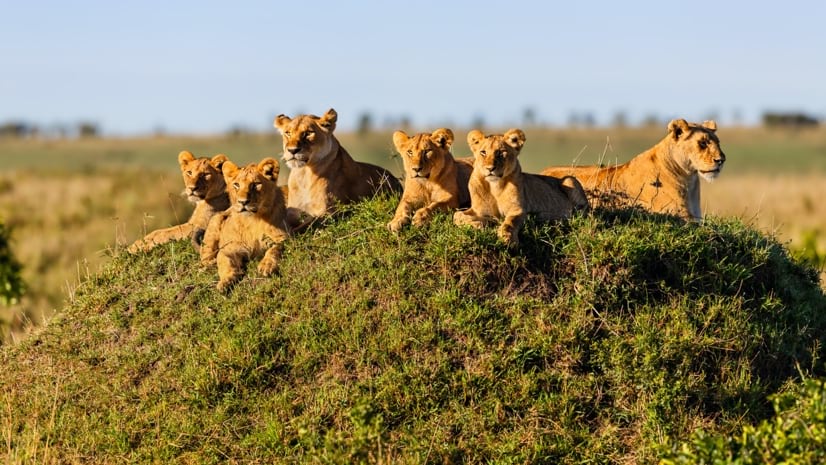
Born Free Uses Smart Maps to Save Lions, Solve Human-Wildlife Conflict
Born Free maps the conflict between lions and communities to find solutions, including fortifying fences to keep lions away from livestock.
 Esri
Esri
Conservation Technology Specialist
 WCS
WCS
11 August 2023 1:21am
Society for Conservation GIS International Conference

26 July 2023 5:19pm
5 November 2023 9:04pm
I'm registered with the TWS2023 app, so feel free to nudge me there as well