In recent years, drone technologies have been explored for a range of applications in conservation including (but not limited to) mapping, biodiversity inventories, antipoaching patrols, wildlife tracking, and fire monitoring. The rise of customizable, open-source drones like those of ArduPilot and OpenROV hold promise for more effective conservation applications, and combined with other monitoring sensors and devices, they are capable of collecting high-resolution data quickly, noninvasively, and at relatively low cost.
However, challenges remain in putting these tools to use. A recent paper reviewing 256 conservation drone projects highlighted some of these major obstacles, ranging from unintended social and ecological consequences of drone operations to still prohibitive costs, both in terms of hardware and in terms of storing and processing large volumes of data. The longstanding challenge of power/battery life remains as well.
If you're considering trying out drones for yourself, and want to explore the possibilities and understand the major conversations happening around this technology, check out these beginner's resources and conversations from across the WILDLABS platform:
Three Resources for Beginners:
- Conservation Technology User Guidelines Issue 5: Drones, World Wildlife Fund | Drones, best practices, ethics, regulations, case studies
- WILDLABS Virtual Meetup Recording: Drones, Craig Elder, Dr. Claire Burke, and Gabriel Levin | Drones, thermal camera, wildlife crime, ML, biologging
- New Paper: Drones and Bornean Orangutan Distribution, Sol Milne | Drones, data analysis, citizen science, community science, primates
Three Forum Threads for Beginners:
- Curious about radio-tracking with drones? | Wildlife Drones, Biologging (5 replies)
- Drones for GIS Best practice Document | Adrian Hughes, Drones (10 replies)
- WWF Conservation Technology Series: Drones in Conservation | Aurélie Shapiro, Drones (7 replies)
Three Tutorials for Beginners:
- How do I use a drone to capture radio-tracking data? | Debbie Saunders, Tech Tutors
- How do I choose the right drone for my conservation goals? | Shashank Srinivasan, Tech Tutors
- How do I strategically allocate drones for conservation? | Elizabeth Bondi, Tech Tutors
Want to know more about using drones, and learn from experts in the WILDLABS community? Make sure you join the conversation in our Drones group!
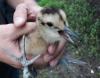
*Header photo: Parker Levinson, Point Blue Conservation Science

- @LindyClydeKnowles
- | he/him

- 0 Resources
- 6 Discussions
- 6 Groups
Certified Associate Wildlife Biologist
M.S. Student


- 2 Resources
- 19 Discussions
- 7 Groups
I'm a wildlife ecologist with interests in a range of technology.
- 0 Resources
- 20 Discussions
- 5 Groups

Passionate advocate for nature and experienced communicator, looking to explore opportunities to leverage technology in wildlife and marine conservation
- 0 Resources
- 0 Discussions
- 7 Groups

Technologist and Visual storyteller focusing on social, conservations issues.
- 0 Resources
- 31 Discussions
- 16 Groups

- @ATM
- | HE
I studied Wildlife and Ecotourism Management in University of Ìbàdàn, Nigeria, I'm a front-end developer. I am interested in conservation technology
- 0 Resources
- 5 Discussions
- 11 Groups
- 0 Resources
- 0 Discussions
- 1 Groups

- 0 Resources
- 0 Discussions
- 11 Groups

Neuroscientist & engineer transitioning to conservation tech. I have experience working with large imaging datasets, pose estimation and positional tracking, and machine learning. Looking to get involved with GIS, remote sensing, and AI for conservation.
- 0 Resources
- 0 Discussions
- 17 Groups

- 0 Resources
- 0 Discussions
- 16 Groups

- 0 Resources
- 0 Discussions
- 6 Groups
Research coordinator Transfrontier Africa, PhD student STELLENBOSCH UNIVERSITY
- 0 Resources
- 5 Discussions
- 2 Groups
Article
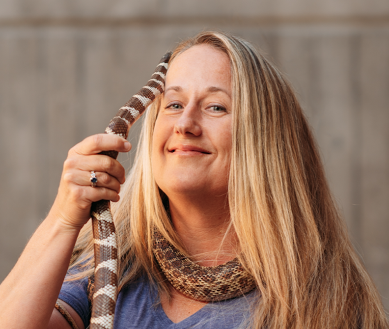
In this case study from herpetologist Emily Taylor, we learn about the best methods and gear used to track snakes, lizards, and other reptiles and amphibians via radio-telemetry, and how these techniques have changed...
31 July 2020
Article
Kākāpō Dreaming: A Wildlife Drones Adventure

Wildlife Drones
What is it like to track endangered species using drones? In this blog post from Wildlife Drones, Dr. Debbie Saunders travels to New Zealand to track the Kākāpō, an extemely rare and elusive bird of which approximately...
8 July 2020
Article

The Monterey Bay Aquarium Research Institute's MARS ocean observatory may someday make conducting deep-sea research more accessible and affordable thanks to Deep-Sea Connect, their new wireless system engineered to ...
31 March 2020
Article
#Tech4Wildlife 2020 Photo Challenge In Review

WILDLABS Team
2020 marked our fifth year holding our annual #Tech4Wildlife Photo Challenge, and our community made it a milestone to remember. Conservationists took to Twitter last week to share their best high-tech snapshots from...
4 March 2020
Funding

The 2020 Tusk Awards are now accepting nominations of outstanding individuals who have made a significant impact on conservation in Africa. These nominations offer the rare and exciting opportunity to honor your peers...
3 March 2020
Article
How do you weigh a live whale?

Fredrik Christiansen
How do we actually know a whale weighs 40 tonnes? After all, we can’t exactly capture an animal the size of a bus and simply put it on a scale. Fredrik Christiansen explains their new, non-invasive way of weighing...
9 October 2019
Article
From the Field: Melissa Schiele

WILDLABS Admin
In this From the Field interview, we talk to Melissa Schiele, a tech whiz, marine ecologist, and conservationist at the Zoological Society of London. She shares with us about her work helping to develop the first-ever...
10 June 2019
Article
Canopy height mapping with drones
Tom Swinfield
Tom Swinfield and colleagues at the Forest Ecology and Conservation Group have assessed the quality of three dimensional forest models produced from drone surveys, and conclude that concerns about their quality for...
31 May 2019
Article
In this blog, Laure Joanny adds her perspectives to an ongoing discussion that we've been seeing in the community about conservation tech and it's relationship to e-waste. How do we tackle the challenge of battery waste...
3 May 2019
Article
#Tech4Wildlife Photo Challenge: Our Favourites from 2019
WILDLABS Team
Happy World Wildlife Day! To celebrate, this week we've asked our community to share photos showing how they are using tech in the field or the lab, using the #Tech4Wildlife hashtag.
3 March 2019
Article
Using Swiss AI and Drones to Count African Wildlife

Susan Misicka
After a promising first run in Namibia, a Swiss project could aid savanna conservation using drones and automatic image analysis.
18 February 2019
Article
In this case study, Science Reporter Jamie Morton tells the story of how Kiwi scientists are teaming up with a local underwater robotics company to gain world-first insights into the lives of whales in Antarctica.
4 February 2019
November 2023

October 2023

29 Products
Recently updated products
| Description | Activity | Replies | Groups | Updated |
|---|---|---|---|---|
| Hi David - have you seen this opportunity? It may be a good one to apply to for support (the Darwin Initiative). |
+19
|
AI for Conservation, Drones, Emerging Tech, Human-Wildlife Conflict, Wildlife Crime | 3 days 10 hours ago | |
| Thank you for elaborating, @evebohnett ! And for the heads ups! |
+22
|
Camera Traps, Drones | 1 month ago | |
| @PaulAllin Thanks for your valuable insights. Zenmuse H20N seems to be very powerful and useful in this case. However, I'm looking for a more affordable option for a self-funded... |
+5
|
Drones, Human-Wildlife Conflict | 3 months 2 weeks ago | |
| We will be conducting in-person demos of our cutting-edge drone technology in the US this year! 🇺🇸 If you're interested in experiencing... |
|
Biologging, Drones, Remote Sensing & GIS, Software and Mobile Apps | 3 months 3 weeks ago | |
| Hi Danilo. you seem very passionate about this initiative which is a good start.It is an interesting coincidence that I am starting another project for the coral reefs in the... |
|
Acoustics, AI for Conservation, Biologging, Camera Traps, Citizen Science, Climate Change, Community Base, Connectivity, Drones, Emerging Tech, Human-Wildlife Conflict, Open Source Solutions, Sensors, Software and Mobile Apps, Wildlife Crime | 4 months ago | |
| Forgot to mention this wildlife drone group - |
|
Drones, eDNA & Genomics | 4 months 1 week ago | |
| Hi, I have used a commercial company for drone work for my PhD and they were willing to give me a significant discount for research purposes. One thing to consider is that in SA a... |
+2
|
Drones, East Africa Community | 4 months 1 week ago | |
| Hi!I would take a look at Although developed for camera trap imagery, it is by no means restricted to such.Cheers,Lars |
|
Camera Traps, Community Base, Data management and processing tools, Drones, Emerging Tech, Remote Sensing & GIS, Software and Mobile Apps | 4 months 1 week ago | |
| In what ways can drones contribute to linking individuals, communities, and small-scale producers in rural areas, facilitating the support... |
|
Drones, Remote Sensing & GIS | 5 months 3 weeks ago | |
| @dmorris joined Variety Hour to give us 'a bunch of lightning talks inside a lightning talk'. Check out the recording to get a whirlwind... |
|
AI for Conservation, Drones, Remote Sensing & GIS | 5 months 3 weeks ago | |
| @caseyslaught is a Full-stack engineer with Virunga National Park, and he's built a handy tool to host, visualize, and... |
|
Drones | 5 months 3 weeks ago | |
| The link above does not seem to work but this does: https://wildlabs.net/sites/default/files/community/files/drones_for_gis_-_best_practice_v2.0.pdf |
|
Drones | 6 months 1 week ago |


Drone flight in Indonesia
16 April 2019 12:08pm
18 April 2019 5:07pm
Thanks so much Sol! How long did it take you to get permission to fly? And were there any costs associated with getting the permit?

4 June 2019 1:33pm
Hi Sophie,
Sorry- I only just saw your reply!
It took about 3 months to get it through the department of civil aviation, but this doesn't mean much, because the Indonesian system may be pretty different. It cost 250RM (£50) for each drone.
Cheers,
Sol
Canopy height mapping with drones
Tom Swinfield
31 May 2019 12:00am
Technology for Wildlife and the Looming Spectre of E-Waste
 Laure Joanny
3 May 2019 12:00am
WILDLABS Virtual Meetup: Low Cost, Open-Source Solutions
WILDLABS Team
18 March 2019 12:00am
#Tech4Wildlife Photo Challenge: Our Favourites from 2019
WILDLABS Team
3 March 2019 12:00am
Using Swiss AI and Drones to Count African Wildlife
Susan Misicka
18 February 2019 12:00am
Getting up close and personal with Antarctica's orcas
 Jamie Morton
4 February 2019 12:00am
Drones with thermal imaging
21 January 2019 10:34am
Viral bear video shows how drones threaten wildlife – and what to do about it
 Margarita Mulero Pazmany
22 November 2018 12:00am
Infrared filters for drone cameras

3 August 2017 11:17am

22 August 2017 3:09am
Although not for NDVI but worth a mention for anyone looking at converting a camera into IR only.
I have had sucess using a DIY filter made out of blank processed camera film from a disposable camera. So long as you can still find somewhere to process the film (or do it yourself) you just cut the processed film (negatives) and replace the digital cameras IR filter (placed over the cameras sensor). This will simply turn the camera into an IR camera only so won't fit your requirement for NDVI but thought that it is worth posting if others are looking at converting a camera or Go-Pro into an IR camera.

23 May 2018 9:41am
Hi Thom,
Did you have any luck with the DIY sensor?
Sam
10 November 2018 11:40am
If you need a piece of exposed (black) film then please get in touch. I still take "real" slides and have a few black frames at start and end of each roll of film.
Drones, Orangutans, and Strangler Figs in Malaysian Borneo
 Sol Milne
22 October 2018 12:00am
Multispectral Cameras

27 September 2018 2:38pm
Underwater Robot Trained to Kill Coral-Destroying Reef Starfish
 The Maritime Executive
18 September 2018 12:00am
Thermal imaging, drones, and sea turtles: a case study using FLIR’s new Duo Pro R camera
 Megan Ossmann
23 August 2018 12:00am
Drone Applications in Water Quality Research?

14 March 2018 4:42pm
16 March 2018 5:49am
Hi Ned,
Thank you so much for your response!
I absolutely agree- going out and testing flights over water at different angles and times of the day would be best. I'll look into a polarizing filter. I have spoken with some colleagues who recommend flying between noon and 3pm, and also that a cloudy day with diffused light can actually be quite helpful to avoid glint. I will look into the oil spill mapping - sounds very interesting. I've also heard that drones are sometimes restricted from oil spill regions due to risks of battery-caused fires (if the drones fall into the water).
Ved! Fantastic idea. I used to work with him down at Ames, so I will certainly reach out. Thank you for the reminder!
Cheers,
Chippie
6 June 2018 6:48pm
Hi CHippie - I am wondering how your thoughts are progressing on this topic? Please let us know an update.
Thanks
Michael
9 June 2018 12:10am
Hi Michael!
Thanks so much for following up. I have yet to really get my feet wet with drones & algal blooms (my water quality issue of interest at the moment), but what I gathered from my literature review is that hyperspectral cameras are a much more precise option than multispectral cameras for algal identification. I'm hoping to try out a red-edge camera to see if there is anything spectrally interesting, as I do not currently have access to a hyperspectral camera. For the time being, I am hoping to play with a MicaSense camera over wet habitat and see if anything can be observed. I'll keep you posted if I find anything of interest!
Thanks,
Chippie
From drone swarms to tree batteries, new tech is revolutionising ecology and conservation
 Euan Ritchie
9 May 2018 12:00am
Tethered UAVs

14 March 2018 4:29pm
27 April 2018 11:46pm
Thanks - I did look into blimps but the helium problem is a big one for remote work. I do have a couple UAVs but the area I work is tricky (airport, waterdrome, and helicopter landing with occasional ships that carry helicopters). my hope was for a tethered solution that could run for longer than the 20min battery life of a drone. thanks for the info.
27 April 2018 11:53pm
thanks I adnt thought of kites - I will have to test one in the field this year. I imagined one of the advantages of a tethered UAV is that I can parasitize all the camera elements (gimble stabilization, pan/tilt/zoom, and real time viewing of the imagery). Maybe I could just secure a cheap UAV under a kite... I wonder how I choose the correct kite size.
28 April 2018 5:13pm
hi Stephen,
Kites have gimbals too (ranging from simple strings to metal rigs) and you can connect to a camera much like a drone. In my case I have a gimbal hanging on a string, and to connect to my camera I get live connection and can change settings with the GoPro app! this website has lots of info - size of the kite depends on payload (some people fly SLRs!) and wind.
Www.kapshop.com
Eddy Expedition Log: Characterizing Eddies
23 April 2018 12:00am
Eddy Expedition Log: Chasing Eddies
 Elisha Wood-Charlson
10 April 2018 12:00am
Eddy Expedition Log: Setting Off to Explore Eddies
Elisha Wood-Charlson
3 April 2018 12:00am
#Tech4Wildlife Photo Challenge 2018: Our Top 10
WILDLABS Team
3 March 2018 12:00am
Online Course: Drones for Land Trust Monitoring and Management with Duke Marine Robotics & Remote Sensing Lab
25 January 2018 12:00am
Technology Empowered Conservation Lecture Series
 Paul Jepson
18 January 2018 12:00am
"harvesting" camera traps, bioacoustic sensors via drones
3 November 2017 4:12pm

15 November 2017 7:05pm
NASA/NOAA did something like this with microbuoys for ocean temp sensing in the arctic - drone deploys (drops) micrbuoys and repeatedly returns to fly over fetching data over the following days and weeks
http://www.arcticobservingsummit.org/sites/arcticobservingsummit.org/files/Bradley_Microbuoys_AOS.pdf
Do you have a specific use case /location in mind?
If we could find research funding I'd be interested, I can fly &build UAS but this is also an interesting data management opportunity which I'm very interested in.
Perhaps you could mod the Ardupilot tracking antenna system if really needed but if you're flying in the vicinity with line of sight I bet you don't even need to aim the antenna
17 November 2017 2:31am
I've seen a couple of papers on similar capabilities, both with airborne drones as well as underwater drones, so there've been folks working on it. @emjay has a good point that the sensor nodes need to support this, which could be a bit tricky depending on your tolerance for battery life. What types of sensors are you thinking about supporting?

21 December 2017 3:48am
Hi Chris,
Your project sounds interesting! How's it coming along?
I'm based in the SF Bay Area. I don't have much drone experience, but it's something that I've been looking into recently. I'm currently working on a face recgnition system for brown bears with a bear researcher in BC, Canada. The goal is to identify bears on the data from camera traps to monitor populations and such. Currently the data is only collected a few times a season.
I agree with @emjay that the ground assets may be an issue. Do you have any thoughts on that front?
In any case, if you have some time in the coming weeks, I'd be happy to get together in the coming weeks to talk it over.
Ed
Drones: the pros and cons for community-based monitoring

10 December 2017 12:43pm
How The San Diego Zoo Is Using AI And Drones To Save Polar Bears
 Mark Wallace
30 November 2017 12:00am
Kids, Drones & Science At The Water’s Edge
 Cara Byington
4 October 2017 12:00am
New paper on using drones in challenging environments
24 August 2017 9:04am
24 August 2017 4:57pm
Excellent - started reading this yesterday. This is a very timely and pertinent paper. Thanks for sharing.
Drone Tracker
23 August 2017 6:47am
24 August 2017 2:54am
Hi Lot,
Thank you for your input. Currently we are the end user instead of developer. That means, we are still using commercial drone like DJI series. However the link that you give absolutely useful for our upcoming innovation plans.
Since we still using commercial type quadcopter, I'm looking for stand alone tracker that work as seperate system from the drone. In other words, this tracker will not be affected should the drone system crash.
So far me and my team come across this device
http://www.dronesmadeeasy.com/Marco-Polo-Drone-Tracker-RF-Recovery-p/marco_polo_1.htm
Unfortunately, the radio signal frequency range so far not approved by Malaysian authority. So, I'm looking for other option.
Anyone in this forum have other option/ opinion?
Regards,
Mazidi

24 August 2017 6:51am
Hi Mazidi,
A couple of options;
- Marco Polo. http://eurekaproducts.com/rc-model-tracking-and-recovery/
I know of people who have relocated their machine using this device.
- Conventional VHF for wildlife tracking. old but solid technology.
Also have a look at commercial / open source devices used for model rockets.
regards
MJ
EDIT: I see that you have already identified Marco Polo.
24 August 2017 1:15pm
Hi Mazidi, all the systems that I recommended are separate systems with their own GPS, not connected to the drone.
Just the last one was the only finished product.
Good luck. Please tell us if you found something good and cheap!
A first-person account of the capture of a tiger in Pilibhit: Four elephants and a bulldozer, as seen from a drone
 Shashank Srinivasan
10 August 2017 12:00am
17 April 2019 4:14pm
Hi Sophie,
The best thing would be to get in contact with the Department of Civil Aviation in the Indonesian state you're working in. You're right that you can fly without a permit for at low altitude in most places, but there may be diferent restrictions if the drone is used for research purposes so its worth checking. I received a license for drone work in Sabah (Malaysian Borneo) and they mainly wanted to know the drone specs, activities, flight coordinates, dates and if possible, times. The only restriction they gave us was to fly below 300 m,
There is usually a lot of back and forth between departments about who is ultimately responsible but they should be able to get it processed, as there are groups in Kalimantan using drones pretty regularly. Please let me know if you have any issues or need any other info.
Best wishes,
Sol