
Sol Milne
Background
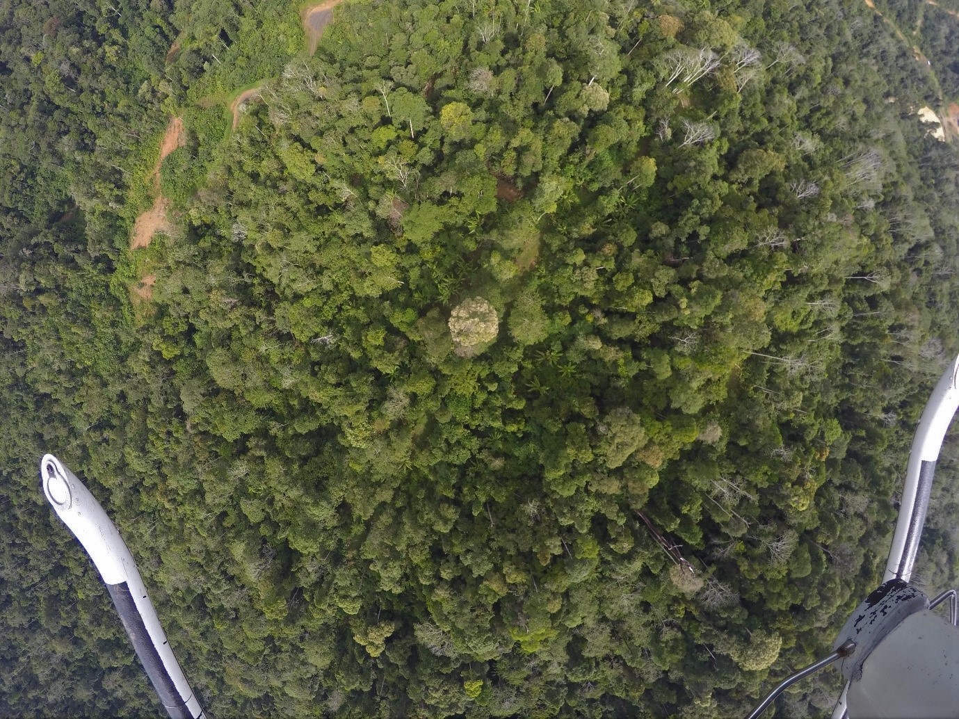
Orangutans are an ecologically important species, serving a vital role as seed dispersers due to their highly varied diet and ability to disperse across large areas on a daily basis. They are also what is known as an ‘umbrella species’, as their habitat requirements overlap with those of many other species. By focusing conservation efforts on orangutans, we are able to protect a large number of these other species as well. The detection and counting of orangutan nests is a vital tool for studying their population ecology, as the size of the population can be estimated from the number of nests per km2. Nests are visible from the forest canopy and can be detected via drone imagery.
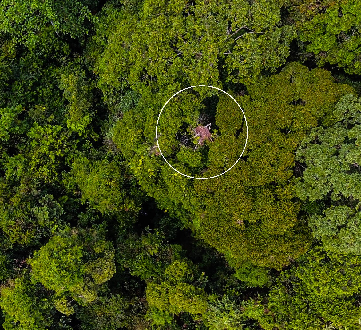
An orangutan nest from above
Strangler figs (Ficus spp.) are also ecologically important species that are highly diverse and have fascinating life histories. After being deposited in the crooks of branches, generally by birds and bats, the seedlings grow around the trunks of existing trees. When mature, some species can fruit up to three times a year, and provide a vital source of food. The fruits are rich in sugars, fats, proteins, and calcium, which is a very limited nutrient in tropical forests. They also have a very distinct tree crown structure, making them easily recognisable in aerial photos.
Our Research
In this study, we are assessing two questions regarding strangler figs:
- To determine how strangler figs are affected by human land use, we are looking at their distribution across a degradation gradient.
- To determine whether they influence orangutan ecology at a landscape scale, we are comparing their distribution to that of orangutan nests.
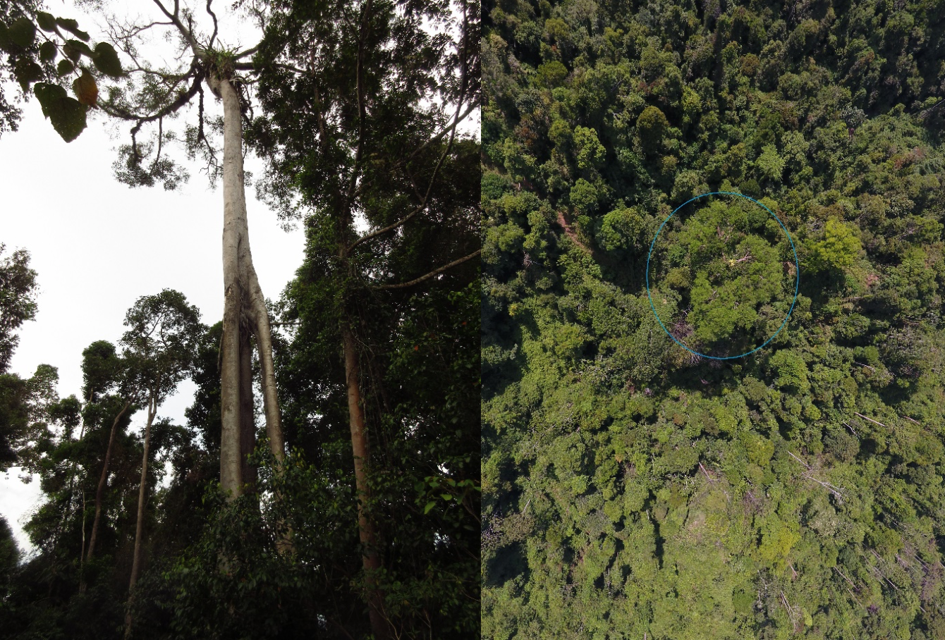
A strangler fig from below and above the canopy
Why are these questions important? To properly manage orangutan populations, we need to understand how they are adapting to changes in their habitat. We also need to know the characteristics of the forests in which they can and cannot survive. Using drones as large-scale surveying tools in this research is useful because it allows us to get a clear understanding of how the landscape is arranged and how human activity is affecting available habitat. The effects of human activities can be direct, through something like clear-fell logging, or indirect, through changes like shifting species composition when fast-growing tree species outcompete slow-growing, fruit-producing species.
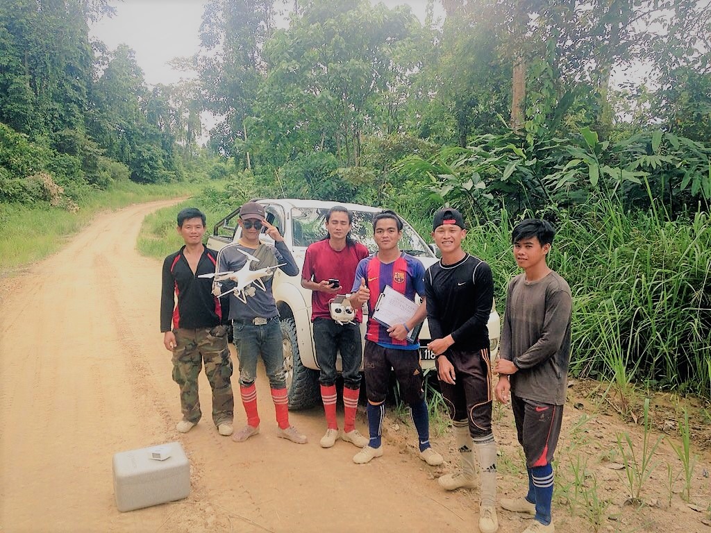
My team of local research assistants
Data Collection
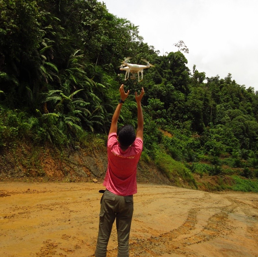
We use a DJI Phantom 4 Pro drone to conduct the aerial surveys, programming the missions with DJI Ground Station Pro for iPad mini. These surveys are conducted over a minimum of 150 hectares and we can get up to 400 images from a single drone survey, depending on the altitude. I review each image to locate each nest and fig tree across each survey area. In order to validate our results, and remove observer bias, my supervisors, Dr Julien Martin and Prof David Burslem, and I have started a citizen science project called Orangutan Nest Watch. It allows users from around the world to help us find these nests and fig trees.
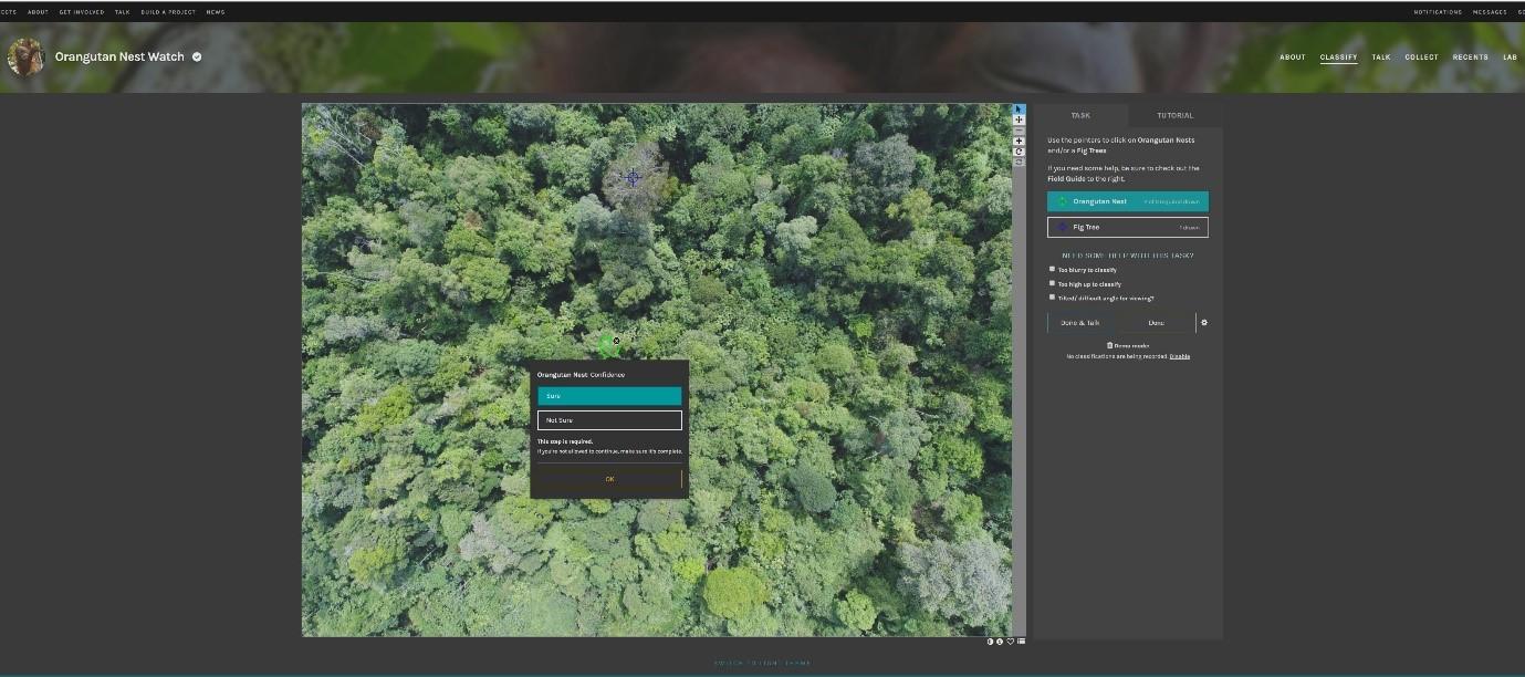
Users review images in random order, after a brief training. The system allows five users to view and identify the same image before it is removed from the online workflow. Beyond allowing us to check our data, this platform gives people the opportunity to see what orangutan habitat is really like and to contribute to our understanding of their needs as that habitat continues to change in response to anthropogenic pressures. Now at one year into the study, we have 2,100 citizen scientists from around the world contributing valuable data to our work.
Get involved: Join the Orangutan Nest Watch Zooniverse Project
Data Analysis: Advice requested
With the fieldwork almost complete, I am back in the UK working on the analysis of the data. In beginning this stage, I have run into some issues with image processing and would be keen to get some feedback from the WILDLABS community.
Here is my issue: every photo I have taken with the drone has central longitude, latitude, and altitude data from the drone’s onboard GPS and barometer. I have used PIX4D and Agisoft Photoscan to produce contiguous, and importantly, georeferenced ‘orthomosaics’, generated through the assembly of all drone photos into a single, complete image.
However, I need to get accurate coordinates for each nest and fig tree I find, but I am not always able to generate the large georeferenced images I need. This is due to errors in the overlap between images, changing light conditions, and variable topography. I have tried to decrypt flight data from the drone in order to generate information on its location during surveys, but these files are heavily protected due to DJI’s intellectual property safeguards. So, we can’t get in and process this information using Exiftool to derive a georeferenced image.
Does anyone have information on how I can process these images, in order to get coordinates for each pixel in the image? This is a big hurdle in my studies and I would be very keen to use the collective knowledge of this community of experts to help me solve this problem.
Have you faced this problem in your work? If so, Sol would appreciate hearing how you handled this challenge. Join the discussion in our drones group here.
Drone in flight
About the Author
Sol Milne is a third-year Ph.D. candidate at the University of Aberdeen in Scotland. His work on orangutans in Malaysian Borneo fits into his broader interest in understanding the characteristics of forest that are affected by land use practices, and how they in turn affect umbrella species, in order to design conservation strategies for the future.
Add the first post in this thread.