In recent years, drone technologies have been explored for a range of applications in conservation including (but not limited to) mapping, biodiversity inventories, antipoaching patrols, wildlife tracking, and fire monitoring. The rise of customizable, open-source drones like those of ArduPilot and OpenROV hold promise for more effective conservation applications, and combined with other monitoring sensors and devices, they are capable of collecting high-resolution data quickly, noninvasively, and at relatively low cost.
However, challenges remain in putting these tools to use. A recent paper reviewing 256 conservation drone projects highlighted some of these major obstacles, ranging from unintended social and ecological consequences of drone operations to still prohibitive costs, both in terms of hardware and in terms of storing and processing large volumes of data. The longstanding challenge of power/battery life remains as well.
If you're considering trying out drones for yourself, and want to explore the possibilities and understand the major conversations happening around this technology, check out these beginner's resources and conversations from across the WILDLABS platform:
Three Resources for Beginners:
- Conservation Technology User Guidelines Issue 5: Drones, World Wildlife Fund | Drones, best practices, ethics, regulations, case studies
- WILDLABS Virtual Meetup Recording: Drones, Craig Elder, Dr. Claire Burke, and Gabriel Levin | Drones, thermal camera, wildlife crime, ML, biologging
- New Paper: Drones and Bornean Orangutan Distribution, Sol Milne | Drones, data analysis, citizen science, community science, primates
Three Forum Threads for Beginners:
- Curious about radio-tracking with drones? | Wildlife Drones, Biologging (5 replies)
- Drones for GIS Best practice Document | Adrian Hughes, Drones (10 replies)
- WWF Conservation Technology Series: Drones in Conservation | Aurélie Shapiro, Drones (7 replies)
Three Tutorials for Beginners:
- How do I use a drone to capture radio-tracking data? | Debbie Saunders, Tech Tutors
- How do I choose the right drone for my conservation goals? | Shashank Srinivasan, Tech Tutors
- How do I strategically allocate drones for conservation? | Elizabeth Bondi, Tech Tutors
Want to know more about using drones, and learn from experts in the WILDLABS community? Make sure you join the conversation in our Drones group!
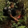
*Header photo: Parker Levinson, Point Blue Conservation Science


- 0 Resources
- 21 Discussions
- 18 Groups
I am an Ecologist with specialisation in GIS and programming with keen interest in drones.
- 0 Resources
- 0 Discussions
- 2 Groups
- @Riley
- | she/they
I'm a Data Scientist at Western EcoSystems Technology. I am interested in AI processing and statistical modeling of acoustic data and camera trap and drone imagery.
- 1 Resources
- 0 Discussions
- 5 Groups

- @Mumonkan
- | he / him
Wild Me
Software Engineer for Wildlife Conservation

- 0 Resources
- 4 Discussions
- 11 Groups
Dzanga-Ndoki national park biodiversity monitoring


- 0 Resources
- 55 Discussions
- 10 Groups

WILDLABS
This account is managed by the WILDLABS Team. Tag us or DM whenever you need help from our community team.


- 19 Resources
- 4 Discussions
- 11 Groups


- 0 Resources
- 2 Discussions
- 6 Groups

- @frides238
- | She/her
Hi! I am Frida Ruiz, a current Mechanical Engineering undergraduate student very interested in habitat restoration & conservation. I am excited to connect with others and learn about technology applications within applied ecology & potential research opportunities
- 0 Resources
- 4 Discussions
- 13 Groups

- 0 Resources
- 0 Discussions
- 7 Groups
World Wide Fund for Nature/ World Wildlife Fund (WWF)
- 0 Resources
- 12 Discussions
- 15 Groups

- @cleo
- | She/Her
Southern African Wildlife College
I am ecologist working in African conservation areas who loves wildlife & wild landscapes. I increasingly recognize that conservation is about people, especially those living in & around protected areas. Finding ways to benefit marginalized people is my passion.
- 0 Resources
- 0 Discussions
- 14 Groups

- 0 Resources
- 0 Discussions
- 5 Groups
Article
Viral bear video shows how drones threaten wildlife – and what to do about it

Margarita Mulero Pazmany
A recent online video of a baby bear's efforts to scale a steep cliff took what seemed like an inspirational moment viral. But after the initial enthusiasm for the video came some controversy when scientists pointed out...
22 November 2018
Article
In this case study, WILDLABS member Sol Milne takes us through his Ph.D. work investigating how changing land-use is affecting orangutan distribution in Sabah, Malaysian Borneo. With the help of five local research...
22 October 2018
Article
Underwater Robot Trained to Kill Coral-Destroying Reef Starfish

The Maritime Executive
Rangerbot, an underwater drone that can accurately identify and fire an injection into crown-of-thorns starfish, is ready to be put to the test on the Great Barrier Reef. The concept for RangerBot won the 2016 Google...
18 September 2018
Article

Technology now frequently used in wildlife conservation is evolving at a rapid pace, with improvements promised to make research applications and integration with other technology easier, faster, and smarter. In this...
23 August 2018
Article

Increasingly complex research questions and global challenges are driving rapid development, refinement, and uses of technology in ecology. This trend is spawning a distinct sub‐discipline, dubbed “technoecology” by...
9 May 2018
Article
Eddy Expedition Log: Characterizing Eddies

WILDLABS Admin
This month, we're following along with the scientists and engineers from the Simons Collaboration on Ocean Processes and Ecology (SCOPE) and the Monterey Bay Aquarium Research Institute (MBARI) who working together to...
23 April 2018
Article
Eddy Expedition Log: Chasing Eddies

Elisha Wood-Charlson
This month, we're following along with the scientists and engineers from the Simons Collaboration on Ocean Processes and Ecology (SCOPE) and the Monterey Bay Aquarium Research Institute (MBARI) who working together to...
10 April 2018
Article
Eddy Expedition Log: Setting Off to Explore Eddies
Elisha Wood-Charlson
If you have ever flown over the Pacific and looked down from the window seat, the water seems still. Viewed from this distance, the water appears stagnant with unmoving dashes of waves. This picture strikes discordantly...
3 April 2018
Article
#Tech4Wildlife Photo Challenge 2018: Our Top 10

WILDLABS Team
Hundreds of people joined our #Tech4Wildlife photo challenge this year, showcasing all the incredible ways tech is being used to support wildlife conservation. We've seen proximity loggers on Tasmanian Devils in...
3 March 2018
Article

With Arctic sea ice disappearing, can advanced sensor technologies provide insights into an ecosystem on the brink?
30 November 2017
Article
Kids, Drones & Science At The Water’s Edge

Cara Byington
It’s one thing to hear that a project is working, it’s another thing entirely to see the data brought to life. Using submersible and aerial drones, as well as scientists with snorkels and digital cameras, The Nature...
4 October 2017
Article
Earlier this year, WILDLABS community member Shashank Srinivasan was involved in an operation to capture the Pilibhit man-eater. In this account, he shares how they successfully managed to tranquilize and capture the...
10 August 2017
November 2023

29 Products
Recently updated products
| Description | Activity | Replies | Groups | Updated |
|---|---|---|---|---|
| Hi David - have you seen this opportunity? It may be a good one to apply to for support (the Darwin Initiative). |
+19
|
AI for Conservation, Drones, Emerging Tech, Human-Wildlife Conflict, Wildlife Crime | 3 days 10 hours ago | |
| Thank you for elaborating, @evebohnett ! And for the heads ups! |
+22
|
Camera Traps, Drones | 1 month ago | |
| @PaulAllin Thanks for your valuable insights. Zenmuse H20N seems to be very powerful and useful in this case. However, I'm looking for a more affordable option for a self-funded... |
+5
|
Drones, Human-Wildlife Conflict | 3 months 2 weeks ago | |
| We will be conducting in-person demos of our cutting-edge drone technology in the US this year! 🇺🇸 If you're interested in experiencing... |
|
Biologging, Drones, Remote Sensing & GIS, Software and Mobile Apps | 3 months 3 weeks ago | |
| Hi Danilo. you seem very passionate about this initiative which is a good start.It is an interesting coincidence that I am starting another project for the coral reefs in the... |
|
Acoustics, AI for Conservation, Biologging, Camera Traps, Citizen Science, Climate Change, Community Base, Connectivity, Drones, Emerging Tech, Human-Wildlife Conflict, Open Source Solutions, Sensors, Software and Mobile Apps, Wildlife Crime | 4 months ago | |
| Forgot to mention this wildlife drone group - |
|
Drones, eDNA & Genomics | 4 months 1 week ago | |
| Hi, I have used a commercial company for drone work for my PhD and they were willing to give me a significant discount for research purposes. One thing to consider is that in SA a... |
+2
|
Drones, East Africa Community | 4 months 1 week ago | |
| Hi!I would take a look at Although developed for camera trap imagery, it is by no means restricted to such.Cheers,Lars |
|
Camera Traps, Community Base, Data management and processing tools, Drones, Emerging Tech, Remote Sensing & GIS, Software and Mobile Apps | 4 months 1 week ago | |
| In what ways can drones contribute to linking individuals, communities, and small-scale producers in rural areas, facilitating the support... |
|
Drones, Remote Sensing & GIS | 5 months 3 weeks ago | |
| @dmorris joined Variety Hour to give us 'a bunch of lightning talks inside a lightning talk'. Check out the recording to get a whirlwind... |
|
AI for Conservation, Drones, Remote Sensing & GIS | 5 months 3 weeks ago | |
| @caseyslaught is a Full-stack engineer with Virunga National Park, and he's built a handy tool to host, visualize, and... |
|
Drones | 5 months 3 weeks ago | |
| The link above does not seem to work but this does: https://wildlabs.net/sites/default/files/community/files/drones_for_gis_-_best_practice_v2.0.pdf |
|
Drones | 6 months 1 week ago |


The 2021 #Tech4Wildlife Photo Challenge: Community Highlights
25 March 2021 12:00am
Funding Opportunity: COVID-19 Science Fund
 National Geographic
10 March 2021 12:00am
Cargo Drones for Conservation

1 March 2021 3:04pm
2 March 2021 10:42am
Nice, where in Zambia are you working? Do you need to transport a lot and regularly?
2 March 2021 8:02pm
Hi Egil,
The group I'm involved with works with remote communities in/around North and South Luangwa National Parks and there is some expansion happening to community areas around Kafue National Park. I think they're interested in regular transport, but I'm not sure exactly how much and how regular, I need to collect more details on the specifics here.
Thank you! Rosemary
Seven technological priorities for automated restoration of tropical forest ecosystems

1 March 2021 12:03pm
Effect of drone flights on wild animals
26 July 2017 11:00pm

19 September 2017 3:22pm
This recent systematic review might be of interest: 'Unmanned aircraft systems as a new source of disturbance for wildlife: A systematic review'
Abstract
The use of small Unmanned Aircraft Systems (UAS; also known as “drones”) for professional and personal-leisure use is increasing enormously. UAS operate at low altitudes (<500 m) and in any terrain, thus they are susceptible to interact with local fauna, generating a new type of anthropogenic disturbance that has not been systematically evaluated. To address this gap, we performed a review of the existent literature about animals’ responses to UAS flights and conducted a pooled analysis of the data to determine the probability and intensity of the disturbance, and to identify the factors influencing animals’ reactions towards the small aircraft. We found that wildlife reactions depended on both the UAS attributes (flight pattern, engine type and size of aircraft) and the characteristics of animals themselves (type of animal, life-history stage and level of aggregation). Target-oriented flight patterns, larger UAS sizes, and fuel-powered (noisier) engines evoked the strongest reactions in wildlife. Animals during the non-breeding period and in large groups were more likely to show behavioral reactions to UAS, and birds are more prone to react than other taxa. We discuss the implications of these results in the context of wildlife disturbance and suggest guidelines for conservationists, users and manufacturers to minimize the impact of UAS. In addition, we propose that the legal framework needs to be adapted so that appropriate actions can be undertaken when wildlife is negatively affected by these emergent practices.
Mulero-Pázmány M, Jenni-Eiermann S, Strebel N, Sattler T, Negro JJ, Tablado Z (2017) Unmanned aircraft systems as a new source of disturbance for wildlife: A systematic review. PLoS ONE 12(6): e0178448. https://doi.org/10.1371/journal.pone.0178448

16 November 2017 5:02pm
Hi all
I would like to know your opinion about this footage:
https://vimeo.com/196847435
I fly drones in this place far away of birds for not disturbing them.
And then National Geographic fly a drone very close to birds to have an excellent footage.
You don't think that they are clearly disturbing them?

25 February 2021 9:45am
Hi!
Interesting subject indeed.
In most cases where UAVs are used in nature "documentaries" it is pretty obvious to a behavioural biologist that the animals were negatively affected.
I know that Sophie Gilbert collected bad examples of wildlife UAV harassment/disturbance at one stage.
WWF: Protecting Ferrets with Drones and Vaccines
 Kristy Bly
17 February 2021 12:00am
Tech Tutors: How do I strategically allocate drones for conservation?

16 February 2021 1:01pm
New Paper: Drones and Bornean Orangutan Distribution
 Sol Milne
12 February 2021 12:00am
How do I strategically allocate drones for conservation?
WILDLABS Team
8 February 2021 12:00am
WWF Conservation Technology Series: Drones in Conservation
19 November 2020 9:11am
24 November 2020 8:33am
Hi Julie,
yes authorizations are needed for drones and these are particularly difficult in many countries and are specific to the weight/size of the drone. Look at our report because the difference with a drone from an (untethered) balloon is the the presence of active collision avoidance, manueverability, size/weight and how far it flies (i.e. if it is beyond line of sight it is a different permit).

4 December 2020 12:15pm
This looks like a great resource, thanks!
29 January 2021 7:17pm
Hello Aurelie,
Thank you for sharing this info. I just downloaded the brochure and I am sure I will find it very useful. I have senseFly's eBee Classic, with RGB, multispectral and thermal cameras, and look for cases of using those in nature/biodiversity monitoring/management. I guess the brochure will include some cases. Thanks for sharing.
kind regards, Giorgi (from Georgia)
Tech Tutors: How do I choose the right drone for my conservation goals?
14 January 2021 1:05pm
Press Release: BAS Giant Iceberg Mission
 British Antarctic Survey
13 January 2021 12:00am
Horizon 2020 UFO project Matchmaking event

8 January 2021 10:58am
Existing guidelines for reducing disturbance to wildlife when using drones-

6 March 2020 3:01pm

18 December 2020 6:34pm
Hi Isla,
That's something that the drone world really needs to take on because there can be a world of difference in drone size, prop types and motor types to reduce impact on the wildlife we're studying.
I've had one real world experience where a Marmot about the size of a large cat was scared of a small drone (DJI Mavic Pro)
But a drone about half the size that could do the exact same work was able to fly 15 feet from the Marmot and not disturb it. If you're only needing an observation drone to take photos and videos I highly recommend the DJI Mavic Mini. I'm not a rep for them but fly their products a lot.
If you have any questions I'm happy to help.

Event: Wildlife Drones at ESA20
 Wildlife Drones
30 November 2020 12:00am
Making the Most of Tech Tutors Season 2!
WILDLABS Team
30 November 2020 12:00am
WILDLABS Tech Tutors: Season Two
WILDLABS Team
24 November 2020 12:00am
Conservation Technology User Guidelines Issue 5: Drones
18 November 2020 12:00am
Towards a more ethical Indian drone industry

15 October 2020 10:26am

23 October 2020 1:11pm
Hello Shashank, I found your post very interesting - congratulations on looking at the ethical side of this technology! One of the reasons that our organisation, WildTrack, focuses on non-invasive wildlife monitoring technology is to avoid the ethical problems associated with disturbing animal behaviour, physiology and ecology. We're also using drones, both fixed wing and multicopter for monitoring and developing AI recognition algorithms, and trying to work out the optimal protocols for collecting data without any disturbance. I'd be interested to talk more with you about what you see as the major ethical challenges.
Report: Helping Ensure Ethical Indian Drone Operations
 Shashank Srinivasan
19 October 2020 12:00am
#Tech4Wildlife News: Airdropping Sensors from Moths
 University of Washington
13 October 2020 12:00am
[ARCHIVED] Drones and the law webinar
5 October 2020 11:51am

8 October 2020 6:30pm
Very cool, thanks for sharing, Adrian! We'll put this up on Twitter as well.
Webinar: Drones for Change
 Wikifactory
7 October 2020 12:00am
Webinar: Advances in Fisheries Electronic Monitoring
 SAFET
SAFET
21 September 2020 12:00am
Tech Tutors: How do I use a drone to capture radio-tracking data?
5 August 2020 8:22pm
6 August 2020 7:26pm
Hi Wildlabbers,
What a great episode and Q&A!! We had SO many questions for Debbie that we couldn't get to all of them during the stream. If you have follow-up questions about tracking wildlife with drones, be sure to ask them here and we'll pass them along to Debbie. You can also see all of the questions from the session here in our collaborative document, which also has resources and a log of the chat!
We'll be posting the full tutorial and Q&A video here tomorrow, so if you missed the episode, you'll be able to catch up soon.
Thanks to everyone who came to this episode, and we hope to see you again next week!
-Ellie

17 September 2020 12:27am
Hi all,
Firstly, I'd just like to say a big thank you to everyone who attended my Tech Tutors presentation last month. And secondly, thank you for your patience in allowing me to respond to your questions. If you have any further questions, please feel free to post them on the forum here or email me ([email protected]). I would love to hear from you!
Cheers,
Debbie
Tech Tutors Q&A:
Carlos: I have one single question today: is Debbie or someone using fully autonomous drones in their projects? No human control ever? Here, they are banned, even in non-populated areas.
Debbie: Our first research prototypes were autonomous (Cliff et al. 2015; 2018), however it had to be able to be controlled manually if needed to comply with flight regulations.
However, the autonomous nature of that prototype meant that it wasn’t able to be readily adapted for use on a diversity of drone platforms as more advanced systems became available, and also recognised that wildlife researcher’s primary need was for a tracking system in the air rather than a robotic tracking system. However, one day we hope to again be able to integrate our system into large-scale fully autonomous monitoring programs. With our current system, once you are provided with bearings to all tags within range you can begin to make decisions about where the next best place to go is to get the most effective intersecting bearing lines.
Cliff, O. Saunders, D. and Fitch, R. (2018) Robotic Ecology: Tracking Small Dynamic Animals with an Autonomous Aerial Vehicle. Science Robotics Vol. 3, Issue 23, eaat8409.
Cliff, O., Fitch, R., Sukkarieh, S., Saunders, D.L. and Heinsohn, R. (2015). Online localisation of radio-tagged wildlife with an autonomous aerial robot system. Proceedings of Robotics: Science and Systems 2015, Rome, Italy, July.
Sol Milne: Amazing work! Has this worked for small, below skin tracking tags?
Debbie: Our system can track any very-high frequency (VHF) radio-tag from any tag manufacturer globally. This includes VHF-tags that are designed to be inserted under the animal’s skin. We have tested Giant Armadillo implant tags previously and have even been able to detect them from when they were 3 metres underground in a burrow (although they are actually pretty big tags!). The effect of having an implanted tag is the same for both drone and manual tracking – with no whip antenna the detection distance is shorter but it can typically still be detected.
Julian Dale: Can you provide a cost for your system? We are developing a system for a longer endurance fixed wing aircraft VTOL (2-4hr endurance) to cover large areas and with full autonomy. I would be interested to chat more about a collaboration if you are interested?
Debbie: Absolutely interested Julian! We definitely have both a fixed wing VTOL and full autonomy on our roadmap – it’s just a matter of getting to it. Please do get in touch ([email protected]) to discuss further and we can also give you some specific pricing for your project needs.
Julian Dale: Would it be possible to combine two antenna and SDR's to cover a wider swath on a fixed wing?
Debbie: This certainly may be possible, but it would need to be thoroughly tested with both the pros & cons considered, such as extra complexity in the code, extra hardware housing and integration etc.
Paul: Q about RF (RT?)- have you looked into using Bluetooth Low Energy or LoRa instead of VHF? Bluetooth or Lora Gateway on the drone would look for signals, vast amount lighter - but not sure about range, hence my question, thank you all the same.
Debbie: When developing our system we decided that rather than trying to invent a new type of miniature tag which has it’s own inherent challenges, we wanted to develop a better way to detect and track VHF tags that are already used all around the world. Having said this, we have explored various alternatives in terms of communications and data transfer such as LoRa but found our setup to perform more reliably and to have much greater communication ranges (tested for real time data feeds out to 2.5km currently).
Arky: Wonder if this system could be adapted for fixed wing drones / Vertical take-off and land (VTOL) systems that could be useful in some use-cases.
Debbie: Yes, it can be. We are currently in the process of exploring the best way for our system to be adapted onto a fixed-wing drone platform and it is a key part of our development roadmap. We can see many advantages and applications for using fixed-wing drones – especially as they are typically able to search much larger areas!
Rob: Hi Debbie, this system is amazing! I am so with Steph (what I could've done with this 10 or 15 years ago)! I was wondering, can your system work with SensorGnome-style coded VHF tags?
Debbie: The key issue with tracking coded tags using our system is that they are all on the same frequency. Our system works by finding the maximum signal for each unique frequency so having lots of tags in all different directions but with the same frequency wouldn’t work. Having said this, I have wondered whether we would be able to ramp up the interrogation of coded tag signals, detect them all and decode them on the fly so that they can be located. But I’m sure my tech team would roll their eyes at me over that one since I am sure it would quite challenging to do. But if you have any good ideas on how this may be achieved we’d be happy to give it a shot!
Sophie: Provided an Argos goniometer on board the drone, you could detect the animal equipped with an Argos tag as well?
Debbie: I’m not sure exactly what signals the goniometer is detecting, however if the Argos tag (or any other tag) includes a standard VHF radio signal as a back up option in case the tag fails then we can track it with our system regardless of who the tag manufacturer is. This may not work if they don’t use VHF radio-signals.
Sophie: Do you have a system to recover the drone in case of loss?
Debbie: If you wanted to put a radio-tag on your drone as well as on your animals, then our system could certainly track them both as long as they are within the detection range of the tag. The detection range varies depending on size, with small tags having shorter detection distances.
Pascal: Have you tried/considered using an automatic direction finder system (which can 'virtually rotate' its beam direction using a phased array of multiple antennas)? And/or continuously recording the received radio signal for (additional) later offline analysis?
Debbie: Yes indeed, we have considered and explored both of these options. The use of a phase array creates many interesting hardware and software challenges when considering a lightweight, robust system that can be used on a drone, and although there could certainly be benefits in such a system we found that the costs generally outweighed the benefits. In terms of collecting data and processing it later, this is currently possible as well as real time data collection. However one of the key advantages of our current system is that you are not “flying blind” since you can see exactly what signals you are/aren’t picking up and their directions which means that your data collection is much more targeted and effective.
Melissa: How does the drone work in high wind? What is the max wind speed you can fly it in? Also, what was the updated the flight time after your initial troubleshooting (if it got better than 10 minutes)?
Debbie: The system can work in high wind but the error margins around estimated locations will be larger due to the buffeting effect of the wind on the magnetometer which provides the bearings. If all you want to see is that you can detect your animals wind wouldn’t matter too much, but if you are aiming to get accurate locations you will find they will have larger errors than if you flew in calmer conditions. If it is really windy and the drone is working really hard to maintain it’s location you will also notice that it can tilt quite a lot and so in this case the antenna may be pointing at the sky instead of across the landscape and so would be less likely to detect tags. It’s always a good idea to fly within the recommended wind speed rating of your drone (from memory the DJI Matrice 210 recommended max wind speed is 10 m/s.
Julian: Can you tune your system to cope with radio interference from different aircraft? [ STEPH: is this duke julian? If so - we might hold this question]
Debbie: Not exactly sure what interference from different aircraft you are referring to sorry, but dealing with radio-interference is certainly one of the greatest challenges when listening for low powered tags in our noisy radio world! However, we do have a nice combination of hardware and software that enable us to eliminate or manage a range of different potential interferers both within and outside of the target frequency bands.
Liam: You mentioned earlier that you were interested in the migration routes of the parrots - have you tested the use of your system for migration pathways in any other species? And how do you work with the battery limitations?
Debbie: We haven’t had the opportunity to use our system to understand the full migratory pathways of swift parrots yet since we are currently unable to use long-term attachments on this species so we have had to focus on tracking them within their winter range instead – but we’re super keen to get there one day! We haven’t tested it along migration pathways as such, but rather we have tracked other migratory species within their winter foraging range. Would be great fun to try tracking along an entire migratory path though!
Miguel: Drones are usually very noisy. Don't animals run away when they hear the drone? Or does it fly high enough that it doesn't disturb the animals? How high can it fly while being able to get the data?
Debbie: Radio-tracking from a drone is less disruptive to most species compared to manually radio-tracking on foot, or using other drone sensors like visual or thermal cameras. This is because our system doesn’t require you to fly directly above or in close proximity of the animals you are tracking in order to get their location. Our system detects signals from distance, determines bearings and then triangulates the animal’s location. Filghts are generally limited to below 120m however we typically fly at around 40m or so depending on the height of the vegetation (at least this is the specific regulation height in Australia).
Isla Duporge: Thanks Ellie, I was just wondering how many have been made, cost of hiring and whether there is the intention to be able to sell them to researchers.
Debbie: So far we have made 30 of these systems and we are happy to provide you with specific costing details for your project if you would like to get in touch ([email protected] ). They are only available for hire, not to buy, but unlike most equipment hire arrangements, we provide full technical support for you and your team should you need any help or guidance. Also, given the tech is advancing all the time, if you have a long term project we will upgrade your system each year with the latest model!
Phoebe Griffith: Similar question to above, I was wondering if they might be possible to purchase (rather than hire) for long term tracking projects (we track animals for 2+ years), and if so what the approx costs are?
Debbie:
Same response as above:
We are happy to provide you with specific costing details for your project if you would like to get in touch ([email protected] ). They are only available for hire, not to buy, but unlike most equipment hire arrangements, we provide full technical support for you and your team should you need any help or guidance. Also, given the tech is advancing all the time, if you have a long term project we will upgrade your system each year with the latest model!
Rob: Have you had a chance to look at using tags/untagged animals for abundance (e.g. koalas) or survival studies, as your drones can cover so much area
Debbie: Yes, so we are currently in the process of using both thermal and radio-tracking drone technology to find both tagged and untagged animals at the same site. We recognise that not all animals can be tagged and have found that thermal technology can help fill that gap. The great thing about drones is that they are capable of carrying multiple sensors, allowing you to collect a diverse range of data.
Sean: Are you using an "off the shelf" flight platform or is it bespoke?
Debbie: Our system is able to be mounted onto off-the-shelf drone platforms that can carry a 1kg payload, such as the DJI Matrice 210 and similar models.
Carly: Also, this might be a stupid question, but can these things go up at night? E.g. tracking nocturnal animals.
Debbie: No such thing as a stupid question! They are all good! Drones can certainly be flown at night to track nocturnal animals. However, it should be noted that in most places, you’ll need to be a licensed drone pilot and have special authorisation to fly at night. We recommend that you check your local area’s drone rules and regulations for more information on this before you fly.
Tech Tutors: Review Session
WILDLABS Team
3 September 2020 12:00am
Sustainable Fishing Challenges: Fishing Gear Innovations
 Daniel Steadman
19 August 2020 12:00am
Tracking Wild Reptiles, Amphibians, And Their Temperatures
 Emily Taylor
31 July 2020 12:00am
15 September 2023 11:02pm
16 October 2023 4:07pm
How do I use a drone to capture radio-tracking data?
 Debbie Saunders
27 July 2020 12:00am
Rural Research residency in drone sowing and wild seeds in Spain
23 July 2020 1:21pm
2 March 2021 1:39am
Exactly the type of thing I was looking for. I'll get in contact with them. Thanks, Steph!