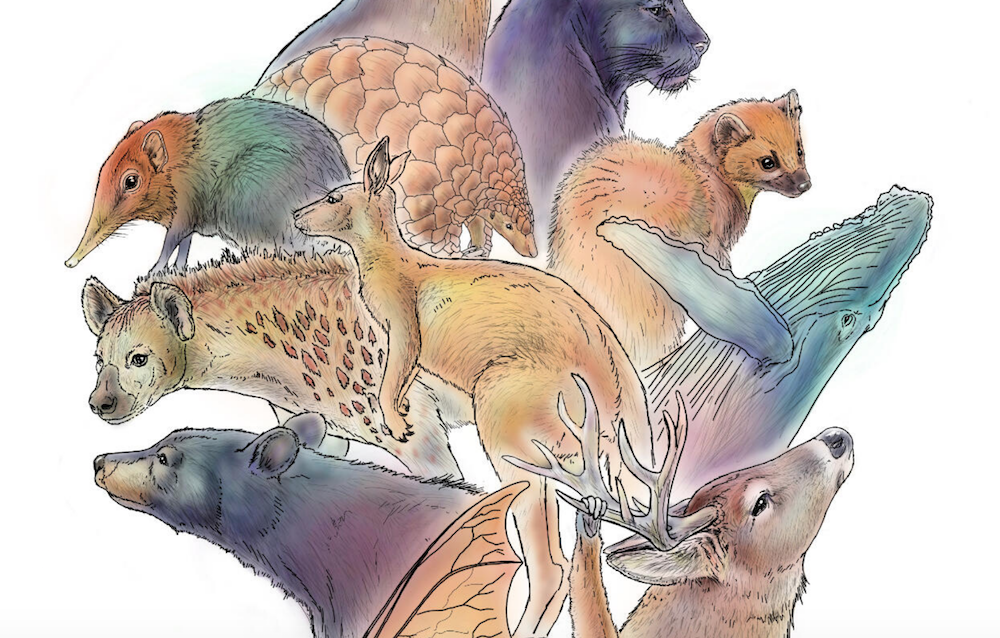
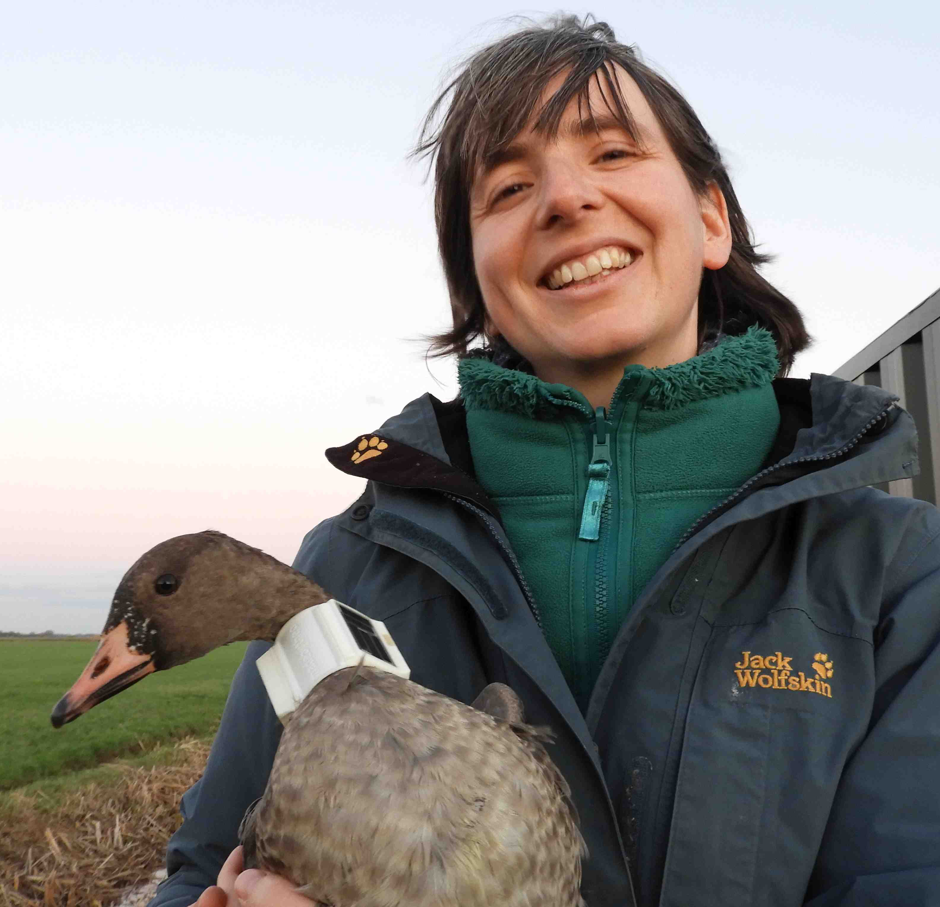
Wildlife tracking technologies have already massively advanced our understanding of the natural world, from uncovering previously mysterious migration patterns and key movement corridors to demonstrating the impacts of anthropogenic pressures and climate change. Recent advances in the development of technologies for collecting and transmitting biologging data have unlocked the potential for fine-scale data collection at a near-global scale, which when integrated with remotely sensed environmental data offers an unprecedented biological lens into ecosystem health and environmental change (Jetz et al. 2022).
New technologies on the horizon include small satellites like CubeSats, which are being investigated by NASA, the ICARUS Initiative's satellite system, and a variety of other ventures aiming to improve the coverage, accuracy, and capacity of wildlife tracking data collection. Combined with the increased availability of high-resolution environmental data and analytical developments in movement modeling, these advancements are empowering movement ecologists to ask previously unanswerable or unimaginable questions. It’s clear that this discipline sits at the precipice of major breakthroughs that could revolutionize our understanding of animal movement and the natural world.

Jack of all trades and master of none
- 0 Resources
- 3 Discussions
- 2 Groups

Friends of Brisbane Ranges

- 0 Resources
- 32 Discussions
- 5 Groups

- @LindyClydeKnowles
- | he/him

- 0 Resources
- 6 Discussions
- 6 Groups
Working in relation to ecosystem services
- 0 Resources
- 0 Discussions
- 8 Groups

Wildlife Drones
Wildlife Drones has developed the world’s most innovative radio animal-tracking system using drones so you can track your radio-tagged animals like never before.

- 11 Resources
- 8 Discussions
- 32 Groups
Postdoc working on movement ecology
- 0 Resources
- 0 Discussions
- 1 Groups
I'm a wildlife ecologist with interests in a range of technology.

- 0 Resources
- 20 Discussions
- 5 Groups

Technologist and Visual storyteller focusing on social, conservations issues.
- 0 Resources
- 31 Discussions
- 16 Groups

- @ATM
- | HE
I studied Wildlife and Ecotourism Management in University of Ìbàdàn, Nigeria, I'm a front-end developer. I am interested in conservation technology
- 0 Resources
- 5 Discussions
- 11 Groups

Stellenbosch University & The Cape Leopard Trust
- 0 Resources
- 22 Discussions
- 6 Groups

- 2 Resources
- 0 Discussions
- 2 Groups
- @Harperinos
- | he/him
'Diploma of Conservation & Ecosystem Management' student at TAFE NSW Australia.
- 0 Resources
- 2 Discussions
- 6 Groups
Funding
Funding Opportunity: COVID-19 Science Fund

National Geographic
National Geographic is offering funding up to up to $50,000 for conservationists conducting research on how the pandemic has impacted wildlife and conservation work. If you are interested in researching aspects of the...
10 March 2021
Article
Sustainable Fishing Challenges: Fish Catch Monitoring

Daniel Steadman
As we launch our new Sustainable Fishing Challenges group in the WILDLABS community, we are excited to welcome Daniel Steadman, the group manager, to give us an overview of three major areas in which #tech4wildlife...
4 December 2020
Article
Introducing Movebank's Arctic Animal Movement Archive (AAMA), a collection of studies containing animal movement and other animal-borne sensor data from the Arctic and Subarctic. Through this collection of 214 studies ...
17 November 2020
Article
Hackathon Opportunity: Vaquita Hacks

The Conservation Project International
Do you have innovative #tech4wildlife ideas that could save one of the most endangered species on earth from extinction? Apply now to join Vaquita Hack, a hackathon for students and early career conservationists! This...
10 November 2020
Article
We've got exciting news from the Icarus project, a satellite-based animal monitoring system: following a successful test phase this year, the first cross-continental scientific pilot project is set to begin this...
15 September 2020
Article
Meet the Scientists of Black Mammalogists Week!
Black Mammalogists Week
To celebrate the first Black Mammalogists Week (starting Sunday, September 13th), we talked to four of the amazing Black scientists behind this event! Find out what they had to say about their favorite (and most...
10 September 2020
Funding
Argos Satellite Tag Open-Source Grant

Thomas Gray
WILDLABS community member Thomas Gray from Argos has given us a preview of an upcoming grant program to develop open-source tags. Three years ago, Argos worked with the Arribada Initiative to develop an open-source...
17 August 2020
Funding
Challenge: ElephantEdge

hackster.io
Protecting elephants from conservation's most pressing issues like poaching and human-wildlife conflict requires big, bold, and innovative solutions. Hackster.io, Smart Parks, Edge Impulse, Microsoft, and several other...
11 August 2020
Article
Sustainable Fishing Challenges: Fishing Vessels of the Future
Daniel Steadman
As we launch our new Sustainable Fishing Challenges group in the WILDLABS community, we are excited to welcome Daniel Steadman, the group manager, to give us an overview of three major areas in which #tech4wildlife...
4 August 2020
Article
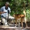
In this case study from herpetologist Emily Taylor, we learn about the best methods and gear used to track snakes, lizards, and other reptiles and amphibians via radio-telemetry, and how these techniques have changed...
31 July 2020
Article
Kākāpō Dreaming: A Wildlife Drones Adventure
Wildlife Drones
What is it like to track endangered species using drones? In this blog post from Wildlife Drones, Dr. Debbie Saunders travels to New Zealand to track the Kākāpō, an extemely rare and elusive bird of which approximately...
8 July 2020
Article
In this three-part WILDLABS feature article series, we take a look at the various technologies used to fight the greatest threat to wild condors, lead poisoning, explore the innovations changing the ways we study and...
2 July 2020
June 2024
September 2024

July 2023
event
Talia Speaker
May 2023
85 Products
Recently updated products
| Description | Activity | Replies | Groups | Updated |
|---|---|---|---|---|
| Hi all, @StephODonnell and I are making plans for our trip to Davos in June for the World Biodiversity Forum. Is anyone else planning to be... |
|
Community Base, Biologging | 20 hours 15 minutes ago | |
| We are ready to make efforts on materials, but today there are few solutions available. Today, our partners' R&D efforts are focused on renewable energies and the energy... |
+4
|
Biologging, Marine Conservation | 1 week ago | |
| Hi Jesse,For a material to be acoustically transparent (in air), the speed of sound in the material times its density must match that of air. Realistically, any solid... |
+1
|
Acoustics, Biologging | 2 weeks 4 days ago | |
| Congratulations! My first hydromoth was just arrived yesterday and so excited! Looking forward for the update from your project!!! |
|
Acoustics, Biologging, Climate Change, Conservation Tech Training and Education, Data management and processing tools, Emerging Tech, Open Source Solutions, Protected Area Management Tools, Sensors, Software and Mobile Apps | 2 weeks 6 days ago | |
| I am working on that too haha. So in my design you load the glue gun with two part Loctite, it has two separate metal rings. Glue and hardener in each ring. Then each ring has a... |
+23
|
Biologging | 4 weeks 1 day ago | |
| I'll find you some. Just organising all of our stock of these. |
+9
|
Biologging | 1 month ago | |
| Hi everyone, @craig joined last month's Variety Hour to chat about Tagranger, which you can read more about here. A TagRanger®... |
|
Biologging, Connectivity, Sensors | 1 month ago | |
| 'Most importantly, we have to make it play a MIDI version of the DoctorWho theme song when you arm the device. That has to be the #1 feature if you ask me!' Seconded! |
+9
|
Acoustics, Biologging, Emerging Tech, Open Source Solutions, Sensors | 1 month ago | |
| Might very well be so! I highly encourage you to take up the challenge! |
+23
|
Biologging | 1 month 1 week ago | |
| You mention you're working with an engineer, here are a couple of pointers:with an SDR (the "digital USB receivers" you mention) you can scan some bandwidth to detect radio pulses... |
|
Biologging, Build Your Own Data Logger Community | 1 month 2 weeks ago | |
| Hello everyone, I'm interested in gathering insights on how the behavior of different species impacts the development and efficacy of... |
|
Biologging, Acoustics, Camera Traps, eDNA & Genomics, Emerging Tech, Marine Conservation | 1 month 4 weeks ago | |
| Hello Peter, Have you find a solution ? I will be happy to discuss with you about your project and field challenges ? Best,Virginie |
+26
|
Biologging | 1 month 4 weeks ago |


Workshop: Analyses of acoustic telemetry data with R
 European Tracking Network
15 January 2021 12:00am
How do I choose the right tech for my bird monitoring project?
 WILDLABS Team
11 January 2021 12:00am
Has anyone used CVEDIA'S ARTEMIS before?

5 January 2021 5:45pm
Sustainable Fishing Challenges: Fish Catch Monitoring
Daniel Steadman
4 December 2020 12:00am
Event: Wildlife Drones at ESA20
Wildlife Drones
30 November 2020 12:00am
Making the Most of Tech Tutors Season 2!
WILDLABS Team
30 November 2020 12:00am
Introducing the Arctic Animal Movement Archive
 Movebank
17 November 2020 12:00am
Weekly Event: OTN Virtual Study Hall
 Ocean Tracking Network
16 November 2020 12:00am
California Condor Conservation - Tech & Resources

18 May 2020 6:44pm
12 November 2020 5:55pm
Hi all,
Just wanted to share some info about VWS's virtual chat series, if you're interesting in hearing the latest condor news about wildfire recovery efforts, how the fires impacted their camera systems, tracking, etc., and about the condor chicks who were rescued from the fires.
The next chat is on November 19th at 4 PM PST, and you can register here. They also have an archive of past recorded chats, including a very cool #tech4wildlife one on condor photography!
-Ellie

12 November 2020 7:18pm
Thanks Ellie - I signed up : )
Hackathon Opportunity: Vaquita Hacks
The Conservation Project International
10 November 2020 12:00am
Drop off pods on collars
7 September 2020 1:41pm
29 September 2020 11:03pm
Thanks for the details Thomas. I am fairly happy with the nichrome release mechanism we use, but it's always good to have alternatives, and the explosive approach could be much more useful for others. Appreciate all the information.
Cheers,
Rob
30 September 2020 8:02pm
Yup - my pleasure.
1 October 2020 6:44pm
Thanks Thomas. The option of desertstar seems strong, and it needs to be strong for the animals I work with (large carnivores). Indeed the pod would need to be designed to fit the collar type, but that's not impossible.
Tech Tutors: How do I use a drone to capture radio-tracking data?
5 August 2020 8:22pm
6 August 2020 7:26pm
Hi Wildlabbers,
What a great episode and Q&A!! We had SO many questions for Debbie that we couldn't get to all of them during the stream. If you have follow-up questions about tracking wildlife with drones, be sure to ask them here and we'll pass them along to Debbie. You can also see all of the questions from the session here in our collaborative document, which also has resources and a log of the chat!
We'll be posting the full tutorial and Q&A video here tomorrow, so if you missed the episode, you'll be able to catch up soon.
Thanks to everyone who came to this episode, and we hope to see you again next week!
-Ellie

17 September 2020 12:27am
Hi all,
Firstly, I'd just like to say a big thank you to everyone who attended my Tech Tutors presentation last month. And secondly, thank you for your patience in allowing me to respond to your questions. If you have any further questions, please feel free to post them on the forum here or email me ([email protected]). I would love to hear from you!
Cheers,
Debbie
Tech Tutors Q&A:
Carlos: I have one single question today: is Debbie or someone using fully autonomous drones in their projects? No human control ever? Here, they are banned, even in non-populated areas.
Debbie: Our first research prototypes were autonomous (Cliff et al. 2015; 2018), however it had to be able to be controlled manually if needed to comply with flight regulations.
However, the autonomous nature of that prototype meant that it wasn’t able to be readily adapted for use on a diversity of drone platforms as more advanced systems became available, and also recognised that wildlife researcher’s primary need was for a tracking system in the air rather than a robotic tracking system. However, one day we hope to again be able to integrate our system into large-scale fully autonomous monitoring programs. With our current system, once you are provided with bearings to all tags within range you can begin to make decisions about where the next best place to go is to get the most effective intersecting bearing lines.
Cliff, O. Saunders, D. and Fitch, R. (2018) Robotic Ecology: Tracking Small Dynamic Animals with an Autonomous Aerial Vehicle. Science Robotics Vol. 3, Issue 23, eaat8409.
Cliff, O., Fitch, R., Sukkarieh, S., Saunders, D.L. and Heinsohn, R. (2015). Online localisation of radio-tagged wildlife with an autonomous aerial robot system. Proceedings of Robotics: Science and Systems 2015, Rome, Italy, July.
Sol Milne: Amazing work! Has this worked for small, below skin tracking tags?
Debbie: Our system can track any very-high frequency (VHF) radio-tag from any tag manufacturer globally. This includes VHF-tags that are designed to be inserted under the animal’s skin. We have tested Giant Armadillo implant tags previously and have even been able to detect them from when they were 3 metres underground in a burrow (although they are actually pretty big tags!). The effect of having an implanted tag is the same for both drone and manual tracking – with no whip antenna the detection distance is shorter but it can typically still be detected.
Julian Dale: Can you provide a cost for your system? We are developing a system for a longer endurance fixed wing aircraft VTOL (2-4hr endurance) to cover large areas and with full autonomy. I would be interested to chat more about a collaboration if you are interested?
Debbie: Absolutely interested Julian! We definitely have both a fixed wing VTOL and full autonomy on our roadmap – it’s just a matter of getting to it. Please do get in touch ([email protected]) to discuss further and we can also give you some specific pricing for your project needs.
Julian Dale: Would it be possible to combine two antenna and SDR's to cover a wider swath on a fixed wing?
Debbie: This certainly may be possible, but it would need to be thoroughly tested with both the pros & cons considered, such as extra complexity in the code, extra hardware housing and integration etc.
Paul: Q about RF (RT?)- have you looked into using Bluetooth Low Energy or LoRa instead of VHF? Bluetooth or Lora Gateway on the drone would look for signals, vast amount lighter - but not sure about range, hence my question, thank you all the same.
Debbie: When developing our system we decided that rather than trying to invent a new type of miniature tag which has it’s own inherent challenges, we wanted to develop a better way to detect and track VHF tags that are already used all around the world. Having said this, we have explored various alternatives in terms of communications and data transfer such as LoRa but found our setup to perform more reliably and to have much greater communication ranges (tested for real time data feeds out to 2.5km currently).
Arky: Wonder if this system could be adapted for fixed wing drones / Vertical take-off and land (VTOL) systems that could be useful in some use-cases.
Debbie: Yes, it can be. We are currently in the process of exploring the best way for our system to be adapted onto a fixed-wing drone platform and it is a key part of our development roadmap. We can see many advantages and applications for using fixed-wing drones – especially as they are typically able to search much larger areas!
Rob: Hi Debbie, this system is amazing! I am so with Steph (what I could've done with this 10 or 15 years ago)! I was wondering, can your system work with SensorGnome-style coded VHF tags?
Debbie: The key issue with tracking coded tags using our system is that they are all on the same frequency. Our system works by finding the maximum signal for each unique frequency so having lots of tags in all different directions but with the same frequency wouldn’t work. Having said this, I have wondered whether we would be able to ramp up the interrogation of coded tag signals, detect them all and decode them on the fly so that they can be located. But I’m sure my tech team would roll their eyes at me over that one since I am sure it would quite challenging to do. But if you have any good ideas on how this may be achieved we’d be happy to give it a shot!
Sophie: Provided an Argos goniometer on board the drone, you could detect the animal equipped with an Argos tag as well?
Debbie: I’m not sure exactly what signals the goniometer is detecting, however if the Argos tag (or any other tag) includes a standard VHF radio signal as a back up option in case the tag fails then we can track it with our system regardless of who the tag manufacturer is. This may not work if they don’t use VHF radio-signals.
Sophie: Do you have a system to recover the drone in case of loss?
Debbie: If you wanted to put a radio-tag on your drone as well as on your animals, then our system could certainly track them both as long as they are within the detection range of the tag. The detection range varies depending on size, with small tags having shorter detection distances.
Pascal: Have you tried/considered using an automatic direction finder system (which can 'virtually rotate' its beam direction using a phased array of multiple antennas)? And/or continuously recording the received radio signal for (additional) later offline analysis?
Debbie: Yes indeed, we have considered and explored both of these options. The use of a phase array creates many interesting hardware and software challenges when considering a lightweight, robust system that can be used on a drone, and although there could certainly be benefits in such a system we found that the costs generally outweighed the benefits. In terms of collecting data and processing it later, this is currently possible as well as real time data collection. However one of the key advantages of our current system is that you are not “flying blind” since you can see exactly what signals you are/aren’t picking up and their directions which means that your data collection is much more targeted and effective.
Melissa: How does the drone work in high wind? What is the max wind speed you can fly it in? Also, what was the updated the flight time after your initial troubleshooting (if it got better than 10 minutes)?
Debbie: The system can work in high wind but the error margins around estimated locations will be larger due to the buffeting effect of the wind on the magnetometer which provides the bearings. If all you want to see is that you can detect your animals wind wouldn’t matter too much, but if you are aiming to get accurate locations you will find they will have larger errors than if you flew in calmer conditions. If it is really windy and the drone is working really hard to maintain it’s location you will also notice that it can tilt quite a lot and so in this case the antenna may be pointing at the sky instead of across the landscape and so would be less likely to detect tags. It’s always a good idea to fly within the recommended wind speed rating of your drone (from memory the DJI Matrice 210 recommended max wind speed is 10 m/s.
Julian: Can you tune your system to cope with radio interference from different aircraft? [ STEPH: is this duke julian? If so - we might hold this question]
Debbie: Not exactly sure what interference from different aircraft you are referring to sorry, but dealing with radio-interference is certainly one of the greatest challenges when listening for low powered tags in our noisy radio world! However, we do have a nice combination of hardware and software that enable us to eliminate or manage a range of different potential interferers both within and outside of the target frequency bands.
Liam: You mentioned earlier that you were interested in the migration routes of the parrots - have you tested the use of your system for migration pathways in any other species? And how do you work with the battery limitations?
Debbie: We haven’t had the opportunity to use our system to understand the full migratory pathways of swift parrots yet since we are currently unable to use long-term attachments on this species so we have had to focus on tracking them within their winter range instead – but we’re super keen to get there one day! We haven’t tested it along migration pathways as such, but rather we have tracked other migratory species within their winter foraging range. Would be great fun to try tracking along an entire migratory path though!
Miguel: Drones are usually very noisy. Don't animals run away when they hear the drone? Or does it fly high enough that it doesn't disturb the animals? How high can it fly while being able to get the data?
Debbie: Radio-tracking from a drone is less disruptive to most species compared to manually radio-tracking on foot, or using other drone sensors like visual or thermal cameras. This is because our system doesn’t require you to fly directly above or in close proximity of the animals you are tracking in order to get their location. Our system detects signals from distance, determines bearings and then triangulates the animal’s location. Filghts are generally limited to below 120m however we typically fly at around 40m or so depending on the height of the vegetation (at least this is the specific regulation height in Australia).
Isla Duporge: Thanks Ellie, I was just wondering how many have been made, cost of hiring and whether there is the intention to be able to sell them to researchers.
Debbie: So far we have made 30 of these systems and we are happy to provide you with specific costing details for your project if you would like to get in touch ([email protected] ). They are only available for hire, not to buy, but unlike most equipment hire arrangements, we provide full technical support for you and your team should you need any help or guidance. Also, given the tech is advancing all the time, if you have a long term project we will upgrade your system each year with the latest model!
Phoebe Griffith: Similar question to above, I was wondering if they might be possible to purchase (rather than hire) for long term tracking projects (we track animals for 2+ years), and if so what the approx costs are?
Debbie:
Same response as above:
We are happy to provide you with specific costing details for your project if you would like to get in touch ([email protected] ). They are only available for hire, not to buy, but unlike most equipment hire arrangements, we provide full technical support for you and your team should you need any help or guidance. Also, given the tech is advancing all the time, if you have a long term project we will upgrade your system each year with the latest model!
Rob: Have you had a chance to look at using tags/untagged animals for abundance (e.g. koalas) or survival studies, as your drones can cover so much area
Debbie: Yes, so we are currently in the process of using both thermal and radio-tracking drone technology to find both tagged and untagged animals at the same site. We recognise that not all animals can be tagged and have found that thermal technology can help fill that gap. The great thing about drones is that they are capable of carrying multiple sensors, allowing you to collect a diverse range of data.
Sean: Are you using an "off the shelf" flight platform or is it bespoke?
Debbie: Our system is able to be mounted onto off-the-shelf drone platforms that can carry a 1kg payload, such as the DJI Matrice 210 and similar models.
Carly: Also, this might be a stupid question, but can these things go up at night? E.g. tracking nocturnal animals.
Debbie: No such thing as a stupid question! They are all good! Drones can certainly be flown at night to track nocturnal animals. However, it should be noted that in most places, you’ll need to be a licensed drone pilot and have special authorisation to fly at night. We recommend that you check your local area’s drone rules and regulations for more information on this before you fly.
Icarus Starts First Global Research Project
 Icarus
15 September 2020 12:00am
Meet the Scientists of Black Mammalogists Week!
Black Mammalogists Week
10 September 2020 12:00am
Tech Tutors: Review Session
WILDLABS Team
3 September 2020 12:00am
Satellite tags for marine turtle recommendations
20 September 2016 4:21pm

6 August 2020 1:11pm
Hi @aponzo
Many thanks for getting in touch. One of the key uses of the Developer's Kit is to develop Argos tags for sea turtle conservation and general Argos-enabled biologgers.
The kits all sold out within about 2 weeks after pre-order sales, however we are moving forward and manufacturing another larger batch.
To form a tag the encapsulation and physical enclosure design itself is quite important so it would be good to start to share designs here too and help to achieve the quality needed (salt water switch position, antenna orientiation and type etc) so if you are interested I'd be happy to start that process, maybe via Slack or Discord.
Kind regards,
Alasdair
7 August 2020 9:07am
Hi @Alasdair
Thanks a million.
It'll be great to give a look at your casing and design and see what material I can get over here, and agree it will be great to see how different people are integrating Horizon.
Just wondering if through the Arribada project directly or Groupget you will be able eventually to send out final products?
I saw the photos of some of the PitStop Turtle Tags case and they look great.
I will drop you an email as interested in the acoustic tag applicator for the sharks and the Pitstop tag.
Thanks again
Ale
26 August 2020 12:18pm
Hi @aponzo
Take a look at the Woods Hole Group newsletter this month. They are giving away some Developer Kits - https://mailchi.mp/1e130f609ed2/august2020?fbclid=IwAR1JqkGNBYDnYvsVgWx2A2ciMcrzzRMtG7ZMsiQvnLqYYF55W2PWJAiwClk
"The goal of the project is to have a database of open-sourced Argos tags accessible for all existing and new users. To get there, we will award grants to those interested in developing on the open-source platform. "
You may want to register your interest if you're wanting to do the same.
All the best,
Alasdair
Argos Satellite Tag Open-Source Grant
Thomas Gray
17 August 2020 12:00am
ElephantEdge -Building the World’s Most Advanced Elephant Tracker

12 August 2020 2:07pm

14 August 2020 9:45am
Hi everyone,
If you want to find out more, join Adam Benzion, co-founder of Hackster.io, @Tim+van+Dam , co-founder of Smart Parks, @smaston Founder of Project 15 at Microsoft, and Rex St John from Arm today 9am PST for a livestream to talk about the #ElephantEdge Hackathon.
They'll be talking about how this collaboration came to be, how to get involved, and how developers and makers can get involved to unlock challenges facing our Earth and help the scientific community advance in their projects by contributing our technology skills to these efforts.
Join here: https://www.youtube.com/watch?v=5dOaHrtlMec
Steph
14 August 2020 7:30pm
Hi Everyone, I'm Anthony Lindley, a PhD candidate at the University of Southampton. I mainly work with computer vision but would like to branch out and try other ML applications.
I love elephants and having only recently got to grips with the scale of the threat to their existance, feel very strongly about this competition! I'm really keen to meet other people who'd potentially be up for collaborating with me or forming a team. Please contact me on twitter at @ajwl27 and we can come up with a plan!
Really looking forward to the solutions everyone comes up with here and of course, I hope that this actually makes an impact in the wild and helps protect these beautiful animals.
The COVID-19 Bio-Logging Initiative - request for datasets
14 August 2020 4:04pm
Tracking via Starlink

11 August 2020 6:18am

11 August 2020 9:39am
It sounds interesting. I've been trying to find coverage maps for Starlink but so far, I haven't found any actual coverage maps. I seem to just find "planned" coverage maps. It's hard to see how these would get used for wildlife tracking at this moment. The initial devices will use an antenna that's 0.5 meters in diameter which for me, would be approximately from the base of my foot to my knee.
I think power consumption and coverage will also be main factors if the system gets used. Based on other satellite communications designs, the system would have to be pretty large by animal tag standards, even without the antenna, due to the batteries required to handle the maximal current. It would be interesting to test out some modules for this technology, though.
FYI for whoever's interested, you can sign up to be a potential beta user. More info here.
Akiba
14 August 2020 12:15pm
This is something I was thinking about recently as well. It is my understanding that the reciever antennas are fairly large. I think, however, there will be some very interesting things that can be done with starlink. If you could do your tracking with some type of antenna network and send the data to the reciever then star link gives you a high speed connection with which you could do near real time data processing.
14 August 2020 1:12pm
Hi all,
Starlink is Ku and Ka-band as they are targetting broadband, so you're looking at similar large(ish) transmit / receive dishes as traditonal VSAT, and they will POE-based so lots of power required for the links. Kineis (Argos), Lacuna, Iridium and ICARUS are the main contenders in my eyes over the next 5+ years.
Challenge: ElephantEdge
hackster.io
11 August 2020 12:00am
Introducing the Terrapin Tracker project
6 August 2020 7:35pm
Sustainable Fishing Challenges: Fishing Vessels of the Future
Daniel Steadman
4 August 2020 12:00am
Event: StreamingScience's #Tech4Wildlife Thursdays
 StreamingScience
3 August 2020 12:00am
Tracking Wild Reptiles, Amphibians, And Their Temperatures
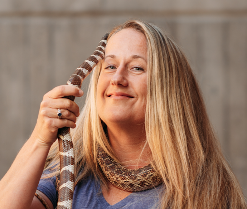 Emily Taylor
31 July 2020 12:00am
15 September 2023 11:02pm
16 October 2023 4:07pm
How do I use a drone to capture radio-tracking data?
 Debbie Saunders
27 July 2020 12:00am
Mataki tracking tags—what's your experience?

24 November 2015 6:22pm
17 July 2020 5:23pm
Hi Joaquin,
The first versions of Mataki tags were open-source and the PCB build information was available online. However the components for this version are obsolete and, if you can get them, are very expensive.
The latest versions of Mataki and the new Mataki-Lite are available commercially from my company and all the information is available at debuginnovations.com/Mataki. My contact information is on the website if you have any questions.
Regards,
Dave
17 July 2020 7:47pm
Hi Dave.
Thanks for your answer.
I saw the Debug Innovations website, the Mataki Little is very interesting.
Either way I am looking for open-source to be able to make our own transmitters because buying electronic devices abroad is very complicated and expensive for us.
Regards,
Joaquín
18 July 2020 11:18am
Hi Joaquin,
If you email me, we can have a discussion of what exactly you need and how we can help.
Dave
Kākāpō Dreaming: A Wildlife Drones Adventure
Wildlife Drones
8 July 2020 12:00am
Era of the Condor: A Species' Future in Recovery (Part 3)
 Ellie Warren
2 July 2020 12:00am
Looking for a long term real time tracking technology for monitoring big game in South Africa
20 January 2016 9:42am
28 April 2020 5:09pm
@Sophie+Maxwell
One point of clarification - Kineis is Argos.
CLS split off the management of the Argos satellite system from itself thereby creating the company called Kineis (a subsidiary of CLS). Kineis' goal was to acquire enough funding ($100m) to launch the 20+ nanosatellites by 2020, and the goal was fully funded a number of months ago. So now it's just a matter of manufacturing the satellites and launching them (one is already in orbit).
I would disagree with your comment about "antenna size issue" with Argos because you can use a patch or a whip antenna. In addition, the whip antenna could be extremely thin and flexible such as using nitinol. With nitinol, for example, you can tie a knot into the antenna, and it would return to its regular state once undone. Of course with a whip antenna you do have a long wire coming out of the tag; however, that can be addressed with a patch antenna for terrestrial applications. Thus, it offers a flexible solution.
I will also add that you can fill in those data gaps and in fact build a "terrestrial-like" network within the Argos framework by deploying a number of the Argos Goniometer stations. In that scenario you would have a tagged rhino transmitting to the Argos satellites, and as you know if a satellite is not overhead the message is lost. However, if there is an Argos Goniometer within range (tens of miles +/-) you will receive that message even if a satellite is not overhead.
One last comment that I'll add is that the power requirements for an Argos transmission are a fraction of what is required from Iridium and/or Globalstar. Right now the lowest power output that I am aware of is 250mW; however, we expect to more than half that when the constellation is launch (70-100mW transmissions). I am not that familiar with some of the new sat tech in regards to transmitter design, output, etc. I suppose the one good thing about having an "old system" is that we know so much more about what can be done and what cannot be done.
Anyways, happy to answer any questions you might have regarding Argos and/or Iridium.

29 June 2020 11:39am
Dear Sophie,
I would like to comment directly on your post regarding your assessment and report about rhino tracking devices in wildlife conservation. I believe it is good to share thoughts and ideas on the WILDLabs forum about these topics, but people should be very careful when they are making bold statement with regards to performance of technology. Some elements in your reporting are highly speculative and lack detailed input from the actual users in the conservation field.
We find this quite concerning as you are not only misinforming people on the WILDlabs-forum, but you might also be providing your own administration (Department for Environment, Food & Rural Affairs)with incorrect information.
With regards to the LoRaWAN based rhino trackers we like to set the following straight and we also raise some questions.
General
- Did you have contact and feedback from people that actually have a personal experience in LoRaWAN based tracking devices for rhino in the field? As far as I know, the people you report about, do not have this experience. I recommend you to look for people in the field that do have this experience, such as park managers of African Parks and Peace Parks.
2.1) Satellite enabled trackers.
- “Africa Wildlife Tracking are the most mature and reliable tracking solution”; How do you know this and what is your source? What numbers did you use to come to this conclusion?
- Why do you name “Argos” CLS as a rhino tracking solution?
- Telerax: “Cited by the community as reliable”; What are your sources here?
- Ear tracking: Who is reporting that ear tag tracking is not an option? This is not a given, so please state your sources so we can verify this.
I realize your attempt is a light-weight update for DEFRA and not an in-depth investigative article, but this level of light-weight leans a bit more to very light-weight if the sources are not named. Or if the sources have vested interests. It’s unlikely that you’ll go into detail with regards to the sources but I find the stated information very superficial to be honest.
2.2) IoT Fixed Infrastructure Tags;
- About your general comment on the “IoT Fixed Infrastructure Tags” – Why do you state that the costs for the infrastructure are “costing several £100,000s” – again, who/what is your source and how is this calculated?
- “Leading solutions in this IoT space seem to be SMART Parks and Sigfox” – again, who is your source and what makes you think Smart Parks is leading? The same goes for Sigfox. For Sigfox I even think you need to identify the solution and not the technology, since Sigfox is “only” a network technology compared to LoRaWAN and is not a end-to-end solution.
- Why are you including links to the websites of the satellite solutions and not to the Smart Parks solutions, even when this is as simple as www.smartparks.org.
- Why are you reporting on the failure of Smart Parks rhino tags “however, there have been recent challenges with their newly miniaturized version, where 5 out of 6 units failed after a short time in Malawi. This could be an anomaly, as their previous versions worked well and we welcome further updates.”?; Who is your source and what did you do to verify this?
- Sigfox: “We have heard some dissatisfaction with customer service and the capability to integrate data with other software and hardware solutions.” Again, who is your source and what makes you say this? Also, why are you speaking of “We”, as I understand this was a personal blogpost?
- Cisco: What makes you say that Cisco “provided IoT trackers” and what is your source?
3) What are the emerging solutions?
- Can you explain why CubeSats are the way to make rhino tracking devices smaller, cheaper and more secure? As you indicate: “Where there is great potential to bring smaller, cheaper, secure satellite tracking to solve these problems”.
- What makes you conclude like this: “Whoever provides cheap tags, small transmitters, multiple gateways with super low costs data will win for wildlife conservation in this exciting new space.” What are your sources and what is the reasoning behind this? (deze zou ik niet doen)
I think a lot of your statements are debatable and not very well substantiated. I’m willing to go as far as to say that they are more damaging than providing solid information to the Wildlab-community and abroad. The community working on trying to find and build better solutions needs reliable information as this is already a very complex problem. Therefore, I would like to suggest that you improve the blogpost where possible with thorough and reliable information. I’m happy to assist you in finding the right information.
To get you started, I would like to offer you some key facts about what Smart Parks has been doing to make a rhino tracking solution:
- In 2017 we have successfully deployed a LoRaWAN rhino horn implant into an Eastern Black rhino in Mkomazi National Park in Tanzania, and the device has giving location update for 2 years without any major issues. The sensor even continued working after it had grown out of the horn. This is a clear proof that a LoRaWAN Geoloc based solutions is perfectly fine for rhino tracking in situations where a LoRaWAN Geoloc network is possible. We have replicated these result in other parks in Africa. Please check our website and other sources for proof: https://www.smartparks.org/news/first-black-rhinos-protected-sensor-implants-horns/
- In 2019 we have successfully deployed a LoRaWAN rhino horn implant into Eastern Black rhino in Liwonde National Park in Malawi. This new sensor does not use LoRaWAN Geoloc to update it’s position, but relies on GNSS (GPS). This allows for rhino tracking based on LoRaWAN in networks and areas that can not or do not want to use the Geoloc function. GNSS can offer higher location accuracy then the Geoloc method. Yes, we have had some issues while deploying prototypes into the field, but this is normal for these type of solutions. We now have a stable sensor in production that is working properly in multiple locations in Africa. Please also look around for proof and maybe start here: https://www.smartparks.org/news/holy-grail-in-rhino-monitoring-deployed-in-liwonde-national-park/
- An important note I would like to add and something I believe is missing from your comments in general, is fact that we have started the OpenCollar Initiative, under which we have made the rhino LoRaWAN + GPS tracker completely open-source. https://opencollar.io/
- Also, you are talking about rhino tracking solutions, however you only discuss the actual tracking devices in your blog post. Please also look at the Application level (what happens to the data) of these solutions, since there are also very important in the total solution.
I’m also happy to put you in touch with park managers who are actually working with the sensors on a day-to-day basis.

29 June 2020 10:19pm
Hi Tim and also Thomas
Thanks for your comments. It is fantastic that there have been so many replies to this thread in response to the request for thoughts, clarifications and questions on this topic.
I’m available on email. You can reach me directly via WILDLABS messages.
Soph
4 September 2020 1:07am
Hi Akiba,
Oh that is amazing, thank you! I'll get in touch with them and let them know! A few of them are members here on WILDLABS already, so I'll see if they've got a wishlist to post for anyone who might like to help out.