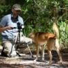
In recent years, drone technologies have been explored for a range of applications in conservation including (but not limited to) mapping, biodiversity inventories, antipoaching patrols, wildlife tracking, and fire monitoring. The rise of customizable, open-source drones like those of ArduPilot and OpenROV hold promise for more effective conservation applications, and combined with other monitoring sensors and devices, they are capable of collecting high-resolution data quickly, noninvasively, and at relatively low cost.
However, challenges remain in putting these tools to use. A recent paper reviewing 256 conservation drone projects highlighted some of these major obstacles, ranging from unintended social and ecological consequences of drone operations to still prohibitive costs, both in terms of hardware and in terms of storing and processing large volumes of data. The longstanding challenge of power/battery life remains as well.
If you're considering trying out drones for yourself, and want to explore the possibilities and understand the major conversations happening around this technology, check out these beginner's resources and conversations from across the WILDLABS platform:
Three Resources for Beginners:
- Conservation Technology User Guidelines Issue 5: Drones, World Wildlife Fund | Drones, best practices, ethics, regulations, case studies
- WILDLABS Virtual Meetup Recording: Drones, Craig Elder, Dr. Claire Burke, and Gabriel Levin | Drones, thermal camera, wildlife crime, ML, biologging
- New Paper: Drones and Bornean Orangutan Distribution, Sol Milne | Drones, data analysis, citizen science, community science, primates
Three Forum Threads for Beginners:
- Curious about radio-tracking with drones? | Wildlife Drones, Biologging (5 replies)
- Drones for GIS Best practice Document | Adrian Hughes, Drones (10 replies)
- WWF Conservation Technology Series: Drones in Conservation | Aurélie Shapiro, Drones (7 replies)
Three Tutorials for Beginners:
- How do I use a drone to capture radio-tracking data? | Debbie Saunders, Tech Tutors
- How do I choose the right drone for my conservation goals? | Shashank Srinivasan, Tech Tutors
- How do I strategically allocate drones for conservation? | Elizabeth Bondi, Tech Tutors
Want to know more about using drones, and learn from experts in the WILDLABS community? Make sure you join the conversation in our Drones group!
*Header photo: Parker Levinson, Point Blue Conservation Science

Founder & CEO of we.are.tohorā, creating a community that cares about whales, the environment and each other.
- 0 Resources
- 0 Discussions
- 13 Groups

- @Fatuma
- | She/Her
I aim to transition my career towards conservation technology after gaining two years of experience in the tech industry.
- 0 Resources
- 0 Discussions
- 14 Groups
Society for Conservation GIS


- 0 Resources
- 21 Discussions
- 5 Groups

Friends of Brisbane Ranges

- 0 Resources
- 32 Discussions
- 5 Groups

- @LindyClydeKnowles
- | he/him

- 0 Resources
- 6 Discussions
- 6 Groups

Wildlife Drones
Wildlife Drones has developed the world’s most innovative radio animal-tracking system using drones so you can track your radio-tagged animals like never before.

- 11 Resources
- 8 Discussions
- 32 Groups
Certified Associate Wildlife Biologist
M.S. Student
- 1 Resources
- 18 Discussions
- 7 Groups
I'm a wildlife ecologist with interests in a range of technology.
- 0 Resources
- 20 Discussions
- 5 Groups

Passionate advocate for nature and experienced communicator, looking to explore opportunities to leverage technology in wildlife and marine conservation
- 0 Resources
- 0 Discussions
- 7 Groups

Technologist and Visual storyteller focusing on social, conservations issues.
- 0 Resources
- 31 Discussions
- 16 Groups

- @ATM
- | HE
I studied Wildlife and Ecotourism Management in University of Ìbàdàn, Nigeria, I'm a front-end developer. I am interested in conservation technology
- 0 Resources
- 5 Discussions
- 11 Groups
- 0 Resources
- 0 Discussions
- 1 Groups
Article
Share Your Work in a Conservation Technology Video

Robin Marti Sarasa
Do you have photos and videos of your conservation tech work? We want to include them in a conservation technology showcase video
17 May 2024
Careers
Save the Elephants is seeking a Principal Investigator for our Elephant Collective Behaviour Project. This role will spearhead research initiatives using cutting-edge video analysis tools to study elephant group...
1 May 2024
Article
The Inventory User Guide

Jake Burton
Read in detail about how to use The Inventory, our new living directory of conservation technology tools, organisations, and R&D projects.
1 May 2024
Article
Introducing The Inventory!
Jake Burton
The Inventory is your one-stop shop for conservation technology tools, organisations, and R&D projects. Start contributing to it now!
1 May 2024
Careers

The Max Planck Institute of Animal Behavior at its sites in Constance and Radolfzell offers an international, interdisciplinary, and collaborative environment that opens up unique research opportunities. The goal of our...
13 March 2024
Article
Catch up on the conservation tech discussions and events that happened during World Wildlife Day 2024!
7 March 2024
Careers
Machine Learning Postdoc Position, Understory

Ross Davison
Join us to help prevent biodiversity loss! Understory is hiring a postdoc to lead R&D Development on generalizing Computer Vision models for vegetation identification across space/time/phenotypes.
29 February 2024
Article
Cutting edge plant conservation

Ben Nyberg
A game-changing new tool is helping conservationists working with critically endangered cliff plants
9 January 2024
Article
ICOTEQ launch TAGRANGER® system of products

Craig Rackstraw
TagRanger® is a state-of-the-art wildlife finding, monitoring and tracking solution for research, conservation and environmental professionals. With superior configurability for logging data, reporting location and...
23 November 2023
Careers
Yale University & Map of Life Rapid Assessments - XPRIZE
8 November 2023
Careers
Data Scientist - Remote Sensing of Individual Trees

Alex Killion
Yale University & Map of Life Rapid Assessments - XPRIZE
8 November 2023
Careers
Yale University & Map of Life Rapid Assessments - XPRIZE
8 November 2023
November 2023

28 Products
Recently updated products
| Description | Activity | Replies | Groups | Updated |
|---|---|---|---|---|
| Drone program manager at Island Conservation - https://www.islandconservation.org/drone-program-coordinator/ Senior Specialist, Flight... |
|
Drones | 2 years 9 months ago | |
| Hi Egil, The group I'm involved with works with remote communities in/around North and South Luangwa National Parks and there is some expansion happening to community areas... |
|
Drones | 3 years 2 months ago | |
| Here is a very interesting conference with different tech approaches about Automated Forest Restoration where we collaborated with our... |
|
Drones | 3 years 2 months ago | |
| Hi! Interesting subject indeed. In most cases where UAVs are used in nature "documentaries" it is pretty obvious to a behavioural biologist that the animals... |
+4
|
Drones | 3 years 2 months ago | |
| Hi Wildlabbers, This week is the last episode of Tech Tutors Season 2! Elizabeth Bondi tackled the question "How do I... |
|
AI for Conservation, Drones | 3 years 3 months ago | |
| Hello Aurelie, Thank you for sharing this info. I just downloaded the brochure and I am sure I will find it very useful. I have senseFly's eBee Classic, with RGB,... |
|
Drones | 3 years 3 months ago | |
| Hi Wildlabbers, Tech Tutors Season 2 continues with our fifth episode, featuring Shashank Srinivasan who will tackle the question... |
|
Drones | 3 years 4 months ago | |
| The UFO project is an H2020 programme dedicated to supporting the development of innovative products and services by integrating ... |
|
Drones | 3 years 4 months ago | |
| Hi Isla, That's something that the drone world really needs to take on because there can be a world of difference in drone size, prop types and motor types to reduce impact... |
|
Drones | 3 years 5 months ago | |
| Hello Shashank, I found your post very interesting - congratulations on looking at the ethical side of this technology! One of the reasons that our organisation,... |
|
Drones | 3 years 6 months ago | |
| Very cool, thanks for sharing, Adrian! We'll put this up on Twitter as well. |
|
Drones | 3 years 7 months ago | |
| Hi all, Firstly, I'd just like to say a big thank you to everyone who attended my Tech Tutors presentation last month. And secondly, thank you for your patience in allowing... |
|
Biologging, Drones | 3 years 8 months ago |


WILDLABS Tech Tutors: Season One
 WILDLABS Team
19 May 2020 12:00am
Using UAVs to Assess carbon in Mangroves

13 May 2020 1:06pm
Training Course: Quantitative Analysis of Marine & Coastal Drone Data
 Duke Marine Lab
29 April 2020 12:00am
Connecting to MBARI's Deep-Sea Instruments
 MBARI
MBARI
31 March 2020 12:00am
WILDLABS Community Call Recording: Rainforest X-PRIZE
30 March 2020 12:00am
Virtual Field Trip: Conservation Technology with Shah Selbe
 Shah Selbe
24 March 2020 12:00am
Able to Provide Movement Detection Software For Live Feed Video
16 January 2020 5:15am
15 March 2020 5:15pm
Hi Jessi,
I can check on the regulations for the specific area that is planned for a wildlife sanctuary in Zimbabwe. What altitude does the drone need to operate in? Does it require communications with any ground-based facility?
Ruth
15 March 2020 11:40pm
Hi Ruth,
Thanks for your email.
Essentially the software is only an advantage if the drones are being flown at altitudes that provide a wide area and less visible detail (i.e. if the operator flies at 3000ft (instead of 1000ft) it will cover 9x the area and see very small detail (which the software can pick up but the human eye may miss). In addition the software needs video feed from a computer (it sort of overlays the video) so it is only useful for drones that are able to relay decent quality video feed to a ground control station where an operator is viewing it live.
I have been advised that the drones that this is most useful for are likely to be at least 5kg (ie not the small toy ones that give video to a tablet).
I hope that helps? Please feel free to ask anything else and I will see what I can find out,
Jessi
#Tech4Wildlife 2020 Photo Challenge In Review
WILDLABS Team
4 March 2020 12:00am
Call for Nominations: Tusk Conservation Awards
 Tusk
Tusk
3 March 2020 12:00am
Hawai'i Conservation Conference
 Hawaiʻi Conservation Alliance
28 February 2020 12:00am
New Conservation Dataset with Thermal Infrared Images from Drones
26 February 2020 6:48pm
Drone Reforestation Tech for everyone

24 February 2020 12:04pm
Hacking Climate Change - Coaction on Climate Crisis
 COACT
COACT
20 February 2020 12:00am
Habitat Restoration in the Pennines, UK

30 January 2020 8:48am
LIDAR USA sensor
14 January 2020 12:38pm
Thermal imaging, drones, and loggerhead sea turtles: a #tech4wildlife case study using FLIR's new Duo Pro R camera

21 September 2018 3:21pm
24 December 2019 6:42am
Rob thanks for the offer, sorry about delay in reply work has been in way. I have spoken to our coordinator here and we would be interested in borrowing flair 640 to see if it helps locate. Let me know he best way to get in touch.

2 January 2020 5:10pm
Hi thermal people,
Just a quick heads up, but I am exploring some of Seek Thermal's (ex FLIR engineers I believe) new Mosaic Core modules by having a play with their developer's kit. I'll report back once I receive the equipment, but their intention is to release 320 x 240 cameras at very low cost. Note - they won't sell them individually, so a reseller will be necessary, but if they are cost effective at this resolution it could prove excellent for wildlife conservation use.
https://www.thermal.com/uploads/1/0/1/3/101388544/mosaic_core_specification_sheet.pdf
Cheers,
Alasdair
2 January 2020 6:12pm
Cheers Al, and looking forward to hearing more about them. I am, as we speak, editing some thermal videos of wallaby behaviour near roads, specifically in relation to devices that activate lights and sounds when a car is approaching (activated by vehicle headlights at night). Used a Flir 640R, but I reckon half that resolution would still be fine. Unfortunately, not much support for the devices themselves working as a deterrent/warning (although I have some ideas on how they could with additional stimuli), but the thermal camera works great for non-invasive observations!
Image Processing Advice
22 October 2018 11:53am

13 November 2018 12:09pm
I just thought I would mention that i've been talking to Sol about his issue and also around multispectral and thermal sensors. No solution as yet to the issue but Sol will share some of his data with us so we can take a look.

28 November 2019 1:45am
Just wanted to mention I found a solution to my georeferencing issue. You can use the 'geosphere' package in R to identify the coordinates of specific coordinates in each image, based on the position of the central coordinate, bearing and distance to target pixel.
Feel free to drop me a line if you want a hand doing this!
28 November 2019 8:53am
Really useful to know about that package, thanks
[ARCHIVE] Virtual Meetup Discussion: Drones
19 November 2019 3:04pm
[ARCHIVE] WILDLABS Virtual Meetup Invitation: Drones
18 November 2019 4:35pm
WILDLABS Virtual Meetup Recording: Drones
WILDLABS Team
9 November 2019 12:00am
How do you weigh a live whale?
 Fredrik Christiansen
9 October 2019 12:00am
Aerial Seeding with drones: reforestation Workshop in Brazil next November
2 September 2019 4:51pm
Tips to create a reforestation platform.
25 August 2019 11:37pm
[ARCHIVE] Promises and Pitfalls of Conservation Drones webinar (June 6)

3 June 2019 11:37am

22 August 2019 5:14pm
Is the webinar recorded and uploaded somewhere?
22 August 2019 5:24pm
It is indeed. You can watch it here:
https://consbio.org/products/webinars/scgis-webinar-promises-and-pitfalls-conservation-drones
I'll also see if we can add it to our resources area for ease of access. Leave it with me.
Workshop: Drones in the Coastal Zone
13 August 2019 12:00am
From the Field: Melissa Schiele
10 June 2019 12:00am
SALE: WingCopter HeavyLift drone, LiDAR, Multispektral camera, NextVision NightHawk
5 June 2019 10:20am
Circular Polarising Filters for the Mavic 2 Pro

29 April 2019 2:36pm

8 May 2019 7:23pm
I like the stuff Polar Pro puts out. I think they are some of the best you can get and it is what I use.
4 June 2019 3:31pm
Thank you for the tip! Shall try and pick up a set soon.
Drone flight in Indonesia
16 April 2019 12:08pm
17 April 2019 4:14pm
Hi Sophie,
The best thing would be to get in contact with the Department of Civil Aviation in the Indonesian state you're working in. You're right that you can fly without a permit for at low altitude in most places, but there may be diferent restrictions if the drone is used for research purposes so its worth checking. I received a license for drone work in Sabah (Malaysian Borneo) and they mainly wanted to know the drone specs, activities, flight coordinates, dates and if possible, times. The only restriction they gave us was to fly below 300 m,
There is usually a lot of back and forth between departments about who is ultimately responsible but they should be able to get it processed, as there are groups in Kalimantan using drones pretty regularly. Please let me know if you have any issues or need any other info.
Best wishes,
Sol
18 April 2019 5:07pm
Thanks so much Sol! How long did it take you to get permission to fly? And were there any costs associated with getting the permit?
4 June 2019 1:33pm
Hi Sophie,
Sorry- I only just saw your reply!
It took about 3 months to get it through the department of civil aviation, but this doesn't mean much, because the Indonesian system may be pretty different. It cost 250RM (£50) for each drone.
Cheers,
Sol
Canopy height mapping with drones
 Tom Swinfield
31 May 2019 12:00am
11 March 2020 3:22am
Hi Ruth,
Thanks for your reply and the suggestion.
I contacted air shepherd and a few similar groups a few moths ago and they were all saying they are not interested due to the difficult drone regulations. Hopefully the regulations are not as arduous in Zimbabwe?
Please don't hesitate to ask if there is any technical information or assistance that I can provide to help with your project,
Jessi Hargrave