
Group curators

Pen-Yuan Hsing
- @Nycticebus_scientia
- | he/they
MammalWeb.org

Shannon Rankin
- @srankin
- | she/her
NOAA Fisheries

Brianna Johns
- @briannajohns
- | she/they
Gathering for Open Science Hardware (GOSH)
Despite critical advancements in the tech solutions available to conservationists worldwide, many existing tools are cost-prohibitive in the landscapes that need them most. Additionally, those who create low-cost and open-source alternatives to pricey market tech often operate on tight budgets themselves, meaning they need more resources to promote their solutions to a broader market. We need increased communication around these solutions to highlight their availability, share lessons learned in their creation, and avoid duplication of efforts.
This group is a place to share low-cost, open-source devices for conservation; describe how they are used, including what needs they are addressing and how they fit into the wider conservation tech market; identify the obstacles in advancing the capacity of these technologies; and to discuss the future of these solutions, particularly their sustainability and how best to collaborate moving forward. We welcome contributions from both makers and users, whether active or prospective.
Here is how we see the current OSS space and how this group plans to change it by supporting both makers and users:
Many users do not appreciate the significant benefits of open-source tech. This group will educate users about the advantages and the need for open-source tech, specifically in the context of ecology work. We achieve this by stimulating regular discussions on the forum and by encouraging and supporting users to use open-source tools wherever possible.
Building OSS can be difficult. We want to support both established and potential makers who wish to develop OSS. The OSS group is a place where makers can find funding opportunities, ask current and potential users questions, and share their technologies.
Using OSS can be difficult. We also want to support adopters of OSS tech. We do this by offering a place for users to share challenges they face and crowdsource advice on things like technology choice or technical support.
Makers may not have access to diversity of Users. The OSS group is a place that facilitates conversations between makers and users. This will give users a voice and ensure that makers are aware of the needs of users, enabling them to build better solutions.
The community is small and scattered. We want to grow an inclusive community of OSS practitioners. Our goal is to become the go-to place for discussions on the topic where people feel a sense of belonging.
Resources for getting started
- How do I use open source remote sensing data in Google Earth Engine? | Tech Tutors
- How do I use open source remote sensing data to monitor fishing? | Tech Tutors
- Low Cost, Open Source Solutions | Virtual Meetup
- What would an open source conservation technology toolkit look like? | Discussion
- December 2024 Open Source Solutions Community Call
Header image: Shawn F. McCracken
Group curators
- @Nycticebus_scientia
- | he/they
MammalWeb.org
Co-founded citizen science camera-trapping project with interest in developing 100% open source wildlife tech. Advocate for open science/open research. Former Community Councilor of the Gathering for Open Science Hardware.



- 4 Resources
- 27 Discussions
- 3 Groups
- @srankin
- | she/her
NOAA Fisheries
Bioacoustics researcher with the National Oceanographic and Atmospheric Administration (NOAA).



- 0 Resources
- 10 Discussions
- 16 Groups
- @briannajohns
- | she/they
Gathering for Open Science Hardware (GOSH)
Interested in the application of open source technologies for conservation research.

- 11 Resources
- 5 Discussions
- 4 Groups
No showcases have been added to this group yet.

Committed to using technology, data and innovation to create efficient, safe and impactful solutions.

- 0 Resources
- 0 Discussions
- 16 Groups

- @TaliaSpeaker
- | She/her
WILDLABS & World Wide Fund for Nature/ World Wildlife Fund (WWF)
I'm the Executive Manager of WILDLABS at WWF


- 28 Resources
- 64 Discussions
- 33 Groups

- @bluevalhalla
- | he/him
BearID Project & Arm
Developing AI and IoT for wildlife




- 0 Resources
- 59 Discussions
- 9 Groups

- @lilithdotgov
- | She/Her
New Jersey Institute of Technology
Mathematical Biologist based in the US | Creating tools today for the science of tomorrow!
- 0 Resources
- 0 Discussions
- 1 Groups
- @jyseltz
- | He/him
Independent researcher working in open-source AI, based in BC & Panamá.

- 2 Resources
- 3 Discussions
- 9 Groups

- @tcsmith
- | he/him
I am a conservation biologist interested in modeling social-ecological systems.
- 1 Resources
- 6 Discussions
- 12 Groups
- @LucyD
- | She/They
Backend engineer and data scientist with an ecology and conservation twist


- 0 Resources
- 3 Discussions
- 10 Groups

Chief Wildlife Biologist & CEO of Altitude Conservation, developing conservation tech. Deployed the first drone multi-frequency VHF tracking system in 2015. With 25+ years’ experience as a wildlife biologist and telemetry developer at NPS, DOC (NZ) +3 other telemetry companies
- 0 Resources
- 4 Discussions
- 14 Groups

Cellular Tracking Technologies
Biz Dev at Cellular Tracking Technologies

- 5 Resources
- 76 Discussions
- 4 Groups
- @srankin
- | she/her
NOAA Fisheries
Bioacoustics researcher with the National Oceanographic and Atmospheric Administration (NOAA).
- 0 Resources
- 10 Discussions
- 16 Groups
- @ianmcfadden
- | he / him
Queen Mary University of London
Assistant Professor of Computational Ecology interested in computer vision, multimodal AI and robotics for ecological scene understanding and navigation in terrestrial and marine environments.
- 0 Resources
- 2 Discussions
- 8 Groups

WILDLABS & Wildlife Conservation Society (WCS)
I'm the Bioacoustics Research Analyst at WILDLABS. I'm a marine biologist with particular interest in the acoustics behavior of cetaceans. I'm also a backend web developer, hoping to use technology to improve wildlife conservation efforts.



- 56 Resources
- 48 Discussions
- 34 Groups
Article
BAM (Biodiversity Around Me) widget

Camille Monchicourt
I am happy to introduce and share our new project BAM, to make open biodiversity data easily accessible to everyone, everywhere!
30 June 2026
Article
It was on the shores of French Guiana, at 4am in the morning, that after 8 years of research and development to develop a ready-to-deploy open source satellite sea turtle tag, we achieved our goal.
7 June 2026
Article

🌍 Conservation technology is transforming how we protect wildlife, but are we thinking carefully enough about the risks? Drones, camera traps, GPS trackers, acoustic sensors, AI, and remote sensing have become...
22 May 2026
Article
Invitation to submit articles for a Special Issue of the journal "Sensors"
28 April 2026
Careers
Yukon2Yellowstone (https://y2y.net/) team is seeking a developer to design, implement, and deploy an application within the MoveApps platform (Movebank) to estimate animal survival.
16 January 2026
Careers
Volunteer Google Ads Specialist Needed!
Rebekka Stutz
We’re reaching out again because we haven’t received any matching applications yet—and we truly believe someone in the Wildlabs community could be the perfect fit. If you care about conservation and want to use your...
19 November 2025
Article

The University of Hawai‘i - Ocean & Resources Engineering program is seeking project ideas from community groups, marine/ocean scientists, government agencies, companies, and non-governmental organizations for their...
16 November 2025
Article
Things have been busy for the Mothbox team over the past few months as we continue developing a new, scalable Mothbox version that can be built and sold anywhere in the world.
27 October 2025
Funding
NEW! eDNA Collaborative 2025 Microgrant

Shana Hirsch
Funding for low-cost DIY Fluorometers by DIYNAFLUOR
15 October 2025

Open-source desktop app, to run AI for biodiversiy
30 September 2025
Link
Request to Participate and Share the Survey

Md Niaz Morshed
Hello, I would greatly appreciate it if you could participate and share the survey link below with your developers and code reviewers. Thank you in advance. https://universityofalabama.az1.qualtrics.com/jfe/form...
23 September 2025
Careers
Conservation technology vacancy at the RSPB
Nigel Butcher
Application deadline 03/10/25
8 September 2025
FREE Drone & GIS Mini Course from GeoWing Academy


FREE Drone & GIS Mini Course from GeoWing Academy
FREE Drone & GIS Mini Course from GeoWing Academy


Fantastic Fields: Field Data Collection the Smart Way
Fantastic Fields: Field Data Collection the Smart Way
Fantastic Fields: Field Data Collection the Smart Way
Drone Photogrammetry & GIS Advanced Course
Drone Photogrammetry & GIS Advanced Course
Drone Photogrammetry & GIS Advanced Course
Drone Photogrammetry & GIS Intermediate Course
Drone Photogrammetry & GIS Intermediate Course
Drone Photogrammetry & GIS Intermediate Course
Drone Photogrammetry & GIS Introduction (Foundation) Course
Drone Photogrammetry & GIS Introduction (Foundation) Course
Drone Photogrammetry & GIS Introduction (Foundation) Course


July 2026
August 2026

June 2026
event
Rebekka Stutz
May 2026
event
Rebekka Stutz
| Description | Activity | Replies | Groups | Updated |
|---|---|---|---|---|
| Well, this has been a year! It started (as most years do) with great intentions and enthusiasm from the Open Source Solutions group... |
|
Open Source Solutions | 4 days 9 hours ago | |
| Somehow I forgot to add the most important graphs!?!?! Here are other results from our earlier survey!!! |
|
Open Source Solutions | 5 days 11 hours ago | |
| Good concept and the component choices are sensible for a low-cost prototype. A few technical observations from working with similar architectures in remote African deployments:On... |
|
Open Source Solutions | 3 weeks 6 days ago | |
| Great discussion — the trade-offs you're navigating with Loko are exactly the right ones for open-source wildlife tracking.A few thoughts on the points raised, particularly for... |
+6
|
Sensors, Animal Movement, Open Source Solutions | 3 weeks 6 days ago | |
| Looks very beautiful. Well done.Poor Rob Appleby. He's just a youngun. |
|
Animal Movement, Open Source Solutions | 1 month 1 week ago | |
| Thanks for this! I've shared this post with the WildTrax (https://wildtrax.ca/) team and CanAvian (https://canavian.ca/) to investigate. We're exploring data standards as... |
|
Acoustics, Autonomous Camera Traps for Insects, Camera Traps, Data Management & Mobilisation, Open Source Solutions, Software Development | 1 month 1 week ago | |
| Hi all, just sharing a workflow we’ve been refining over the last 15 months. We wanted to move beyond visual observations and truly... |
|
Drones, Citizen Science, Conservation Tech Training and Education, Emerging Tech, Geospatial, Open Source Solutions, Protected Area Management Tools, Sensors | 1 month 2 weeks ago | |
| That is so cool! Love the video! |
|
Acoustics, AI for Conservation, Latin America Community, Open Source Solutions | 1 month 2 weeks ago | |
| Hi John,The standard rate for Argos airtime for NGOs is typically €63 p/m for unlimited transmissions within that month for marine projects (sea turtles etc). For fixed assets (... |
|
Open Source Solutions | 1 month 2 weeks ago | |
| Using drone mapping as a way to create beautiful maps and 3D models of our study sites is pretty cool. Those photogrammetry outputs are... |
|
Citizen Science, Conservation Tech Training and Education, Data Management & Mobilisation, Drones, Emerging Tech, Geospatial, Open Source Solutions, Sensors | 1 month 3 weeks ago | |
| A halow router by itself will draw a bit over 4W. Maybe 4.5 from memory with my tests. |
|
Open Source Solutions, Sensors | 1 month 3 weeks ago | |
| It certainly is! The great thing about it too is that the aerial detections often lead to more ground detections when teams are locating the trees from the map data and by using... |
|
Conservation Tech Training and Education, Drones, Emerging Tech, Geospatial, Open Source Solutions | 1 month 4 weeks ago |






















The (Wildlabs) Year in Reflection for OSS Group
22 July 2026 7:52pm
Open Source Solutions (OSS) Group Survey Results
13 February 2026 7:35pm
14 February 2026 6:28pm
As a newcomer to this platform/community, this was incredibly insightful. I look forward to exploring this network and building a better world together.
17 February 2026 5:33pm
Please feel free to fill out the survey (link in post, above), we appreciate any additional feedback!
21 July 2026 6:22pm
Somehow I forgot to add the most important graphs!?!?! Here are other results from our earlier survey!!!
BAM (Biodiversity Around Me) widget
30 June 2026 7:10pm
SwarmGuard: low-cost autonomous mesh system to detect poaching threats and protect wildlife
15 June 2025 7:03pm
21 July 2025 2:41pm
Good morning Aleksey,
Your idea is very similar to an idea I had -- I guess we are experiencing some convergent evolution. I'd be very interested in understanding your project more. I'd be curious to know if you've done much testing with Lora and dense foliage. I'm just curious to know if you've hit any real limitations. Reading your description, it sounds like perhaps you are using some mesh networking. Anyway -- it's nice to meet you and see we had similar ideas.
Chris
4 August 2025 8:20am
29 June 2026 9:07pm
Good concept and the component choices are sensible for a low-cost prototype. A few technical observations from working with similar architectures in remote African deployments:
On the ESP32 deep sleep current — the ESP32-WROOM in deep sleep draws ~10-20μA in practice, which is fine for battery life calculations, but the TP4056 charging IC has a quiescent current of ~55μA in standby. This means the charging circuit itself can dominate your sleep current if the solar panel voltage is too low to trigger charging. Worth profiling the actual system current rather than relying on datasheet deep sleep figures alone.
On the MAX9814 — it's a good low-cost choice but has a relatively high quiescent current (~3mA continuously) for a mic preamp. If you're using sound threshold waking via an interrupt, the mic circuit needs to stay powered during sleep, which significantly impacts your power budget. The ICS-43432 I2S MEMS mic combined with a hardware comparator for wake-up threshold detection is a more power-efficient alternative for this use case.
On the SX1278 LoRa mesh — the SX1278 supports raw LoRa but not LoRaWAN natively. For a mesh topology you need a protocol layer on top — Meshtastic or a custom implementation. Worth being explicit about this in the architecture, as it affects how you integrate with existing ranger communication infrastructure.
On the IP65 enclosure in African savannah — IP65 protects against dust and water jets but not against the daily thermal cycling that drives condensation inside sealed enclosures. A Gore-Tex vent membrane port is worth adding to any permanent outdoor installation.
Interesting project overall — happy to discuss the power architecture in more detail.
GPS Tracker For Wildlife
27 February 2025 12:13pm
8 October 2025 12:52pm
Hi Akio,
Yes we can have a chat about this at some stage.
Best wishes
Nigel
15 October 2025 9:49pm
Hi Akio!
Is there any more extensive documentation for Loko than what I see on the website in the link you sent? I'm curious to learn more, such as what the mean and median positional errors are, and how long the battery would last at various fix intervals (such as 5 minutes fixes vs 15 minute fixes), whether the device is capable of taking more than 6,500 consecutive fixes if it is able to regularly connect to the ground device, how it handles failed fixes (i.e. there are no satellites detected), etc.
I'm working on a project in which we are deploying GPS receivers on gopher tortoises. As with many devices, one of our biggest challenges is finding a device that can store a lot of fixes so that we can leave it out for long deployments (we have been looking at devices with pure receivers, and no transmission option), and as someone else mentioned, ruggedness is very important as well- the turtles can be very hard on trackers. These animals present some unique tracking challenges because they spend much of their time underground, meaning that the device will be unable to detect satellites and/or get a good fix most of the time. We also value customizability- someone else pointed out that we biologists have been known to open up devices and DIY them for our own uses- and we are wont to do the same with software as well, if able. For example, for my study we are interested in options where we can choose an adaptive fix interval, for example, every 5 minutes but only during daylight hours, to save on battery as well as memory space. I know triggered firmware is a common request as well- various groups will use different sensors, such as light, temperature, moisture, float, accelerometer, etc. to tell a device when it's appropriate to take a fix (when the animal moves, when it surfaces, etc.).
Best,
Jocelyn
29 June 2026 8:52pm
Great discussion — the trade-offs you're navigating with Loko are exactly the right ones for open-source wildlife tracking.
A few thoughts on the points raised, particularly for large animal tracking in Africa with limited budget:
On waterproofing the LoRaWAN antenna — the antenna does need to protrude or be positioned at the surface of the enclosure, but this doesn't have to compromise IP rating. A simple approach is to use a helical or meandered trace antenna on the PCB itself (no external stub needed) and cast the entire PCB in epoxy or use a conformal coating, with the enclosure providing the mechanical protection. For collar deployments on large mammals, the antenna is often routed along the collar belt itself as a flexible element, which also improves radiation pattern.
On geofencing for large animals with infrequent fixes — I'd agree with the caution raised earlier. For animals with large home ranges like elephants or lions in Africa, a 1-4 hour fix interval means an animal can travel 10-30km between fixes. Geofencing only works reliably when you can predict where the base station receiver will be relative to the animal's trajectory. For open savannah, a LoRaWAN gateway on a fixed elevated point (a termite mound, a tree, a ranger station) with 10-20km range is more practical than trying to download when the animal passes close.
On memory — 6,500 records at hourly fixes gives about 270 days of logging, which is enough for most large mammal deployments. The limiting factor in practice is usually battery rather than storage.
I work with LoRaWAN-based tracking systems and have field experience in southern Africa — happy to discuss specific deployment scenarios.
Imageomics Institute: FloraPalooza, August 2026
17 June 2026 4:49pm
10 years later, achievement unlocked! A breakthrough for sea turtle satellite tracking
7 June 2026 1:05am
16 June 2026 12:48am
This post makes me so freaking happy! Glad to have met you through conservation technology discussions all the way over here in Australia back in the early days :) I am also super excited to see your innovations continue.
16 June 2026 2:13pm
Looks very beautiful. Well done.
Poor Rob Appleby. He's just a youngun.
Safe and Sound project report: Is Camtrap DP a suitable standard for (bio)acoustic data?
18 March 2026 4:17pm
12 April 2026 6:19pm
Your report on extending Camtrap DP to bioacoustics resonated with something we are just beginning to explore in Mindoro Island, Philippines.
We have ongoing camera trap deployments in interior forest habitats and are beginning to examine the acoustic layer embedded in those recordings, particularly for nocturnal species such as the Mindoro Boobook. The discussion around terminology and how datasets are structured feels especially relevant, though I am still trying to understand how frameworks like Camtrap DP would apply in practice to this kind of data.
It is encouraging to see this direction being shaped at the community level. I will be following this closely as we continue to learn and figure out how our own datasets might eventually align.
15 June 2026 11:54pm
Thanks for this! I've shared this post with the WildTrax (https://wildtrax.ca/) team and CanAvian (https://canavian.ca/) to investigate. We're exploring data standards as part of a recent initiative so this will be very helpful! @jeffcullis
Quantifying 15-months of fynbos vegetation recovery using Drone Photogrammetry and QGIS
12 June 2026 11:56am
🐸 WILDLABS Awards 2025: Open-Source Solutions for Amphibian Monitoring: Adapting Autonomous Recording Devices (ARDs) and AI-Based Detection in Patagonia
27 May 2025 8:39pm
12 November 2025 7:36pm
🌿 Project Update — November 2025
Sharing our experience at the Symposium on Physics Applied to Ecology and Conservation (Foz do Iguaçu, Brazil).
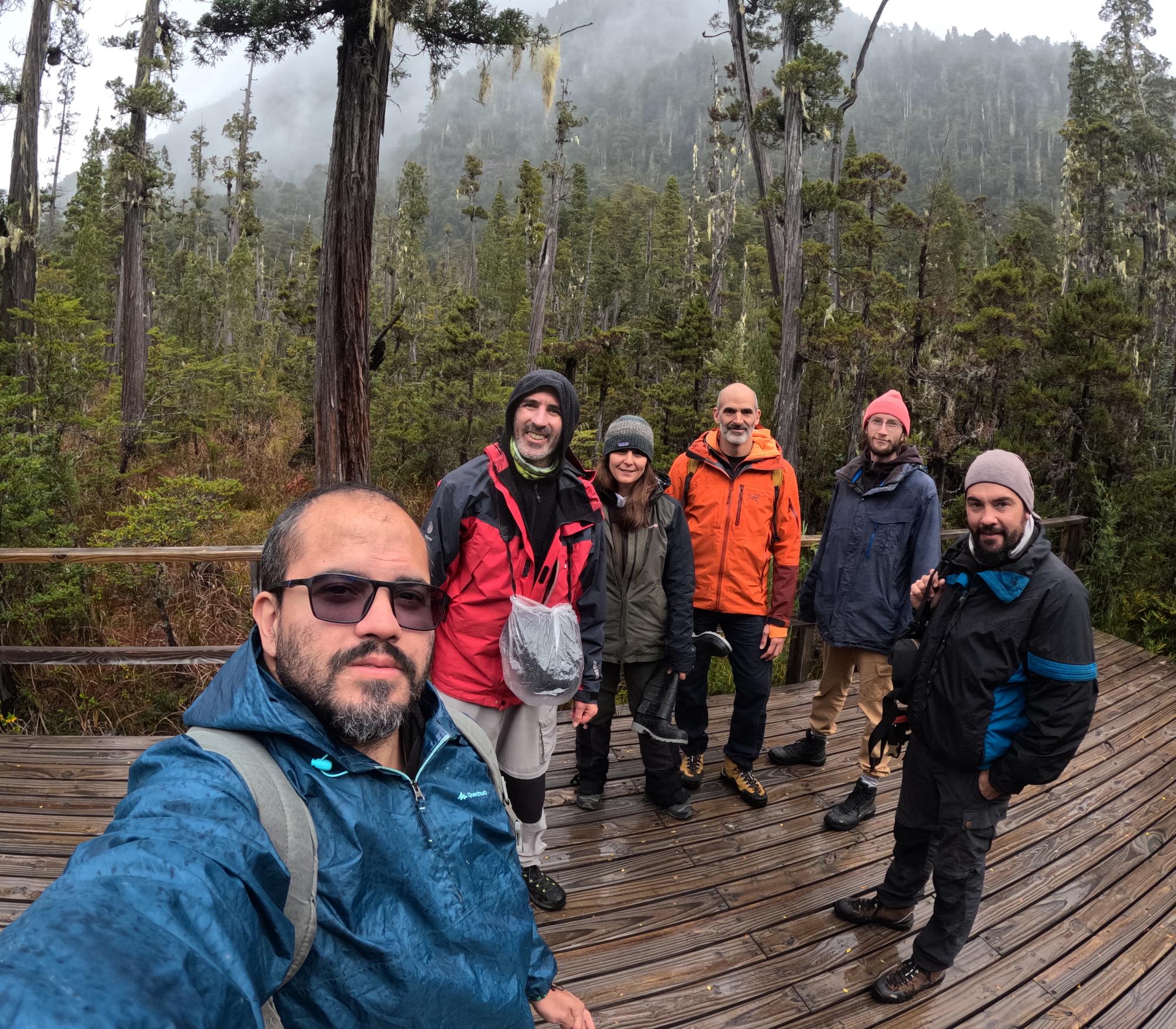
We’d like to thank Carlos Araujo for kindly inviting us to take part in the Symposium on Physics Applied to Ecology and Conservation, held on November 6–7, 2025, at the PTI Campus – Universidade Federal da Integração Latino-Americana (UNILA) in Foz do Iguaçu, Brazil.
The event aimed to build bridges between researchers from different disciplines and countries, exploring how physics can support acoustic monitoring, ecological data collection, and biodiversity conservation.
🎙️ We joined Roundtable 3 — Hardware, Sensors, and Audio Recording, where we discussed:
Open-source autonomous recorders for biodiversity monitoring.
Energy-efficient design and sensor integration.
Alternative battery types and power solutions (particularly relevant to our developments)
🎥 Watch the roundtable recording here.
It was also a great opportunity to share our experience and highlight the WildLabs community, connecting with colleagues working at the intersection of physics, ecology, and technology.
9 June 2026 3:36pm
Hi everyone!
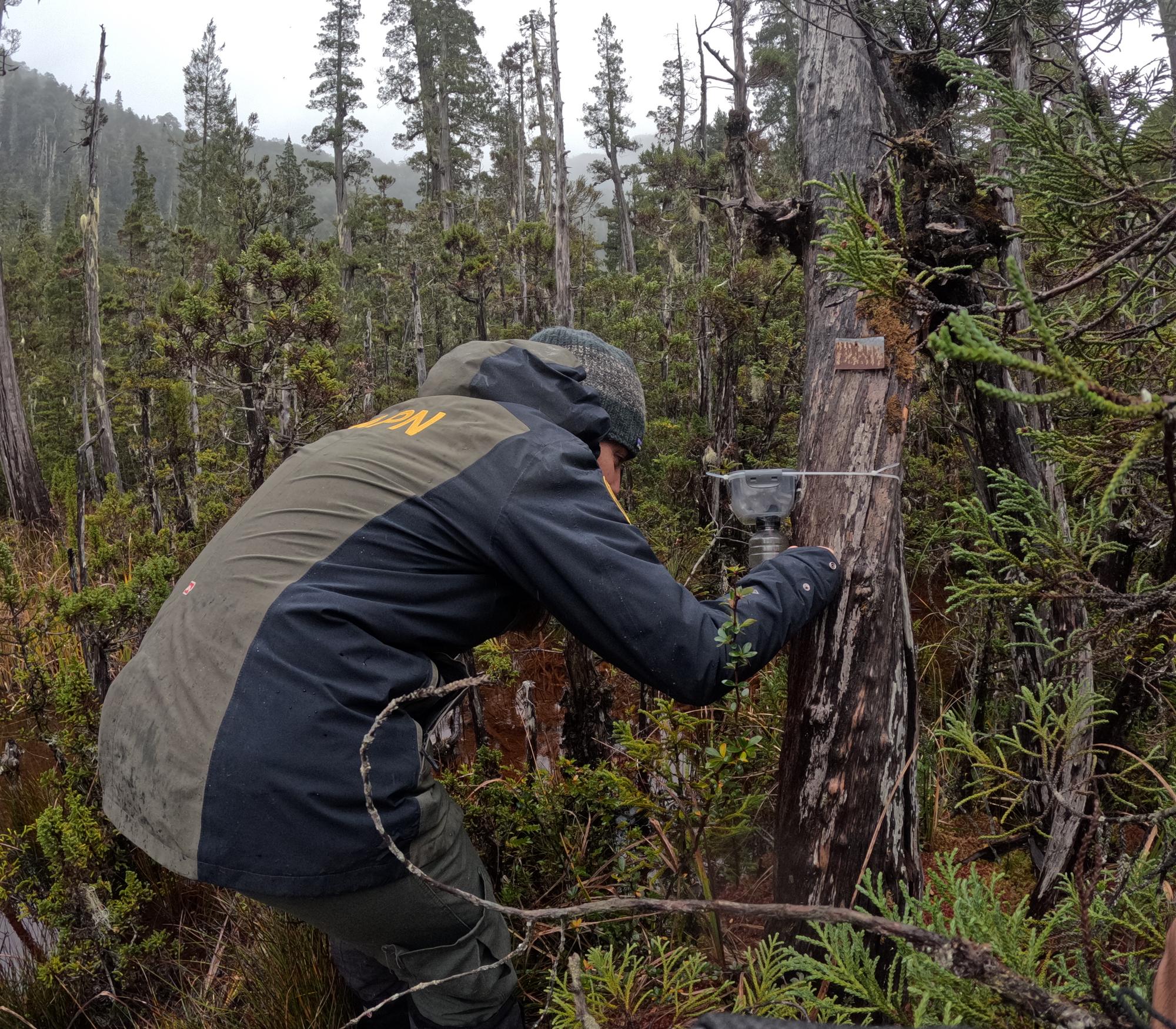
Following up on our project development, we have just published the full report on our work integrating environmental monitoring into AudioMoth devices and the resulting BirdNET workflows for Patagonian amphibians. You can find the complete documentation and results here.
Beyond the technical implementation, we’ve documented the custom firmware, the AI training pipeline for our species, and the practical challenges we faced during field deployments:
Project Video: YouTube Video Link
Firmware: AudioMoth I2C Firmware Repository (GitLab)
AI Workflow: BirdNET-based Workflow for Amphibians (GitHub)
Edge Models: TinyFrog Repository (GitHub)
PyTorch reimplementation: BirdNET-Analyzer (GitHub)
If you are working on similar setups or have questions about the hardware or the workflow, feel free to reach out. I hope this documentation proves useful for your own research.
Thanks for the support and the exchange of ideas during these months!
10 June 2026 1:58pm
That is so cool! Love the video!
Design your own wildlife satellite tag at the ICTC
17 January 2026 8:20pm
14 March 2026 12:18pm
Hi Arky,
We enjoyed running the workshop and it was a fantastic conference overall. Due to the nature of running it live we couldn't record the session, but we have some ideas to try and make it a more regular thing, so watch this space.
17 April 2026 6:52pm
Did not make it to the conference, but this is a topic of interest. Will keep an eye out for future workshops announcements.
It looks like the hardware is reasonably priced. Can you give a sense of what the connectivity costs are?
7 June 2026 12:35pm
Hi John,
The standard rate for Argos airtime for NGOs is typically €63 p/m for unlimited transmissions within that month for marine projects (sea turtles etc). For fixed assets (ground stations) it's possible to discuss bulk discounting prices, but for 1 tag you'll be looking at the above.
Here's a new article too with an overview of the latest sea turtle satellite tag developed with the SMD - A breakthrough in low cost sea turtle satellite tagging and telemetry
A breakthrough in low cost sea turtle satellite tagging and telemetry
7 June 2026 12:37am
8 June 2026 3:14pm
Huge congratulations to the whole team of Arribada for years of dedication to making this happen and delivering incredible open hardware for the community 😃
12 June 2026 4:08pm
Amazing 🤩 🤩
Super congratulations for the perseverance and so many years of work.
Thank you also for keep everything open source.
Looking forward to deploy a few tags.
Pretty exciting.
Beyond the Map: How Drone Data Reveals Ecological Recovery Through Statistics
5 June 2026 10:06am
Habitat box monitoring?
14 January 2026 10:39am
30 May 2026 11:19pm
Quickest way to do that is to do a simple range test using 2 modules like this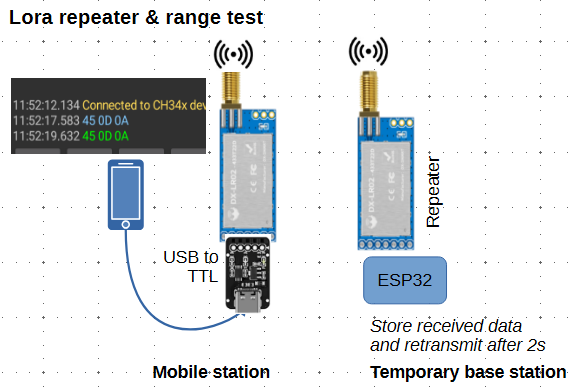
It's minimal cost and no need for any wiring or soldering etc. You can also use it to see how antenna height affects the range, and - if needed - use the temporary base station as a repeater to extend the range of boxes that are in difficult locations. But the repeater will need to be equipped with a solar cell to keep the battery charged.
I use a kit like this - but with longer antenna to get a better range
I think they are on sale at the moment https://www.aliexpress.com/item/1005009827293700.html
If you like, just send me the coordinates of the area where you intend to monitor the boxes. With Google Earth (or a contour map if you have) I may be able to give you an indication of what range you can expect.
31 May 2026 2:36am
also certainly interested if anyone has experimented with low-cost devices supporting HaLow Wifi, to get enough bandwidth to send back pictures for a webcam
31 May 2026 7:40am
A halow router by itself will draw a bit over 4W. Maybe 4.5 from memory with my tests.
WOOHOO ITS WORKING!! Tech finds undetected decades old Alien Invasive Parent Plants in indigenous forest!
24 July 2025 12:21pm
8 October 2025 1:26pm
Thanks @SeanHill - I'll take a look!
5 May 2026 11:02pm
This is a very promising result. The use of drones for detecting invasive species demonstrates strong potential for improving monitoring efficiency and accuracy. In a country like Brazil, where ecosystems are significantly affected by invasive species such as Hovenia dulcis (Japanese raisin tree) and Pinus spp., this technology could become a valuable tool for early detection and management.
29 May 2026 10:15am
It certainly is! The great thing about it too is that the aerial detections often lead to more ground detections when teams are locating the trees from the map data and by using the ground app, they are able to mark the locations and photograph the newly discovered aliens and sync it to the existing maps as well. This allows for truly comprehensive removal and monitoring data capture.
Help shape best-practice guidance on conservation technology - input to survey
22 May 2026 10:20am
Engineer Searching for Biologists
20 May 2026 3:18pm
Nature Tech Unconference - Anyone attending?
8 March 2025 12:11pm
24 April 2026 9:59am
What about this year? Who will be there?
https://www.naturetechweek.com/
I am planning to be there for the Unconference and some satellite events.
28 April 2026 4:10pm
I'll be there for the Unconference- looking forward to it!
13 May 2026 12:05pm
Myself and the Fauna & Flora Conservation Technology team will be there (@Chelsea_Smith and @ugyenpenjor ) and also the WILDLABS team @HRees ! See you!
Nature Credit Markets Webinar with Sensing Clues: Trustworthy Data for Validation and Verification Purposes
11 May 2026 6:51am
Looking for internships, fellowships, and scholarships in conservation technology
2 May 2026 9:03am
Looking for opportunities in AI for Bioacoustics and Environmental Monitoring
6 April 2026 10:37am
8 April 2026 7:26pm
Hi I am also looking for collaborators
if interested in the project let me know
we can add acoustic monotoring for bees
17 April 2026 1:19pm
Hi Leonardo,
Let’s chat! I potentially have some opportunities, collaborations or even short-term employment. Send me a message.
1 May 2026 3:51pm
Hey Leonardo
I might have something. Lets chat, reach out to me at [email protected]
"Sensor Systems for Biodiversity and Ecosystem Monitoring" - Special Issue Invitation
28 April 2026 12:10pm
Biowatch: a free, open-source desktop app for camera trap analysis
21 April 2026 10:07am
22 April 2026 11:30am
Thanks Andrew! Looking forward to your feedback when you get a chance to test it out!
22 April 2026 7:50pm
This looks amazing and I look forward to trying it out when I get the chance!
Just wondering, when it comes to the AI recognitions, is there a way to "rename" the recognitions that were incorrect?
23 April 2026 12:56pm
Yes it is possible. We provide an annotation UI to let you quickly review the model predictions and update them as you see fit!
Reproducible Builds in Software Development
8 September 2025 8:47pm
3 April 2026 2:46pm
Hi Stephen,
My experience of Nix is limited unfortunately but I think it offers a lot of the same benefits. I'm an Emacs/Lisp fan so it's perfect for me :)
There is Cuirass, which is a Guix specific CI and build automation service and a pack command to create containers. It's nice to have everything linked with Guix rather than different systems/frameworks
I built a small POC to explain the benefits.
3 April 2026 6:39pm
Makes sense, I thought there might be a Lisp preference factoring in there 🙂
Cuirass looks cool, I'm going to check it out, and the eco-pulse-monitor project looks great too, well done!
Related to AI sustainability, have you checked out any of the CodeCarbon tools by chance? I've been working on incorporating their library into our daily code tasks at work, seems like a worthwhile project -
EcoLogits just joined CodeCarbon too I think, also neat -
Thanks!
5 April 2026 10:10pm
Thank you. That looks great! I was trying to build something similar but, as usual, there's a Python library already :) I was leaning towards trying SLMs like llama.cpp
My end goal is to find ways to use this approach in animal conservation specifically. I'm looking at data sets from the IUCN to see what's possible. I'd love to hear more about your work
Camera Trap Integration Webinar with Sensing Clues: Connecting Your Camera Traps with All Your Conservation Data
19 March 2026 10:07am
The boring fund: Standardizing Passive Acoustic Monitoring (PAM) data - Safe & sound
27 January 2025 3:47pm
12 February 2025 4:15pm
Hey Sanne, awesome - we definitely need a consistent metadata standard for PAM.
If you haven't already, I would suggest sharing this on the Conservation Bioacoustics Slack channel and the AI for Conservation Slack channel. You would reach a lot of active users of PAM, including some folks who have worked on similar metadata efforts.
If you're not a member of either one of those, DM me your preferred email address and I'll send you an invite!
7 April 2025 11:07pm
Hello everyone,
Thank you all for your contribution!
You can read some updates about this project in this post.
Julia
18 March 2026 3:48pm
For future readers, here you can find the report for this project:
Seeking input: FAIR & AI-ready wildlife drone datasets
4 March 2026 9:21am
7 March 2026 10:27am
Thanks Sean! Looking forward to the community's feedback on this! Feel free to fill out the survey, or open an issue on GitHub to track specific suggestions.
12 March 2026 11:11am
Hi @jennamkline , are you in the SCB Drones and Data Working Group? I think it would be great to have that as a topic for discussion during the next meeting! I'd be keen to hear more about this work.
@annavallery this might be of interest to you.
13 March 2026 2:36pm
hi @elsa thanks so much for the suggestion! i would love the SCD Drones and Data Working Group's input on this proposal. I was planning on attending one of their meetings later in March to solicit feedback. If there are additional venues to engage with the group, please let me know!
How to measure canopy heights with a drone and free software: A quick easy guide!
9 March 2026 3:16pm
When Wildlife Becomes Data: Ethical AI in Biodiversity Monitoring- Join the GEO Indigenous Alliance Summit 2026 March 16-19
5 March 2026 3:53pm