In recent years, drone technologies have been explored for a range of applications in conservation including (but not limited to) mapping, biodiversity inventories, antipoaching patrols, wildlife tracking, and fire monitoring. The rise of customizable, open-source drones like those of ArduPilot and OpenROV hold promise for more effective conservation applications, and combined with other monitoring sensors and devices, they are capable of collecting high-resolution data quickly, noninvasively, and at relatively low cost.
However, challenges remain in putting these tools to use. A recent paper reviewing 256 conservation drone projects highlighted some of these major obstacles, ranging from unintended social and ecological consequences of drone operations to still prohibitive costs, both in terms of hardware and in terms of storing and processing large volumes of data. The longstanding challenge of power/battery life remains as well.
If you're considering trying out drones for yourself, and want to explore the possibilities and understand the major conversations happening around this technology, check out these beginner's resources and conversations from across the WILDLABS platform:
Three Resources for Beginners:
- Conservation Technology User Guidelines Issue 5: Drones, World Wildlife Fund | Drones, best practices, ethics, regulations, case studies
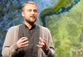
- WILDLABS Virtual Meetup Recording: Drones, Craig Elder, Dr. Claire Burke, and Gabriel Levin | Drones, thermal camera, wildlife crime, ML, biologging
- New Paper: Drones and Bornean Orangutan Distribution, Sol Milne | Drones, data analysis, citizen science, community science, primates
Three Forum Threads for Beginners:
- Curious about radio-tracking with drones? | Wildlife Drones, Biologging (5 replies)
- Drones for GIS Best practice Document | Adrian Hughes, Drones (10 replies)
- WWF Conservation Technology Series: Drones in Conservation | Aurélie Shapiro, Drones (7 replies)
Three Tutorials for Beginners:
- How do I use a drone to capture radio-tracking data? | Debbie Saunders, Tech Tutors
- How do I choose the right drone for my conservation goals? | Shashank Srinivasan, Tech Tutors
- How do I strategically allocate drones for conservation? | Elizabeth Bondi, Tech Tutors
Want to know more about using drones, and learn from experts in the WILDLABS community? Make sure you join the conversation in our Drones group!
*Header photo: Parker Levinson, Point Blue Conservation Science
- 0 Resources
- 0 Discussions
- 5 Groups

- @Gcharron
- | Mr.
Cofounder of Outreach Robotics, I have a master in mechanical engineering and I thrive on developing new technology for field scientists using remote controlled robots.
- 1 Resources
- 1 Discussions
- 4 Groups

M.A.P Scientific Services
Co-founder and Director of M.A.P Scientific Services, South Africa
- 0 Resources
- 0 Discussions
- 8 Groups

- 1 Resources
- 5 Discussions
- 4 Groups

- @Gody
- | He
Godfrey Nyangaresi, a dedicated Protection Manager with 12+ years of wildlife conservation experience. Skilled in technologies, administration, and law enforcement, he leads protection efforts at STEP, ensuring the sustainable conservation of elephants in southern Tanzania.
- 0 Resources
- 3 Discussions
- 17 Groups

- @Mathilde
- | she/her
Natural Solutions
Engineer, I work for a web development company on web application projects for biodiversity conservation. I'm especially interested by camera traps, teledetection and DeepLearning subjects.
- 0 Resources
- 0 Discussions
- 11 Groups

WildTrack
Research, development and implementation of non-invasive montoring for endangered species


- 0 Resources
- 25 Discussions
- 12 Groups
- 0 Resources
- 0 Discussions
- 6 Groups
- @kricherds
- | she/her
Technology advisor for social change

- 0 Resources
- 0 Discussions
- 13 Groups

My name is Ann Wambui ,a conservationist working as a conservation officer at Mugie Conservancy. Am a Diploma holder specialized in Wildlife Management from the Wildlife Research Training Institute. Currently, am Distance Learning student at the Africa Nazarene University.

- 1 Resources
- 5 Discussions
- 9 Groups

- @dilip_singh556
- | Him
On the way to Bridge technology and Nature.
- 0 Resources
- 2 Discussions
- 10 Groups

- 0 Resources
- 14 Discussions
- 3 Groups
Article
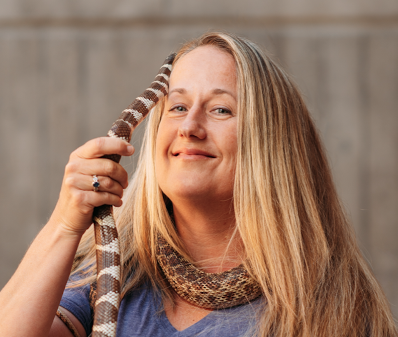
In this case study from herpetologist Emily Taylor, we learn about the best methods and gear used to track snakes, lizards, and other reptiles and amphibians via radio-telemetry, and how these techniques have changed...
31 July 2020
Article
Kākāpō Dreaming: A Wildlife Drones Adventure

Wildlife Drones
What is it like to track endangered species using drones? In this blog post from Wildlife Drones, Dr. Debbie Saunders travels to New Zealand to track the Kākāpō, an extemely rare and elusive bird of which approximately...
8 July 2020
Article

The Monterey Bay Aquarium Research Institute's MARS ocean observatory may someday make conducting deep-sea research more accessible and affordable thanks to Deep-Sea Connect, their new wireless system engineered to ...
31 March 2020
Article
#Tech4Wildlife 2020 Photo Challenge In Review

WILDLABS Team
2020 marked our fifth year holding our annual #Tech4Wildlife Photo Challenge, and our community made it a milestone to remember. Conservationists took to Twitter last week to share their best high-tech snapshots from...
4 March 2020
Funding

The 2020 Tusk Awards are now accepting nominations of outstanding individuals who have made a significant impact on conservation in Africa. These nominations offer the rare and exciting opportunity to honor your peers...
3 March 2020
Article
How do you weigh a live whale?

Fredrik Christiansen
How do we actually know a whale weighs 40 tonnes? After all, we can’t exactly capture an animal the size of a bus and simply put it on a scale. Fredrik Christiansen explains their new, non-invasive way of weighing...
9 October 2019
Article
From the Field: Melissa Schiele

WILDLABS Admin
In this From the Field interview, we talk to Melissa Schiele, a tech whiz, marine ecologist, and conservationist at the Zoological Society of London. She shares with us about her work helping to develop the first-ever...
10 June 2019
Article
Canopy height mapping with drones

Tom Swinfield
Tom Swinfield and colleagues at the Forest Ecology and Conservation Group have assessed the quality of three dimensional forest models produced from drone surveys, and conclude that concerns about their quality for...
31 May 2019
Article
In this blog, Laure Joanny adds her perspectives to an ongoing discussion that we've been seeing in the community about conservation tech and it's relationship to e-waste. How do we tackle the challenge of battery waste...
3 May 2019
Article
#Tech4Wildlife Photo Challenge: Our Favourites from 2019
WILDLABS Team
Happy World Wildlife Day! To celebrate, this week we've asked our community to share photos showing how they are using tech in the field or the lab, using the #Tech4Wildlife hashtag.
3 March 2019
Article
Using Swiss AI and Drones to Count African Wildlife

Susan Misicka
After a promising first run in Namibia, a Swiss project could aid savanna conservation using drones and automatic image analysis.
18 February 2019
Article

In this case study, Science Reporter Jamie Morton tells the story of how Kiwi scientists are teaming up with a local underwater robotics company to gain world-first insights into the lives of whales in Antarctica.
4 February 2019
July 2023
June 2023
event

Stephanie O'Donnell
29 Products
Recently updated products
| Description | Activity | Replies | Groups | Updated |
|---|---|---|---|---|
| Dear all, Next November 2019 I will hold a aerial sowing workshop with Drones in Brazil, in Rondonopolis, in collaboration with the... |
|
Drones | 4 years 9 months ago | |
| Hello everyone, I am applying to a call to create an online ecological restoration platform that incorporates drone images to facilitate... |
|
Drones | 4 years 9 months ago | |
| It is indeed. You can watch it here: https://consbio.org/products/webinars/scgis-webinar-promises-and-pitfalls-conservation-drones I'll also see if we can add it... |
|
Drones | 4 years 9 months ago | |
| Hi everyone, I am selling a drone and 3 sensors... The drone is a 178 WingCopter Heavylift :https://wingcopter.com/technology/... |
|
Drones | 5 years ago | |
| Thank you for the tip! Shall try and pick up a set soon. |
|
Drones | 5 years ago | |
| Hi Sophie, Sorry- I only just saw your reply! It took about 3 months to get it through the department of civil aviation, but this doesn't mean much, because the... |
|
Drones | 5 years ago | |
| https://news.mongabay.com/2019/01/drones-and-thermal-cameras-help-detect-cryptic-species/ |
|
Drones | 5 years 4 months ago | |
| If you need a piece of exposed (black) film then please get in touch. I still take "real" slides and have a few black frames at start and end of each roll of film.... |
|
Drones | 5 years 6 months ago | |
| We are starting a new drones project at the RSPB to looks at multispectral cameras. I would love to hear about any experience people... |
|
Drones | 5 years 8 months ago | |
| Hi Michael! Thanks so much for following up. I have yet to really get my feet wet with drones & algal blooms (my water quality issue of interest at the moment), but... |
|
Drones | 5 years 11 months ago | |
| hi Stephen, Kites have gimbals too (ranging from simple strings to metal rigs) and you can connect to a camera much like a drone. In my case I have a gimbal... |
|
Drones | 6 years 1 month ago | |
| Hi Chris, Your project sounds interesting! How's it coming along? I'm based in the SF Bay Area. I don't have much drone experience, but it's something... |
|
Drones | 6 years 5 months ago |


April Meetup: Can UAVs be used to measure forest quality?

24 May 2016 2:06pm
Great article talking about applying drones to scientific research

13 April 2016 6:30pm
Can UAVs be Used to Measure Forest Quality?
Tom Swinfield
27 April 2016 12:00am
What to you is the biggest small problem with using UAVs in the field?
24 February 2016 7:47pm
5 April 2016 5:17pm
Wait, can you implement the range extenders in DJI systems? Is it costly in order to do so?

5 April 2016 5:58pm
jprobert,
Due to the proprietary nature of DJI, no the antenna tracker listed above cannot be added easily. Some engineering would need to go into hacking DJI. I'm not sure if you can get the telemetry data from DJI's app or ground control station. If so, one could parse the telemetry data and feed the GPS location into the open source tracker. You could also add another radio on board which transmits the GPS from the UAV. However, this is not the most efficient way and will cost some flight time for the added weight and power consumption.
Without hacking DJI or doing some digging, you could replace the antennas on the hand controller and UAV with higher gain antennas. This could improve range, but would limit the directions you could fly(directional antenna).
I will look into data provided by DJI and see what it possible.

26 April 2016 9:34am
I agree that it is likely that a dirigible would probably struggle in a lot of common mapping settings. People do use kites though. If you are interested in developing the flight control systems for dirigibles though I would also suggest that the best place to start is Ardupilot.
Automated Forest Restoration with Drones

10 March 2016 4:59pm
13 April 2016 10:56am
Hi Lot, great to see you here too.
Collecting Your Opinions about Drones

11 April 2016 6:52pm
12 April 2016 9:26am
Hi Sean,
Thanks for sharing your survey - is there a specific date you'll be closing the survey?
It'd be great if you could share the results of the survey here, as I (for one) will be quite interested to see what comes back.
Cheers,
Steph
Solar powered drone for conservation

16 March 2016 4:17pm

26 March 2016 12:03pm
Hey Gregg,
The project looks cool!
Just wondering how much you envisage the load carrying capacity of the drone to be? So being able to carry cameras, GPS, etc.
Also, do you see the price coming down later? $5000 sounds quite steep...
And finally, have you thought about creating it as an open source project? Since all the perks at this points are mostly symbolic, this way people would be more compelled to contribute.
Have a nice day,
Daniel
28 March 2016 12:27pm
Hi Daniel
Thanks for the interest in the project.
The load carrying capacity will be a few kgs. The battery I've sized at this stage is around 2kgs and should allow it to fly over night, but if this storage is increased in future it will impact the other loads. It is a tricky trade-off between flight time and capability.
I'm hoping to include both visual and thermal cameras on a gimbal but they will need to be miniature versions (adds to cost). The drone will definitely include GPS/autopilot and I'm also hoping to include onboard image processing in future so the drone can send an alarm when it notices something out of place. The video feed will also need to be encrypted so that poachers cannot use the drone as their own scouting vehicle.
The price tag of $5000 is for the first few prototypes and will come down with mass production and buying in bulk. I don't see it dropping much below $3000-4000 at current equipment prices though. For instance, the solar PV cells and charge circuit alone will cost around $1000 and the cost of even the cheap uncooled microbolometer therml imagers is over $1000. This isn't an average consumer drone but I've tried to keep the costs down as much as possible so it's feasible. I've also considered offering a stripped down drone of just the charging circuit and airframe so that people can add their own equipment and autopilot etc.
In terms of the perks, I tried to model this campaign after other campaigns that had a product already, which has been a mistake. The build diary included in some of the perks was my attempt at making it open source. I am considering reworking all the perks as it is unlikely to get any funding at this stage.
Thanks for the valuable feedback. Please let me know if you have any other questions or comments.
Cheers,
Gregg
Integrating UAV imagery into ArcGIS
1 March 2016 2:34pm
SnotBots: Can drones transform whale conservation?
25 February 2016 12:00am
Bringing Conservation Technology to Life
 Shah Selbe
17 February 2016 12:00am
PhD Positions: UAVs and Wild Animal Tracking Systems

2 February 2016 10:13pm
DJI and Ford launch a competition with $100,000 prize
12 January 2016 2:59pm
Achieving Moonshots: Advancing Humankind and Preserving Nature
22 December 2015 12:00am
Cheap Space, DIY Imaging and Big Data
21 December 2015 12:00am
Drones as elephant deterrent (herding device)

24 November 2015 6:32pm
17 December 2015 6:39pm
Hi Dave,
I believe with any DJI drones you can plot out the course of a drone and let it fly along the route with you controling the speed and height of the drone. The limitation is that it has to eb within a mile of the pilot.
Regards,
John
17 December 2015 6:43pm
True, but ideal the navigation system would need to be more interactive to be able to respond to the elephant movements in real-time.
The Social Lives of Conservation Technologies and Why They Matter
 Chris Sandbrook
2 November 2015 12:00am
3 May 2016 9:16am
Interesting. A case in point is the viral video making the rounds about drone fishing:
We've seen an array of inventive uses for drones of late across a whole range of endeavors, often having direct or indirect implications for natural resource management. Using drones to improve our ability to target/hunt species of concern seems at once both a natural progression and something new with a slightly ominous overtone. This strikes me as one of those moments where we might want to pause and take stock of what is going on with this technology and where it might go in the not too distant future.
Should we ignore this development? Work to restrict the use of drones for such activities? Support this? Regardless of where we might come down on this question, I can't help but fell that this notion of drone fishing certainly seems to have the sense of "crossing the Rubicon" somehow.
http://aarr.piratelab.org/news/drone-fishing/