In recent years, drone technologies have been explored for a range of applications in conservation including (but not limited to) mapping, biodiversity inventories, antipoaching patrols, wildlife tracking, and fire monitoring. The rise of customizable, open-source drones like those of ArduPilot and OpenROV hold promise for more effective conservation applications, and combined with other monitoring sensors and devices, they are capable of collecting high-resolution data quickly, noninvasively, and at relatively low cost.
However, challenges remain in putting these tools to use. A recent paper reviewing 256 conservation drone projects highlighted some of these major obstacles, ranging from unintended social and ecological consequences of drone operations to still prohibitive costs, both in terms of hardware and in terms of storing and processing large volumes of data. The longstanding challenge of power/battery life remains as well.
If you're considering trying out drones for yourself, and want to explore the possibilities and understand the major conversations happening around this technology, check out these beginner's resources and conversations from across the WILDLABS platform:
Three Resources for Beginners:
- Conservation Technology User Guidelines Issue 5: Drones, World Wildlife Fund | Drones, best practices, ethics, regulations, case studies
- WILDLABS Virtual Meetup Recording: Drones, Craig Elder, Dr. Claire Burke, and Gabriel Levin | Drones, thermal camera, wildlife crime, ML, biologging
- New Paper: Drones and Bornean Orangutan Distribution, Sol Milne | Drones, data analysis, citizen science, community science, primates
Three Forum Threads for Beginners:
- Curious about radio-tracking with drones? | Wildlife Drones, Biologging (5 replies)
- Drones for GIS Best practice Document | Adrian Hughes, Drones (10 replies)
- WWF Conservation Technology Series: Drones in Conservation | Aurélie Shapiro, Drones (7 replies)
Three Tutorials for Beginners:
- How do I use a drone to capture radio-tracking data? | Debbie Saunders, Tech Tutors
- How do I choose the right drone for my conservation goals? | Shashank Srinivasan, Tech Tutors
- How do I strategically allocate drones for conservation? | Elizabeth Bondi, Tech Tutors
Want to know more about using drones, and learn from experts in the WILDLABS community? Make sure you join the conversation in our Drones group!
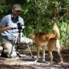
*Header photo: Parker Levinson, Point Blue Conservation Science

- @bluevalhalla
- | he/him
BearID Project & Arm
Developing AI and IoT for wildlife


- 0 Resources
- 27 Discussions
- 6 Groups

- @Frank_van_der_Most
- | He, him
FileMaker developer with a passion for nature and an interest in funding and finance


- 11 Resources
- 83 Discussions
- 7 Groups

British Antarctic Survey (BAS)
Machine learning researcher at the British Antarctic Survey
- 0 Resources
- 0 Discussions
- 5 Groups

- @capreolus
- | he/him
Capreolus e.U.
wildlife biologist with capreolus.at


- 1 Resources
- 71 Discussions
- 16 Groups

Holder of BSc in Applied Zoology. Ecologist at Ruaha National park

- 0 Resources
- 1 Discussions
- 12 Groups

Aarhus University
Biologist and Research Technician working with ecosystem monitoring and research at Zackenberg Research Station in Greenland


- 12 Resources
- 216 Discussions
- 7 Groups

Assiniboine Park Conservancy
- 0 Resources
- 6 Discussions
- 3 Groups

- 0 Resources
- 1 Discussions
- 2 Groups

Worked as a mechanical engineer for a defence co, then software engineer, then for a research lab specialising in underwater robotics.


- 1 Resources
- 139 Discussions
- 16 Groups

- @carlybatist
- | she/her
Science Outreach Lead-Rainforest Connection (RFCx) & Arbimon; Ecoacoustics, biodiversity monitoring, primates, lemurs


- 69 Resources
- 285 Discussions
- 18 Groups

- @StephODonnell
- | She / Her
WILDLABS & Fauna & Flora
I'm the Executive Manager at WILDLABS.


- 152 Resources
- 668 Discussions
- 30 Groups
I am geographer who is interested on mapping, GIS , biodiversity and communities.
- 0 Resources
- 0 Discussions
- 1 Groups
Article
New WildLabs Funding & Finance group

Frank van der Most
WildLabs will soon launch a 'Funding and Finance' group. What would be your wish list for such a group? Would you be interested in co-managing or otherwise helping out?
5 June 2024
Funding
Apply! 2024 Conservation Tech Award

Jordan Steward
Now accepting applications for two $15,000 grants to help protect wildlife through cutting-edge, technology-driven efforts
3 June 2024
Article
Share Your Work in a Conservation Technology Video

Robin Marti Sarasa
Do you have photos and videos of your conservation tech work? We want to include them in a conservation technology showcase video
17 May 2024
Careers
Save the Elephants is seeking a Principal Investigator for our Elephant Collective Behaviour Project. This role will spearhead research initiatives using cutting-edge video analysis tools to study elephant group...
1 May 2024
Article
The Inventory User Guide

Jake Burton
Read in detail about how to use The Inventory, our new living directory of conservation technology tools, organisations, and R&D projects.
1 May 2024
Article
Introducing The Inventory!
Jake Burton
The Inventory is your one-stop shop for conservation technology tools, organisations, and R&D projects. Start contributing to it now!
1 May 2024
Careers

The Max Planck Institute of Animal Behavior at its sites in Constance and Radolfzell offers an international, interdisciplinary, and collaborative environment that opens up unique research opportunities. The goal of our...
13 March 2024
Article
Catch up on the conservation tech discussions and events that happened during World Wildlife Day 2024!
7 March 2024
Careers
Machine Learning Postdoc Position, Understory

Ross Davison
Join us to help prevent biodiversity loss! Understory is hiring a postdoc to lead R&D Development on generalizing Computer Vision models for vegetation identification across space/time/phenotypes.
29 February 2024
Article
Cutting edge plant conservation

Ben Nyberg
A game-changing new tool is helping conservationists working with critically endangered cliff plants
9 January 2024
Article
ICOTEQ launch TAGRANGER® system of products

Craig Rackstraw
TagRanger® is a state-of-the-art wildlife finding, monitoring and tracking solution for research, conservation and environmental professionals. With superior configurability for logging data, reporting location and...
23 November 2023
Careers
Yale University & Map of Life Rapid Assessments - XPRIZE
8 November 2023
April 2024
event

Wildlife Drones
event
Wildlife Drones
29 Products
Recently updated products
| Description | Activity | Replies | Groups | Updated |
|---|---|---|---|---|
| Dear all, Next November 2019 I will hold a aerial sowing workshop with Drones in Brazil, in Rondonopolis, in collaboration with the... |
|
Drones | 4 years 9 months ago | |
| Hello everyone, I am applying to a call to create an online ecological restoration platform that incorporates drone images to facilitate... |
|
Drones | 4 years 9 months ago | |
| It is indeed. You can watch it here: https://consbio.org/products/webinars/scgis-webinar-promises-and-pitfalls-conservation-drones I'll also see if we can add it... |
|
Drones | 4 years 9 months ago | |
| Hi everyone, I am selling a drone and 3 sensors... The drone is a 178 WingCopter Heavylift :https://wingcopter.com/technology/... |
|
Drones | 5 years ago | |
| Thank you for the tip! Shall try and pick up a set soon. |
|
Drones | 5 years ago | |
| Hi Sophie, Sorry- I only just saw your reply! It took about 3 months to get it through the department of civil aviation, but this doesn't mean much, because the... |
|
Drones | 5 years ago | |
| https://news.mongabay.com/2019/01/drones-and-thermal-cameras-help-detect-cryptic-species/ |
|
Drones | 5 years 4 months ago | |
| If you need a piece of exposed (black) film then please get in touch. I still take "real" slides and have a few black frames at start and end of each roll of film.... |
|
Drones | 5 years 6 months ago | |
| We are starting a new drones project at the RSPB to looks at multispectral cameras. I would love to hear about any experience people... |
|
Drones | 5 years 8 months ago | |
| Hi Michael! Thanks so much for following up. I have yet to really get my feet wet with drones & algal blooms (my water quality issue of interest at the moment), but... |
|
Drones | 5 years 11 months ago | |
| hi Stephen, Kites have gimbals too (ranging from simple strings to metal rigs) and you can connect to a camera much like a drone. In my case I have a gimbal... |
|
Drones | 6 years 1 month ago | |
| Hi Chris, Your project sounds interesting! How's it coming along? I'm based in the SF Bay Area. I don't have much drone experience, but it's something... |
|
Drones | 6 years 5 months ago |


New WildLabs Funding & Finance group
5 June 2024 3:24pm

6 June 2024 1:38am
6 June 2024 4:16am
Mass Detection of Wildlife Snares Using Airborne Synthetic Radar
7 January 2024 6:50am
28 May 2024 5:06am
Hi @DaveGaynor regarding funding, have you reached out to any lodges? I know that snaring is rife in the Manyaleti ... maybe some of the lodges in the Sabi Sands would be interested in helping you with your goal?
31 May 2024 12:57pm
Aakash, that is a really amazing offer, we really need people capable of analyzing the radar data and used to working with signal processing I will reach out to you now.

4 June 2024 7:52pm
Hi David - have you seen this opportunity? It may be a good one to apply to for support (the Darwin Initiative).
Apply! 2024 Conservation Tech Award

3 June 2024 3:51pm
Share Your Work in a Conservation Technology Video

17 May 2024 9:06pm
Using drones and camtraps to find sloths in the canopy
18 July 2023 7:39pm
3 May 2024 6:48pm
Thank you for the tip, Eve! In fact, in the area where the foundation works, there clearly are dry seasons, the past few years much drier than normal, where trees loose their leaves a lot.
6 May 2024 4:29pm
Yes, if the canopy is sparse enough, you can see through the canopy with TIR what you cannot see in the RGB. We had tested with large mammals like rhinos and elephants that we could not see at all with the RGB under a semi-sparse canopy but were very clearly visible in TIR. It was actually quite surprising how easily we could detect the mammals under the canopy. It's likely similar for mid-sized mammals that live in the canopy that those drier seasons will be much easier to detect, although we did not test small mammals for visibility through the seasons. Other research has and there are a number of studies on primates now.
I did quite a bit of flying above the canopy, and did not have many problems. It's just a matter of always flying bit higher than the canopy. There are built in crash avoidance mechanisms in the drones themselves for safety so they do not crash, although they do get confused with a very brancy understory. They often miss smaller branches.If you look in the specifications of the particular UAV you will see they do not perform well with certain understories, so there is a chance of crashing. The same with telephone wires or other infrastructure that you have to be careful about.
Also, it's good practice to always be able to see the drone, line-of-sight, which is actually a requirement for flight operations in many countries. Although you may be able to get around it by being in a tower or being in an open area.
Some studies have used AI classifiers and interesting frameworks to discuss full or partial detections, sometimes it is unknown if it is the animal of interest. I would carefully plan any fieldwork around the seasons and make sure to get any of your paperwork approved well before the months of the dry season. It's going to be your best chance to detect them.
7 May 2024 1:49am
Thank you for elaborating, @evebohnett ! And for the heads ups!
Elephant Collective Behaviour Project - Principal Investigator
1 May 2024 1:59pm
The Inventory User Guide

1 May 2024 12:46pm
Introducing The Inventory!
1 May 2024 12:46pm

2 May 2024 3:08pm

3 May 2024 5:33pm
17 May 2024 7:29am
The IUCN-SSC Crocodile Specialist Group (CSG) Conference

9 April 2024 8:21am
Wildlife Drones will be at the 21st Australasian Bat Society Conference
9 April 2024 6:03am
PhD Opening: Revealing the Dynamics of Soaring Environments Through GPS and Drones
13 March 2024 2:11pm
Here's what you missed at World Wildlife Day 2024
7 March 2024 9:02pm
15 March 2024 2:42pm
Machine Learning Postdoc Position, Understory

29 February 2024 11:56pm
Seeking Advice on Thermal Drones for Night-Time Elephant Observation

25 December 2023 9:53am
13 February 2024 8:39am
Hi Nilaksha (and everyone else),
I have been looking at the application of thermal to improve the automated detection through RGB imagery. One of the large drawbacks of thermal is the lower resolution. This is impart cost but also down to basic physics, IR light has a much longer wavelength and therefore a sensor can't have as many 'pixels' on it compared to an RGB sensor. This implies that you either need a thermal camera lens with a longer focal length, which reduces the area you cover, or you need to fly much lower. The drawback of the latter is you cover much less ground per unit of time/battery and you have the potential of disturbing the animals.
I know that DJI have recently released a starlight camera combined with thermal (DJI Enterprise Zenmuse H20N). It looks very impressive but I have not yet managed to test it. Being self-funded as well I have opted for hiring in a drone company to fly for me with the state of the art equipment rather than buying and flying myself.
Hope that helps and keen to hear how you get on!
16 February 2024 8:23am
@PaulS Thank you. It sounds great. I'll have a look and get back.
16 February 2024 8:34am
@PaulAllin Thanks for your valuable insights. Zenmuse H20N seems to be very powerful and useful in this case. However, I'm looking for a more affordable option for a self-funded research.
Wildlife Drones will be hosting in-person demos in the U.S.
12 February 2024 3:32am
Passionate engineer offering funding and tech solutions pro-bono.

23 January 2024 12:06pm

26 January 2024 3:18pm
Hi Krasi! Greetings from Brazil!
That's a cool journey you've started! Congratulations. And I felt like theSearchLife resonates with the work I'm involved round here. In a nutshell, I live at the heart of the largest remaining of Atlantic forest in the planet - one of the most biodiverse biomes that exist. The subregion where I live is named after and bathed by the "Rio Sagrado" (Sacred River), a magnificent water body with a very rich cultural significance to the region (it has served as a safe zone for fleeing slaves). Well, the river and the entire bioregion is currently under the threat of a truly devastating railroad project which, to say the least is planned to cut through over 100 water springs!
In face of that the local community (myself included) has been mobilizing to raise awareness of the issue and hopefully stop this madness (fueled by strong international forces). One of the ways we've been fighting this is through the seeking of the recognition of the sacred river as an entity of legal rights, who can manifest itself in court, against such threats. And to illustrate what this would look like, I've been developing this AI (LLM) powered avatar for the river, which could maybe serve as its human-relatable voice. An existing prototype of such avatar is available here. It has been fine-tuned with over 20 scientific papers on the Sacred River watershed.
And right now myself and other are mobilizing to manifest the conditions/resources to develop a next version of the avatar, which would include remote sensing capacities so the avatar is directly connected to the river and can possibly write full scientific reports on its physical properties (i.e. water quality) and the surrounding biodiversity. In fact, myself and 3 other members of the WildLabs community have just applied to the WildLabs Grant program in order to accomplish that. Hopefully the results are positive.
Finally, it's worth mentioning that our mobilization around providing an expression medium for the river has been multimodal, including the creation of a shortfilm based on theatrical mobilizations we did during a fest dedicated to the river and its surrounding more-than-human communities. You can check that out here:
Let's chat if any of that catches your interest!
Cheers!
2 February 2024 1:22pm
Hi Danilo. you seem very passionate about this initiative which is a good start.
It is an interesting coincidence that I am starting another project for the coral reefs in the Philipines which also requires water analytics so I can probably work on both projects at the same time.
Let's that have a call and discuss, will send you a pm with my contact details
There is a tech glitch and I don't get email notifications from here.
Using drone or other unmanned vehicle for DNA sampling on fresh elephant dung in a Baï, Congo Rainforest.
29 January 2024 9:44am
30 January 2024 10:30am
I think we can habituate elephant to noise, especially if it's could looks like a natural one.
The problem is that many elephants are concentrated in the baï and if we want to avoid DNA contamination we have to sample it quite fast.

30 January 2024 8:19pm
Hi Antoine,
I would recommend talking to the engineers at Outreach Robotics - @Gcharron .
We have been working on collecting tools for rare plants, and I would guess it wouldn't be a huge adjustment to collect elephant dung. I think the amount of dung required for analysis will drive the size of the collecting drone. Maybe the drone could be up very high to not disturb the elephants with a long line sampling mechanism?
30 January 2024 9:01pm
Forgot to mention this wildlife drone group -
Reasonable price for drone pilot (south africa)?
27 January 2023 11:20am
16 January 2024 12:21pm
Hello Stephanie,
I am not sure if you are still monitoring this thread, but if you need any information, please let me know. I have flown drones for a couple of years in Zimbabwe and South Africa in conservation and anti-poaching operations. I would be happy to answer any questions you may have.
Regarding the £500-700 range you mentioned, it seems waaaayyyy overpriced. Those rates are usually charged by lawyers and accountants in South Africa.
If you have found the information you were seeking, I wish you all the best.
Quin
26 January 2024 10:39pm
Hi Steph,
I think everyone below has summarised it pretty well.
A couple of comments to add.
Select your pilot well - We offer drone flying services. This wasn't our intention, initially, however we have determined that there are many drone pilots, but fewer who do it really well. Having said that, we work predominantly with animal tracking equipment, not just flying straight line vectors, if this is what you are undertaking.
In Australia, fees to become a pilot are about $5,000 AUD, and a reasonable commercial drone with changeable payload capability costs around $20,000- $30,000 AUD, and then as is suggested below, there are insurance and factoring in repairs and maintenance, and of course eventual replacement costs, travel, an hourly rate as wages etc. Obviously, the day rates you have listed aren't profit, they include cost.
Paul
Wildlife Drones
28 January 2024 4:59pm
Hi, I have used a commercial company for drone work for my PhD and they were willing to give me a significant discount for research purposes. One thing to consider is that in SA a drone pilot requires a pilots license and there is quite some red tape to go through which does make it much more complex than just going out and buying a drone oneself. The price you mention seems on the high side to me but I'm not sure if that already includes the drone, sensors, flight permissions, travel of the pilot to and from your location and any other costs.
Need advice - image management and tagging
12 January 2024 7:55pm
15 January 2024 8:47pm
Interesting, Iʻll give it a shot. Looks like this could save me some time.
Thanks for the explanation @wade!

24 January 2024 5:16pm
I have no familiarity with Lightroom, but the problem you describe seems like a pretty typical data storage and look up issue. This is the kind of problem that many software engineers deal with on a daily bases. In almost every circumstance this class of problem is solved using a database.
In fact, a potentially useful analysis is that the Lightroom database is not providing the feature set you need.
It seems likely that you are not looking for a software development project, and setting up you own DB would certainly require some effort, but if this is a serious issue for your work, you hope to scale your work up, or bring many other participants into your project, it might make sense to have an information system that better fits your needs.
There are many different databases out there optimized for different sorts of things. For this I might suggest taking a look at MongoDB with GridFS for a couple of reasons.
- It looks like you meta data is in JSON format. Many DBs are JSON compatible, but Mongo is JSON native. It is especially good at storing and retrieving JSON data. Its JSON search capabilities are excellent and easy to use. It looks like you could export your data directly from Lightroom into Mongo, so it might be pretty easy actually.
- Mongo with the GridFS package is an excellent repository for arbitrarily large image files.
- It is straightforward to make a Mongo database accessible via a website.
- They are open source (in a manner of speaking) and you can run it for free.
Disclaimer: I used to work for MongoDB. I don't anymore and I have no vested interest at all, but they make a great product that would really crush this whole class of problem.
25 January 2024 8:32am
Hi!
I would take a look at
Although developed for camera trap imagery, it is by no means restricted to such.
Cheers,
Lars
Cutting edge plant conservation
9 January 2024 7:33am
9 January 2024 4:56pm

9 January 2024 7:10pm
In what ways can drones contribute to linking individuals, communities, and small-scale producers in rural areas, facilitating the support of local food value chains

15 December 2023 3:44pm
Come for the trees and geese, stay for the AI: using computer vision for urban forestry and wildlife monitoring
13 December 2023 5:58pm
Drone mapping at scale: capturing, processing, and distributing aerial imagery in Virunga National Park
13 December 2023 5:31pm
Ekobot WEAI robot - autonomous weeding at farm scale
29 November 2023 12:11am
A little off the typical path for Wildlabs - and probably not the sort of drone people typically think about here 😄 - but I find robotic agriculture very interesting, with the potential to greatly reduce use of poison and improve effective yields. Anyone working on like things?
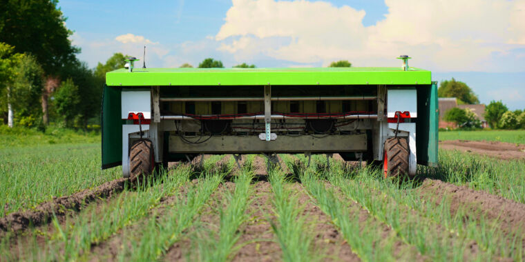
Mother plucker: Steel fingers guided by AI pluck weeds rapidly and autonomously
Robot that uses AI to pull weeds may reduce poisonous herbicide use by 70% for some crops.
 Ars Technica
Drones for GIS Best practice Document

31 March 2020 10:42am
12 May 2020 12:42pm
They will be great for crocs. I'm sure the RSPB can provide a presentation of the variety of applications we have used UAV's for including bird monitoring, nest finding, habitat assessments and their limitations/ legislation/ technicalities.
12 May 2020 1:14pm
We hope to devlop a fourm on the CSG website people can go to for information ant to contribute. We are hoping networking will be able to help everyone.
27 November 2023 6:14pm
The link above does not seem to work but this does: https://wildlabs.net/sites/default/files/community/files/drones_for_gis_-_best_practice_v2.0.pdf
ICOTEQ launch TAGRANGER® system of products

23 November 2023 1:25pm
AWMS Conference 2023
Catch up with The Variety Hour: November 2023
16 November 2023 12:59pm
5 June 2024 4:14pm