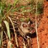
Race against a GPS tagged snow leopard

21 October 2019 9:58am
내려 anigana.co.kr/sandz/ - 샌즈카지노
16 January 2020 12:15pm
LIDAR USA sensor
14 January 2020 12:38pm
ImageNet?

31 October 2019 6:36pm

9 November 2019 10:47pm
Hi, deep learning frameworks like Pytorch and Tensorflow come with state-of-the-art image recognition models (VGG, GoogleLeNet, ResNet, Inception etc.) already pre-trained on ImageNet, so one can just download and use them straight away.
This provides a solid starting point as these models have already learnt how to classify objects really well. Transfer learning can then be used to fine-tune them for a specific task like identifying ivory in photos. This just requires that you tweak the existing model a bit and train it on a smaller custom dataset of the image’s/categories you would like to classify.
Hope that helps!
9 January 2020 7:44pm
Really helpful, @adnortje ! And thanks for listing out some of the latest and greatest image recognition models. Do you know of any programs that are using GoogleLeNet for wildlife image recognition, by chance?
13 January 2020 4:31am
Google’s Wildlife Insights, mentioned in another thread, can classify 614 different animal species.
It uses the Inception-V4 model as a basis, which is similar to GoogLeNet, and tunes it on camera trap images (https://www.wildlifeinsights.org/about-wildlife-insights-ai).
Wildlife Insights - Google's latest AI project!
10 January 2020 9:57pm
[ARCHIVED] Workshop on Deep Learning Methods and Applications for Animal Re-Identification at WACV2020 Conference!
9 January 2020 7:48pm
Number of radio collared animals?

9 December 2019 7:27pm

4 January 2020 10:58pm
There are over 7000 tracked animals via Argos alone (monthly). More info here - http://www.argos-system.org/applications-argos/wildlife-monitoring/
5 January 2020 10:49am
Thanks Alasdair
So there are low double figure thousands just with the various services of satellite collars. Then surely high tens of thousands, maybe low hundreds of thousands with terrestrial GPS and conventional VHF.
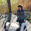
List of grant opportunities for conservation dogs

14 May 2018 9:48pm
31 August 2018 9:57pm
Two more resources that may be worth checking (USA):
- Working Dogs for Conservation https://wd4c.org/
- Conservation Canines - Center for Conservation Biology, University of Washington https://conservationcanines.org/
(Thanks to Kate Wing for the tips).
27 April 2019 5:22pm
Just learned about this community and am super excited to see it exists. I wanted to comment on Conservation Canines (CK9). I served as the coordinator for CK9 for 18 years. The majority of CK9, including myself and its 17 dogs, have broken off and are trying to get a new program set up called Rogue Detection Teams! We are just getting our paws under us but we are all super excited to be unleashed from the University and embarking on a grand new adventure. Rogue Detection Teams can be reached at [email protected] and also found on Facebook @roguedogs and IG and Twitter at @roguedetection. We have a website in the works at Roguedogs.org but it is not up just yet. Looking forward to being a part of the community. Dogspeed!

3 January 2020 7:17pm
Hi Yvan, My name is Jennifer Hartman and I work with Rogue Detection Teams, a program that works with and instructs conservation detection dog teams. Did you ever receive enough information to pursue your project? If not, one, we'd love to learn of more opportunities ourselves, as we have many conservation projects that we would like to support and are unable to. Additionally, we have recently learned about a group, Midwest Conservation Dogs who just received a grant to train a new dog. I think it was a local grant but we're sure that they would be more than hh=appy to discuss with you how they received their grant. Most of our projects that we conduct, and we have worked on storm petrel burrows in Haida Gwaii, British Columbia, come from government funding or special program fudning (some past partners include The Nature Conservancy, World WIldlife Fund, various univeristies, etc.). We're happy to discuss how we might help to get your project off the ground, or if you have already conducted it, we'd love to learn how it went and how you were able to fund it. We can be reached at [email protected] or our website is at roguedogs.org. Warm regards in the New Year, Jennifer
Conservation dogs deployed in Assam to counter poaching
26 June 2017 3:33pm

27 June 2017 11:09am
Countryfile Working Animals Compilation - 04:48 conservation dogs sniffing our bats and newts.
http://www.bbc.co.uk/iplayer/episode/b08wysbf/countryfile-working-animals-compilation
27 June 2017 2:53pm
Awesome!
3 January 2020 7:13pm
Hi jprobert, my name is Jennifer Hartman and I work with Rogue Detection Teams. I wanted to share some other resources for you if you are still interested in learning more about conservatin detection dogs and thier applications. From live animals, invasive species as well as scat and toxin surveys, our teams have conducted a great many projects around the world and we're happy to talk shop with you. There are also several other detection dog groups around the world and if you would like to be put in touch with them, we're happy to assist. Please let us know if we can help. We can be reached at [email protected] or you can first check us out at roguedogs.org. Warm regards, Jennifer
Thermal imaging, drones, and loggerhead sea turtles: a #tech4wildlife case study using FLIR's new Duo Pro R camera

21 September 2018 3:21pm
24 December 2019 6:42am
Rob thanks for the offer, sorry about delay in reply work has been in way. I have spoken to our coordinator here and we would be interested in borrowing flair 640 to see if it helps locate. Let me know he best way to get in touch.
2 January 2020 5:10pm
Hi thermal people,
Just a quick heads up, but I am exploring some of Seek Thermal's (ex FLIR engineers I believe) new Mosaic Core modules by having a play with their developer's kit. I'll report back once I receive the equipment, but their intention is to release 320 x 240 cameras at very low cost. Note - they won't sell them individually, so a reseller will be necessary, but if they are cost effective at this resolution it could prove excellent for wildlife conservation use.
https://www.thermal.com/uploads/1/0/1/3/101388544/mosaic_core_specification_sheet.pdf
Cheers,
Alasdair
2 January 2020 6:12pm
Cheers Al, and looking forward to hearing more about them. I am, as we speak, editing some thermal videos of wallaby behaviour near roads, specifically in relation to devices that activate lights and sounds when a car is approaching (activated by vehicle headlights at night). Used a Flir 640R, but I reckon half that resolution would still be fine. Unfortunately, not much support for the devices themselves working as a deterrent/warning (although I have some ideas on how they could with additional stimuli), but the thermal camera works great for non-invasive observations!
Radio telemetry
4 June 2019 4:39pm
5 June 2019 11:33am
Hi Helen,
Two suggestions coming through over twitter:
A good start is to reduce your reciever's gain as far as possible.
Hopefully you can snuff out the antenna's rear lobe that way. Headphones really help there too. https://t.co/9Eg4gpHVly
— Faunatech Austbat (@FtechAustbat) June 5, 2019
sometimes it helps to put your body behind the antenna at about waist height. Does that make sense?
— Rob Appleby (@wildspyrob) June 4, 2019
Steph
18 December 2019 4:00am
Hi Helen, what tags are you using? Position on the animal and what species?
24 December 2019 5:07pm
HI there,
Biotrack combined Avian GPS SOB tag & PicoPip AG317 Tag on the back of Hawfinch.
H
Webinar: The Business of Saving the Planet: Technology, Innovation & Intelligence in Conservation, Jan 7
20 December 2019 4:32pm
Average speed system needed
15 December 2019 9:27am
20 December 2019 1:11pm
Dear Sam,
PS. As a starter we could easily have rumble strips put in to slow traffic down at teh beginning and teh end so that the vehicles would not be flying past your detector.
I do understand this challenge as when collecting data over 700 metre stretches using a stopwatch we tried to catch numberplates with a standard motion camera and unless the vehicles were slow we never got the number plate.
20 December 2019 1:15pm
PPS 4 - 800 should have been 4-8000 THOUSAND
20 December 2019 1:16pm
Hi Gregory,
That is quite shocking to hear that a road could be so detrimental to wildlife. If you were able to place a speed hump or rumble strip where you place the camera you could even embed the metal detecting sensor in them to ensure accurate detection of every vehicle when they are going slower.
Our camera takes a burst of images and this can be set to be quite a quick burst or a slower burst so with a little bit of testing I am sure we could get the numberplates.
I am assuming that a lot of time these collisions happen at night. Would there be a way to have a fixed light at the camera locations as otherwise the cameras can be blinded by headlights and taillights making reading the VRN difficult.
At the moment our system is satellite connected. This does have a relatively high monthly data cost. We are also planning to develop a cellular version but this will require more funding and development time that we have not got yet.
The system is in the final stages of development and we plan to launch it in mid-2020 once it has undergone some prolonged field trials at ZSL sites, so it is not currently available. Final costings are still under review and will be released early next year.
I am sorry that we are not able to provide this capability to you right now.
Have you found any commercially available camera systems? In the UK I believe the automatic number plate recognition cameras placed on gantrys over motorways are called SPECS and a quick google said they are sold by a company called Jenoptik. If you find out how much they are and how they work, perhaps you could update this thread?
Thanks,
Sam
Acoustic Telemetry Workshop Series
 Ocean Tracking Network
19 December 2019 12:00am
Innovate for Wildlife and People: Incentivising and rewarding community-based wildlife conservation
19 December 2019 12:00am
AI for camera trap public data
17 December 2019 9:20pm
Open source, low cost proximity loggers
17 December 2019 10:45am
A New Cloud Platform Unveils the Most Diverse Camera Trap Database in the World
 Wildlife Insights
17 December 2019 12:00am
Conservation biologist and wildtech journalist Sue Palminteri, 1965-2019
 Mongabay
13 December 2019 12:00am
Virtual Meetup Discussion: eDNA
5 December 2019 12:03pm
12 December 2019 8:23pm
Hey Alex,
Our pleasure! Yep, we will be uploading the recording along with our notes from the session to this page. We'll also upload the individual talks to our yourtube channel here. We'll have them up in the next few days, probably early next week.
We're starting to think through topics for next season - I'm interested to hear if there are any technologies/tools or questions you'd like us to cover?
Steph
12 December 2019 8:35pm
Thanks!
I know there was some discussion of bioacoustics--I'll echo this interest. I have no experience and will be deploying audiomoths in my study area in early spring, so I need to get up to speed quickly!
Alex
12 December 2019 8:41pm
Ah! Well you're in luck.. We're doing acoustics first thing next year. Late January some time, so in good time for your field season. We also had the audiomoth team give a talk at one of our previous meetups - Peter Prince's talk is here.
Steph
Image Processing Advice
22 October 2018 11:53am

13 November 2018 12:09pm
I just thought I would mention that i've been talking to Sol about his issue and also around multispectral and thermal sensors. No solution as yet to the issue but Sol will share some of his data with us so we can take a look.

28 November 2019 1:45am
Just wanted to mention I found a solution to my georeferencing issue. You can use the 'geosphere' package in R to identify the coordinates of specific coordinates in each image, based on the position of the central coordinate, bearing and distance to target pixel.
Feel free to drop me a line if you want a hand doing this!
28 November 2019 8:53am
Really useful to know about that package, thanks
[ARCHIVED] Workshop on Deep Learning Methods and Appliocations for Animal Re-Identification

25 November 2019 6:24pm
Software Camera Traps
25 November 2019 12:52pm
WACV2020 AI for Animal Re-ID: Deep Learning Methods and Applications for Animal Re-Identification
 Sara Beery
25 November 2019 12:00am
12 Nov: Tech-crime workshops
4 September 2019 12:08pm
19 November 2019 1:05pm
Hi - how can I find out about future meetups please?
22 November 2019 3:14pm
The ASC conference happens annually, the next one will be in Washington DC over the 18-21 November 2020. Details for the pre-conference workshops are only e-mailed a few months in advance to conference participants. I won't be attending next year, otherwise I would post any opportunities that come up on here. You could e-mail the organiser (Susan Case; [email protected]) next September 2020 to see if there are any tech-related workshops planned.
Mitigate Elephant-Human Conflict with ADSMO
Very easy to use online form to collect sea turtle data
9 July 2019 11:45am

27 August 2019 10:35am
Hi @kierancamb
A colleague of mine let me know about this thread as it's very similar to lots of things we've built (Angel Shark sightings map, Thames Marine Mammal sightings map for example). Thinking about it more this could be a simple online free and open source tool.
It could use a JSON schema compiled form made through an interface much like: https://jsonform.github.io/jsonform/playground/index.html?example=schema-morecomplex
And take a parameter for an email address to send the results to.
You could then save the form schema and the email address in a bookmarkable URL and it could just let people fill the form out and send the results on. Annoyingly URLS have a 2000 character limit but we could take a parameter of a configuration file stored elsewhere (Office Online, Google Docs, PasteBin, GitHub) that way the form would be editable by who created it too.
If anyone has any ideas on this or could also use something like it I'd happily start an open source GitHub project and build the basics.
Have been thinking about doing this for a while.

27 August 2019 1:35pm
Hi Kieran and all,
I jump into the topic as I am doing research on data collection through mobile application in conservation. (I currently have a test in Cambodia in the education sector with a mobile app and the possibility for the ngo to push questions through notifications on the user's smartphone).
Kieran could you tell me what are the main problem of downloading an app for your users ? it seems it is a general concern, any idea why ?
i really believe in a system where people providing data should be incentivised for it so the data becomes of higher value and of higher quality.
Fabien
20 November 2019 8:00pm
I'm part of a citizen science biodiversity project and we ask our citizen scientists to use Kobo Toolbox's webforms to collect field data using a smart phone. Kobo was started by Harvard Humanitarian Initiative, and gets funding from various organizations including branches of the United Nations. https://www.kobotoolbox.org
KoBoToolbox is a suite of tools for field data collection for use in challenging environments. Our software is free and open source. Most of our users are people working in humanitarian crises, as well as aid professionals and researchers working in developing countries.
Project leaders design a webform and send people a link to the form. People load the form in a browser when they have internet connection, then go into the field and fill out the form. The forms work both online and offline. If the users fill out the form when there is no internet connection, the next time the users open the form when there is internet connection, the data is synced to the Kobo servers.
Kobo has an admin interface where project leaders can view, edit, and download the data. Project leaders can use condtional logic when designing the questions on the webform (if user answers yes, show question A; if users answers no, show question B).
Camera trap ML competition

20 November 2019 12:32am
[ARCHIVE] Virtual Meetup Discussion: Drones
19 November 2019 3:04pm
[ARCHIVE] WILDLABS Virtual Meetup Invitation: Drones

18 November 2019 4:35pm
20 January 2020 4:01am
URL is www.runtastic.com/run-wild