Group curators
Elsa
Fauna & Flora

Catherine Breen
- @cbreen
- | she/her

Tanner Corless Smith
- @tcsmith
- | he/him
Who We Are
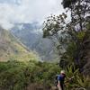
Geospatial data and analysis is critical for conservation, from planning to implementation and measuring success. Every day, mapping and spatial analysis are aiding conservation decisions, protected areas designation, habitat management on reserves and monitoring of wildlife populations, to name but a few examples. The Geospatial group focuses on all aspects of this field, from field surveys to remote sensing and data development/analysis to GIS systems.
The ability to visualize and analyze spatial data underpins many areas of conservation, this group may serve as a landing point and gateway for those new to conservation technology. Through promotion of learning resources, and aforementioned groups of overlapping interest, this group can expand the horizons of newcomers and deepen the knowledge of veterans.
How to Get Started
Want to learn more about how remote sensing is used in conservation? Check out the first two episodes of this season of Tech Tutors, where our Tutors answer the questions How do I use open source remote sensing data to monitor fishing? and How do I access and visualise open source remote sensing data in Google Earth Engine? You can also check out our Earth Observation 101 lecture series from Dr. Cristian Rossi.
Our Purpose
The WILDLABS Geospatial Group is for conservation practitioners, geospatial analysts, and academics who want to:
- Share geospatial resources, best practices, data, and ideas;
- Network amongst geospatial and data practitioners;
- Create peer learning opportunities;
- Promote the use of free and open-source geospatial software; and
- Improve the use of GIS software and geospatial analyses in conservation management and research.
Group curators
Fauna & Flora
Remote Sensing Scientist, Conservation Technology & Nature Markets


- 61 Resources
- 64 Discussions
- 11 Groups
- @cbreen
- | she/her
wildlife ecologist and snow scientist

- 2 Resources
- 2 Discussions
- 5 Groups
- @tcsmith
- | he/him
I am a conservation biologist interested in modeling social-ecological systems.
- 0 Resources
- 6 Discussions
- 12 Groups
No showcases have been added to this group yet.

- @Dauson_M
- | Mr
Dauson Msumange is a social enterpreneur, founder and director of Tanzania Eco-Tech And Conservation Hub (TEACH).
- 0 Resources
- 1 Discussions
- 23 Groups
- @jcsibley
- | she/her
GIS and Data Manager
- 0 Resources
- 0 Discussions
- 4 Groups

WILDLABS & Wildlife Conservation Society (WCS)
I'm the Bioacoustics Research Analyst at WILDLABS. I'm a marine biologist with particular interest in the acoustics behavior of cetaceans. I'm also a backend web developer, hoping to use technology to improve wildlife conservation efforts.


- 45 Resources
- 40 Discussions
- 34 Groups

- @carlybatist
- | she/her
ecoacoustics, biodiversity monitoring, nature tech


- 133 Resources
- 373 Discussions
- 19 Groups

- @StephODonnell
- | She / Her
Tech, Sustainable Finance at World Bank & CFA (prev. Founder WILDLABS)


- 197 Resources
- 670 Discussions
- 31 Groups

- @Pema
- | He/Him/His
Naturalist/Wildlife Biologist
- 1 Resources
- 1 Discussions
- 6 Groups

- @Lysa001
- | she/her
Ecologist & Conservationist | Sabah, Malaysia #sundapangolin #movementecology #communityengagement #publicoutreach #conservationpolicy
- 0 Resources
- 0 Discussions
- 15 Groups
Field site operator based in Asturias, Spain. I run the Asturias Field Lab, a high‑altitude (1200 m) real‑world testing site located inside the UNESCO Biosphere Reserve “Redes”. My work focuses on IoT, GPS tracking, environmental sensors, camera traps, and AI‑based wildlife moni
- 0 Resources
- 0 Discussions
- 8 Groups

Worked as a mechanical engineer for a defence co, then software engineer, then for a research lab specialising in underwater robotics.


- 1 Resources
- 147 Discussions
- 16 Groups

- @jennamkline
- | She/Her
Imageomics Institute & ABC Global Climate Center
Edge AI for Autonomous Ecological Monitoring

- 4 Resources
- 15 Discussions
- 8 Groups

- @joelm
- | he/him/his
Earth Logic LLC
geographer with geospatial & data-engineering skills and passion for wildlife and nature.
- 3 Resources
- 2 Discussions
- 2 Groups
Department of Conservation (New Zealand)
Computer Engineer and Environment Enthusiast
- 0 Resources
- 1 Discussions
- 16 Groups
Careers
Ecologist (Postdoctoral Research Fellow), IS-0408-09

Lacey Hughey
The Smithsonian’s National Zoo & Conservation Biology Institute (in collaboration with Duke Farms, a center of the Doris Duke Foundation) is seeking a postdoctoral researcher to lead the development of next-gen...
1 June 2026
Article

🌍 Conservation technology is transforming how we protect wildlife, but are we thinking carefully enough about the risks? Drones, camera traps, GPS trackers, acoustic sensors, AI, and remote sensing have become...
22 May 2026
Careers

A 3-year, fully-funded PhD studentship at the interface of ecological theory, AI and global biodiversity mapping
28 April 2026
Article
Invitation to submit articles for a Special Issue of the journal "Sensors"
28 April 2026
Article
"Pixels, Pods, and Peat: The Future of Mangrove Survival"

BAISAKHI KHATUA
Intro: Welcome to the Muck To step into a mangrove forest is to step into a paradox. It is a world suspended between land and sea, dominated by the scent of sulfur and the relentless rhythm of the tides. For centuries...
23 April 2026
Careers
Ecological Data Scientist
Lacey Hughey
The Smithsonian Institution is the world’s largest museum, education, and research complex, with 21 museums and the National Zoo. This position is located in the Smithsonian's National Zoo and Conservation Biology...
21 April 2026
In Kenya’s arid and semi-arid north, where livelihoods depend on healthy rangelands and reliable water, conservation managers need reliable data. The Isiolo County Conservancies Association (ICCA) is putting Earth...
4 April 2026
Link
The Wetlands Insight Tool (WIT) provides insights into a wetland’s seasonal and interannual dynamics. WIT is a spatiotemporal summary of a wetland that combines multiple datasets derived from the Landsat archive held...
4 April 2026
Ecosystems are under pressure from environmental change and human activity, while data to support decision-making remains limited. An initiative supported by the Global Development Assistance demonstrated how satellite...
4 April 2026
Link
The Miti360 Dataset
Elsa
A high-resolution, multi-modal dataset for machine learning in African forestry, developed by the Centre for Data Science and Artificial Intelligence (DSAIL) at Dedan Kimathi University of Technology.
2 April 2026
Careers

Diseñar y ampliar la infraestructura digital que transforma los conjuntos de datos globales en herramientas prácticas y en tiempo real para los profesionales de la conservación en todo el mundo.
2 April 2026
FREE Drone & GIS Mini Course from GeoWing Academy

FREE Drone & GIS Mini Course from GeoWing Academy
FREE Drone & GIS Mini Course from GeoWing Academy


Fantastic Fields: Field Data Collection the Smart Way
Fantastic Fields: Field Data Collection the Smart Way
Fantastic Fields: Field Data Collection the Smart Way
NASA ARSET Fundamentals of Remote Sensing


NASA ARSET Fundamentals of Remote Sensing
NASA ARSET Fundamentals of Remote Sensing


Drone Photogrammetry & GIS Advanced Course
Drone Photogrammetry & GIS Advanced Course
Drone Photogrammetry & GIS Advanced Course
Drone Photogrammetry & GIS Intermediate Course
Drone Photogrammetry & GIS Intermediate Course
Drone Photogrammetry & GIS Intermediate Course
Drone Photogrammetry & GIS Introduction (Foundation) Course
Drone Photogrammetry & GIS Introduction (Foundation) Course
Drone Photogrammetry & GIS Introduction (Foundation) Course


GIS E-learning Course 1: What is GIS and why should you care?


GIS E-learning Course 1: What is GIS and why should you care?
GIS E-learning Course 1: What is GIS and why should you care?


GIS E-learning Course 2: Introduction to QGIS
GIS E-learning Course 2: Introduction to QGIS
GIS E-learning Course 2: Introduction to QGIS


GIS E-learning Course 4: Becoming Confident in Spatial Analysis & Geoprocessing
GIS E-learning Course 4: Becoming Confident in Spatial Analysis & Geoprocessing
GIS E-learning Course 4: Becoming Confident in Spatial Analysis & Geoprocessing

GIS E-learning Course 3: Introduction to ArcGIS Pro
GIS E-learning Course 3: Introduction to ArcGIS Pro
GIS E-learning Course 3: Introduction to ArcGIS Pro

July 2026
May 2026
event

Ginevra Bellini
event

Rebekka Stutz
136 Products
Recently updated products
| Description | Activity | Replies | Groups | Updated |
|---|---|---|---|---|
| It certainly is! The great thing about it too is that the aerial detections often lead to more ground detections when teams are locating the trees from the map data and by using... |
|
Conservation Tech Training and Education, Drones, Emerging Tech, Geospatial, Open Source Solutions | 5 days 6 hours ago | |
| Myself and the Fauna & Flora Conservation Technology team will be there (@Chelsea_Smith and @ugyenpenjor ) and also the WILDLABS team @HRees ! See you! |
+6
|
Geospatial, Acoustics, AI for Conservation, Camera Traps, Citizen Science, Community Base, Data Management & Mobilisation, Emerging Tech, Open Source Solutions, Protected Area Management Tools | 3 weeks ago | |
| Wolves, cool!Will this then need collared wolves ? |
|
Early Career, Animal Movement, Geospatial, Software Development | 1 month 1 week ago | |
| Interesting. If you need help with any of this and can utilize my skillset, let me know.Thanks, Mike |
|
Geospatial | 1 month 3 weeks ago | |
| Thank you. That looks great! I was trying to build something similar but, as usual, there's a Python library already :) I was leaning towards trying SLMs like llama.cpp My... |
|
Software Development, Geospatial, Open Source Solutions | 1 month 3 weeks ago | |
| Quick update – our next SCB Drones & Data Working Group coordination meeting is 24 March 2026.Two identical sessions to accommodate time zones:EARLY: 07:00 UK / 08:00 CET / 15... |
|
Drones, AI for Conservation, Data Management & Mobilisation, Emerging Tech, Geospatial, Marine Conservation | 2 months 1 week ago | |
| Greetings, I'm based in Gibsonia, PA and looking to help anyway I can part time either local or remote.My skillsets are the following:.NET... |
|
Acoustics, AI for Conservation, Animal Movement, Autonomous Camera Traps for Insects, Build Your Own Data Logger Community, Camera Traps, Citizen Science, Climate Change, Community Base, Connectivity, Conservation Dogs, Conservation Tech Training and Education, Data Management & Mobilisation, Drones, Earth Observation 101 Community, East Africa Community, Edge Computing, eDNA & Genomics, Emerging Tech, Ethics of Conservation Tech, Funding and Finance, Geospatial, Human-Wildlife Coexistence, Latin America Community, Marine Conservation, Protected Area Management Tools, Sensors, Sustainable Fishing Challenges | 2 months 2 weeks ago | |
| Years ago when I needed to estimate tree heights, the method was… fairly basic.Tape up a straight stick in 50cm intervals.Stand next to the... |
|
Conservation Tech Training and Education, Drones, Emerging Tech, Geospatial, Open Source Solutions, Sensors | 2 months 3 weeks ago | |
| It is a fantastic tool, really helps save time and increases efficiency. Have you used or designed tools like this before? |
|
AI for Conservation, Conservation Tech Training and Education, Drones, Emerging Tech, Geospatial, Open Source Solutions | 3 months ago | |
| In this recent case, the system has been closed for over 8 months under hot, dry conditions. This has caused shallow water temperatures to... |
|
Citizen Science, Community Base, Connectivity, Conservation Tech Training and Education, Drones, Emerging Tech, Ethics of Conservation Tech, Geospatial, Human-Wildlife Coexistence, Marine Conservation, Protected Area Management Tools, Sustainable Fishing Challenges | 3 months 1 week ago | |
| Hello Wildlabs! A merry belated 2026 to you all, I hope the year is off to a stellar start. I thought it might be interesting for some to... |
|
AI for Conservation, Citizen Science, Conservation Tech Training and Education, Drones, Emerging Tech, Ethics of Conservation Tech, Geospatial, Open Source Solutions | 4 months ago | |
| The NASA Applied Remote Sensing Training (ARSET) program has launched a new online training series: Monitoring Water... |
|
Geospatial | 4 months ago |


Ecologist (Postdoctoral Research Fellow), IS-0408-09
1 June 2026 4:02pm
WOOHOO ITS WORKING!! Tech finds undetected decades old Alien Invasive Parent Plants in indigenous forest!
24 July 2025 12:21pm

5 May 2026 11:02pm
This is a very promising result. The use of drones for detecting invasive species demonstrates strong potential for improving monitoring efficiency and accuracy. In a country like Brazil, where ecosystems are significantly affected by invasive species such as Hovenia dulcis (Japanese raisin tree) and Pinus spp., this technology could become a valuable tool for early detection and management.
29 May 2026 10:15am
It certainly is! The great thing about it too is that the aerial detections often lead to more ground detections when teams are locating the trees from the map data and by using the ground app, they are able to mark the locations and photograph the newly discovered aliens and sync it to the existing maps as well. This allows for truly comprehensive removal and monitoring data capture.
Help shape best-practice guidance on conservation technology - input to survey
22 May 2026 10:20am
Nature Tech Unconference - Anyone attending?
8 March 2025 12:11pm

24 April 2026 9:59am
What about this year? Who will be there?
https://www.naturetechweek.com/
I am planning to be there for the Unconference and some satellite events.
28 April 2026 4:10pm
I'll be there for the Unconference- looking forward to it!
13 May 2026 12:05pm
Myself and the Fauna & Flora Conservation Technology team will be there (@Chelsea_Smith and @ugyenpenjor ) and also the WILDLABS team @HRees ! See you!
Open PhD project: Decoding and mapping Earth's species interactions with ecological AI
28 April 2026 4:51pm
"Sensor Systems for Biodiversity and Ecosystem Monitoring" - Special Issue Invitation
28 April 2026 12:10pm
"Pixels, Pods, and Peat: The Future of Mangrove Survival"
23 April 2026 8:12pm
Ecological Data Scientist
21 April 2026 9:22pm
Looking To Connect: Game Developer to Conservation Tech (Built Animal Movement App)
3 December 2025 1:10am

29 December 2025 8:38pm
Hi Kristof,
Very cool that you made your own app like this! I'm not a movement ecologist, but I'd generally say this sort of thing will be more nice to look at than solves research questions. For example, most statistical models will show that proximity to water and human development are the strongest predictors of elephant movement. But it's still a very cool tool for outreach and communication with the general public or conservation decision makers!
I can imagine a visualization like this being very helpful in communicating drivers of human-elephant conflict in SE Asia, where elephant movements outside of protected areas may be explained by the combination of attractive food crops, accessible water and shade refuge in tree plantations, and repulsive hazing by farmers. These sorts of things that can be modeled statistically don't necessarily translate well to the public - so visualization is really important!
On a non-geospatial note, I would say that AR/VR also has a lot of potential for increasing public engagement/support for conservation. Getting individuals who may never go to East Africa to experience visually how increasingly severe droughts affects the landscape and promotes conflict between pastoralists and agriculturalists and wildlife could be really powerful. That's perhaps an area where game development expertise would be particularly useful.
Cheers,
Brandon

20 April 2026 4:05am
I am glad to see more programmers coming into the conservation field. The first big project I did that really got me involved with conservation work, was taking the path finding algorithms I used from learning game programming, and using them to detect and measure the distance of routes that turtles traveled up and down streams in a river drainage.

20 April 2026 7:39am
Wolves, cool!
Will this then need collared wolves ?
The Hidden World of Sensitive Species Data
10 April 2026 4:03pm
Data storage and Esri integration with Microsoft Azure
8 January 2025 10:30am
13 March 2026 3:19pm
I'm interested in chatting about this if you are still looking.
24 March 2026 7:58am
Hi Leanne.
As you mentioned, ArcGIS Pro is not meant to work with cloud storage solutions (
ArcGIS pro and Cloud Storage Services
ArcGIS Pro does not currently support the use of cloud storage services, such as OneDrive and Google Drive, unless otherwise stated in the ArcGIS Pro user interface or about specific tools and functi

). Although you now can connect to raster and parquet files (
). That is why we use ArcGIS Online to share geospatial data within our organization. You can get discounts for NGOs. Check in with your local ESRI organization (ESRI UK?), they also sometimes host events to help NGOs. While we also have access to Azure and Fabric, this does not seem the best place to store and access spatial data. Rather we push data to Fabric from ArcGIS Online as needed to incorporate into other datasets.
Theresa
8 April 2026 12:36pm
Interesting. If you need help with any of this and can utilize my skillset, let me know.
Thanks, Mike
Reproducible Builds in Software Development
8 September 2025 8:47pm
3 April 2026 2:46pm
Hi Stephen,
My experience of Nix is limited unfortunately but I think it offers a lot of the same benefits. I'm an Emacs/Lisp fan so it's perfect for me :)
There is Cuirass, which is a Guix specific CI and build automation service and a pack command to create containers. It's nice to have everything linked with Guix rather than different systems/frameworks
I built a small POC to explain the benefits.
3 April 2026 6:39pm
Makes sense, I thought there might be a Lisp preference factoring in there 🙂
Cuirass looks cool, I'm going to check it out, and the eco-pulse-monitor project looks great too, well done!
Related to AI sustainability, have you checked out any of the CodeCarbon tools by chance? I've been working on incorporating their library into our daily code tasks at work, seems like a worthwhile project -

EcoLogits just joined CodeCarbon too I think, also neat -

Thanks!
5 April 2026 10:10pm
Thank you. That looks great! I was trying to build something similar but, as usual, there's a Python library already :) I was leaning towards trying SLMs like llama.cpp
My end goal is to find ways to use this approach in animal conservation specifically. I'm looking at data sets from the IUCN to see what's possible. I'd love to hear more about your work
Closing the Information Gap: Earth Observation puts evidence in the hands of Kenya’s conservancy managers
4 April 2026 5:34pm
Closing the information gap: Earth observation puts evidence in the hands of Kenya’s conservancy managers | Digital Earth Africa
In Kenya's arid and semi-arid north, where livelihoods depend on healthy rangelands and reliable water, conservation managers need reliable data.

Wetlands Insight Tool
4 April 2026 5:30pm

Coastal carbon and fishery assessment in Madagascar and Comoros Satellites supporting coastal resilience in Madagascar
4 April 2026 5:17pm

The Miti360 Dataset
2 April 2026 5:54pm
Desarrollador remoto de software geoespacial en TerrAdapt
2 April 2026 1:51pm
Remote Senior Scientist with TerrAdapt
2 April 2026 1:48pm
SCB Drones and Data Working Group (Society for Conservation Biology)
3 January 2026 5:30am

3 January 2026 9:40pm
Congratulations David. Looking forward to attending the inaugural meeting :)
Akiba
7 January 2026 2:08am
Thanks for joining, @Freaklabs
23 March 2026 12:37pm
Quick update – our next SCB Drones & Data Working Group coordination meeting is 24 March 2026.
Two identical sessions to accommodate time zones:
EARLY: 07:00 UK / 08:00 CET / 15:00 HKT / 16:00 Tokyo / 17:00 Brisbane / 18:00 Sydney / 20:00 New Zealand
LATE: 17:00 UK / 18:00 CET / 12:00 US Eastern / 09:00 US Pacific
If you’re interested in joining the Working Group or haven’t yet completed the Expression of Interest, you can still do so here:
https://docs.google.com/forms/d/e/1FAIpQLScKxh3-e2duORzdqvuD2UCqC-Cpp7booTdWu7zFSHYPV0HOfw/viewform
Please email any questions to me at [email protected]
Agenda:
• Confirming Working Group scope and positioning within SCB
• Establishing governance and leadership roles
• Defining priority outputs for the next phase
• Progressing toward full SCB Working Group status
Looking To Utilize My Skillsets To Help
19 March 2026 10:26pm
CIRES/ ESIIL and Earth Lab Software Developer at University of Colorado-Boulder
19 March 2026 3:40pm
How to measure canopy heights with a drone and free software: A quick easy guide!
9 March 2026 3:16pm


AI Segmentation Tool for QGIS
2 March 2026 8:29am

2 March 2026 7:08pm
Interesting.
3 March 2026 7:51am
It is a fantastic tool, really helps save time and increases efficiency. Have you used or designed tools like this before?
Society for Conservation GIS (SCGIS) 29th Annual Conference
26 February 2026 5:12pm
Manage NbS project integrity with continuous monitoring

23 February 2026 9:57am
When should managers actively breach a temporarily closed estuary?
20 February 2026 10:16am
8 October 2025 1:26pm
Thanks @SeanHill - I'll take a look!