Ten years ago, we couldn't have imagined how tools like machine learning, eDNA, and satellites would advance and transform conservation work. Now technology is advancing faster than ever, and as tools become smaller, lighter, and more affordable, it's vital to have a space where community members can discuss the next big thing, share ideas, compare tool options, and tell the story of their experiences - positive, negative, and anything in between - while using new technologies.
In 2021, the WILDLABS State of Conservation Tech report detailed what tools show the most promise according to community members, as well as what tools are currently seen as the most effective. And as new tools enter the field, we're excited to see how this data will change over time, and how this group grows over time as well.
Our State of Conservation Tech research also discusses something called the "Hype Cycle" - the pattern that occurs when a new technology bursts onto the scene, promises to be an exciting solution, encounters challenges as new users adopt the tool and put it into practice beyond just theory, and eventually settles into its most effective state as users acquire the right skills to use it to its actual potential. Machine learning, one of the most promising technologies, is currently in the middle of its own hype cycle, and we see community members working through their own hurdles to incorporate ML into their work effectively. Despite what you may think, this Hype Cycle can also be positive for tech development, as it means that users have big ideas for new tools, and with the right resources and skills, they can work toward bringing those ideas to life. And as our community members experiences the Hype Cycle for various tools at their own paces, we hope this group will also serve as a place to discuss that process and overcome hurdles together.
Ready to discover new possibilities? Join our Emerging Tech group now and get to know your forward-thinking conservation tech peers!
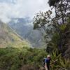
Header photo: Internet of Elephants
No showcases have been added to this group yet.
- @ReillyHammond
- | She/her
Graduate student at Arizona State University studying viral cancer in sea turtles and community science and conservation engagement through conservation and technology.

- 0 Resources
- 1 Discussions
- 11 Groups

- @MandyEyrich
- | She/Her
University of Florida (UF)
Wildlife Conservation meets Experience Strategy -- 15+ years of cross-sector expertise specializing in user-centric technology and product strategy (UX research, UX/UI design), process optimization, and end-to-end agile product development, moving from ideation to iteration


- 0 Resources
- 12 Discussions
- 26 Groups

WILDLABS & Wildlife Conservation Society (WCS)
I'm the Bioacoustics Research Analyst at WILDLABS. I'm a marine biologist with particular interest in the acoustics behavior of cetaceans. I'm also a backend web developer, hoping to use technology to improve wildlife conservation efforts.


- 54 Resources
- 42 Discussions
- 34 Groups
- @nora.gourmelon
- | She/her
PhD candidate in Computer Science working on Computer Vision for glacier front delineation in synthetic aperture radar satellite images
- 0 Resources
- 0 Discussions
- 2 Groups

I support humanitarian drone operations in the Global South, as well as ecology and conservation efforts utilising drones. I specialise in drone: Safety, Operations, Regulations, and Airspace Management


- 1 Resources
- 23 Discussions
- 22 Groups

- @biocontech
- | Mr.
College of African Wildlife Management (CAWM), Mweka
Wildlife Scientist, focusing on the use of Technology for Research and Conservation
- 0 Resources
- 6 Discussions
- 6 Groups
- @SenecaParkZooSociety
- | He, Him
Director of Conservation Advancement
- 0 Resources
- 0 Discussions
- 11 Groups

- @StephODonnell
- | She / Her
Tech, Sustainable Finance at World Bank & CFA (prev. Founder WILDLABS)


- 197 Resources
- 670 Discussions
- 31 Groups

- @crazybirdguy
- | Him
Field Biologist at Yayasan Cikananga Konservasi Terpadu, Indonesia, with experience and interest mainly in ornithology, citizen science and bioaccoustic
- 0 Resources
- 11 Discussions
- 12 Groups
Conservationist | Ecologist| Geospatial Scientist
- 0 Resources
- 1 Discussions
- 12 Groups

- @torresk
- | she/her
MS Forestry Student at SIU; PEASE Lab
- 2 Resources
- 5 Discussions
- 9 Groups
Building perimeter monitoring technology for protected areas with Safora
- 0 Resources
- 2 Discussions
- 10 Groups
Careers
Full Stack Developer - Conservation X Labs

Dante Wasmuht
Conservation X Labs is looking for an awesome Full-Stack Developer!
18 June 2026
Careers
Biodiversity Monitoring Scientist

Tom August
This role would suit someone with a background in ecology or environmental science who enjoys combining fieldwork, data analysis, and applied research to support real-world environmental outcomes.
8 June 2026
Article

🌍 Conservation technology is transforming how we protect wildlife, but are we thinking carefully enough about the risks? Drones, camera traps, GPS trackers, acoustic sensors, AI, and remote sensing have become...
22 May 2026
Careers
We are currently recruiting for multiple positions in the Ecological and Collective Cognition Lab (Kano Lab) at Kyushu University (Institute for Advanced Study, Japan)
9 May 2026
Careers

A 3-year, fully-funded PhD studentship at the interface of ecological theory, AI and global biodiversity mapping
28 April 2026
Article
Invitation to submit articles for a Special Issue of the journal "Sensors"
28 April 2026
Careers
Diseñar y ampliar la infraestructura digital que transforma los conjuntos de datos globales en herramientas prácticas y en tiempo real para los profesionales de la conservación en todo el mundo.
2 April 2026
Careers
Remote Senior Scientist with TerrAdapt
Leah Stahmann
Lead the design of complex applied science projects, using remote sensing and ecological modeling to provide partners with the evidence-based insights needed to prioritize conservation action.
2 April 2026
Careers

Summer internship opportunity with WWF
3 March 2026
Article
Join the 2026 #Tech4Wildlife Challenge! (Feb. 2-6)

WILDLABS Team
For the 10th year in a row, we’re inviting the community to share photos and videos of how they’re engaging with technology for wildlife conservation. Participate to connect with the community, vote for your favorites,...
20 January 2026
Careers
Interim Co-Chair Position with Move BON

Lacey Hughey
Move BON is seeking a new Interim Co-Chair to help shape the future of biodiversity observation and movement ecology.
6 January 2026
FREE Drone & GIS Mini Course from GeoWing Academy

FREE Drone & GIS Mini Course from GeoWing Academy
FREE Drone & GIS Mini Course from GeoWing Academy


Fantastic Fields: Field Data Collection the Smart Way
Fantastic Fields: Field Data Collection the Smart Way
Fantastic Fields: Field Data Collection the Smart Way
Drone Photogrammetry & GIS Advanced Course
Drone Photogrammetry & GIS Advanced Course
Drone Photogrammetry & GIS Advanced Course
Drone Photogrammetry & GIS Intermediate Course
Drone Photogrammetry & GIS Intermediate Course
Drone Photogrammetry & GIS Intermediate Course
Drone Photogrammetry & GIS Introduction (Foundation) Course
Drone Photogrammetry & GIS Introduction (Foundation) Course
Drone Photogrammetry & GIS Introduction (Foundation) Course


June 2026
event
Rebekka Stutz
April 2026
event
Rebekka Stutz
| Description | Activity | Replies | Groups | Updated |
|---|---|---|---|---|
| I really recommend GardePro. They are not too expensive and very resilient in the field. |
+8
|
Camera Traps, Animal Movement, Community Base, Early Career, East Africa Community, Emerging Tech, Human-Wildlife Coexistence | 6 hours 28 minutes ago | |
| Hi all, just sharing a workflow we’ve been refining over the last 15 months. We wanted to move beyond visual observations and truly... |
|
Drones, Citizen Science, Conservation Tech Training and Education, Emerging Tech, Geospatial, Open Source Solutions, Protected Area Management Tools, Sensors | 1 month ago | |
| Using drone mapping as a way to create beautiful maps and 3D models of our study sites is pretty cool. Those photogrammetry outputs are... |
|
Citizen Science, Conservation Tech Training and Education, Data Management & Mobilisation, Drones, Emerging Tech, Geospatial, Open Source Solutions, Sensors | 1 month 1 week ago | |
| It certainly is! The great thing about it too is that the aerial detections often lead to more ground detections when teams are locating the trees from the map data and by using... |
|
Conservation Tech Training and Education, Drones, Emerging Tech, Geospatial, Open Source Solutions | 1 month 2 weeks ago | |
| @annavallery here's the article with geospatial-ish highlights in case you're interested: https://wildlabs.net/en/article/wildlabs-geospatial-group-ictc-2026. Let me know if... |
|
AI for Conservation, Animal Movement, Camera Traps, Citizen Science, Community Base, Data Management & Mobilisation, Drones, Emerging Tech, Ethics of Conservation Tech, Human-Wildlife Coexistence, Latin America Community, Protected Area Management Tools, Wildlife Crime | 2 months ago | |
| Myself and the Fauna & Flora Conservation Technology team will be there (@Chelsea_Smith and @ugyenpenjor ) and also the WILDLABS team @HRees ! See you! |
+6
|
Geospatial, Acoustics, AI for Conservation, Camera Traps, Citizen Science, Community Base, Data Management & Mobilisation, Emerging Tech, Open Source Solutions, Protected Area Management Tools | 2 months ago | |
| Hi everyone,I'm a student in Mexico studying engineering with a focus on conservation technology — working on IoT sensor networks, wildlife... |
|
Acoustics, Conservation Tech Training and Education, Latin America Community, East Africa Community, Connectivity, Marine Conservation, Camera Traps, Sustainable Fisheries, Software Development, Data Management & Mobilisation, Protected Area Management Tools, Early Career, Sensors, Open Source Solutions, Emerging Tech | 2 months 1 week ago | |
| Hi Mykhailo. That citizen science tool seems interesting. But, how do you expect people to detect microplastics (ranging from 1 µm to 5 mm in size)? |
|
AI for Conservation, Citizen Science, Connectivity, Conservation Tech Training and Education, Emerging Tech, Software Development | 2 months 1 week ago | |
| Open-source LoRa telemetry node for sea turtle nesting monitoring — looking for field feedbackHi everyone — I'm Toshi, an... |
|
Emerging Tech, Ethics of Conservation Tech, Marine Conservation | 2 months 3 weeks ago | |
| do I see in the diagram some elements positioned below the sand? (perhaps below the tide-line and saturated with water..?) |
+14
|
AI for Conservation, Emerging Tech, Sensors | 2 months 3 weeks ago | |
| Wonderful work! Would you be interested in documenting a story about afforestation from the Pacific Ocean to the Himalayas (Indus River focus)? I’m interested in doing an... |
|
Acoustics, AI for Conservation, Animal Movement, Camera Traps, Citizen Science, Drones, Emerging Tech, Marine Conservation, Sensors, Sustainable Fisheries, Wildlife Crime | 3 months 2 weeks ago | |
| Quick update – our next SCB Drones & Data Working Group coordination meeting is 24 March 2026.Two identical sessions to accommodate time zones:EARLY: 07:00 UK / 08:00 CET / 15... |
|
Drones, AI for Conservation, Data Management & Mobilisation, Emerging Tech, Geospatial, Marine Conservation | 3 months 3 weeks ago |


Camera trap recommendations
2 April 2026 11:40pm
10 July 2026 10:22pm
It’s worth considerig thermal cameras. They will see more, particularly small mammals at night. Here’s a Comparison of thermal and trail cameras.

13 July 2026 11:18pm
I really recommend GardePro. They are not too expensive and very resilient in the field.
Full Stack Developer - Conservation X Labs
18 June 2026 3:37pm
Quantifying 15-months of fynbos vegetation recovery using Drone Photogrammetry and QGIS
12 June 2026 11:56am
Biodiversity Monitoring Scientist
8 June 2026 5:22pm
Beyond the Map: How Drone Data Reveals Ecological Recovery Through Statistics
5 June 2026 10:06am
WOOHOO ITS WORKING!! Tech finds undetected decades old Alien Invasive Parent Plants in indigenous forest!
24 July 2025 12:21pm

8 October 2025 1:26pm
Thanks @SeanHill - I'll take a look!

5 May 2026 11:02pm
This is a very promising result. The use of drones for detecting invasive species demonstrates strong potential for improving monitoring efficiency and accuracy. In a country like Brazil, where ecosystems are significantly affected by invasive species such as Hovenia dulcis (Japanese raisin tree) and Pinus spp., this technology could become a valuable tool for early detection and management.
29 May 2026 10:15am
It certainly is! The great thing about it too is that the aerial detections often lead to more ground detections when teams are locating the trees from the map data and by using the ground app, they are able to mark the locations and photograph the newly discovered aliens and sync it to the existing maps as well. This allows for truly comprehensive removal and monitoring data capture.
Help shape best-practice guidance on conservation technology - input to survey
22 May 2026 10:20am
Call for Collaboration: Share your voice at ICTC next week!
11 February 2026 3:29am
19 February 2026 3:35am
Hi Anna!
Is there anything that sparks your curiosity, which I can address for you? Take a look at the upcoming day 2 and day 3 sessions, and if you see anything that intrigues you, please let me know! I'll happily join the session that aligns, and share your thoughts! ☺️
Kind regards,
Mandy
13 May 2026 2:18pm
That's a great idea @MandyEyrich ! Similar to your idea, I wrote up an article with geospatial highlights from ICTC 2026: https://wildlabs.net/en/article/wildlabs-geospatial-group-ictc-2026.
Is the Human-Wildlife Coexistence article available yet? Would love to read it and share it with colleagues at Fauna & Flora.
13 May 2026 2:21pm
@annavallery here's the article with geospatial-ish highlights in case you're interested: https://wildlabs.net/en/article/wildlabs-geospatial-group-ictc-2026. Let me know if you have any questions or specific interests. Happy to share further details!
Nature Tech Unconference - Anyone attending?
8 March 2025 12:11pm

24 April 2026 9:59am
What about this year? Who will be there?
https://www.naturetechweek.com/
I am planning to be there for the Unconference and some satellite events.
28 April 2026 4:10pm
I'll be there for the Unconference- looking forward to it!
13 May 2026 12:05pm
Myself and the Fauna & Flora Conservation Technology team will be there (@Chelsea_Smith and @ugyenpenjor ) and also the WILDLABS team @HRees ! See you!
Nature Credit Markets Webinar with Sensing Clues: Trustworthy Data for Validation and Verification Purposes
11 May 2026 6:51am
Open Positions – Postdoc, Technical Staff, and Students (Kyushu University, Japan) Ecological and Cognition Lab (Kano Lab)
9 May 2026 12:23am
Looking for internships, fellowships, and scholarships in conservation technology
2 May 2026 9:03am
Citizen science tool for microplastic mapping in underserved regions
18 April 2026 3:48am

1 May 2026 12:39pm
Hi Mykhailo. That citizen science tool seems interesting. But, how do you expect people to detect microplastics (ranging from 1 µm to 5 mm in size)?
Open PhD project: Decoding and mapping Earth's species interactions with ecological AI
28 April 2026 4:51pm
"Sensor Systems for Biodiversity and Ecosystem Monitoring" - Special Issue Invitation
28 April 2026 12:10pm
Open-source LoRa telemetry node for sea turtle nesting monitoring — looking for field feedback
22 April 2026 8:14am
Non-Invasive Turtle Nest Monitoring Using RTI Technology
29 May 2025 1:12pm

18 April 2026 2:47pm
Greetings Nik, it is interesting to see to the project you are working on. If there's anything I can do to help with my skillset let me know.
Thanks, Mike
20 April 2026 6:14am
Ooo, got it. That makes sense and is actually a good idea. I'll relay this to our engineer.

21 April 2026 2:49am
do I see in the diagram some elements positioned below the sand? (perhaps below the tide-line and saturated with water..?)
Desarrollador remoto de software geoespacial en TerrAdapt
2 April 2026 1:51pm
Remote Senior Scientist with TerrAdapt
2 April 2026 1:48pm
I WANT TO TELL YOUR STORY
29 June 2025 10:22am

1 October 2025 7:43am
I'm not involved with this, but I just learned about Sea Shepherd today and their project to fight illegal octopus trapping. Sorry I can't help with an intro, but it would be a very cool story to share if you can get in touch!

11 January 2026 7:33am
Amazing!
Found your instagram page and have been scrolling all morning ( most educative doomscrolling I've done so far😂). Love it, am seeing sea creatures I've never seen.

24 March 2026 1:37pm
Wonderful work! Would you be interested in documenting a story about afforestation from the Pacific Ocean to the Himalayas (Indus River focus)?
I’m interested in doing an expedition documentary bridging mythology and conservation with a YouTuber to help bring awareness towards forest conservation all along the river. The focus is water and water wildlife.
SCB Drones and Data Working Group (Society for Conservation Biology)
3 January 2026 5:30am

3 January 2026 9:40pm
Congratulations David. Looking forward to attending the inaugural meeting :)
Akiba
7 January 2026 2:08am
Thanks for joining, @Freaklabs
23 March 2026 12:37pm
Quick update – our next SCB Drones & Data Working Group coordination meeting is 24 March 2026.
Two identical sessions to accommodate time zones:
EARLY: 07:00 UK / 08:00 CET / 15:00 HKT / 16:00 Tokyo / 17:00 Brisbane / 18:00 Sydney / 20:00 New Zealand
LATE: 17:00 UK / 18:00 CET / 12:00 US Eastern / 09:00 US Pacific
If you’re interested in joining the Working Group or haven’t yet completed the Expression of Interest, you can still do so here:
https://docs.google.com/forms/d/e/1FAIpQLScKxh3-e2duORzdqvuD2UCqC-Cpp7booTdWu7zFSHYPV0HOfw/viewform
Please email any questions to me at [email protected]
Agenda:
• Confirming Working Group scope and positioning within SCB
• Establishing governance and leadership roles
• Defining priority outputs for the next phase
• Progressing toward full SCB Working Group status
Looking To Utilize My Skillsets To Help
19 March 2026 10:26pm
Camera Trap Integration Webinar with Sensing Clues: Connecting Your Camera Traps with All Your Conservation Data
19 March 2026 10:07am
How to measure canopy heights with a drone and free software: A quick easy guide!
9 March 2026 3:16pm


AI Segmentation Tool for QGIS
2 March 2026 8:29am

2 March 2026 7:08pm
Interesting.
3 March 2026 7:51am
It is a fantastic tool, really helps save time and increases efficiency. Have you used or designed tools like this before?
East Africa coordination between ICTC Peru and GCTDF Kenya – informal community update
27 January 2026 12:52am

24 February 2026 1:03pm
How are current drone pilots in the Mara handling biometric authorization for flight logs to ensure data integrity?
25 February 2026 11:27am
Hi @DavidGlobalDroneForum , I have attended ICTC and tried to be in the drone-related sessions as much as possible. I'm am not based in Africa but very much would like to better understand how drones are being used there as the organisation I work for are keen to increase the use of drones in that area. Would be happy to contribute in some way with reflections depending on timeline. Unfortunately I won't attend the conference in Kenya in person. I have also signed up to the Drone WG so was hoping to share something then too!
7 July 2026 1:20am
GP A60 Review is now up. See: https://winterberrywildlife.ouroneacrefarm.com/2026/05/23/gardepro-a60-trail-camera-teardown-and-review/