
El crimen contra la vida silvestre es uno de los mayores desafíos para la conservación y una de las áreas de mayor innovación en el mundo de la tecnología aplicada a la conservación. Constantemente surgen nuevas ideas y soluciones para rastrear y proteger las especies objetivo de los cazadores furtivos, gestionar áreas protegidas, apoyar a los guardaparques y combatir el creciente mercado en línea de productos ilegales de vida silvestre. Los ingenieros y conservacionistas que trabajan para resolver los numerosos desafíos del crimen contra la vida silvestre se basan en herramientas como el aprendizaje automático, el registro biológico, las cámaras trampa, el monitoreo acústico, los drones, las aplicaciones móviles y más.
Esta amplia variedad de tecnologías interrelacionadas convierte a nuestro grupo de Crimen contra la Vida Silvestre en un crisol potencial para muchas de nuestras otras comunidades, y en un lugar especialmente interesante para encontrar colaboradores que trabajan en diferentes ámbitos tecnológicos para alcanzar un objetivo común. Ya sea que seas un experto en cámaras trampa que busca información sobre visión térmica para detectar posibles cazadores furtivos, un experto en aprendizaje automático con las habilidades para analizar datos acústicos de disparos, o un administrador de áreas protegidas que busca las últimas herramientas móviles integradas, ¡este grupo puede conectarte con los miembros adecuados de nuestra comunidad!
A continuación, encontrarás recursos y conversaciones de WILDLABS que te ayudarán a comprender cómo se están utilizando diferentes tecnologías en la lucha contra los delitos contra la vida silvestre y qué necesitan los profesionales de la tecnología de la conservación para que estas herramientas sean efectivas.
Tres tutoriales y videos para principiantes:
- ¿Cómo puedo usar la IA para combatir los delitos contra la vida silvestre? | Lily Xu, Tech Tutors
- Proyecto de Tecnología contra los Delitos contra la Fauna Silvestre de WWF | Eric Becker, Reuniones Virtuales
- SmartParks | Laurens de Groot, reuniones virtuales
Tres hilos de foro para principiantes:
- Tecnologías de detección de trampas | Rachel Kramer
- Herramientas para la gestión de la conservación | Chris Muashekele
- ¿Busca software de base de datos de inteligencia? | Dexter Oelrichs
Tres artículos para principiantes:
- Utilizando datos AIS para investigar los puertos pesqueros del mundo, Max Schofield
- ¿Cómo ven los expertos en delitos contra la vida silvestre las tecnologías de teledetección utilizadas para combatir los delitos contra la vida silvestre?, Isla Duporge
- Sensores detectores de metales para la lucha contra la caza furtiva, Sam Seccombe
¡Únete a este grupo ahora para conocer nuestra comunidad y empezar a debatir soluciones e ideas juntos!
Foto de cabecera: © Frank af Petersens/Save the Elephants
Aún no se han agregado destacados a este grupo.

- @StephODonnell
- | She / Her
Tech, Sustainable Finance at World Bank & CFA (prev. Founder WILDLABS)



- 197 Recursos
- 670 Discusiones
- 31 Grupos

Royal Society for the Protection of Birds (RSPB)
- 0 Recursos
- 0 Discusiones
- 5 Grupos

- @Aurel
- | She/Her
Looking to reconcile biodiversity conservation and finance.


- 2 Recursos
- 1 Discusiones
- 10 Grupos
Building perimeter monitoring technology for protected areas with Safora
- 0 Recursos
- 1 Discusiones
- 10 Grupos

- @TaliaSpeaker
- | She/her
WILDLABS & World Wide Fund for Nature/ World Wildlife Fund (WWF)
I'm the Executive Manager of WILDLABS at WWF


- 28 Recursos
- 64 Discusiones
- 33 Grupos

Committed to using technology, data and innovation to create efficient, safe and impactful solutions.

- 0 Recursos
- 0 Discusiones
- 16 Grupos
My research focuses on using Next-Generation Sequencing (NGS) to study endangered species, including carnivores, chiropterans (bats), and lizards, as well as their microbiomes.


- 7 Recursos
- 10 Discusiones
- 20 Grupos

WILDLABS & Wildlife Conservation Society (WCS)
I'm the Bioacoustics Research Analyst at WILDLABS. I'm a marine biologist with particular interest in the acoustics behavior of cetaceans. I'm also a backend web developer, hoping to use technology to improve wildlife conservation efforts.




- 53 Recursos
- 42 Discusiones
- 34 Grupos

I'm a software developer that has pivotted to starting a company, Wildlife Security Innovations, to help people and wildlife live together safely.

- 0 Recursos
- 518 Discusiones
- 8 Grupos

- @ahmedjunaid
- | He/His
Zoologist




- 90 Recursos
- 7 Discusiones
- 16 Grupos

Technologist and Visual storyteller focusing on social, conservations issues.


- 1 Recursos
- 64 Discusiones
- 17 Grupos
- 0 Recursos
- 0 Discusiones
- 5 Grupos
Artículo

🌍 Conservation technology is transforming how we protect wildlife, but are we thinking carefully enough about the risks? Drones, camera traps, GPS trackers, acoustic sensors, AI, and remote sensing have become...
22 Mayo 2026
Artículo
Invitation to submit articles for a Special Issue of the journal "Sensors"
28 April 2026
Carreras

Summer internship opportunity with WWF
3 Marzo 2026
Artículo
Oxford Nanopore sequencing combined with environmental DNA (eDNA) metabarcoding as a rapid and field-adapted tool for monitoring elusive carnivores
8 February 2026
Carreras

New PhD position at University College London (UCL) and Institute of Zoology (IoZ)
15 Diciembre 2025
Artículo

The University of Hawai‘i - Ocean & Resources Engineering program is seeking project ideas from community groups, marine/ocean scientists, government agencies, companies, and non-governmental organizations for their...
16 November 2025
Carreras
Conservation technology vacancy at the RSPB
Nigel Butcher
Application deadline 03/10/25
8 Septiembre 2025
Artículo

Please help us by participating in a MSc research project on what you consider to be 'evidence' in your work in conservation.
19 Junio 2025
Carreras
SPOTS Internship Programme

Georg Strunck
Strategic Protection Of Threatened Species (NGO) is looking for engineering interns at the Dinokeng Game Reserve, South Africa
6 February 2025
Artículo
INSTANT DETECT 2.0 - ALPHA TESTING
Sam Seccombe
The worst thing a new conservation technology can do is become another maintenance burden on already stretched field teams. This meant Instant Detect 2.0 had to work perfectly from day 1. In this update, Sam Seccombe...
28 Enero 2025
Artículo
INSTANT DETECT 2.0 – THE OPTIMISATION YEARS
Sam Seccombe
The Zoological Society of London's Instant Detect 2.0 is the world's first affordable satellite connected camera trap system designed by conservationists, for conservationists. In this update, Sam Seccombe describes the...
21 Enero 2025
Financiamiento
The Connected Conservation is thrilled to announce our award's third round in collaboration with the Airbus Foundation. This award champions the use of cutting-edge satellite imagery to tackle biodiversity loss and...
30 Septiembre 2024


Marzo 2026
evento
Diana Mastracci
49 Products
1 R&D Projects
46 Organisations
Recently updated products
Recently updated R&D Projects
Recently updated organisations
| Descripción | Actividad | Respuestas | Grupos | Actualizado |
|---|---|---|---|---|
| I would be interested |
+3
|
Ciencia Ciudadana, Base Comunitaria, Capacitación y Educación en Tecnología para la Conservación, Data Management & Mobilisation, Prevención del Tráfico de Vida Silvestre en Línea, Ética de la Tecnología para la Conservación, Human-Wildlife Coexistence, Sustainable Fisheries, Crimen contra la Vida Silvestre | 1 semana 5 días ago | |
| BTW. On my roadmap is to develop a very long distance IR system that could detect humans at 1km with reliably in complete darkness but I don't have the funding for it at the... |
|
Cámaras Trampa, Crimen contra la Vida Silvestre, Sensores | 3 semanas 1 día ago | |
| @annavallery here's the article with geospatial-ish highlights in case you're interested: https://wildlabs.net/en/article/wildlabs-geospatial-group-ictc-2026. Let me know if... |
|
IA para la Conservación, Movimiento Animal, Cámaras Trampa, Ciencia Ciudadana, Base Comunitaria, Data Management & Mobilisation, Drones, Tecnologías Emergentes, Ética de la Tecnología para la Conservación, Human-Wildlife Coexistence, Comunidad Latinoamericana, Herramientas para la Gestión de Áreas Protegidas, Crimen contra la Vida Silvestre | 1 mes 3 semanas ago | |
| Hi Mandy, writing from Indonesia where we manage the Sumatra Merang Peatland Project (SMPP) which is in a landscape supporting some of the last Sumatran tigers. Our project is... |
|
Movimiento Animal, Human-Wildlife Coexistence, Crimen contra la Vida Silvestre, Sensores | 2 meses 1 semana ago | |
| Hi, all! I'm a HUGE fan of Mongabay -- I greatly appreciate their approach to scientific storytelling, etc. I'm continuing to surface 'hot... |
|
Base Comunitaria, Ética de la Tecnología para la Conservación, Human-Wildlife Coexistence, Herramientas para la Gestión de Áreas Protegidas, Crimen contra la Vida Silvestre | 2 meses 2 semanas ago | |
| Hi Lin! That's the program I completed. It was excellent- feel free to reach out if you have any questions! 😊-Mandy |
+1
|
Crimen contra la Vida Silvestre | 2 meses 2 semanas ago | |
| Wonderful work! Would you be interested in documenting a story about afforestation from the Pacific Ocean to the Himalayas (Indus River focus)? I’m interested in doing an... |
|
Acústica, IA para la Conservación, Movimiento Animal, Cámaras Trampa, Ciencia Ciudadana, Drones, Tecnologías Emergentes, Conservación Marina, Sensores, Sustainable Fisheries, Crimen contra la Vida Silvestre | 3 meses 2 semanas ago | |
| If there is anything I can do with skillsets to help, let me know. |
|
Prevención del Tráfico de Vida Silvestre en Línea, Conservación Marina, Crimen contra la Vida Silvestre | 3 meses 3 semanas ago | |
| Hi Susan, We are just organising the one – Global Conservation Tech and Drone Forum 2-6 March in Nairobi. Women in Conservation Forum is a one-day forum on 2nd March, part of... |
|
IA para la Conservación, Ciencia Ciudadana, Cambio Climático, Base Comunitaria, Conectividad, Capacitación y Educación en Tecnología para la Conservación, Data Management & Mobilisation, Drones, Carrera Temprana, Comunidad de África Oriental, Tecnologías Emergentes, Conservación Marina, Soluciones de Código Abierto, Herramientas para la Gestión de Áreas Protegidas, Sustainable Fisheries, Crimen contra la Vida Silvestre, Programa Mujeres en Tecnología para la Conservación (WiCT) | 5 meses 1 semana ago | |
| Hi team, can you please provide an update on where this effort sits now? There is a similar discussion on AI FOR CONSERVATION: Mass Detection of Wildlife Snares Using Airborne... |
+17
|
Crimen contra la Vida Silvestre | 6 meses ago | |
| Hi team, Can you please provide an update on where this effort sits now? The original post from January 2024 described three trials of airborne synthetic aperture radar for... |
+39
|
IA para la Conservación, Drones, Tecnologías Emergentes, Human-Wildlife Coexistence, Crimen contra la Vida Silvestre | 6 meses ago | |
| I’m writing a Substack that tests ideas at the intersection of offender insight, policing models, and evidence standards in conservation.... |
|
Crimen contra la Vida Silvestre | 7 meses 3 semanas ago |




















New "Human Dimensions" group on Wildlabs?
29 Mayo 2026 7:25pm
24 June 2026 7:37pm
Hi Matt,
I would definitely be interested in joining this group.
One thing I often find is that we spend a lot of time discussing technologies and ecological outcomes, but much less time discussing the social and institutional processes that ultimately shape whether those technologies succeed or fail.
I think a Human Dimensions group could be a great space to connect people working on governance, policy, stakeholder engagement, values, and other topics that are often spread across different communities.
Looking forward to seeing how this develops!
25 June 2026 12:59am
yes, this group is definitely needed!
26 June 2026 6:33pm
I would be interested
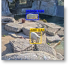
A thermal (at 1280x1024 resolution) impression of Kasteel park Born, The Netherlands
28 Marzo 2026 10:50am
16 June 2026 3:21pm
Hi Kim,
I come from automotive CV where false positives around vulnerable road users are a constant challenge, especially with edge cases at night and in low-visibility conditions (in Greenland or Canada winter conditions might skew the video clarity).
I’m curious about how this is handled in conservation/anti-poaching setups, particularly in IR-based detection systems that can pick up humans at range in darkness.
In automotive we rarely try to classify object intent, rather just direction of movement and proximity, so I’m wondering how systems in your context avoid over-interpreting a detection (e.g. differentiating a hiker or worker from a genuine threat scenario), and what role something like restricted location, known poacher trails, activity, or time of day might play into interpreting the detection.
Is the system usually designed to be triggered based with a manual triage backend or if there might be some degree of automated triage? Or if the methods you use are mostly for animal detection a la camera traps and human detections are an added benefit?
Would be great to hear how you structure that pipeline in practice.
Thanks,
Ron
17 June 2026 7:45am
Great questions! Actually, I added AI object detection with large models to my system back in 2019, before I got involved in wildlife, it was for security purposes. I got involved in wildlife in 2023. I think the vast majority of wildlife users of AI are using very small models deployable on low power systems. So they would have many false positives and negatives I expect.
My systems have not yet been used for poacher detection. When I developed it for security, I needed to make it so reliable that I could have it wake me at night. So false positives and misses had to be very small. To that end I wrote the software so it could combine several other mitigating factors. Such as multiple modules at the same time, statistical based triggers etc. For example, we could make it detect a person requiring both a high confidence thermal match and a low confidence visible match in order to trigger. That sort of thing. It can be made very reliable.
I don't think you need to determine intent with the system. That can be left to the humans. So long as they can be notified. With our systems, in addition to getting the notification they can then come in live and view the situation from multiple camera actions. Very effective visibility is the key and rapid detection and clear notification. For my home security setup, I'm using yolov6 large model with inference on 1280x1280 images. The large model is a 140 million parameter model. It's very good with both recall and accuracy. I can't remember the last time any false detection woke me. And it never misses anything.
It also had from the very start a flexible state machine built in that can be menu configured to combine all kinds of state before it triggers.
(I'll find out about low visibility situations soon as I'll be deploying some thermal systems to Greenland next month).
17 June 2026 8:00am
BTW. On my roadmap is to develop a very long distance IR system that could detect humans at 1km with reliably in complete darkness but I don't have the funding for it at the moment. It would use a zoomable IR system with a 30-180mm thermal zoom at 1280x1024 resolution. It's kind of a dream system on mine and I'm determined to build it.
Help shape best-practice guidance on conservation technology - input to survey
22 Mayo 2026 10:20am
Call for Collaboration: Share your voice at ICTC next week!
11 February 2026 3:29am
19 February 2026 3:35am
Hi Anna!
Is there anything that sparks your curiosity, which I can address for you? Take a look at the upcoming day 2 and day 3 sessions, and if you see anything that intrigues you, please let me know! I'll happily join the session that aligns, and share your thoughts! ☺️
Kind regards,
Mandy
13 May 2026 2:18pm
That's a great idea @MandyEyrich ! Similar to your idea, I wrote up an article with geospatial highlights from ICTC 2026: https://wildlabs.net/en/article/wildlabs-geospatial-group-ictc-2026.
Is the Human-Wildlife Coexistence article available yet? Would love to read it and share it with colleagues at Fauna & Flora.
13 May 2026 2:21pm
@annavallery here's the article with geospatial-ish highlights in case you're interested: https://wildlabs.net/en/article/wildlabs-geospatial-group-ictc-2026. Let me know if you have any questions or specific interests. Happy to share further details!
Tiger coexistence challenges
20 April 2026 3:20am
2 May 2026 6:32am
Hi Mandy, writing from Indonesia where we manage the Sumatra Merang Peatland Project (SMPP) which is in a landscape supporting some of the last Sumatran tigers. Our project is part of a corridor including two national parks and a few scattered conservation areas within active oil palm and Acacia plantations. There's not a lot of room for tigers and they do range through human communities or come into contact with plantation workers.
Fatal attacks are rare but two occurred in 2022. We hold annual HWC trainings with communities but also celebrate International Tiger Day with them, having a light-hearted event with games, face paint, and education of the importance of biodiversity, even when scary. We emphasize common sense personal safety measures to reduce the potential for conflict. Luckily livestock aren't very common in this area so that conflict trigger is not a major issue. Mostly it's about restricting activity at dusk/night/dawn, travelling in groups, not running, etc. We haven't found any feasible tech options (tagging is beyond our scope/budget) but we do use camera traps to see if/when tigers are present in/around our project area. This can only do so much for HWC as it's not a rapid response tool but does indicate presence.
Regarding your question "Who/what parties should be held responsible for the loss of life, both human and tiger? Can they be held responsible?" there isn't an easy answer! Indonesian law technically gives tigers the same right-to-life as humans but in practice reprisals of course happen. In our region the military did respond to the 2022 events with patrols and presence, but they were not allowed to shoot. Obviously there is no proactive recourse against the tiger itself as a responsible party. It's an opportunity to redouble efforts on community education to explain why the attacks occurred (both fatalities were at forest frontiers, crouching with back to the forest, etc) and how to avoid re-occurrence!
"Sensor Systems for Biodiversity and Ecosystem Monitoring" - Special Issue Invitation
28 April 2026 12:10pm
War in Iran - has it impacted your projects?
23 April 2026 9:10pm
Looking for tips about masters in Wildlife forensics and possible places to get some work experience.
10 Septiembre 2016 10:21am
13 March 2026 1:22am
I'm applying to that UF forensics masters program...
13 March 2026 4:29am
Congratulations on completing the masters and going into the PhD program. We hear a lot about wildlife crime out here in Asia. You may want to connect with ZSL Thailand who are working in the illegal wildlife trade and the smuggling of animals/parts through Thailand and the Myanmar border.
Good luck!
Akiba
20 April 2026 3:45am
Hi Lin! That's the program I completed. It was excellent- feel free to reach out if you have any questions! 😊
-Mandy
I WANT TO TELL YOUR STORY
29 Junio 2025 10:22am
1 October 2025 7:43am
I'm not involved with this, but I just learned about Sea Shepherd today and their project to fight illegal octopus trapping. Sorry I can't help with an intro, but it would be a very cool story to share if you can get in touch!
11 January 2026 7:33am
Amazing!
Found your instagram page and have been scrolling all morning ( most educative doomscrolling I've done so far😂). Love it, am seeing sea creatures I've never seen.
24 March 2026 1:37pm
Wonderful work! Would you be interested in documenting a story about afforestation from the Pacific Ocean to the Himalayas (Indus River focus)?
I’m interested in doing an expedition documentary bridging mythology and conservation with a YouTuber to help bring awareness towards forest conservation all along the river. The focus is water and water wildlife.
Measurements for species vulnerability to overharvesting
20 Mayo 2024 3:06pm
14 March 2026 7:06pm
If there is anything I can do with skillsets to help, let me know.
When Wildlife Becomes Data: Ethical AI in Biodiversity Monitoring- Join the GEO Indigenous Alliance Summit 2026 March 16-19
5 Marzo 2026 3:53pm
Wildlife Detection Tech Graduate Intern
3 Marzo 2026 8:57pm
Assessing Oxford Nanopore-based eDNA metabarcoding for carnivore monitoring in Saudi Arabia: detection of Arabian leopard DNA as a case study
8 February 2026 6:43pm
Women in Marine Conservation session in the Women in Conservation Forum (WiCF) day 2nd March in Nairobi, Kenya.
30 Enero 2026 4:52am
30 January 2026 4:56am
Disclaimer: The related organisations in the blue box below are not partnership statements. I am merely trying to spread the word. We only have official partnerships (e.g. by an MoU) with CCF and WildDrone for the GCTDF.
Thank you!
30 January 2026 10:55am
Hi Macayle
Are these two different forums; one in Mombasa and other in Nairobi? can you make me understand please?
1 February 2026 2:02am
Snare detection technologies
23 Mayo 2017 4:19pm
5 October 2019 2:11am
Hi Dave,
How did the trial with the dogs go?
Chris
20 March 2024 7:12pm
I am interested in expanding our capability and understanding of snare detection by canines. We have two canines working in Asia that have successfully detected snares in training scenarios. However, final protocols for training and deployment are being developed and integrated into the team's capability.
A potential enhancement is to add technology that supports the canine's detection capability.
8 January 2026 3:17am
Hi team, can you please provide an update on where this effort sits now? There is a similar discussion on AI FOR CONSERVATION: Mass Detection of Wildlife Snares Using Airborne Synthetic Radar
I want to add this as one of our competitions at the Global Conservation Tech & Drone Forum www.GCTDF.org in Kenya in early March, and include it in the new SCB Drones and Data WG as a discussion: https://wildlabs.net/discussion/scb-drones-and-data-working-group-society-conservation-biology
This would build on the recent launch of a hands-on Tech Innovation Challenge around of the ADS-B proximity alert , as a safety layer in real conservation field operations where pilots are often multitasking. Please let me know the current status, data availability, key contacts, and what next steps might look like if this is to be integrated into the Forum and the Working Group agenda.
Thanks.
[email protected]
Mass Detection of Wildlife Snares Using Airborne Synthetic Radar
7 Enero 2024 6:50am
21 November 2024 4:52pm
Hats off to your team for this absolute game-changing technology!
We rescue stray and wild animals in Taiwan, and the bulk of our work is saving animals maimed by wire snares and gin traps. We've become better at finding the devices, but still not good at all. There's simply too much difficult terrain to cover and we only have eyeballs and hiking sticks to find them. We know roughly where they are because the maimed stray dogs will eventually find their way onto a road and be reported to us. Then we close one of them, set up a trail camera, get the evidence of the poacher in the act of re-setting it, and get him prosecuted and shut down. But we need to be able to scale this greatly.
I've been using a thermal-imaging drone to locate stricken animals and am now considering buying another drone more suited to finding traps and snares. Some newer drones are able to navigate through forest without crashing into thin branches, so I've been looking into equipping one with LiDAR to see if that can detect the devices. But then I came across your YouTube channel and then this post about using airborne synthetic radar, and I'm incredibly excited to see where you might take this incredible technology.
How can we get our hands on the SAR you're using? It's 3 kg, right? I'm wondering if I could fit it to a suitable drone. If it works above forest canopy to detect traps and snares on the forest floor, then I can use a load-carrying drone instead of a light obstacle-avoidance drone.
If you made the SAR yourselves, then maybe think about crowdfunding for your project. I'd happily pledge funds if it meant I could get my hands on the kind of equipment you're using.
I can't tell you how happy I am thinking about all the animals' lives you'll save with this. Don't just remove the snares—gather evidence and put the poachers out of business too!
7 January 2026 2:07am
Hi @DaveGaynor and team. I am really keen to pursue this with some practical testing in Kenyan conservancies. What is the status of this effort, and could we meet to discuss how to take it forward as part of the Global Conservation Tech and Drone Forum in Nairobi, 2-6 March. I am chair of the Society for Conservation Biology Drone and Data Working Group and would like to discuss this at our inaugural meeting on 20th January. https://wildlabs.net/discussion/scb-drones-and-data-working-group-society-conservation-biology
8 January 2026 2:53am
Hi team, Can you please provide an update on where this effort sits now? The original post from January 2024 described three trials of airborne synthetic aperture radar for detecting snares and gin traps with foliage-penetrating radar scanning at 120 m AGL and generating geolocated alerts back into EarthRanger with identity and confidence metrics.
I want to add this as one of our competitions at the Global Conservation Tech & Drone Forum www.GCTDF.org in Kenya in early March, and include it in the new SCB Drones and Data WG as a discussion: https://wildlabs.net/discussion/scb-drones-and-data-working-group-society-conservation-biology
This would build on the recent launch of a hands-on Tech Innovation Challenge around of the ADS-B proximity alert , as a safety layer in real conservation field operations where pilots are often multitasking. Please let me know the current status, data availability, key contacts, and what next steps might look like if this is to be integrated into the Forum and the Working Group agenda.
Thanks.
[email protected]
PhD Position: Deep Learning for Cheetah Conservation
15 Diciembre 2025 11:18am
Wildlife Crime Inquiry — invitation to critique
18 November 2025 8:19am
🚨 🔔 Call for Project Ideas: Partner with Graduate Ocean Instrumentation and Technology Course!
16 November 2025 7:22am
QGIS For Wildlife Crime Data Analysis
12 November 2025 5:24pm
Drone & ai use for uncovering illegal logging camps
21 April 2025 4:49am
21 April 2025 12:49pm
Hi Adam!
Sounds like you have your work cut out for you. I have not used radar systems or AI systems for this sort of detection, but there are methods using change detection models to visualise changes in forests where logging may be occuring between different dates using drone photogrammetry and GIS software. I have found these methods very effective when monitoring deforestation, especially because not only can you quickly visualise where deforestation has happened, but you can also quantify the damage at the same time. Let me know if you would like to learn more.
Kind regards
Sean Hill
14 October 2025 6:03pm
I am not sure about the legal restrictions for drones in Cambodia and the size of the area you want to cover. However, I would assume you would need a fairly large fixed-wing drones for the size of area, you would be interested in. At this scale, a small manned aircraft might be more accessible.
Regarding the use of sensors, the use of radar on drones is a rather uncommon outside military applications. Some mining companies use magnetic sensors to detector iron ore under the ground. Maybe they would be able to detect large metal objects as well. However, I assume logging activities should be fairly obvious, and I think a simple RGB sensor would be sufficient. In terms of data process, assuming you are looking for larger logging activity and camps, I do not think you need to develop an AI model to do this. The impact on the landscape should be obvious.
However, what you are describing sounds like the perfect use case of spaceborne SAR. ICEYE is a commercial product which might be an all-in-one solution for you. Otherwise, there is Global Forest Watch or you could develop your own workflow using something like Sentiel-1.
Good luck with your project!
Enrolment Open: QGIS For Wildlife Crime Prevention
3 Octubre 2025 10:42am
Conservation technology vacancy at the RSPB
8 Septiembre 2025 2:26pm
Piloting a QGIS Course for Conservation Staff – Seeking Interest & Input
28 July 2025 1:05pm
28 August 2025 8:40am
Hi Sean - if this is still of interest I have just finished my first pilot run - I have spaces for a next run through September - this is the link to the training course:
29 August 2025 11:00am
Hi Emma! Thank you for sharing the link to the course! The next 3 months are quite busy for me. But, I'll keep the info in my record for future enrollment. Many thanks!
3 September 2025 2:15pm
Thank you for sharing this Emma! I apologies for the delayed reply, I have been quite busy of late and will get to this as soon as possible! I look forward to it!
New Group Proposal: Systems Builders & PACIM Designers
18 Junio 2025 2:52pm
19 June 2025 12:19pm
Hello again sir - PACIMs really mean 'projects' is the way I see it. Each part of the acronym can be seen as a project (if you have an assignment to do, you have a project really).
As for your query on 10 projects in 'this' group - I should ask for clarification if you mean particularly acoustics or in any group (I see now this is the acoustics thread after I selected all the groups for this post). If you are asking on acoustics, you're right - I am unsure on 10 as I am not too keen on acoustics yet. If you are asking 10 projects as a whole like 10 projects in the funding and finance group - I believe 10 to be a very reasonable number. Our projects we have co-created are for the most part replicable, rapidly deployable, quickly scalable, fundable through blended finance and more.
Thank you again for the feedback.
19 June 2025 1:43pm
Thank you for your reply, Chad
I meant 10 as a whole, indeed. Perhaps you see your post in one group, but since it is tagged for all groups, I assumed you meant 10 in total.
In your first post you explain PACIM stands for "Projects, Assignments, Campaigns, Initiatives, Movements, and Systems", so I understood it as more than just projects. Obviously, many things can be packed into a project or called a project, but then, what does it mean that 'Projects' is part of the list?
Well, if you think 10 projects is doable, then don't let me stop you.
1 September 2025 2:51pm
hi chad, its great to hear from you_its really a great idea and impactful journey in our community
having experience in community-led conservation initiatives, working and leading in community based conservation @nature_embassy as the leader (found on insta and other social pages),
i will be glad to be part of the group, thankyou
WEBINAR: Sound Decisions
5 August 2025 5:15pm
Gulf of America Dead Zone Restoration
9 Junio 2025 9:49pm
21 June 2025 6:22am
Hi WILDLABS Community! I have started mapping the project for the Gulf of America Dead Zone and here are some photos of the progress.
In the last picture, I have included WILDLABS entities at random and I will be mapping them to the industry collaborators we are seeking.
I hope to have any interested parties please reach out and if you'd like to contribute your technology, wisdom, or just follow along, I appreciate it! Thank you
Opportunity to participate in study on what counts as evidence in conservation
19 Junio 2025 11:11am
Apply for Free Access to Nature FIRST Conference (innovative solutions for biodiversity monitoring and human-wildlife coexistence)
22 Mayo 2025 2:37pm
28 May 2025 4:20pm
Nice!
Thought I'd mention that Wildlife Security Innovations will have a booth there, demonstrating our new multi-camera, local AI camera trap that supports miniature high resolution thermal modules. I will be bringing these along.
31 May 2025 4:21pm
Hi
This is great!
So just to double check - there is no way to join online? I would love to be part of this conference.
Thanks, Els van Lavieren
Poaching data request
23 Enero 2025 2:27pm
25 March 2025 8:33am
Hello Martina, I just messaged you! Hope to speak soon! :)
29 March 2025 5:18pm
Late, but better than not at all - they unfortunately don't have exact geolocations available. Just general hotspots without related numbers.
Sorry I could not help further!
13 May 2025 3:49pm
Hi Georg,
Oh, that's a pity. But thanks anyway for checking!
Really appreciate it!
Cheers
Martina