
Adu Mensah Junior is a climate scientist and geospatial data analyst with an MSc in Climate Change and GIS from Swansea University. He is passionate about youth-led climate action, urban sustainability, and climate philanthropy. His work focuses on using GIS and satellite data.
For open discussion. Kindly share your views on these geospatial indices widely used for land/water variability calculation. 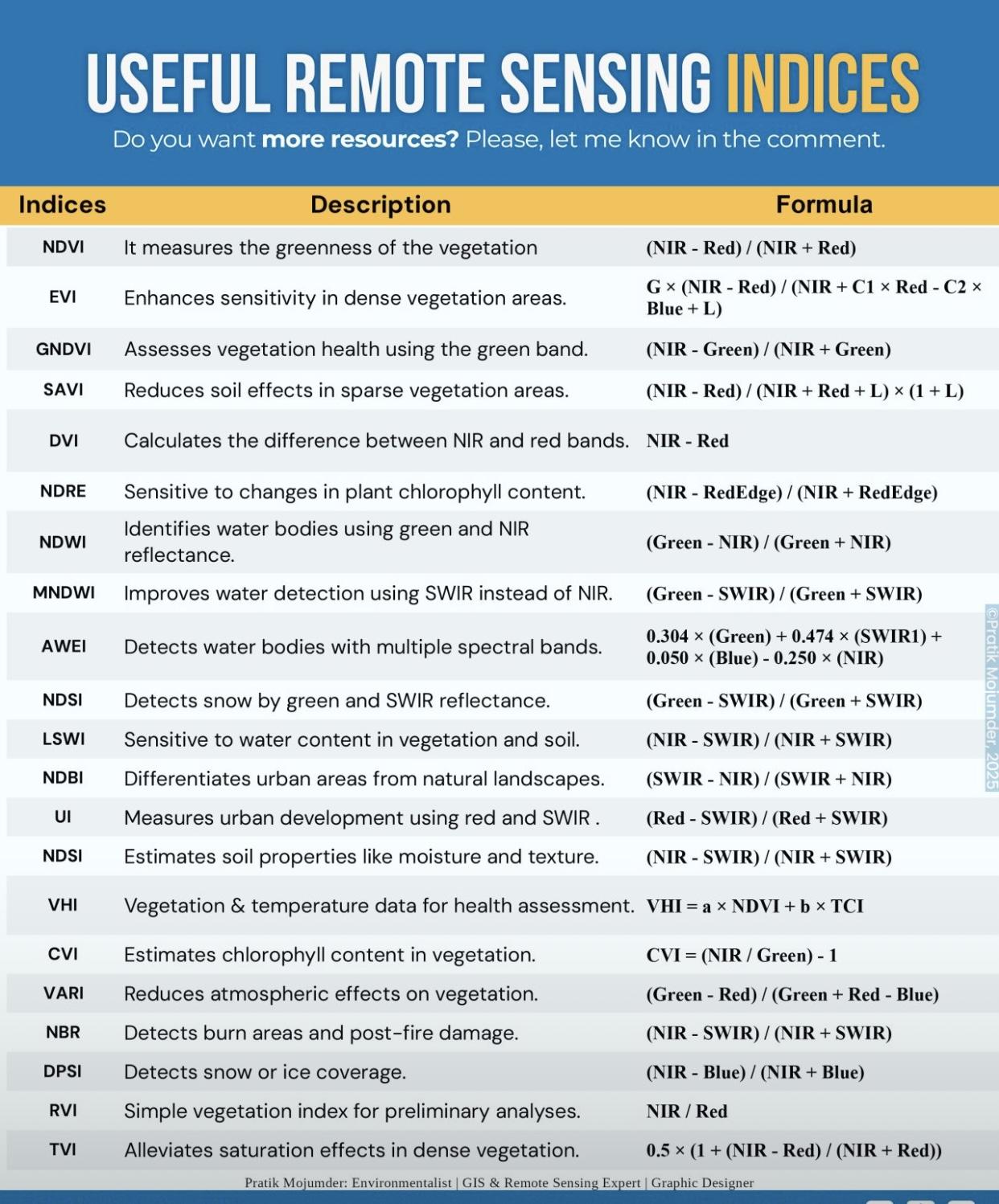
10 September 2025 4:01pm
Hi Adu,
I'm afraid your question is a little too broad. As you mentioned, these are widely used and accepted indices in remote sensing. It completely depends on what your analysis/research question is. There are also many papers comparing the results of similar indices. This list also runs the gamut from land to water to fire and urban, and others. So context matters here. What are you trying to analyze?
Best,
Vance


Vance Russell
3point.xyz