


Related Inventory Content
You may be wondering why GeoWing Academy has been a bit quiet lately, well here's why 😊 We're upgrading our Foundation Course (Parts 1, 2, 3 and 4) 🥳 And WOW are we excited!!
The classroom has had a major overhaul, the content has been refined and improved and the user experience has been upgraded to a whole new level making learning super easy and fun 🥳 🦾
Each Part will be released systematically over the coming weeks. All current GeoWing Academy learners will have immediate access to all the upgraded course material. The Intermediate and Advanced courses will also be upgraded over the coming months 🦾 🌳 This does not mean that the existing courses are no longer relevant!!
Check out the latest course from GeoWing Academy called Fantastic Fields which teaches you how to design and customise your own project specific field data collection app (QFields) using smart attributes and drone maps (but not drone data specific) for effortless ground data collection and GIS project syncing 🛰️ 🌍 The first 15 people to sign up for the course will get the course absolutely free! 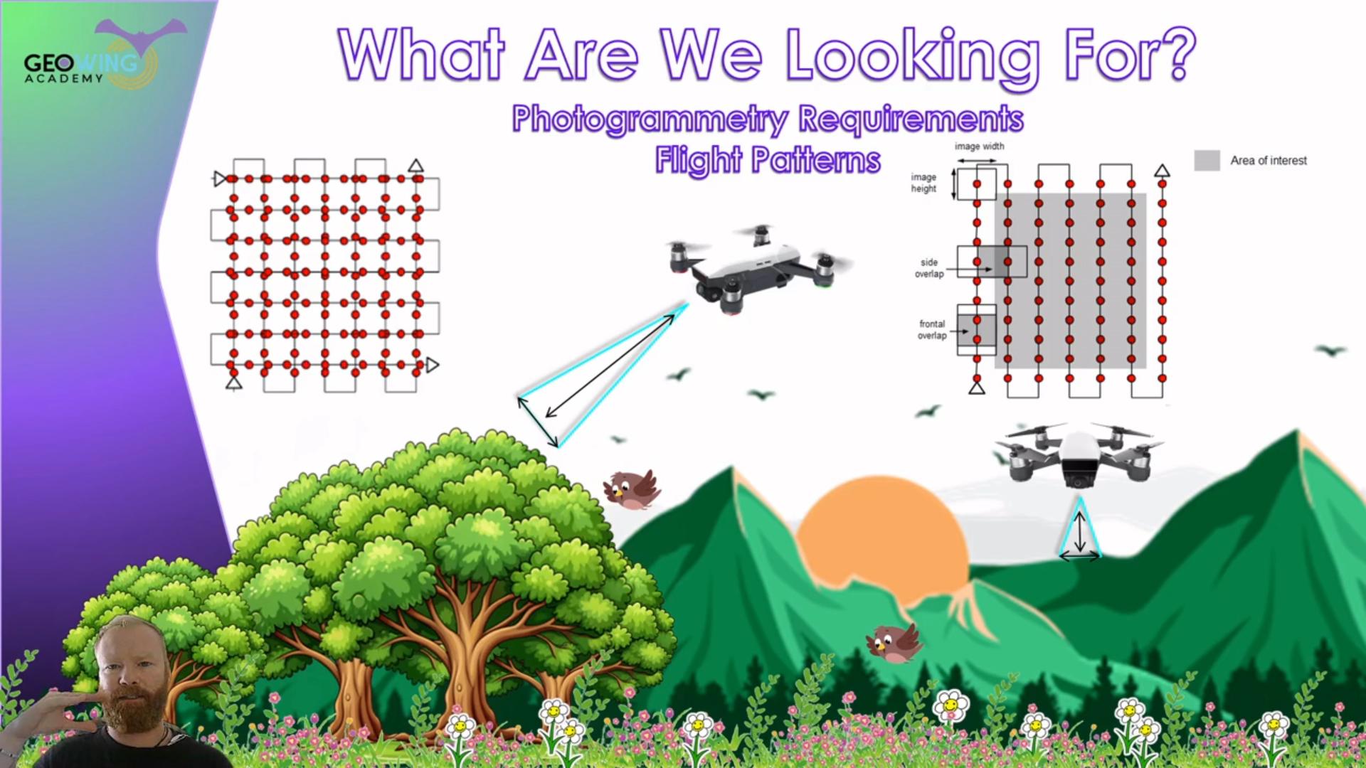
For more information go to www.geowingacademy.com and have a look at which courses suit your needs regarding all things drones, open source photogrammetry and GIS training today 🥳 Thank you for your patience during the upgrade period 😁
Image right: A still from The Foundation Course Part 2 coming soon!