


Related Inventory Content
WOOHOO 🥳 The GeoWing Academy Foundation Course Upgrades are now complete and the Intermediate Course upgrades are done!
You gave us the feedback and we implemented those changes into the courses including better classroom visuals, larger icons, course chapters for easier referencing of specific course information and so much more 😁 🚀! Have a look at some snapshots from the Intermediate Course Classroom Parts 1 and 2 below: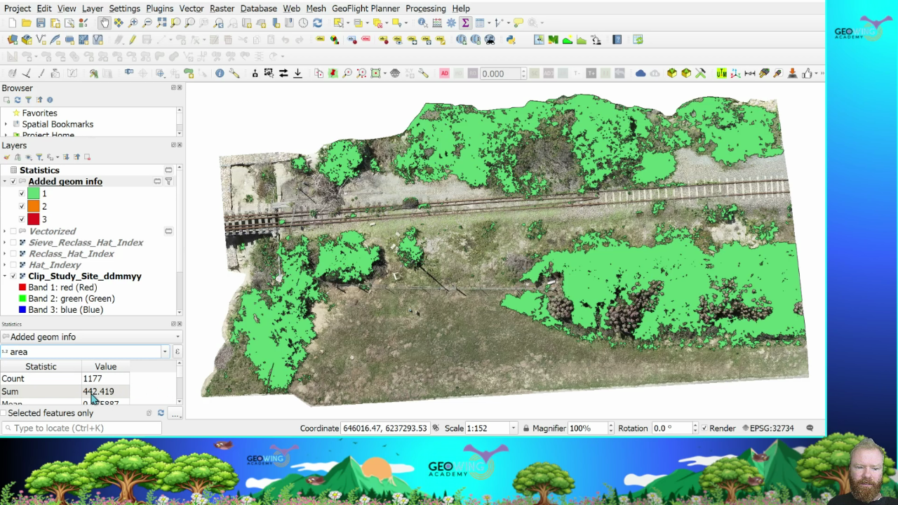
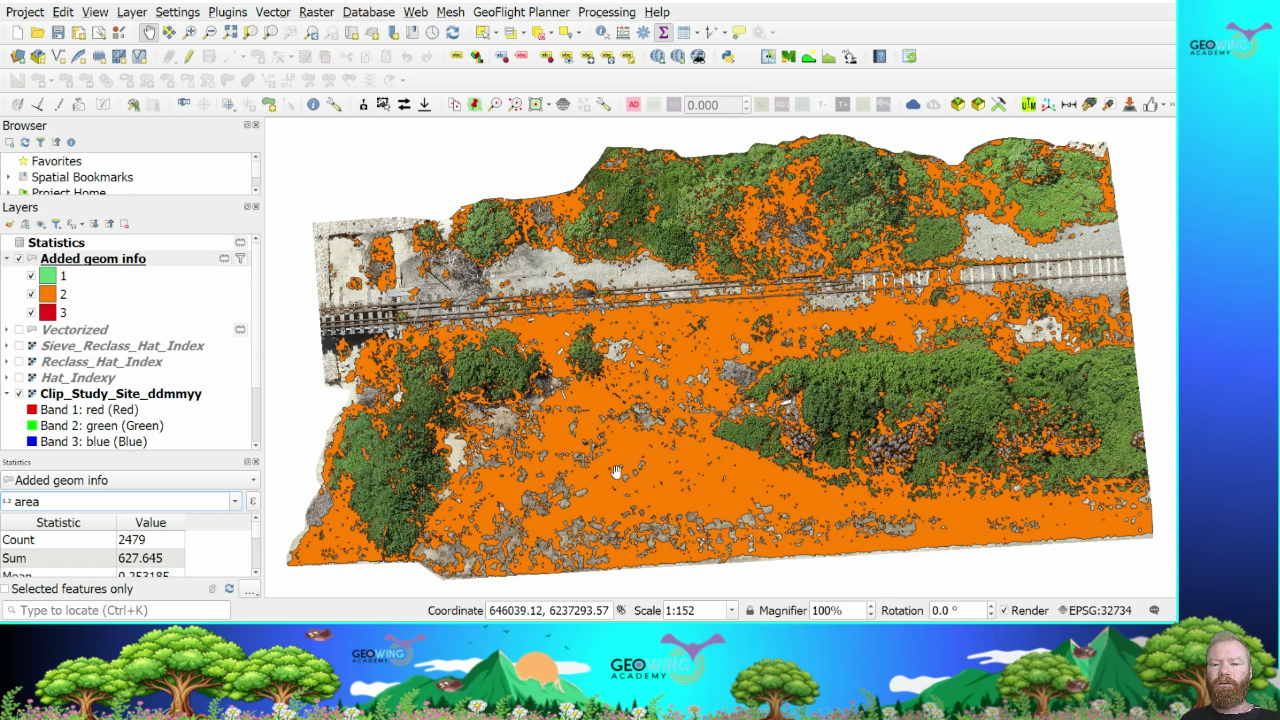
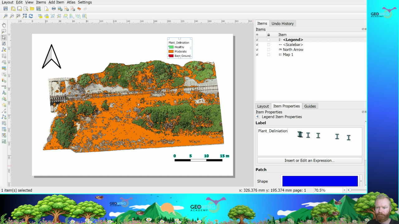
In the Intermediate Course Part 1, we look at delineating vegetation from drone imagery, quantifying the data in terms of cover area and plant health using indices. In other words, finding out just how much of the image is happy veg, how much is moderate veg and how much is soil using open source GIS software 🌴 🍂. Then we ready the imagery and data tables for reporting purposes, lets make it look pretty 😁
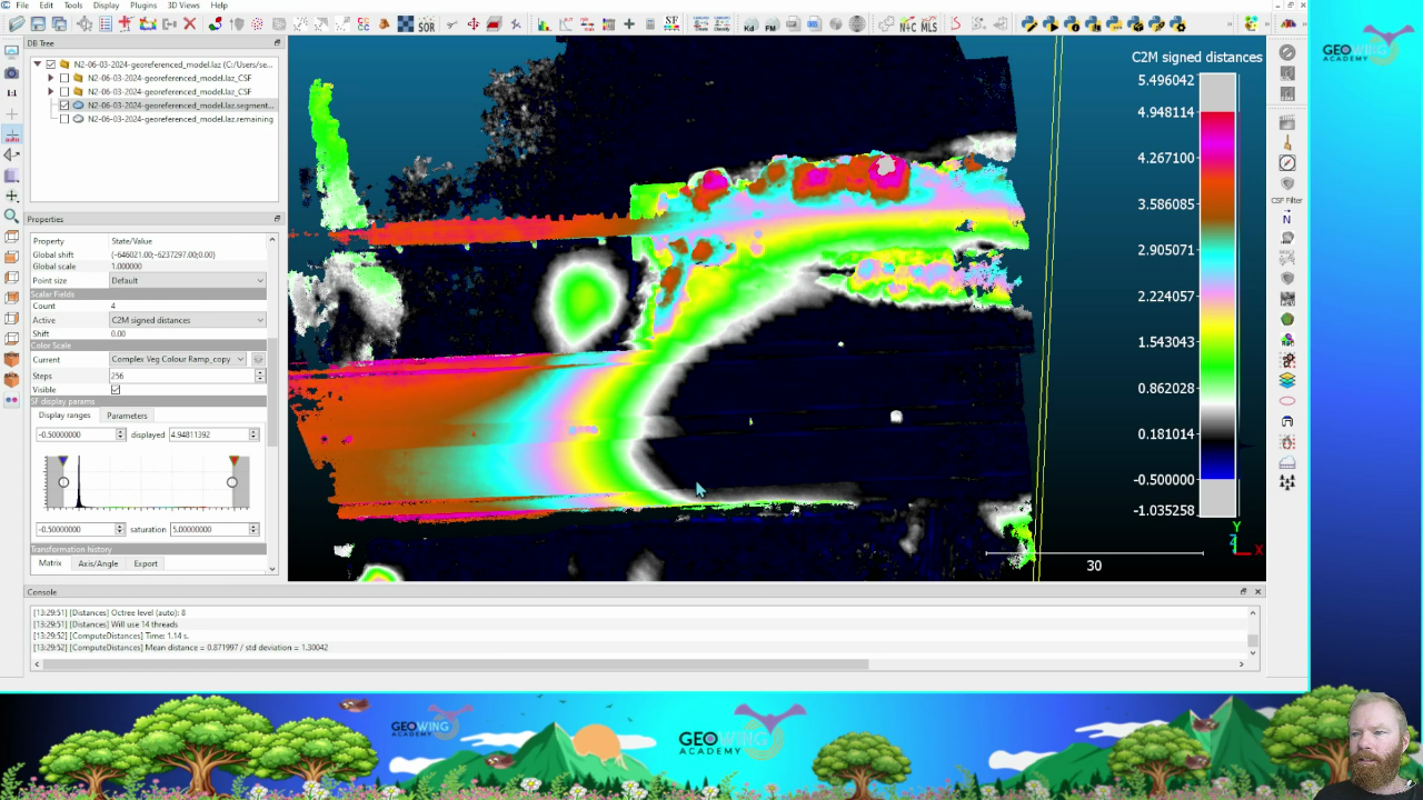
In Part 2 we look at the basics of open source point cloud analysis software and how to measure object heights in 3D using mesh to cloud computations which gives us insight into tree canopy heights and so much more 🍀 🌳!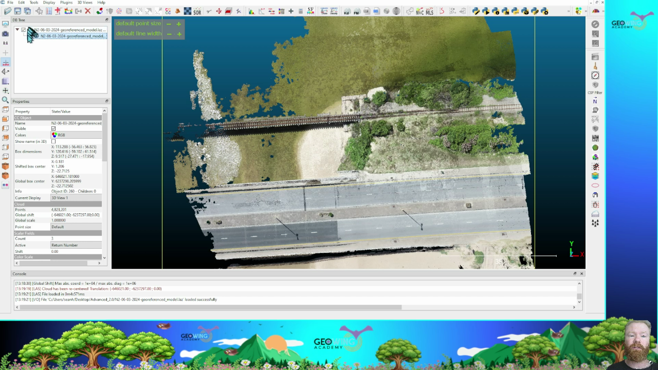
Go to GeoWing Academy today for more information about how to analyse your drone data using inexpensive open source software platforms that give you higher accuracy and the option to customise workflows to match your specific drone data analysis needs which proprietary software cannot do 😎!
www.geowingacademy.com
15 November 2025 1:13pm
Great
Boaz Loya
College of African Wildlife Management Mweka