Badges
Editing badges. Drag to reorder.

Groups joined
Discussion Comments
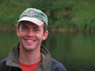
Lammert Hilarides contributed to Product - "Global Mangrove Watch"
Groups
Group
- Group Stats
-


- 712
- 385
- Latest Discussion
- Looking To Utilize My Skillsets To Help
Geospatial data and analysis are critical for conservation, from planning to implementation and measuring success. The Geospatial group focuses on all aspects of this field, from field surveys to remote sensing and data development/analysis to GIS systems. The ability to visualize and analyze spatial data underpins many areas of conservation, this group may serve as a landing point and gateway for those new to conservation technology.
🌍 Conservation technology is transforming how we protect wildlife, but are we thinking carefully enough about the risks? Drones, camera traps, GPS trackers, acoustic sensors, AI, and remote sensing have become essential tools for conservation practitioners around the world. They help us monitor species, detect threats, and respond faster than ever before. But these same technologies can also introduce unintended risks, and in some cases, can be exploited by those seeking to harm the very wildlife we're trying to protect. 🦏 Input now and/or join the discussions/research.
Group
- Group Stats
-


- 1356
- 607
- Latest Discussion
- AI for Impact Series at WWF: Looking for experts/speakers
Artificial intelligence is increasingly being used in the field to analyse information collected by wildlife conservationists, from camera traps and satellite images to audio recordings. AI can learn how to identify which photos out of thousands contain rare species; or pinpoint an animal call out of hours of field recordings - hugely reducing the manual labour required to collect vital conservation data. The AI For Conservation group is intended to unite and inspire all WILDLABS community members—whether already involved in AI for conservation, or not—to understand how to use and/or directly contribute to open-source research and development efforts.
🌍 Conservation technology is transforming how we protect wildlife, but are we thinking carefully enough about the risks? Drones, camera traps, GPS trackers, acoustic sensors, AI, and remote sensing have become essential tools for conservation practitioners around the world. They help us monitor species, detect threats, and respond faster than ever before. But these same technologies can also introduce unintended risks, and in some cases, can be exploited by those seeking to harm the very wildlife we're trying to protect. 🦏 Input now and/or join the discussions/research.
Group
- Group Stats
-


- 279
- 61
- Latest Discussion
- Looking To Utilize My Skillsets To Help
Welcome to the official group for our virtual course, Earth Observation 101. This is your space to engage with course instructor Dr Cristian Rossi, find help and resources for each module, collaborate and chat with your fellow course participants!
Group
- Group Stats
-


- 496
- 151
- Latest Discussion
- Engineer Searching for Biologists
This group is for anyone interested in open source technologies for ecology and conservation. We welcome contributions from both makers and users, whether active or prospective. Here, we believe that open source hardware, software, and data are key to conducting both rigorous and honorable science and research. It is a place to share novel or existing technologies, exchange resources, discuss new projects, ask for advice, find collaborators, advocate for adopting open source technologies, and share strategies for making them sustainable. Open Source Solutions naturally overlaps with existing WILDLABS groups, and we aim to embrace this overlap while maintaining our unique space for growth of Open Source Solutions as a priority in conservation science.
🌍 Conservation technology is transforming how we protect wildlife, but are we thinking carefully enough about the risks? Drones, camera traps, GPS trackers, acoustic sensors, AI, and remote sensing have become essential tools for conservation practitioners around the world. They help us monitor species, detect threats, and respond faster than ever before. But these same technologies can also introduce unintended risks, and in some cases, can be exploited by those seeking to harm the very wildlife we're trying to protect. 🦏 Input now and/or join the discussions/research.
Bookmarks
¡Mantén un registro de los recursos que te interesan! Las colecciones te permiten guardar, organizar y compartir contenido de toda la comunidad de WILDLABS. Crea tu primera colección haciendo clic en el icono del marcador.
My Courses
These are your in-progress and completed courses. Explore more courses through our catalogue.
To find courses you have created, see your "My Draft Content" or "My Content" tabs.
Settings
Lammert Hilarides's Content
Lammert Hilarides's Comments
A contact on the following Inventory items
Product
Global Mangrove Watch (GMW) is an online platform that provides the remote sensing data and tools for monitoring mangroves.
Lammert Hilarides commented on "Insight into Some Geospatial Calculation"