Fauna & Flora


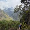
Time flies! It’s been a couple of months since ICTC 2026, yet it still feels like we were all just gathered in beautiful Peru exchanging ideas and discussing geospatial challenges together. I left feeling energized. There’s something so powerful about so many people working towards ONE goal: making sense of the massive geospatial datasets we gather and turning them into smarter, high‑impact tools for conservation.
For anyone who couldn’t make it, here are a few geospatial data, tools and platforms that were presented (the list is non-exhaustive!):
- Amazónicos por la Amazonía (AMPA) presented their work on successfully using early warning deforestation alerts from Global Forest Watch (@sam_hughes).
- Forest Foresight (WWF): R package that provides a way to generate 6-month deforestation predictions, facilitating analysis at various spatial scales (Kaori Wong).
- PalmsCNN (IIAP): Segment and detect the crowns of three palm species in Amazonian forests using RGB imagery captured by drones (@rcardenas).
- WRI presented lots of new and improved datasets coming soon on Global Forest Watch (e.g., deforestation driver at 30m resolution, forest typology) (Jessica Webb).
- Ecoscope (Allen Institute for AI): A free and open-source data analytics and reporting platform designed to turn conservation data into action (@jordantsteward @joshua ).
- ManglarAI (WWF Peru): A project that deployed 12+ different types of sensors including LiDAR & multispectral drones and is using satellite imagery such as PlanetScope, monthly basemaps, and SkySat (@nicolechabaneix).
- Monitoring of the Andes Amazon Program (MAAP): presented on the use of the latest technology to monitor and report on the most urgent cases of deforestation and fires across the Amazon Basin in a user-friendly format (Matt Finer).
- Remote sensing for marine mammal detection (whales and manatees) (Esteban Rodofili).
- M.A.P Scientific Services presented some fantastic ESRI Dashboards illustrating land use change and bush fires monitoring over time (@MAPSS).
And much more... so if you were there and you want to add something please do so in the comments below…and also please add it to “The Inventory”. Very important, so it doesn’t get lost!
Another highlight at ICTC was the workshop organised by NASA “What can space agencies do to increase their impact on Biodiversity Science and Ecological Conservation?”.
We discussed barriers for adoption of satellite-based products and possible solutions including producing a useful list of recommendations for overcoming those barriers. The feedback gathered will be integrated in the Decadal Survey that sets NASA priorities for the next decade (2027–2037). Thanks @Antonio.A.Ferraz , @TaliaSpeaker , @Rolandisimo and @lhughey for organising.
The Geospatial Group also organised an informal coffee chat during the break on Friday 20th Feb. We had a great turnout with eager geospatial folks from AMPA, Wildlife Conservation Society, WWF, WRI, Development Seed and M.A.P Scientific Services to name a few.
Thank you sooo much to Eddy Mendoza, Vidya Padmakumar, @sam_hughes , @MAPSS, Carlos Alberto Lim Vega, Maria Martínez Garcia, @wenddy , @anthonyboyd , Edwin Quispe, @Omar_Torrico , @hunterlistwin , Jessica Webb and Caitlin Mothes for joining the coffee break chat.
I would like to thank ARM for funding my attendance to ICTC, the organising committee and all the speakers for a super impactful conference!
Related content
Article
A First Look at the ICTC Program!

WILDLABS Team
Five days. One global conservation technology community. Check out the International Conservation Technology Conference program overview below!
18 December 2025
Article
The ICTC 2026 agenda is now live!
WILDLABS Team
Explore more than 300 sessions covering all aspects of conservation tech, now available in our conference app, Whova.
27 January 2026
Article
ICTC 2026: What we heard from attendees
WILDLABS Team
Insights from participant feedback and how they are shaping future events
26 March 2026
Related Inventory Content
The World Wide Fund for Nature is a Swiss-based international non-governmental organization founded in 1961 that works in the field of wilderness preservation and the reduction of human impact on the environment.


Organisation
The World Resources Institute is the global research non-profit organization behind Global Forest Watch and the Forest Watcher App.

Organisation
Developing geospatial solutions for conservation organisations so that they can protect landscapes more effectively


Add the first post in this thread.