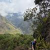
Launched in 2015, Amazon Conservation’s Monitoring of the Andes Amazon Program (MAAP)’s innovative application of satellite-based technologies from multiple sources delivers actionable information that provides a transformational tool for governments and local people to rapidly detect deforestation and fires as they happen. MAAP currently covers 100% of the Amazon across its 9 countries – Brazil, Bolivia, Colombia, Ecuador, French Guiana, Guyana, Peru, Suriname, and Venezuela. In addition, the initiative also develops “big-picture analyses” of the most important topics related to the Amazon, such as the tipping point, roads, carbon, climate, and more.
Main Address
Website
External Resources
Services
- Deforestation monitoring
Conservation Challenges
 WILDLABS Content
Pinned
Related
 Article
Geospatial highlights