Software and mobile applications are equally as important to conservation technology as the hardware used in the field. Increasingly developed specifically for #tech4wildlife needs, there are mobile apps and software options designed to help with protected area management, wildlife crime reporting, and anti-poaching patrol planning, data analysis, community science, data visualization and GIS mapping, outreach and engagement, and even conservation storytelling.
Likewise, mobile games have opened up new avenues for engaging the public in conservation efforts, allowing for immersive storytelling and interactive experiences. By combining cutting-edge technology and important conservation information with a media form already familiar to the public, conservationists are finding exciting ways to make audiences feel personally invested in critical species and habitats.
Whether you're looking for software and mobile app developers to help you with your own conservation tech needs, you have questions about development, you're looking for resources, or you'd like to share your own app, software, or gaming tools, this is the group for you!
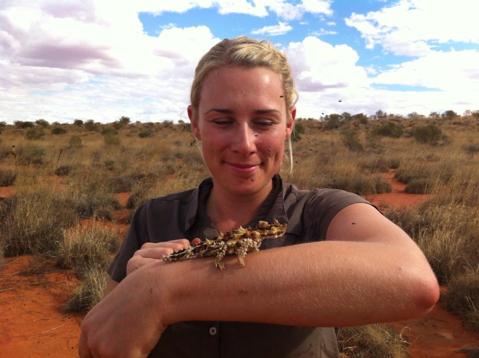
Header photo: Trevor Hebert

- @diyaquanauts
- | he / him
Digital nomad, software developer, running mechatronic engineering firm in Seychelles to assist ocean conservation groups.
- 0 Resources
- 7 Discussions
- 9 Groups

Software Developer (movebank.org, firetail.de)
- 0 Resources
- 0 Discussions
- 5 Groups

- @dilip_singh556
- | Him
On the way to Bridge technology and Nature.
- 0 Resources
- 2 Discussions
- 10 Groups

Octophin Digital
Director at Octophin Digital building things for wildlife conservation.


- 1 Resources
- 20 Discussions
- 2 Groups
- @Lucille
- | She/Her
University of Bristol, University of Auckland & La Trobe University
Marine bioacoustician and elasmobranch scientist
- 0 Resources
- 0 Discussions
- 5 Groups

- 0 Resources
- 0 Discussions
- 4 Groups

Wildlife Ecologist
- 0 Resources
- 0 Discussions
- 9 Groups
A Wildlife Biologist interested in Environment Assessment and Restoration, In-situ and Ex-situ strategies, Technologies used in Conservation and Illegal Wildlife Trade.
- 0 Resources
- 5 Discussions
- 13 Groups

Cornell University


- 0 Resources
- 0 Discussions
- 6 Groups

- @Markbowler
- | He/Him
University of Suffolk
Wildlife distributions and the effects that human activity has on populations. Spatial ecology of Amazonian mammals through audio and camera surveys. Hunter and gun tracking in Peru. Bats in suburban and agricultural landscapes in the UK
- 0 Resources
- 1 Discussions
- 9 Groups

- 0 Resources
- 0 Discussions
- 15 Groups

- @Brickles
- | He/Him
- 0 Resources
- 0 Discussions
- 6 Groups
April 2024

July 2024
event

Filippo Maria Buzzetti

October 2024

May 2023
April 2023

Download the SMART 2018 Annual Report

19 July 2019 4:16pm
data collection on mobile app

27 August 2019 4:05pm

27 August 2019 5:09pm
Hi Fabian,
In the interest of helping you get some useful feedback - did you have some more specific questions you wanted answered?
You might also want to have a look at this thread - Mobile App Comparison Table - as it might have some useful info about what people are looking for, particularly what they've listed under the pros/cons comparision of different mobile apps.
Steph
27 August 2019 7:46pm
Hi Stephanie,
Thanks for the link I hadn't seen it. It's very usefull.
i realise I have listed a list of points without specific questions, here are a few:
Do people face difficulties in onboarding users ? What are the reasons for people doing observations in the field for not installing an app ?
We face in the education sector a problem of computer/smartphone literacy that requires the application interface to be very simple. Is this also the case in conservation projects ? Any suggestions to solve this ? Examples ?
Does incentivizing data collectors (users) make a difference in the onboarding process ? Quality of data ? Number of users ?
that's a few to start :)
Thanks
ICCB 2019: 5 Key Discussions about the Future of Conservation Tech
 Stephanie O'Donnell
21 August 2019 12:00am
Tender: Extreme Citizen Science Group (ExCiteS) Technology Partner
 UCL
UCL
12 August 2019 12:00am
What lessons have you learnt along the way when developing apps or software for conservation?
21 June 2017 5:57pm

20 October 2017 6:58am
I agree re: Venture Studio model. I feel like the ideal situation is where the studio team has at least one or two products already underway and out in the market, rather than starting with the consulting work to bootstrap the products. I'm in the latter situation at the moment, and turning down work is really hard.
I think there's the possibility for a situation where an anchor client who is aligned with a product vision is able to provide a core early chunk of seed funding in exchange for lifetime use (or guaranteed 5 years for example) of a product. That's a model I'm really excited about to get the $10-20k that you'd need to get to a proof of concept.
24 July 2018 1:26am
Great lessons around stakeholder engagement and project management in this article. Users and developers alike are key to your project. User requirements gathering can provide a lot of insight if done well but it can be hard to prioritise the magic that some users want versus what can be practically achieved by a developer with your time and budget constraints. Find advice from a good project manager or business analyst if you can to help with technical language and project design barriers. Definitely agree with the above comments on getting your developers engaged with your users where possible.
Field based users often want to spend as little time as possible with technology. You need to use their time wisely to capture their requirements. Make sure they feel listened to. You can never please them all but hopefully you can focus in on critical users and key priorities and they will bring the others along.
31 July 2019 8:49am
Lots of good ideas and advice from everyone.
Time/money/quality/speed/etc tradeoffs, as always. Start with your minimum viable product, get it out there (at least to your initial target users - early adopters/enthusiasts), and iteratively improve, if poss. Don't go for the Big Bang approach where everything is "perfect", because it won't be. Users expect a lot from apps - there are incredibly well-resourced companies putting out incredible apps for free - and users almost always expect more. So... if there's an existing app (like iNaturalist/eBird/...) that can do the job for you, use it, or work with them to adapt.
Additionally, mobile phone hardware/software upgrades can often result in app issues/upgrades being necessary, so plan on maintenance costs as well as enhancements along the way, as others have said. Particularly when targetting both major platforms (use a cross-platform dev tool!).
If you're lucky enough to have a volunteer development team, treat/reward them as well as possible, to keep the system going. Whether that's with money or publication co-authorship or beer, find a way.
Could probably comment more but should probably write a paper...!
New technology trialled to better monitor human-gorilla conflict in Uganda
23 July 2019 12:00am
World first workshop of "Spatial Monitoring & Reporting Tool - SMART" in Portuguese takes place in Protected Area in the Brazilian Amazon
12 July 2019 4:46pm
Blockchain-verified data collection app
6 July 2019 5:42am
Database Design for Wildlife Enforcement

7 June 2019 3:33pm
Researching most affordable GPS chips with sensor capability

7 December 2018 7:10pm
18 January 2019 5:42pm
Hello Malou
I hazard the guess that what you are looking for is already available for livestock monitoring, so I would look in that direction unless you want to re-invent that wheel. I admit I am not 100% sure what is out there as I am working on something unrelated. Homemade tags may be cheaper but don't underestimate the effort and experience required to make something reliable and robust.
Reliably monitoring body temperature and heart rate may also be more difficult than you expect. I looked into this some time ago for birds such as golden eagles and discovered that the most reliable option required attaching a sensor onto the skin. I then decided that I would have to do without this and moved on. I am in no way an expert on this and others may know much better so don't give up quite yet. Again, there may be ready-made solutions in the livestock tracking market that do these types of measurements already.
Anyway, I can offer you a few details on GPS components I have come across that may be of interest. Please note that although these components are on my tracker prototype, this is still under development and I cannot yet say how well they perform. But their technical details looked good enough to give them a try for my project.
GPS MODULE: uBlox EVA-M8M
- certainly not the cheapest, GBP 10 bought in single units, cheaper in bulk;
- stores GPS satellites' almanac and ephemeris data onboard and can interpolate future trajectories. This means that the module has to be switched on only once in 48 h to get all the satellite data (typically takes 45 s) and then fire up only for a few seconds to get a position fix. The key benefit of this is energy conservation, which on most tags is important.
Data sheet: https://www.u-blox.com/sites/default/files/EVA-M8-FW3_DataSheet_(UBX-16014189).pdf
Source: https://www.digikey.com/product-detail/en/u-blox-america-inc/EVA-M8M-1/672-1112-1-ND/9818030
GPS ANTENNA: ProAnt PRO-OB-430, GBP1.00
A very small and lightweight GPS antenna, much more so than the usual ceramic patch antennas. If weight and size are an issue then this may come in handy.
data sheet: http://www.proant.se/files/user/Application%20note%20-%20OnBoard%20SMD%20GNSS%20rev%202.0.pdf
Source: https://www.digikey.co.uk/products/en?keywords=1532-1000-1-ND
A hint for more inspiration and sources of useful information on lightweight and energy-efficient electronics: websites on remote controlled model aircraft and amateur weather balloons.
It would be useful if you could post here a summary of your results on the GPS module search, once complete, for the benefit of those looking for the same details in the future.
Good luck !
J
18 January 2019 8:43pm
Hello! Thank so much for responding to this. I appreciate it very much.
I would agree with you- at this point we're researching the different wildlife/livestock tracking systems and hoping to reverse engineer a few close options. Our price point has to be substantially lower than what is currently on the market or being manufacured in order for livestock producers to even consider this possibility. I do have a software engineer in Seattle who has created something similar, but again not just what we need.
I too learned that body temp and heart rate will be hard to get and probably pricey. For the work we need this system for, I think we could get away with just body temp at this point but in the future would need both because we're trying to pinpoint the exact or near exact time livestock are being preyed upon by large carnivores, so the heart rate is the stress response to all of that.
Thank you for this wonderful info on GPS. I'll dive further into what you sent me after I'm finished creating a presentation I have at a Living with Wildlife conference. And yes- I'll plan on keeping this group up to date on anything we're able to gather together/create, etc. I definietly don't have the time to reinvent the wheel, so to speak, so if you come acorss anything else in your endeavors, pleasde do reach out. I'll do the same.
Thanks again! MUCH appreciated!
Best,
Malou
6 June 2019 5:20pm
https://github.com/LoRaTracker/GPSTutorial/tree/master/GPS%20performance%20comparisons
I'm a bit late to this conversation, but in case anyone else is searching "gps" that link above is one of the best "gsp shoot outs" I've come across.
HTH
Creating a wifi hotspot in a remote site
17 April 2019 3:30pm
18 April 2019 10:03am
Thanks1 The Moja system looks fantastic. I've neevr heard of anything similar in the Caribbean.
10 May 2019 7:12am
Hi Jenny,
Trust you're well. Were you successful in getting something for your team?
4 June 2019 4:02pm
Hi Jenny,
Interesting problem.
I don't have direct experience, but it looks like there are some experts you can probably reach out to and ask... if you haven't already:
http://www.groundcontrol.com/Caribbean_Satellite_Internet.htm
http://www.globaltt.com/en/internet_satellite/Caribbean.html
Also I found an interesting discussion on Reddit:
https://www.reddit.com/r/networking/comments/72wrio/satellite_internet_in_the_caribbean/
Best of luck!
Ivan
Technology lab focused on wildlife protection opens on Ol Pejeta Conservancy
 Ol Pejeta Conservancy
31 May 2019 12:00am
Canopy height mapping with drones
 Tom Swinfield
31 May 2019 12:00am
Investment Showcase and Pitching Competition

24 May 2019 1:14pm
FLIR Conservation Discount Program
 FLIR Systems, Inc.
23 May 2019 12:00am
Announcing DotDotGoose – open source software for counting objects in an image
22 May 2019 1:37pm
GWP Webinar Recording: Using SMART at scale for effective wildlife protection
21 May 2019 12:00am
Meet the WILDLABS TECH HUB Winners
 WILDLABS Team
13 May 2019 12:00am
SocialCoder.org

27 March 2019 11:13am
28 March 2019 10:45am
HI Robert,
I have so many thoughts about this topic.. will try to keep them brief! It's definitely a discussion topic I'd like to throw around in the virtual meetup we have coming up in May that's going to be about Tools and Spaces for Collaboration.
I haven't seen this programme specifically, but I'm aware of others that have similar goals. I (and a lot of others) agree - better/clearer pathways for connecting tech people with conservation needs is something long overdue for conservation tech. It's a need we've had our eye on since launching WILDLABS.
We're seeing it happen organically/opportunisitcally here in WILDLABS already (sometimes exactly the way you've mentioned - people posting in forums, other times it's happening behind the scenes with our community team making the connections). But I think we've reached a maturity/stability level in the community where we can now think about how to do it more strategically.
In our 2019 survey (still a few days left to get your thoughts in - access it here), the priority we're hearing from respondants is for tools that make it easier to either find projects to get involved in, or to find people/skills who can answer needs - tools for collaboration. I've included the current responses to this question below. At the top of the list is an 'I need help portal' - I envisage this as a sort of Task Rabbit for conservation. This could be one way of delivering this matchmaking service at scale and giving tech people (early career or not) an easier way to find projects that need there specific skill set.
I think there's also a need for a more bespoke approach, that like a mentoring/hand-picked matching process. Inevitably this is way heavier on the staff capacity requirements but may have a greater impact.It feels like this might be closer to the social coder approach. The SCB Conservation Tech Working Group is working on developing a path for how we can engaging individual tech experts and connect them with projects/challenges that could use their expertise (we'll share more on this as it evolves), and the WILDLABS Tech Hub is developing this sort of approach at a company level, engaging whole teams from tech companies strategically based on specific projects needs.
One final thought - when we're talking about these sort of initaitves, I think it's important to keep in mind that while there's a clear benefit for getting tech people involved in addressing conservation needs, there is also a cost/risk especially if there isn't alignment between the skills on offer and an actual need. It can take significant staff time to manage these projects or even just articulate the challenge properly, if there isn't a plan for sustaining the solution then conservationists are left with something that ends up draining resources/not delivering, and we also run the risk of fatigue with tech projects not working out or field teams not wanting to be test subjects and just wanting things that work. These challenges are not a reason avoid this work, but they are things to keep in mind.
Anway, interested to hear your thoughts or anyone elses? Are others thinking in this space? Does what i've said resonate?
Steph

WILDLABS Virtual Meetup: Low Cost, Open-Source Solutions
WILDLABS Team
18 March 2019 12:00am
Help Offered: Technology Professional (Software) Looking to Help
21 February 2019 4:18pm
Technology Professional Looking to Help
21 February 2019 4:09pm
we seek Beta-testers for our new platform for wildlife intelligence

23 January 2019 6:56am
18 February 2019 12:29pm
Excellent, that good to hear.
No, I didn't have anyone in particular in mind, it's just helpful to have that info in the back of my mind as I talk to different people/projects. I was also wondering whether to include the invite in our next Digest which will be coming out tomorrow, and based on this response I'll pop it in there :)
18 February 2019 12:45pm
Great :-)
19 February 2019 11:17pm
Congratulations! This looks like great tech.
Call for action for tech people

17 February 2019 11:22am
TRAINING Opportunity: Open spots available at first ever Global SMART Marine Training in Jamaica March 2019
14 February 2019 8:56pm
Call for ideas & feedback
2 January 2019 5:24pm

7 February 2019 12:45am
It certainly is. Whatever gets the job done and makes it easier for us to find the animals and prosecute the poachers. Also interested in thermal-imaging hardware and perhaps radar. I'm new to them all.
11 February 2019 9:57pm
Hello Sean
If you want to get hands-on with thermal imaging hardware then you may be interested to know that this type of technology has dramatically reduced in price in recent years. IR cameras used to costs thousands (€, £, $) but can now be had for around US$500. See here for the FLIR C2: https://www.flir.com/products/c2/
I bought one of these a couple of years ago for building inspections etc. I would expect it to show very clearly any captured animals as long as they are alive. Having said that, you need ideally a good difference in temperature between object of interest and surrounding area. From my time in Taiwan I would expect that for some part of the year you won't get much contrast. Worth trying anyway. This would, of course, be a rather manual solution to finding captured animals.
In theory, you would be able to pick up metal objects with this, too, even if they are at the same temperature as their surroundings. Bare metals (i.e. not covered in something like paint) have a very different "thermal signature" (technically known as "emissivity") from many other materials. This means they usually appear much cooler in a thermal image than they actually are. The reason you are unlikely to pick this up with a basic IR camera is quite simply the low resolution of such cameras. The FLIR C2 has 60x80 pixels. Much more expensive cameras are better on this point but you would still have to watch very carefully to pick up a thin wire that would only be a few pixel wide at the most.
It may be worthwhile getting in touch with FLIR directly to see what ideas they have. I would not be surprised if they have a base in Taiwan.
Good luck,
Joachim
11 February 2019 10:27pm
Hello Sean
I just had another thought: industrial machine vision systems come with all sorts of image inspection tools including such things as "edge detection". I wonder if this could be used in conjunction with a normal (not thermal) high resolution digital camera.
The general idea would be to:
1. take photos whilst on the move through a snare-infested area where a high res camera would be able to pick up a thin wire loop with sufficient resolution to make it visible;
2. let attached computer with vision software analyse images instantly for straight or looped edges that would indicate a snare.
What could help considerably is to take pictures in subdued natural light, maybe at dusk or dawn using a strong flash, possibly not just the built in flash of the camera but an external one. On the assumption that most snares are made from plain "shiny" metal, they should show up fairly well as "bright highlights" against the otherwise fairly dull (in terms of specular reflection) undergrowth. It would get more difficult though if the foilage was covered in water droplets as these would reflect the flash light, too.
I admit this is an idea that just sprung to mind and I have no idea how well this may work in practice. If you want to have a go yourself, set up a typical "snare scenario" and take some high resolution photos as described above from a few metres away. Then use free vision system software to process the images on your computer and see what you can find. Try this one, for example, https://www.teledynedalsa.com/en/products/imaging/vision-software/sherlock/
I have used it some years ago (for an industrial application) and found it very useful on early trials as it allows you to use all features processing images from a local folder rather than a live camera. This would be all you need to test whether there is any merit in this.
Sorry if industrial vision applications are not within your skill set but I thought I mention it here in case someone else wants to investigate it. I am not exactly twiddling thumbs otherwise I would be seriously tempted to have a look at this myself (pun intended:)).
Let me know if you need some more input on this,
Joachim
P.S.: A rough calculation on camera resolution:
- snare wire diameter is, say, 3 mm
- target size in image of the wire is at least 6 pixels (to reliably show diagonal edges)
- 20 Megapixel camera image is about 5000 pixel wide
- then you could cover an area 2.5 m wide per image (5000 / 6 * 3)
> this may be a workable distance to cover per image.
rOpenSci Community Call - Governance strategies for open source research software projects
10 December 2018 5:18pm
Open spots available at SMART Advanced Training in Zambia January 2019
6 December 2018 1:13pm
How to help
22 November 2018 3:52pm

27 November 2018 2:51am
Hi Ross,
Let's connect - I am a social scientist that has been researching demand reduction and am working on some projects, including a website, that helps consumers avoid illegal "unsafe" souvenirs. I have a few ideas floating around in my head that would take someone more tech-savvy than me to know if feasible - maybe we can exchange thoughts via email. I'd love to hear more about your ideas to reduce demand!) Feel free to email me at [email protected].
Best, Rosemary

29 November 2018 2:31pm
Hi Ross,
We are developing a web-based platform with multiple tools to analyse biodiversity quality, habitat assessement management and other apps. We need some help thinking how to monetise the apps/subscriptions as well as further developing the platform. You can email me here: [email protected] if interested. Thanks.
Kind regards,
Vance
WILDLABS Virtual Meetup: Big Data in Conservation
WILDLABS Team
27 November 2018 12:00am
20 September 2019 4:47pm
Great work Drew thanks for sharing, hopefully, for the 2019 report, we will have a greater presence of Latin American countries adopting SMART as we have ongoing training activities going on 03 "new smart countries" Brazil, Argentina & Paraguay.
Here is a post about Paraguay first SMART training, hold in the beginning of the month:
https://www.linkedin.com/pulse/paraguay-takes-first-step-towards-adopting-spatial-tool-spina-avino/
Regards!