Zoological Society London (ZSL)
Poacher alert dataset
https://drive.google.com/file/d/0B9qkd5vrU3_fUXJTNk1wM2tpSGs/view?usp=sharing
This dataset contains a list of example alerts similar to those that would be received by a System Manager in a secure control room of a Protected Area deploying a Security system with camera traps and sensor for detecting potential poaching incidents. These alerts contain information on the time, date and location of the incident, along with information on the type of threat if applicable. A Raspberry Pi computer is currently used in the field to manage operations centers. You should seek to develop a solution that is compatible with Raspberry Pi Operating Systems (e.g. Linux, PIXEL or Ubuntu).
Image recognition dataset
https://drive.google.com/drive/folders/0B5fqynlOappiTGJYbXByYXNacFE?usp=sharing
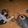
A ‘live training’ dataset is provided with a 1100 images, with only a few humans. The challenge is to find an image recognition solution that can be trained using relatively small datasets that represent those likely to be received from a field deployment – basically the smaller the dataset that can be used to train the model to accurately pick out humans, the better! The idea being that these datasets could be collected over a few days when a camera is first set up and used to train the model, and the model could then be used moving forwards to detect human presence and potential poaching risk.
Other useful datasets including data to help with ‘Your Idea! Create a Wildlife Trafficking Technology Solution’
The IUCN Red List of Threatened Species
http://www.iucnredlist.org/technical-documents/spatial-data
The IUCN Red List of Threatened Species contains assessments for just over 76,000 species, of which about two-thirds have spatial data. This spatial data provided below is for comprehensively assessed taxonomic groups.
Population trends from the Living Planet Index Database
https://www.dropbox.com/s/t48dd7m0o088w69/LPI_pops_restricted_20160421.csv?dl=0
The Living Planet Index (LPI) is a measure of the state of the world's biological diversity based on population trends of vertebrate species from terrestrial, freshwater and marine habitats. This database contains population trends from over 15,000 populations of over 3500 vertebrate species.
The world database of protected areas
https://www.protectedplanet.net/
The World Database on Protected Areas (WDPA) provides a picture of the extent, location, name, status and other useful information on the world’s protected areas.
Launched in 1981, this joint project between UNEP and the International Union for Conservation of Nature (IUCN) World Commission on Protected Areas represents the most complete data set on the world's terrestrial and marine protected areas.
https://peerj.com/articles/2354/
Note - all downloadable datasets are provided in the Supplemental Information
The Great Elephant Census (GEC) was initiated in 2014 to provide a coordinated, timely, high-quality survey of savannah elephants across the African continent. GEC surveys were conducted in 18 countries in 2014–2015, providing one of the best-quality wildlife surveys to date in Africa.
Provides an open access comprehensive resource on the legal, international trade in species listed in the Appendices of the Convention on International Trade in Endangered Species of Wild Fauna and Flora (CITES). CITES Authorities use the database on a day-to-day basis to monitor levels of trade and adopt policy decisions to protect vulnerable fauna and flora.
Species+/CITES Checklist API
This API allows institutions to request data from the CITES Checklist and Species+. These lists are used to assist Parties with implementing CITES, CMS and other multilateral environmental agreements (MEAs). It may be used, for example, by CITES Authorities to update their national systems with information maintained in the CITES Checklist and Species+, thus increasing standardisation and reducing errors and duplication of effort.